![]()
Prev Page--The Logging Operation || Next Page--The Gamma Ray Log
Digital Logs
The Beginning of Digital Logs
A typical logging operation creates multiple measurement curves over extensive lengths of hole. Consequently, the logging data are both numerous and numerical and are obvious candidates for computer storage,
In this form they can be used readily for both analysis and display. When logging trucks moved from analog recording on photographic film to digital storage on the truck, the logging engineer would record these on "field tapes."
If the customer wanted to pay the extra charge for a "customer tape" then this would be produced at a logging company processing center. When created by Schlumberger, the customer tape would be coded in LIS (Log Information Standard) binary format. The customer would then mount the tape on a mainframe computer tapedrive and decode the binary data into readable alphanumeric form.
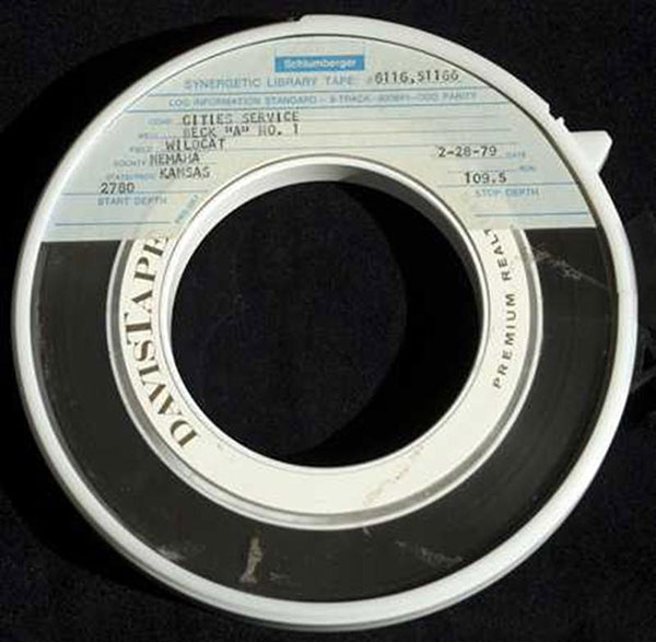
The tape above was produced in 1979 as an LIS digital file of logs recorded on the wildcat #1 Beck drilled by the Cities Service Oil Company in Nemaha County, Kansas. The wildcat resulted in an oil discovery in the Middle Ordovician Viola Limestone, and was named the Corning Field.
When personal computers took the place of mainframes in the 1980's, the digital log storage medium moved from tapes to floppy discs. The space limitations of early PCs prompted the development of the LAS (Log Ascii Standard) format by the Canadian Well Logging Society as a simple way to code logs that occur most commonly and is now a standard used all over the world.
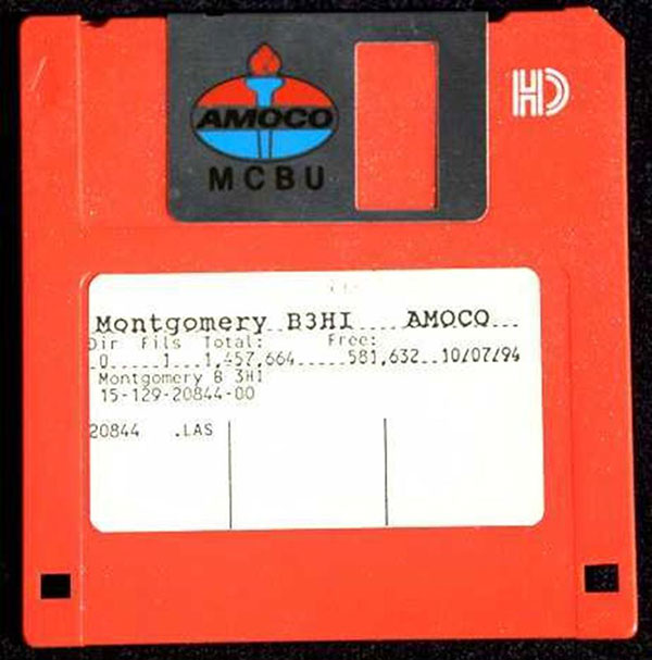
The floppy disc on the right was created in 1994 is from Amoco (now BP) and contains the LAS file of logs recorded of the Permian Chase Group from a Hugoton gas field well in Morton County, Kansas.
Both the tape and the disc are museum pieces from a bygone digital age. In today's world, digital logs are stored on servers and transmitted over the Internet. The LAS format is the preeminent medium for digital logs which are increasingly replacing hard-copy paper logs.
The State of Kansas requirement for logs to be filed with the KCC has recently been modified to accept LAS files where they are available, in a move away from paper copy. After a two-year confidentiality period, they are made available to the public and can be downloaded for free from the website of the Kansas Geological Survey.
The ability to download and read an LAS file is therefore not an academic exercise, but a skill that you may be called upon to apply routinely in your future career.
The LAS Digital Log Format
LAS stands for "Log ASCII standard" and is a simple format that can be read by standard word processors and spreadsheet software. The format is coded in ASCII which was first introduced in 1963 and corresponds to a "text only" record, with a basic encoding of numbers, alphabetic letters, and standard punctuation symbols.
All LAS files end with ".las" and can be opened with WORD, EXCEL, and other software. Each LAS file is subdivided into sections that start with the character '~' (tilde). The sections are:- ~V - contains the version and wrap mode information
- ~W - contains the well identification information
- ~C - contains log curve information
- ~P - contains well parameters and constants
- ~O - contains additional information such as comments
- ~A - contains the log data
In the previous lesson, we looked at logs of a Niobrara Chalk gas discovery well, where we became acquainted with some fundamentals. The LAS digital log file from this well is therefore a good example to work with, because we have already seen much of the digital information on the LAS file in analog form.
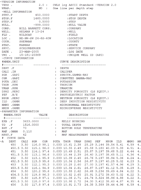
The illustration shows the beginning of the LAS file. The record of the digital log curves extends down to a depth of 1460 feet.
The version (~V) information states that it the file is formatted in Version 2.0, with one line per depth.
The well (~W) information section records data that we saw on the log header in the previous lesson
The curve (~C) section lists the log curves in their order of appearance on the file. Each curve is identified by a mnemonic (MNEM) - an abbreviation of its name, followed by an abbreviation of its units of measurement, and then a description of the curve.
The parameter (~P) section lists measurements associated with the well, typically elevations, total depth (TD), bottom hole temperature (BHT), and drilling mud characteristics, which apear on the log header.
On this well, no other (~O) section was included in the LAS file.
Notice that some lines begin with pound signs (#). These mark "comment" lines that would be ignored by specialized log analysis software used in industry.
The ASCII (~A) section contains the logging data, with the first line of the curve mnemonics to identify each data column. In the U.S., the depth is measured in feet, and the frequency is set at two readings per foot. Elsewhere in the word, the depth is recorded in meters, with a frequency of ten readings per meter.
Software to Display Logs from an LAS File
Because the LAS file is a text-only ASCII file, it can be read directly into an EXCEL workbook and plotted by the standard graphics option of Chart Wizard.
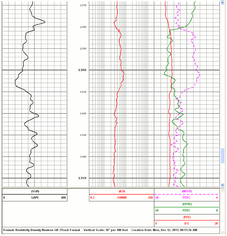
Software that is designed for log analysis will automatically recognize the formatting conventions of an LAS file and will immediately provide output for reservoir characterization. These software packages are typically very expensive, but free software is also available for basic log display such as Dataview which can be downloaded from the Schlumberger website. The log display is under the control of the user, so that depth scales can be changed and log curves presented in a variety of colors and scales. As an example, a Dataview display of the Beecher Island gas zone in this well is shown below, and created by Dataview from the Niobrara chalk well LAS file.
Exercise: Download an LAS Digital Log File
The LAS file for the Niobrara Chalk gas well (along with many, many others) resides on the website of the Kansas Geological Survey. Once you have accessed the KGS website at www.kgs.ku.edu, follow these instructions:
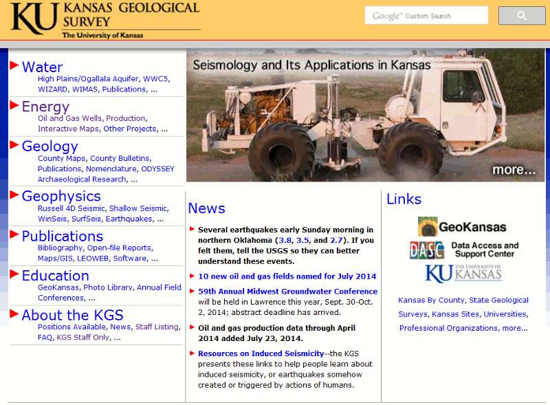
Click on 'Energy' (located at upper left on KGS page)
KGS homepage
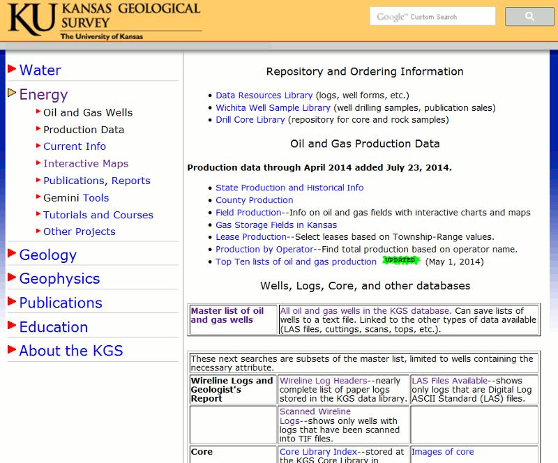
Now click on 'Oil and Gas Wells'
Energy Page options

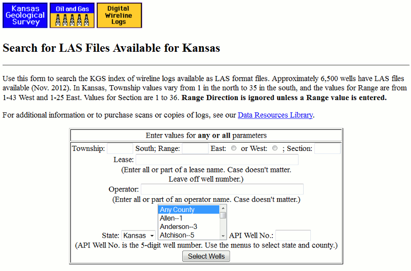
Now click on 'Las Files Available' (at lower right)
LAS Files Available
Enter the Township, Range, and Section of the well. For this exercise, the location of the well in question is Township 6, Range 40, Section 24. The well is west of the Sixth Principal Meridian, so make sure that the radio button for 'West' is checked.
Township, Range, Section
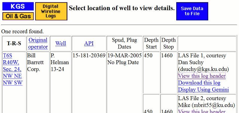
The LAS file details for The Bill Barrett Corporation, Lease P. Helman 13-24 are shown. Click on the Download option for the LAS file marked 'Courtesy Dan Suchy'
LAS files found shown here
The LAS file will now be downloaded onto your computer, but it will be as a zipped file. Unzip the file, using the standard unzip utility on all computers and save the LAS file. Open the LAS file with software that can graph data (e.g. EXCEL).
Prev Page--The Logging Operation || Next Page--The Gamma Ray Log
Kansas Geological Survey
Placed on web March 24, 2017.
Comments to webadmin@kgs.ku.edu
The URL for this page is http://www.kgs.ku.edu/Publications/Bulletins/LA/02_digital.html