Skip Navigation

Pawnee Valley Hydrogeology

Prev Page--Registered wells


Appendix B

Water-level decline values for each grid of the model area for all options considered

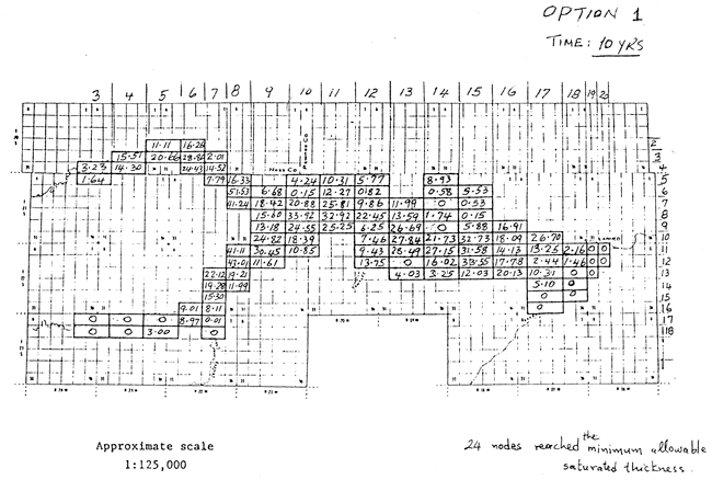
Option 1, time 10 years: 24 nodes reached the minimum allowable saturated thickness.

Map of study area with water-level decline values listed for each node.

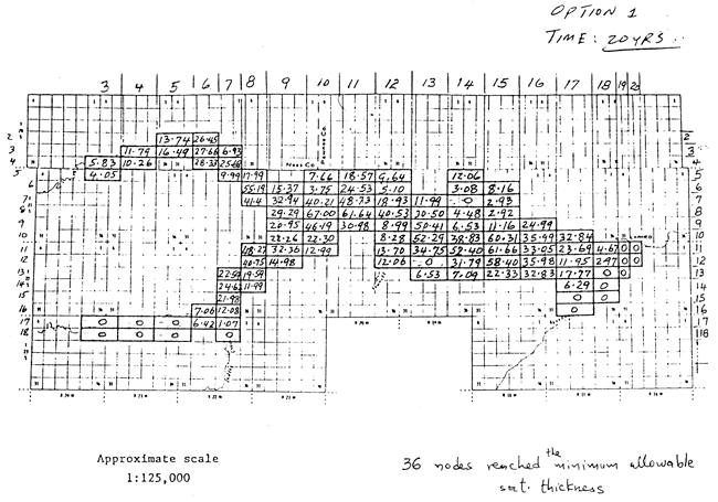
Option 1, time 20 years: 36 nodes reached the minimum allowable saturated thickness.

Map of study area with water-level decline values listed for each node.

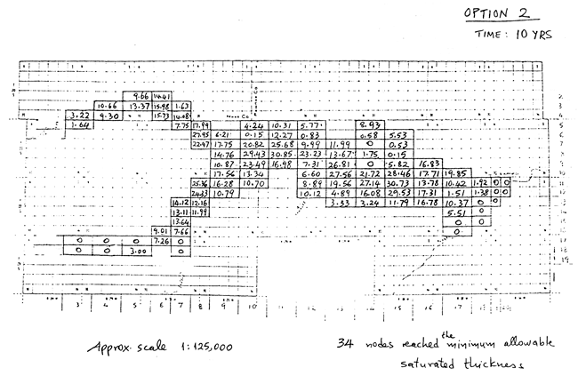
Option 2, time 10 years: 34 nodes reached the minimum allowable saturated thickness.

Map of study area with water-level decline values listed for each node.

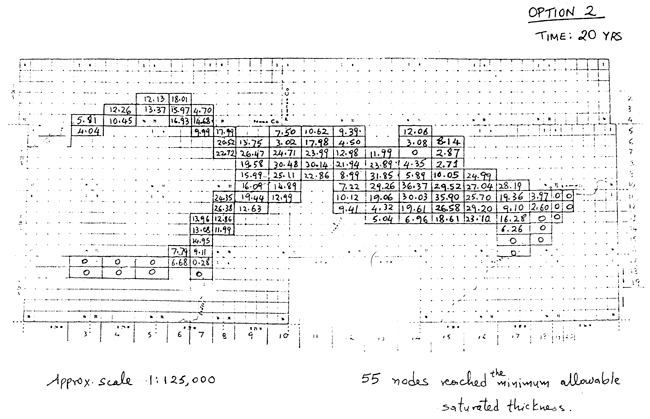
Option 2, time 20 years: 55 nodes reached the minimum allowable saturated thickness.

Map of study area with water-level decline values listed for each node.

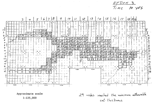
Option 3, time 10 years: 29 nodes reached the minimum allowable saturated thickness.

Map of study area with water-level decline values listed for each node.

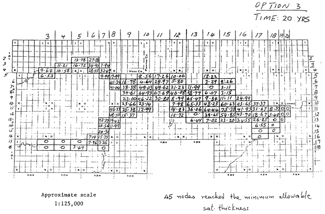
Option 3, time 20 years: 45 nodes reached the minimum allowable saturated thickness.

Map of study area with water-level decline values listed for each node.

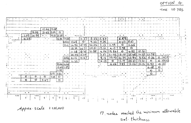
Option 4, time 10 years: 17 nodes reached the minimum allowable saturated thickness.

Map of study area with water-level decline values listed for each node.

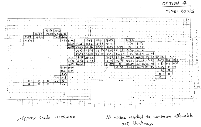
Option 4, time 20 years: 33 nodes reached the minimum allowable saturated thickness.

Map of study area with water-level decline values listed for each node.

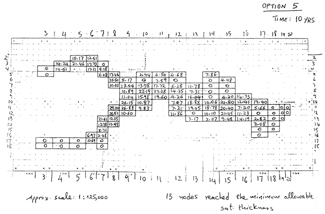
Option 5, time 10 years: 13 nodes reached the minimum allowable saturated thickness.

Map of study area with water-level decline values listed for each node.

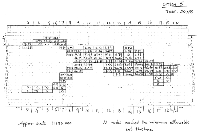
Option 5, time 20 years: 33 nodes reached the minimum allowable saturated thickness.

Map of study area with water-level decline values listed for each node.

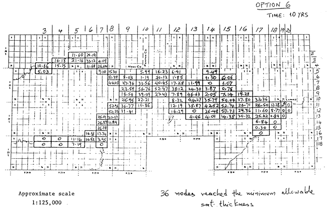
Option 6, time 10 years: 36 nodes reached the minimum allowable saturated thickness.

Map of study area with water-level decline values listed for each node.

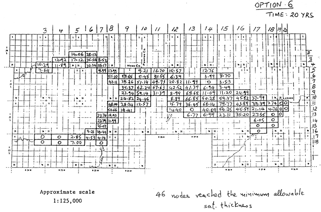
Option 6, time 20 years: 46 nodes reached the minimum allowable saturated thickness.

Map of study area with water-level decline values listed for each node.


Prev Page--Registered wells

Kansas Geological Survey, Hydrogeology
Placed on web Aug. 1, 2012; originally published April 1980.
Comments to webadmin@kgs.ku.edu
The URL for this page is http://www.kgs.ku.edu/Hydro/Publications/OFR80_6/10_model.html