![]()
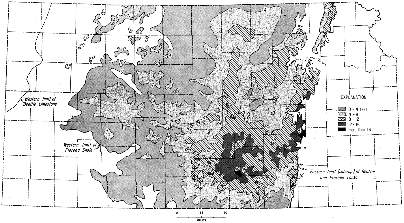
Figure 45
Figure 45--Isopachus map of Florena Shale in Kansas, based on about 2,500 control points (Fig. 46). Contour interval 4 feet. Maximum thickness, about 18 feet, in southwestern Sedgwick County.
Kansas Geological Survey, Geologic History of Kansas
Comments to webadmin@kgs.ku.edu
Web version Jan. 2009. Original publication date Dec. 1963.
URL=http://www.kgs.ku.edu/Publications/Bulletins/162/fig045.html