
TECHNIQUES
A variety of geophysical methods can be used to produce images of the subsurface without the invasive nature of drilling. The KGS is using and improving a variety of these techniques, applying them to various geologic problems and settings.
Electromagnetic Methods to Monitor a Hog-confinement Facility
Animal wastes normally produce materials with higher electrical conductivity. Nearly 10,000 meters of electromagnetic (EM) line surveys have been acquired around a hog-confinement facility in western Kansas over the last three years. The purpose of the project has been to 1) find possible subsurface seepage around the hog lagoon and 2) evaluate two popular EM instruments in monitoring or detecting animal-lagoon leakage and to set up an efficient field EM survey routine to monitor animal-lagoon leakage.
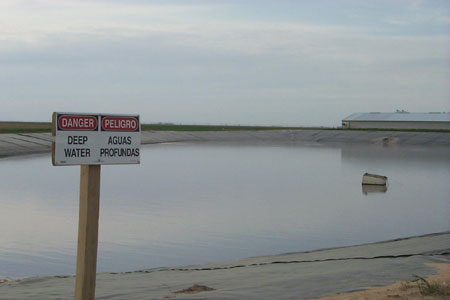
Hog lagoon.
Suppression of Rotor Noise in Aerogeophysical
Surveys
Aeromagnetic surveys are designed to measure changes in intensity of the
Earth’s magnetic field, information that provides clues about the
makeup of the subsurface and its resources. Interference such as power-line
noise routinely plagues aeromagnetic surveys. Recently developed boom-mounted
aeromagnetic systems are subject to noise from helicopter engines and
rotors. A hum filter was designed to suppress rotor noise.
Scholte Waves
The KGS is collaborating with the Geological Survey of Canada in using
a deep-tow seismic eel as part of an ocean research project funded by
the Geological Survey of Canada, Chevron Canada Resources, Husky Energy,
and Petro-Canada Ltd. The program adapts land-based seismic techniques
to a marine environment. This year research was carried out on the Canadian
government-owned ocean research vessel CCGS Hudson with the voyage focusing
on Hebron, Terra Nova, and White Rose areas of the Grand Banks. Considering
the water depth (100 meters), these techniques have the potential to open
up a vast portion of the ocean for evaluation of exploration and production.
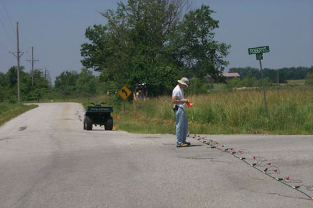
Automated Acquisition System
Routine scanning of the subsurface using seismic techniques could be done
at relatively high production rates and interpretations made with confidence
by minimally trained technical staff. These techniques could prove invaluable
in identifying portions of roads or highways at risk of failure. In Kansas,
coal, lead-zinc, and salt mining activities have left subsurface scars
that are neither mapped nor their failure potential established. Locating
and mapping areas with subsurface materials (upper 30 meters) under high
stress regimes or where stress is increasing would provide invaluable
early warning, potentially avoiding damage or loss of property, and in
some situations, loss of life. Critical to that system will be an acquisition
system operated by two people and able to telemetry data to a central
facility for review and analysis.
Tunnel/Anomaly Detection
Seismic-reflection techniques have been used to image targets for shallow
engineering, environmental, and ground-water purposes. Extending this
technology to variations in rock units as well as tunnel and fracture
detection, bedrock mapping, and subsidence/karst delineation has required
a unique approach that incorporates various methods. Data have been and
will be acquired over lead-zinc mines, buried landfills, underground pipes
and cables, fractured rock, utility tunnels, karst sinkholes, tunnels
beneath the US/Mexico border, on dam crests, and on an asphalt parking
lot looking for bedrock fractures. Work is now underway or completed in
Baxter Springs, Galena, Olathe, Lenexa, and Lawrence.
Evaluation of Paved Surfaces
A pavement system usually consists of the uppermost layer of asphalt or
concrete (or a mixture of both), a base of gravel or sand (or mixture
of both), and a subgrade of soils. The goal of this seismic evaluation
is to assess the rigidity of each layer in order to examine the required
specification of a road after its construction, before actual construction
of the road takes place, and during maintenance. The preliminary results
of research conducted in collaboration with Lund University, Sweden, indicate
that seismic phenomenon over the pavement system is so unusual that the
conventional method lacks significant integrity. The results from the
multichannel approach successfully observed and confirmed the complicated
seismic characteristics predicted theoretically almost a half century
ago but not accounted for by the traditional method.
Multichannel seismic evaluation of pavement system.
Other Seismic Techniques
In addition to the developing applications for high-resolution seismic
reflection, the KGS is working on a number of technical improvements in
seismic techniques, including an automated acquisition system, higher
modes of high-frequency Rayleigh waves, solving for near-surface P-wave
quality factor Q, wave velocities using mutilchannel analysis of surface
waves (MASW), field data-acquisition parameters for the MASW method, the
orthogonality-using-combisweep method of Vibroseis seismic-data collection,
evaulation of high-output rotary servo valve for minivibrators, coded
impact-source techniques, and estimation of Vp field from continuous-acquisition
methods.
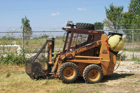
Assisted weight-drop equipment for evaluating surface seismic waves using MASW at a sinkhole near Baxter Springs, Kansas.
Geostatistical Characterization
of Shallow Earth Properties
The Smart Weapons Test Range (SWTR) lies within the Yuma Proving Ground
(YPG), Arizona. SWTR is a new facility constructed specifically for developing
and testing futuristic intelligent battlefield-sensor networks. Results
of an extensive high-resolution geophysical characterization study at
the SWTR site were validated using 3-D modeling. In this study, several
shallow seismic methods and novel processing techniques were used.
In addition to supporting materiel developers with important geophysical information at this test range, data from this study will be used to validate sophisticated 3-D seismic-signature models for moving vehicles.
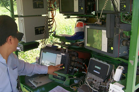
Seismic equipment.
List of 2002 Publications—Techniques References
Kansas Geological Survey
Online May 20, 2003
Comments to: webadmin@kgs.ku.edu
URL:http://www.kgs.ku.edu/Publications/AnnRep02/techniques/techniques.html