![]()
Back to the Ogallala Formation...
Figure 18
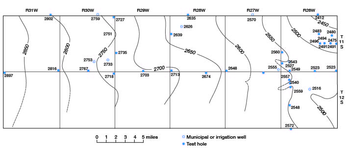
Figure 17--Map of northern part of Gove County showing configuration of Cretaceous bedrock surface beneath unconsolidated Tertiary and Quaternary deposits. Contour interval 50 feet.
Back to the Ogallala Formation...
Kansas Geological Survey, Geology
Placed on web Sept. 30, 2008; originally published June 1960.
Comments to webadmin@kgs.ku.edu
The URL for this page is http://www.kgs.ku.edu/General/Geology/Gove/fig17.html