![]()
Prev Page--Table of Contents || Next Page--Geography
Introduction
Purpose and Scope of the Investigation
The Geological Survey, United States Department of the Interior, and the State Geological Survey of Kansas, with the cooperation of the Division of Sanitation of the Kansas State Board of Health and the Division of Water Resources of the Kansas State Board of Agriculture, started an extensive program of ground-water investigations in the western part of the State in July, 1937. In 1938, investigations were begun in parts of western Kansas where irrigation from wells was being carried on or was potentially important. This report presents the results of a study made during the summer and fall of 1940 to determine the availability and quality of ground water and to study and map the various rock formations in Finney and Gray counties.
The universal use of ground water for domestic, municipal, and industrial supplies, the extensive use of ground water for irrigation in the Arkansas valley, and the increasing development of irrigation from deep wells on the upland plains in the two counties has made it necessary that a better understanding of the hydrology and geology of this area be acquired.
The investigation was made under the general administration of K.C. Moore and K.K. Landes, State Geologists, J.C. Frye, acting State Geologist, and O.E. Meinzer, geologist in charge of the Division of Ground Water of the Federal Geological Survey, and under the immediate supervision of S.W. Lohman, Federal geologist in charge of ground-water investigations in Kansas.
Location and Extent of the Area
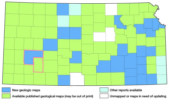
Finney and Gray are adjacent counties in southwestern Kansas and together they embrace a total of 60 townships, or about 2,160 square miles. Finney is the larger of the two counties and has an area of about 1,300 square miles. The location of Finney and Gray counties with respect to adjoining counties is shown in figure 1.
Figure 1--Index map of Kansas showing area described in this report and areas covered by other geologic maps, as of Feb. 2002. For additional information, the KGS Geologic Maps of Kansas Page.
Previous Geologic and Hydrologic Work
Numerous studies have been made in the past dealing with the geology and ground-water resources of the area under consideration. The most important of these studies are listed below in chronological order.
In 1892, Colonel Nettleton (1892, pp. 26, 27, appendix no. 10) reported on the results of some underflow surveys along the Platte and Arkansas river valleys, and included a discussion and plat of a north-south profile of the water table extending across Finney County and passing through Garden City. In 1897, Haworth (1897) described the geology and physiography of western Kansas, and included a discussion of Arkansas River. He also published the log of a well drilled near Garden City (Haworth, 1897, p. 27). That same year Haworth (1897a) published the results of an investigation of the underground waters of southwestern Kansas which included all of Gray County and about the southern half of Finney County. A report of the Board of Irrigation Survey and Experiment to the Legislature of Kansas for the years 1895 and 1896 was also published in 1897, which contained the log and water-supply data for a State-financed test well in Gray County (Sutton, 1897, pp. 18, 19). In the same report, Haworth (1897b) gave a general account of the geology of underground water in western Kansas. A few years later, Johnson (1901, 1902) reported on the utilization of the High Plains, including in his report brief descriptions of the slope of the water table near Garden City (Johnson, 1902, p. 647) and early attempts at irrigation near Garden City (Johnson, 1902, pp. 639, 668). In 1902, Slichter published a report entitled "Motions of Underground Waters" in which he included a hydrograph of the city well at Garden City (Slichter, 1902, p. 68).
In 1905, Darton (1905, pp. 297, 298, and 300) published a preliminary report on the geology and ground-water resources of the Central Great Plains in which he gave a general description of the water supply in Finney and Gray counties. In the same year, Burgess and Coffey (1905) published the results of a soil survey of the Garden City area.
In 1904, Slichter (1906) made an intensive investigation of the underflow of Arkansas River in Finney and Kearny counties. He reported in detail on the velocity and origin of the underflow, fluctuations of the ground-water level, and quality of the water. He also made pumping tests on a number of pumping plants in the valley to determine the specific capacity of the wells and cost of pumping.
The quality and availability of water in Finney and Gray counties was studied and reported on by Parker (1911, pp. 87-90, 99, 100) in 1911. In 1912, Coffey and Rice (1912) published a report containing the results of a reconnaissance soil survey of the western half of Kansas, including Finney and Gray counties. In 1913, Haworth (1913) described the well waters in Kansas and included in his report a brief description of Arkansas River and a discussion of ground water in the Tertiary rocks of western Kansas.
A preliminary report on the ground-water resources of the shallow-water basin in Scott and Finney counties was published by Moss (1933) in 1933. In 1935, Theis, Burleigh, and Waite (1935) described briefly the water-bearing formations and the availability of ground water in the entire southern High Plains. In 1937, Smith (1937) contributed a preliminary paper on Pleistocene gravels in southwestern Kansas in which he described gravel terraces along the Arkansas valley and listed two vertebrate fossils collected from gravel pits in Finney County (Smith, 1937, p. 289). In 1938, the Division of Water Resources of the Kansas State Board of Agriculture released a report (Anon., 1938) containing the results of tests of deep-well pumping plants with particular emphasis on fuel consumption. Two of the plants tested are in Finney County and one is in Gray County. A practical report dealing with the construction and costs of irrigation pumping plants in Kansas was published by Davison (1939) in 1939. This report contains a description of different types of pumping plants, the conditions for which each is best adapted, construction methods, and a discussion of construction costs. A report on the cost of pumping for irrigation was published that same year by McCall and Davison (1939) this report includes data on several tests of irrigation pumping plants in the area under consideration. In 1940, Smith (1940) described the Tertiary and Quaternary geology of southwestern Kansas, including Finney and Gray counties. A report giving a general description of the ground-water resources of Kansas was published by Moore (1940) in the same year. Included in this report is a chapter on the shallowwater basin in Scott and Finney counties by H.A. Waite (Moore, 1940, pp. 73, 74). Also in 1940, a report was published (Meinzer and Wenzel, 1940, pp. 138-145, 158-161) on water levels and artesian pressures in the United States in 1939, which contains chapters on the observation-well programs in Finney and Gray counties. A similar report (Meinzer and Wenzel, 1942, pp. 45-52, 61-66) was published in 1942 for the year 1940, and additional reports of this series will be published annually.
A report published in 1942 on the availability of ground-water supplies for national defense industries in Kansas includes descriptions of the availability of ground-water supplies in Finney and Gray counties (Lohman and others, 1942, pp. 37-42, 55-57).
Methods of Investigation
The investigation on which this report is based was begun in the fall of 1939 when about five weeks were spent in the area locating observation wells in which monthly water-level measurements have since been made. The principal part of the investigation, however, was not undertaken until the summer and fall of the following year, during which time about three months were spent in Finney County and about one and one-half months in Gray County. Approximately 540 wells and springs were visited, and the total depth and depth to water level were measured in about 310 of the wells. All measurements were made using a steel tape from a fixed measuring point at the top of each well. Additional information concerning the nature and thickness of the water-bearing material, yield of the wells, drawdown, and the use and general character of the water was obtained from many well owners, tenants, and well drillers. Information on the amount of water pumped and the number of acres irrigated from wells during 1939 was obtained for most of the irrigation plants.
Samples of water collected from 27 representative wells in Finney County and 24 representative wells in Gray County were analyzed by E.O. Holmes, chemist, in the Water and Sewage Laboratory of the Kansas State Board of Health at Lawrence. The Kansas State Board of Health also furnished analyses of water for the four public water supplies in the area, making a total of 55 analyses for the two counties.
The altitudes of the measuring points of the wells in Finney County were determined with a spirit level by John LaDuex, assisted by Milton Sears; those in Gray County were determined by the Topographic Branch of the United States Geological Survey at the time that altitudes were being established in preparation for topographic mapping. The same two men, John LaDuex and Milton Sears, did this work aided by several men supplied by the Works Progress Administration.
During the investigation, 25 test holes were drilled by Ellis D. Gordon, Perry McNally, and Laurence Buck, and 3 test holes were drilled by James Cooper, Nick Fent, and Milford Klingaman, using a portable hydraulic-rotary drilling rig owned by the State and Federal Geological Surveys. Samples from the test holes were collected and studied in the field by Perry McNally and later were examined in the office by me. Additional logs of wells drilled in the area were obtained from the Garden City Company, the Soil Conservation Service, drilling companies, independent well drillers, and from landowners.
Pumping tests on six wells in the area were conducted by Melvin Scanlan of the Division of Water Resources, Kansas State Board of Agriculture, and Woodrow Wilson of the Federal Geological Survey. The results of these tests are given on pages 52-54 of this report. Measurements of the yield and drawdown made on many irrigation wells were furnished by Kenneth McCall of the Division of Water Resources, Kansas State Board of Agriculture, by P.H. Browne, representative of the Johnston Pump Company, and by F.E. Stoeckly, engineer of the Garden City Company. These measurements are given on pages 107 and 108.
Field data were compiled on county highway maps prepared by the State Highway Department. The base maps for plates 1 and 2 were prepared from the same maps that were used in the field. The locations of the roads were corrected from field observation, and the drainage was corrected from aerial photographs obtained from the United States Department of Agriculture, Agricultural Adjustment Administration. The areal geology shown on plate 1 was taken in part from the state geologic map (Geologic Map of Kansas, 1937) and modified by me from field observations. Considerable use was made of the aerial photographs in outlining the boundaries of the various geologic formations. Plate 2 shows the locations of all wells and springs visited during the course of the investigation. The locations of wells and springs within the sections are based upon speedometer distances taken at the time they were visited. Two numbers are shown opposite most of the well symbols on plate 2, the upper one corresponding with that used in the well tables and in the text, and the lower one indicating the depth to water level below the land surface. Where there are many wells in one section the depth to water level is given only for a few representative wells, but all wells are numbered. Brackets around a well number indicate that the water from that well has been sampled and that an analysis is given in this report (tables 20 and 21). The wells and springs are numbered in order by townships from north to south and by ranges from east to west. Within a township they are numbered in the same order as the sections.
Acknowledgments
I am indebted to the many residents of Finney and Gray counties who so willingly supplied information concerning their wells; to Lester Pelner, Ray Stevenson, J.A. Becraft, Rail McGraw, George Slocum, L.M. Waddell, and the Soil Conservation Service for furnishing well logs and other necessary data pertaining to wells; to T.A. Blair, chief engineer for the Atchison, Topeka, and Santa Fe Railway, for supplying information on the railroad wells in the area; and to J.A. Roby, city engineer at Garden City, D.B. Rabourn, city engineer at Montezuma, V.E. Reese, city engineer at Copeland, and Mr. Crusinberry, city engineer at Cimarron, for giving data concerning the municipal wells in their respective cities.
Unpublished data relating to wells were made available by George S. Knapp, chief engineer for the Division of Water Resources of the Kansas State Board of Agriculture. Kenneth D. McCall and Milburn H. Davison, engineers for the same agency, conducted pumping tests on several irrigation wells in the area and made available the results of these tests. Mr. McCall also spent several days in the field with me giving invaluable aid in locating observation and irrigation wells. The Division of Water Resources also furnished water-level data for a well in the Arkansas valley on which they maintain an automatic water-stage recorder.
Thanks are due E.F. Stoeckly and W.E. Levitt of the Garden City Company for furnishing information concerning the many wells owned by that company, and P. H. Browne, Johnston Pump Company, for releasing the results of pumping tests that he conducted on irrigation wells in this area. I also acknowledge the helpful assistance given by Forrest Luther of Cimarron, during my work in Gray County. I am grateful to Claude W. Hibbard, curator of vertebrate paleontology of the Dyche Museum of Natural History, University of Kansas, and A.B. Leonard, assistant professor of zoology, University of Kansas, for their helpful identifications of fossil material collected during this investigation.
The manuscript for this report has been critically reviewed by S.W. Lohman, O.E. Meinzer, W.D. Collins, L.K. Wenzel, and E.W. Lohr of the Federal Geological Survey; J.C. Frye and J.M. Jewett of the State Geological Survey of Kansas; George S. Knapp of the Division of Water Resources, Kansas State Board of Agriculture; and Paul D. Haney and Ogden S. Jones of the Division of Sanitation, Kansas State Board of Health. The geologic names used in this report were checked by the Committee on Geologic Names of the Federal Survey. The manuscript was edited by Edith H. Lewis and the illustrations were drafted in final form under the supervision of Eileen Martin.
Prev Page--Table of Contents || Next Page--Geography
Kansas Geological Survey, Geology
Web version April 2002. Original publication date Dec. 1944.
Comments to webadmin@kgs.ku.edu
The URL for this page is http://www.kgs.ku.edu/General/Geology/Finney/02_intro.html