![]()
Prev Page--Contents || Next Page--Geography
Introduction
Location and Extent of Area
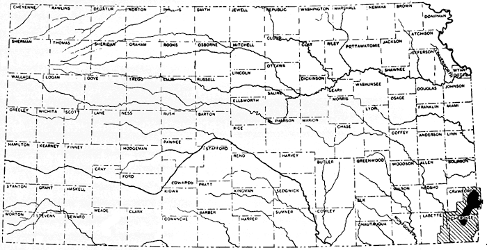
The oldest and most important coal-mining area in Kansas is the Cherokee- Crawford district, which extends northeastward from northern Cherokee County through eastern Crawford County and into the northwestern part of Barton County, Missouri. The limits of the district were originally determined by the extent of a single coal bed, the Weir-Pittsburg coal, but with the advent of large-scale surface stripping of thin coal beds the field has been extended, particularly to the southwest and north. Pittsburg, which, according to the 1930 census, had a population of 18,145, is the largest city and is the commercial center of the coal industry of the district. The area described in this report includes the eastern and southern parts of Crawford County, all of Cherokee County except that part southeast of Spring River, the eastern part of Labette County, Kansas, and a small area in western Missouri, including parts of Barton and Vernon counties. In all about 1,160 square miles are included, of which about 60 square miles are in Missouri and the remainder in Kansas, 375 square miles in Crawford County, 525 square miles in Cherokee County, and 200 square miles in Labette County (see fig. 1).
Figure 1--Index map of Kansas, showing area of this report (cross lined) and the so-called Cherokee-Crawford coal district (solid).
Present Investigation
The known reserves of the principal coal bed of southeastern Kansas--the Weir-Pittsburg bed--have been nearly exhausted and in recent years attention has turned to beds of lesser thickness which may be minable by surface stripping. The approximate extent and thickness of the Weir-Pittsburg bed have long been known from drill records and underground mining, but very little detailed information was available concerning the other coal beds which now constitute the main coal reserves of the area. The Cherokee shale, which is the principal coal-bearing formation, produces a large amount of oil and gas in an area lying west of the coal field, and therefore detailed information on it, where exposed along its outcrop, was also desirable.
Fieldwork was undertaken in the region, through an allotment of funds from the Public Works Administration, to map the geology and determine the coal resources. The coal beds were accurately mapped and about 4,500 well logs and drill records of prospect holes were assembled and correlated, so that a regional picture of the horizontal extent and thickness of the several coal beds could be obtained. In order to show the depth of coal below the surface and the attitude of the coal-bearing strata, altitudes were determined on the coal beds at the outcrop and in drill holes where the coal lay at some depth below the surface.
The fieldwork extended over a period of eight months from April through November 1934. During April the senior author made reconnaissance observations of the area and assembled some of the drill-hole data to be used. From early May to late November, C. E. Straub, W. H. Courtier, and F. M. Haase served as geologists with the party. About the middle of July, the party was enlarged by E. A. Koester and E. L. Griffin as geologists and L. M. Wilshire, R. S. Worthington, and Fred Coleman as instrument men. In October James Williams spent three weeks with the party studying the paleontology and stratigraphy of the area.
Soil maps published by the United States Bureau of Chemistry and Soils were enlarged from a scale of one inch to the mile to two inches to the mile and used as base maps for plane-table traverse in Crawford and Labette counties and part of Cherokee County. The Columbus and Joplin district topographic maps were used for base maps and elevations in part of Cherokee County. The mapping in Missouri was done in reconnaissance by automobile speedometer traverse and elevations were determined by a surveying aneroid.
The locations of the outcrops of the principal coal beds and of formation and member boundaries were determined by plane-table traverse, except for the small area in Cherokee County covered by topographic maps. A number of lines of altitudes from railroad and highway surveys were tied together and converted to sea-level datum and were then used for vertical control in plane-table traversing. Altitudes at geologic boundaries, coal outcrops, and drill holes were determined for the most part by alidade readings, but in a few places a surveying aneroid was used.
The parts of the report written by the senior author include the Introduction, Carboniferous Stratigraphy, Structure, and Coal. The junior author has compiled the geologic map and written the Tertiary and Quaternary Stratigraphy and that part of the report dealing with the Physical and Chemical Character of the Coal.
Acknowledgments
During the scores of years that mining has been carried on in southeastern Kansas, a tremendous amount of data has been acquired from test drilling and mining. Practically all of this information was made freely available to the Geological Survey and has been of inestimable value in the work. The fine cooperation of all the mining companies and others who contributed information cannot be commended too highly. This opportunity is taken to thank the mining companies operating in the field, particularly the Pittsburg-Midway Coal Mining Co. and Kenneth Spencer of that company for many drill records and other information on the coal field; the Western Coal & Mining Co. and A. L. Toengus of that company for drill records and mine data; the Central Coal & Coke Co. for access to its drill records and numerous mine maps; the Sheridan Coal Co., the Mackie-Clemens Coal Co., the Eagle Cherokee Coal Mining Co., the Crowe Coal & Mining Co., the Clemens Coal Co., and the other mining companies and individuals who made their data available. The several railroads which serve the area have generously given us much information from their files, particularly the St. Louis-San Francisco Railway Co. and F. X. Natchmann of that company, who furnished many drill records and map data in Crawford County and railroad elevations and profiles; the Missouri-Kansas-Texas Railroad which gave access to drill data in Labette County; the Missouri Pacific Railroad, which furnished a map of the coal field and benchmark elevations along the railroad; and the Kansas City Southern Railroad, which supplied benchmark elevations along its right of way. The State Geological Survey of Kansas gave access to maps and other data pertaining to the area. The Kansas Gas & Electric Co. kindly loaned us logs of drilling done in northwestern Cherokee County. The State Highway Department supplied elevations along many of the highways, and the county engineers--E. M. Conrad of Crawford County, L. C. Belt of Cherokee County, and J. R. Jarboe of Labette County--gave us similar information for many county roads. The logs of drill prospecting for lead and zinc, in the southeastern part of Cherokee County, have been made available by the Kansas Explorations, Inc., by several other mining companies, and by W. M. Stewart. George Fowler has kindly furnished many logs and maps showing the depth to the base of the Cherokee shale. The writers also wish to express their appreciation to G. E. Abernathy, State Mine Inspector William Glennon, R. L. Cooper, Earl Tibbets, Giles Overton, the Kansas Well Log Bureau, Hazel & Sons, R. O. Deming, and numerous individuals who supplied information concerning thickness of coal, well logs, and coal samples.
Without the splendid assistance of the members of the party, it would not have been possible to assemble the data presented in this report. Their hard and conscientious work is to be commended and is deeply appreciated. The project was carried forward under the direction of H. D. Miser, who also made helpful suggestions in the preparation of the report.
Previous Publications
The first comprehensive report published on Kansas coal was by Haworth and Crane (1898). A large part of this report deals with the coal of southeastern Kansas, which at that time was in the early stages of development. Since then there has been a great deal of mining and drill hole prospecting, which has furnished needed information in a region of few natural exposures. A report (Haworth, 1908) on oil and gas, published by the Geological Survey of Kansas in 1908, contains a good reconnaissance map of the formations in the southeastern part of the state. Another report on Kansas coal in 1925 by Young and Allen, furnished additional data on the district, particularly with reference to the engineering and production methods in use, and the chemical composition of the coal. An excellent description of the stratigraphy of the Cherokee shale, which is applicable to this district, is contained in a report by Greene and Pond (1926) on an adjoining area in western Missouri, and by Greene (1933) in a later report, gives more recent suggestions on stratigraphic correlations in western Missouri. Moore and Landes (19297) have discussed the coal of southeastern Kansas in their report on the "Underground resources of Kansas." The United States Bureau of Mines (1929) has published a number of analyses of coal from the Weir-Pittsburg bed, and annual reports of the Kansas coal mine and metal mine inspection give data on production and mines.
Up to the time the present study was made, the outcrops of the coal beds had not been mapped and their relations to one another and their position in the Cherokee shale had not been determined except in a very general way.
Prev Page--Contents || Next Page--Geography
Kansas Geological Survey, Geology
Placed on web July 27, 2011; originally published Sept. 1938.
Comments to webadmin@kgs.ku.edu
The URL for this page is http://www.kgs.ku.edu/Publications/Bulletins/24/02_intro.html