![]()
Prev Page--Contents || Next Page--Formations
Introduction
[Note: A preliminary report on this subject, prepared by the author, was published in Am. Assoc. Petroleum Geologists Bull., vol. 18, pp. 1313-1345, 1934. Discussion by F. G. Holl, J. L. Rich and others appeared on pp. 1343-1345, and by R. S. Tarr on pp. 1710-1712.]
Elongated lenses of quartz sand that are prolific bearers of high-grade oil are found in the lower part of the Cherokee shale, of Pennsylvanian age, at depths ranging around 2,000 feet in Greenwood, Butler and adjacent counties, Kansas. Some lenses are between six and eight times, and many are as much as four times greater in length than width. The individual lenses are arranged approximately end to end, separated by narrow gaps so that they form collectively long narrow systems, each 20 to 50 miles long and only a half mile to 1 1/2 miles wide. Because of the great lengths of the belts compared with their widths the sand bodies are commonly referred to as shoestring sands; also, the oil and gas fields developed in the sands are likewise referred to as shoestring pools. In Kansas the belts of shoestring sand lenses and also the shoestring pools, are referred to as "trends." Small elliptical and circular lenses of sandstone that produce oil and gas in T. 24 S., R. 12 E., and T. 25 S., R. 13 E., Greenwood County, are regarded as shoestring sands also, and the oil pools as shoestring pools, because the sand bodies occur not only at the stratigraphic horizon of other shoestring sands in the region, but also in the trend of other shoestring pools. Two sand trends, one 15 miles and the other 45 to 50 miles long, extend as parallel bands, about 6 miles apart, from eastern Butler County in a direction of north 40 to 45 degrees east across northwestern Greenwood County into Lyon County (see Plate 1). These are locally referred to as the main trends. Two other sand trends, about 8 to 10 miles apart, extend in a direction of north 40 to 50 degrees west from western Woodson County across northern Greenwood County into Lyon County. These are locally called "cross trends." One of the cross trends crosses at right angles the longer main trend in the northwesternmost part of T. 23 S., R. 11 E. A fifth sand trend, somewhat removed from the four trends just mentioned, extends slightly west of north for more than 30 miles from north-central Cowley County through south-central Butler county, but it is broken by comparatively wide gaps.
For convenience in referring to the sand trends they are designated in this report the Teeter, Sallyards, Quincy, Lamont and Haverhill trends (see Plate 1). The sand lenses are not all at one stratigraphic horizon, but all are confined to a restricted stratigraphic zone. The great expanses of country between the narrow sand trends contain little sand at the horizon of the lenses; there, gray to black shale, red rock, or very fine sandy shale are the most common rock types at this horizon.
The chief problem in the present study of these sand bodies is that of their origin. The correct interpretation of this problem is not only of scientific interest, but it has much commercial importance because of the economic application of the interpretation to Greenwood, Butler and adjacent counties and to other portions of Kansas, as well as to areas in Oklahoma and other states where oil deposits of similar type remain to be drilled. As information has accumulated during the exploration in the oil-producing states, particularly Kansas, Oklahoma and Texas, oil-bearing sand lenses not wholly unlike these Greenwood-Butler county shoestrings have been found to be much more numerous than was earlier believed. Their very limited dimensions and lack of expression at the surface make them difficult to locate with the drill, but the high quality of the oil, the longevity of the production, and the relative shallowness of the drilling in many localities make their exploitation attractive to the oil producer.
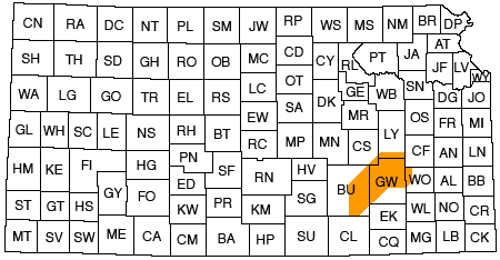
Location of the Area
The shoestring sands described in this report occur in southeast-central Kansas, chiefly in Greenwood and Butler counties, and to a lesser extent in Woodson, Lyon, Chase and Cowley counties. (See Fig. 1.) Shoestring sands are of common occurrence throughout a much larger region, including much of southeastern and east-central Kansas. Those in Miami, Franklin, Linn, Anderson and Allen counties have been studied by Rich (1923, p. 103-113, 1926, p. 568-580) and those in Anderson County by Charles (1927).
Figure 1--Index map of Kansas showing the area described in this report.
Surface Features
The surface of the eastern third of Kansas is characterized by a series of parallel plains trending in a northeasterly direction and separated in steplike succession by eastward facing rises or escarpments. The plains, therefore, form a succession of steps that increase in altitude progressively westward. The Flint Hills, a strip of country that has comparatively high relief for the plains country, constitute the most pronounced step in eastern Kansas. They trend slightly east of north across the eastern parts of Cowley and Butler counties and across the western part of Greenwood County. They are characterized by steep, eastward slopes with a relief of 150 to 300 feet in a distance of 2 to 3 miles, and a plain sloping from the crest of the Hills westward at a low grade. The westward sloping plain is floored by resistant chert-bearing limestone. Thick shale and thin limestone strata occupy the steep east-facing slopes. The Browning, Teeter, Scott and Sallyards shoestring oil fields, shown on Plate 1, lie within the Flint Hills.
The surface of the region ranges in altitude from a little less than 900 feet to a little more than 1,600 feet above sea level. The Flint Hills attain an altitude of a little more than 1,500 feet above sea level over large areas and reach an altitude of a little greater than 1,600 feet in a few localities; much of the surface of the plains country west of the Flint Hills in Butler and Cowley counties is slightly below 1,500 feet and the plains east of the Flint Hills range between 1,100 and 1,250 feet in much of Greenwood County. The channels of some of the streams in the eastern part of Greenwood County have an altitude of only 900 feet.
The Verdigris River and its tributary, Fall River, are the main streams east of the Flint Hills in Greenwood County and the Walnut River is the chief stream west of the Flint Hills in Butler and Cowley counties.
Field and Office Work
This report contains the results of about two and one half years' study; about a quarter of the time was spent in the field in structural and stratigraphic studies of the surface rocks in several of the shoestring oil pools; much of the time in office was devoted to studies of records of approximately 5,000 wells and to laboratory studies of chunk samples (large samples usually resulting from shooting the wells), cores and drill cuttings, mainly from the oil-producing sands.
The actual field work for the report was limited to a study of the relation of the attitude of the surface rocks to the buried sand lenses; in other words, the object of the field work was to determine whether or not the buried sand lenses have produced folds in the surface beds. The field mapping was conducted by means of a plane table and telescopic alidade in accordance with the usual procedure employed by petroleum geologists. Datum points were, however, more closely spaced than is the common practice; this was done for the purpose of providing detailed control for elevations on the structure contour maps, the contour interval being 2 feet instead of the more commonly used interval of 10 feet. Stratigraphic studies outside the oil fields mapped in this way were made at numerous localities between the Oklahoma-Kansas boundary and the Cottonwood River in the northern part of Chase County in order to determine the correlation of the beds exposed in oil fields of Greenwood County with described stratigraphic sections in Osage County, Oklahoma, and in the Cottonwood River valley, Kansas.
The well logs that were studied in the office were furnished by the Well Log Bureau of the Kansas Geological Society, the Prairie Oil & Gas Co., the Empire Oil & Refining Co., the Skelly Oil Co., the Shell Petroleum Corporation, and other oil companies. These well records supplied data for drawing several hundred stratigraphic sections across the sand bodies and a few longitudinal sections through some of the sand lenses, for drawing block diagrams of the sand bodies of several of the oil fields, and for delimiting the areas that contain the shoestring sands. Studies with the aid of a binocular microscope were made of numerous sets of drill cuttings from the producing sand, which were supplied by the oil companies and individual operators in the region. Also a compilation was made of a large number of microscopic examinations that had been made of drill cuttings by oil company geologists. A few core samples from the sand bodies were studied; thin sections were made from the core samples and studied with a petrographic microscope; also samples of the sands were classified as to grain size by passing them through a series of sieves.
In the course of the field study visits were made to outcrops of elongated, lenticular sand deposits of Pennsylvanian age near Warrensburg, Moberly, Lawrenceburg, and other localities in Missouri. These have, therefore, been compared with the shoestring sands in Greenwood and Butler counties, Kansas. Also, the forms of the shoestring sand trends have been compared with the meander patterns of rivers and also with shore features shown by maps of the coasts of the United States. Shortly before this report was submitted for publication, the Atlantic coast between Cape Henry, VA, and Atlantic City, NJ, which includes an almost continuous succession of offshore bars and accompanying marshes, was visited by H. D. Miser and me for the purpose of studying modern coast features that appear to be similar to those that prevailed during the time of deposition of the shoestring sands.
Acknowledgments
It is with a feeling of genuine pleasure that I take this opportunity of expressing my appreciation for the wholehearted cooperation of the many geologists and executives of the operating oil companies and geologists engaged in independent work. Without this cooperation the study resulting in this report would have been impossible to complete. Information that had been obtained through many years was placed so freely at my disposal by so many individuals and companies that space is not available to mention all. In the free discussion that I had with several geologists, no doubt ideas were borrowed that are now incorporated in this report. Wherever it has been possible to segregate the ideas of others, acknowledgment is made at appropriate places in this text.
Special acknowledgment should be made to the companies and individuals named below: John M. Nisbet, Frank T. Clark and George F. Berry, of the Empire Oil & Refining Co., supplied drill cuttings, core samples, descriptions of samples and base maps showing wells in the shoestring sand region; in addition Mr. Clark reviewed the illustrations that were prepared by me for this report. The Skelly Oil Co., through the courtesy of R. B. Rutledge, provided a very complete set of base maps of the shoestring sand region and a base map showing the distribution of the sand lenses; and, through the courtesy of Howard S. Bryant, I made repeated use of the company's file of logs in connection with the detailed subsurface studies of the shoestring sands. The Shell Petroleum Corporation made available well cuttings and well logs. The Prairie Oil & Gas Co., through Richard Foley and Raymond A. Whortan, and the Sinclair Oil & Gas Co., through L. W. Kesler, permitted me to use plotted logs in much of the region studied in detail. The Sinclair Prairie Oil & Gas Co., through Messrs. Kesler and Foley, made available maps showing wells in the region; Plate I was prepared largely from these maps. The Mid-Kansas Oil and Gas Co., through A. E. Cheyney, permitted me to use the company's log file. W. K. Cadman, who described the region several years ago (1927, p. 1151-1172), gave me maps of Greenwood and Butler counties, showing by symbol all wells that found sand, and by a different symbol all wells that failed to find sand at the horizon of the shoestring sand zone; these maps were a great aid in the preparation of Plate 1. R. E. Bending supplied many surface and subsurface structure contour maps of parts of the region. Edward A. Koester supplied the locations of wells in central Kansas that have been drilled to granite. John S. Barwick reviewed the illustrations for the report. The Kansas Geological Society, through Harvel E. White, manager of its Well Log Bureau, made available its file of well logs. The Mid-Continent Petroleum Corporation, through L. S. Youngs, permitted the use of well logs. The Pure Oil Co., through Theron Wasson, A. A. Langworthy and Ira, H. Cram, supplied surface structure maps and other data on Greenwood County. J. L. Garlough supplied structure contour maps of parts of Greenwood County. George H. Norton gave me a surface structure contour map of the region that had been compiled by him; he also gave me a map showing the distribution of the sand lenses. The Union Gas Corporation, through C. W. Studt, made available its file of well logs in southeastern Kansas. Theodore Gore, drilling contractor of Wichita, Kansas, supplied chunk samples of the producing sand from wells drilled in the sand trends. W. H. Rex, El Dorado, Kansas, permitted me to use maps from his files. R. J. Conley examined for me a thin section of sand from the Madison oil field. John L. Rich gave me a map of an eastern Kansas stream channel sand; Walter W. Larsh and L. L. Bechtel, of the Stanolind Oil & Gas Co., gave me descriptions of cores taken from the sand in the Edwards Extension oil field. Many of the persons mentioned above, as well as many others, including F. G. Holl, Roy H. Hall, L. C. Hay, T. E. Weirich, Alex W. McCoy, Fritz L. Aurin, J. V. Howell, Douglas W. Johnson, W. H. Twenhofel, and K. C. Heald, discussed with me the problems of the shoestring sands and gave me helpful suggestions and ideas. G. L. Knight, of the Geology Department of the University of Kansas, assisted me in the study of the thin sections of the sands. W. L. Stryker provided data concerning the oil and gas producing sands of Woodson County.
In addition I wish to express my appreciation for the competent assistance in the field mapping of the Browning oil field given by Joseph L. Borden during two months in 1931, and in the mapping of the Thrall and Fankhouser oil fields given by Richard V. Henderson during three months in 1932; for the laboratory studies of core samples of the sand made by P. G. Nutting, of the United States Geological Survey; for suggestions and criticism by Hugh D. Miser, of the United States Geological Survey, and Raymond C. Moore, state geologist of Kansas, under whose joint direction the work was carried on; for criticism of the report by R. W. Richards and P. D. Trask of the United States Geological Survey.
Previous Reports
The Sallyards and Blankenship oil fields, two shoestring oil fields that are parts of the shoestring trends of this report, were described by Berger in 1921 (p. 276-281). Loomis wrote an article in 1923 (p. 482-487) on the Burkett-Seeley oil pools which were then being developed. Cadman is the author of the first comprehensive report on the shoestring sands of the Greenwood County region; his report was published in 1927 (p. 1151-1172), after development of more than 80 percent of the present known oil fields had been largely completed. This was followed in 1929 (p. 150-159) by a detailed report on the Madison shoestring by Cheyney, which contains a brief discussion of the origin of the sand bodies that comprise the chief shoestring sand trends. Cheyney's conclusions differ from those reached by Cadman.
Rich's conclusions on the origin of the shoestring sands in the eastern-most part of Kansas, were published in 1923 (p. 103-113) and 1926 (p. 568-580), and have been of much value to the studies in the Greenwood County region. In 1927 Charles described the shoestring sands of Anderson County, in the eastern part of the state. Other lenticular sand bodies that are further removed from the Greenwood-Butler County region, but related to it in a general way, are mentioned below. The extent and interpretation of the Hogshooter gas sand of northeastern Oklahoma were described by Berger in 1919 (p. 212-216), and the sand body of the Burbank oil field in Osage County, Oklahoma, was described in 1924 (p. 584-592) and again in 1927 (p. 1045-1054) by Sands. The producing sand body of the Rainbow Bend pool in Cowley County, Kansas, was described by Snow and Dean in 1925 (p. 794-982) and again in 1929 (p. 52-29). Snow's (1932, p. 881-890) more recent article describing the Bartlesville sand in northeastern Oklahoma, and Weirich's (1932, p. 25-28) article on the character of the sands of the Cherokee shale in northeastern Oklahoma, have a bearing on the Greenwood County shoestring sand study, inasmuch as they describe sandstones that in general are of the same age as, and are similar in some characters to the Kansas sands. A preliminary report on the shoestring sands in Greenwood and Butler counties, Kansas, by Bass (1934, p. 1313-1345) has been discussed by Holl (1934, p. 1343-1344), Rich (1934, p. 1344-1345), and Tarr (1934, p. 1710-1712). Since the preparation of this report a channel sandstone in Pennsylvanian beds in southeastern Kansas has been described by Pierce and Courtier (1935, p. 1061-1064).
Prev Page--Contents || Next Page--Formations
Kansas Geological Survey, Geology
Placed on web May 3, 2011; originally published Sept. 1936.
Comments to webadmin@kgs.ku.edu
The URL for this page is http://www.kgs.ku.edu/Publications/Bulletins/23/02_intro.html