![]()
Figure 1
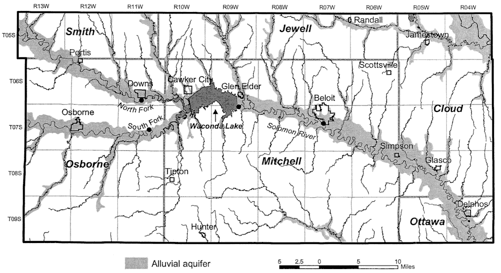
Figure 1. Map of the study area with sampling loctions. The study area includes the North Fork Solomon River from Portis and the South Fork Solomon River from Osborne downstream to the Solomon River near Glasco. The locations where water samples were collected by the Division of Water Resources and Kansas Geological Survey (KGS) and analyzed by the KGS are shown as solid circles on the North Fork at Downs and on the South Fork south of Downs (near Corinth), at Glen Elder Dam, and at Beloit.
Kansas Geological Survey, Geohydrology
Comments to webadmin@kgs.ku.edu
Placed online Jan. 17, 2006
URL=http://www.kgs.ku.edu/Hydro/Publications/2003/OFR03_49/fig1.html