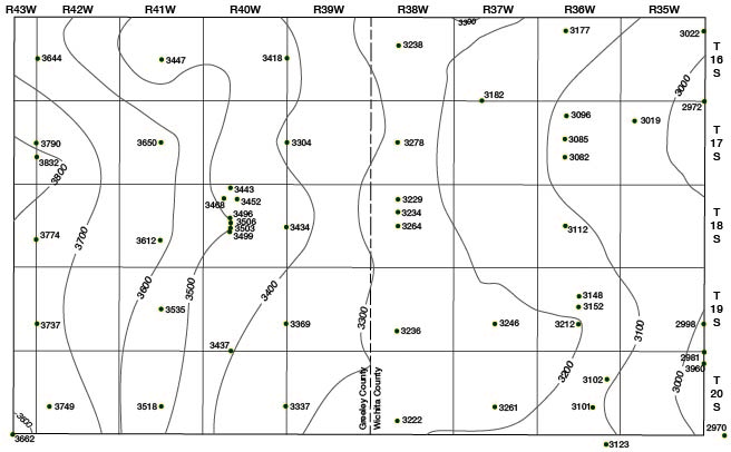
Figure 10
Fig. 10--Map of Wichita and Greeley counties showing the configuration of the bedrock surface beneath the Pliocene and Pleistocene deposits.
Kansas Geological Survey, Geology
Placed on web Jan. 11, 2008; originally published April, 1954.
Comments to webadmin@kgs.ku.edu
The URL for this page is http://www.kgs.ku.edu/General/Geology/Wichita/fig10.html
