![]()
Prev Page--Water Table || Next Page--Recovery and Utilization
Ground Water, continued
Ground-water Recharge
General Features
Recharge, the addition of water to the ground-water reservoir, may be accomplished in several ways. All ground water available to wells in Sherman County is derived from precipitation falling as rain or snow within the area or within near-by areas to the west. Part of the water that falls as precipitation is carried away as surface runoff and is lost to streams, part evaporates, and some is absorbed by plants and returned to the atmosphere as water vapor by the process known as transpiration. Water that escapes runoff, evaporation, and transpiration, percolates slowly down through the soil and underlying strata, and part of it eventually reaches the zone of saturation.
The quantity of water that is carried away by surface runoff depends upon several factors: the intensity of rainfall, the slope of the land, the type of soil, the type and amount of vegetation, and the season.
In general, for a given amount of rainfall a greater percentage of the rainfall will enter the ground during a long gentle rain than during a torrential downpour when the percentage of runoff is large. The slope of the land is an important factor in determining the amount of runoff and the steeper the slope, the greater the amount of runoff. In much of Sherman County slopes are gentle, but there are fairly steep slopes along some of the streams. Runoff in the uplands is reduced considerably by drainage into many small basins.
The type of soil also affects the amount of runoff. In general, runoff is greater in places of tightly compacted, fine-grained soil than in places of loose sandy soil. Runoff from rainfall is greater in the winter when the frozen ground prevents infiltration.
The velocity of surface runoff is reduced by a suitable vegetative cover and water has a better chance to seep into the ground. Modern methods of land terracing and contour farming generally tend not only to retard the erosion of valuable soil but to reduce runoff and therefore increase the recharge of water to the soil and to the water table.
Most of the water from precipitation is evaporated or transpired, never having reached the water table. A large percentage of the precipitation falls during the period from May through September when temperatures are high, humidity is low, and wind movement is relatively high; consequently the rate of evaporation is high.
The water that escapes evaporation, transpiration, and runoff percolates downward into the soil zone. When the amount of water absorbed by the soil is greater than can be held by the capillary force opposing the pull of gravity, water will move from the soil zone to the saturated zone. During the growing season this downward percolation is greatly retarded by evaporation and by absorption and transpiration by plants, and at the end of the growing season moisture in the soil zone may be near depletion. During the fall and winter when evaporation and transpiration are at a minimum the soil zone may again become saturated and recharge to the water table may take place if precipitation is sufficient.
The average annual precipitation of Sherman County is about 18 inches; very little of this ever reaches the water table. The amount of annual recharge in Sherman County is not known but is very small. Frye (1942, p. 66) has estimated that in the High Plains in southwestern Kansas the average amount of ground-water recharge is about one-fourth inch, but marked differences between the geology of the two areas indicates that it is much less than this in Sherman County and is probably of the magnitude of one-tenth inch.
Upland Areas
Ground-water recharge in the upland areas in Sherman County is probably very slight. The uplands are covered by a mantle of windblown silt (loess) which is as much as 50 feet thick in places. Although the loess generally is sandy, it is usually rather impermeable. The porosity of loess is fairly high but water percolates down through it at a very slow rate. Rodent burrows may furnish some avenues of recharge, and recharge may take place through sod cracks which develop during dry seasons. These sod cracks in places attain a width of several inches and extend along the surface for several hundred feet. Hay (1895) also considered that sod cracks were important in recharge of ground water. Several times during the test drilling in Sherman County, water circulation was lost while drilling in loess, indicating the presence of cracks or openings beneath the surface.
Depressions
Shallow depressions are very common in the upland areas of Sherman County. The locations of some of these depressions are shown on Plate 1 as intermittent ponds. After heavy rains water collects in the depressions and forms temporary ponds. The water in some of these ponds disappears quickly, but in others it may remain for several weeks or months. Whether much ground-water recharge is derived from undrained depressions of this sort is problematical. A study of the character of deposits underlying similar depressions in the High Plains of Texas has revealed that subsurface conditions are quite varied. Several hundred test holes were drilled. It was found that some depressions were underlain by permeable beds, whereas others were underlain by relatively impermeable caliche or cemented beds (White, Broadhurst, and Lang, 1940, pp. 6-8). The floors of some depressions in Sherman County are traversed by mud cracks that develop during dry periods. It is possible that some recharge after rains may take place through these mud cracks until they are sealed over again. Other depressions have a soil cover that would seem to be an effective seal against recharge of ground water. In his hypothesis for the origin of High Plains depressions, Johnson (1901) assumed that significant quantities of water entered the ground from these depressional ponds.
Streams
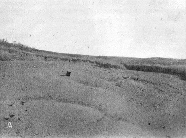
One of the principal sources of recharge of the ground-water reservoir in Sherman County is the loss of water from the channels of streams. NVith the possible exception of the southeastern part of the North Fork Smoky Hill River and the northeastern part of Beaver Creek, all streams in Sherman County are ephemeral, flowing only after periods of heavy rainfall. The alluvium in most of the stream valleys in Sherman County is rather permeable (Pl. 6A) and it is probable that during periods of stream flow, much water percolates down through the alluvium and eventually reaches the body of ground water.
Plate 6A--Deposits of alluvial sand and gravel along Beaver Creek. View looking east in the NE SW sec. 26, T. 7 S., R. 41 W. There probably is considerable ground-water recharge in such deposits during periods of stream flow.
Subsurface Inflow
The water-table map (Pl. 1) indicates that ground water in this area moves in a northeasterly direction. The bulk of ground water available to wells in Sherman County is derived from subsurface inflow. Estimates based on available data indicate that approximately 7 billion gallons of water enter the county annually from the west and southwest. This amount is much larger than that thought to join the water table from local precipitation in Sherman County.
Discharge of Subsurface Water
Meinzer (1923a, p. 48) has divided the discharge of subsurface water into vadose-water discharge (discharge of soil water not derived from the zone of saturation) and ground-water discharge (discharge from the saturated zone).
Vadose-water Discharge
The discharge of soil water not derived from the zone of saturation is called vadose-water discharge and includes the discharge of water directly from the soil by evaporation and discharge from growing plants by transpiration. The consumption of soil water by crops is large and is vitally important to agriculture. This consumption of water reduces recharge to ground water because the deficiency of soil moisture must be replenished before recharge can take place.
Ground-water Discharge
Ground-water discharge is discharge of water from the zone of saturation and may take place through evaporation and transpiration, by discharge from wells and springs, by seepage into streams, and by underground movement to adjacent areas.
Transpiration and evaporation--Water may be taken into the roots of plants directly from the zone of saturation or from the capillary fringe and discharged from the plants by the process known as transpiration. The depth to which the roots of plants go for water varies with different kinds of plants and types of soil. Ordinary plants and grasses do not draw water from depths of more than a few feet; alfalfa may obtain ground water from as much as 20 or 30 feet below the surface and the roots of certain types of desert plants have been known to extend 50 or 60 feet below the surface to reach the water table (Meinzer, 1923, pp. 82-83).
Loss of ground water through direct evaporation and transpiration from the water table is probably not very great in Sherman County, where depths to water table in most areas are considerably below the roots of plants. The only places where transpiration is of much significance in ground-water discharge are in parts of the valley of the North Fork Smoky Hill River and in parts of the valley of Beaver Creek. Discharge of ground water by direct evaporation is also restricted to these areas where the water table is very shallow (Pl. 2).
Springs and seeps--The amount of water discharged from springs in Sherman County is negligible. There are springs in some places along the North Fork Smoky Hill River where the water table intersects the ground surface. In the NE sec. 33, T. 10 S., R. 39 W., a spring is at the contact between the Ogallala and Pierre formations. Water moving laterally at the base of the Ogallala formation on the top of the relatively impermeable Pierre shale flows or seeps out at the surface where the top of the Pierre is exposed.
Most of the streams in Sherman County are influent (or losing) streams, discharging water to the water table during periods of flow. However, parts of Beaver Creek and the North Fork Smoky Hill River receive water from the water table and are effluent (or gaining) streams in these areas.
Wells--Ground water is also discharged by pumpage from wells. All domestic, railroad, and municipal water supplies and much of the livestock water supply in Sherman County are derived from wells. A relatively small quantity of ground water is pumped for irrigation. The amount of water discharge from wells for all purposes is estimated to be of the magnitude of 350 million gallons a year.
Subsurface outflow--Before wells were drilled in Sherman County, the ground-water reservoir in the area was in a state of approximate equilibrium-that is, the average annual recharge was approximately balanced by the average annual discharge and the water table was moderately stable except for seasonal fluctuations. Ground water was added by underground movement from the west, by recharge from precipitation, and by seepage from streams. Discharge of ground water took place mainly by subsurface movement from the area with smaller amounts being discharged by evaporation and transpiration, and by seepage into streams. In spite of the additional discharge due to pumping, the dominant method of ground-water discharge in Sherman County is still by subsurface movement to adjacent areas. Measurements of ground-water discharge through subsurface outflow could not be made, but estimates based on available data indicate that subsurface outflow, predominantly to the east and north, is slightly more than 7 billion gallons a year.
Prev Page--Water Table || Next Page--Recovery and Utilization
Kansas Geological Survey, Geology
Placed on web Aug. 1, 2008; originally published Nov. 1953.
Comments to webadmin@kgs.ku.edu
The URL for this page is http://www.kgs.ku.edu/General/Geology/Sherman/05_gw2.html