![]()
Prev Page--Contents || Next Page--Topography
Introduction
Location and Extent of the Area
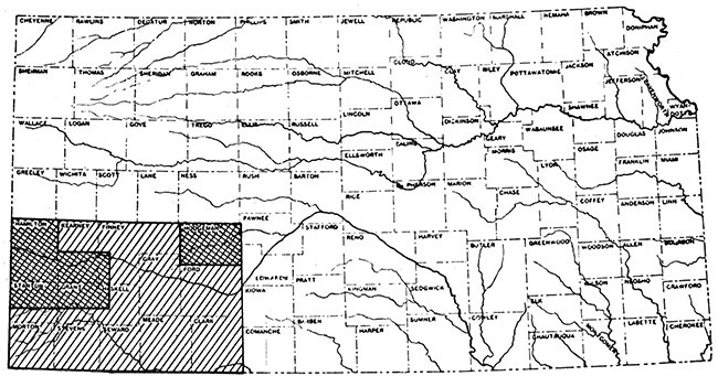
The area described in this report comprises a block of fourteen counties in the southwestern corner of Kansas: Clark, Ford, Finney, Grant, Gray, Hamilton, Haskell, Hodgeman, Kearny, Meade, Morton, Seward, Stanton, and Stevens (fig. 1). It extends southward from the north line of T. 21 S. to the Oklahoma boundary and westward from the east line of R. 21 W. to the Colorado boundary. The total area is about 12,000 square miles, or about one-seventh that of the state of Kansas.
Figure 1--Map showing the area described in this report. Areas in which detailed studies have been made previously are indicated by double crosshatching.
Purpose of the Report
It is the purpose of this report to outline the broad features of Cenozoic geology in southwestern Kansas, and to consider their relations to the natural resources of the region, particularly to the underground waters. No detailed geologic mapping or areal description is undertaken. Rather it is endeavored to provide a foundation for future studies of detailed character in more restricted areas, and to anticipate some of the problems that must arise in the course of such studies. Working hypotheses are suggested for application to questions that cannot be answered satisfactorily now, with the expectation that they will be subjected to the test of future intensive work in critical areas.
Previous Geologic Studies
The important studies dealing specifically with the Cenozoic geology of southwestern Kansas are listed below. Others of more general character or less direct application to this area are cited at pertinent points in the text.
One of the first, if not the first, geologists to comment on the Tertiary of southwestern Kansas was Newberry (1861), who traversed a part of the area on returning from an expedition to the far west in 1858. [Note: All citations of geological literature refer to the bibliography at the end of this report. The references are arranged alphabetically by authors, and chronologically under individual authors. The citations are made by giving author's name and date, either enclosed in parentheses or not, depending upon the context.] The first detailed study, however, was published by St. John in 1887, and in 1890 Hay published a reconnaissance geologic map and general description of the stratigraphy. In 1894, Case presented additional observations on the Mesozoic and Cenozoic formations. Hay, in 1896, assembled a comprehensive bibliography of Kansas geology prior to 1893. The reader is referred to this bibliography for reference to numerous obscure and relatively inaccessible works touching casually on the geology of the area here discussed. In 1897, Haworth contributed three important papers, one (1897) on underground waters, another (1897a) on areal physiography, and a third (1897b) on the nature and origin of the Tertiary deposits. In 1898, a topographic map of the state, on a contour interval of 100 feet, was compiled by Gannett. A report by Johnson (1901), regarded by many geologists as a classic in its field, presents a detailed analysis of the deposition of the Tertiary strata in western Kansas and contributes much valuable information on physiography, underground waters, and land utilization in parts of the area, particularly in Meade County. In 1905, Darton published a general report on the geology of the central Great Plains, outlining the stratigraphy of the region, and summarizing available data on underground waters, particularly with respect to deep wells. In the following year, Slichter (1906) presented the results of some detailed studies on underground waters along the Arkansas valley. Haworth, in 1913, published a general report on well waters, including those in southwestern Kansas. In 1916, Darton published a semi-popular account of the geology along the route of the Santa Fe Railroad. In 1920, the same author gave a detailed account of the geology of the Syracuse and Lakin quadrangles, embracing large sections of Hamilton, Kearny, Grant, and Stanton counties. In 1926, Bass contributed further to the geology of Hamilton County. In 1928, Landes published a detailed account of volcanic ash deposits and their utilization. Moss, in 1932, described in detail the areal geology of Hodgeman County. In 1934, some general features of regional geology were summarized by Ver Wiebe. In 1935, a preliminary announcement on results of ground-water studies by Theis and others was released. In 1937, the areal geology was delineated on a geologic map of Kansas (Moore and Landes, 1937) having a scale of about 8 miles to the inch (1:500000), issued by the State Geological Survey. In the same year, a summary of the mineral resources of individual counties was prepared by Landes (1937). A short preliminary paper on ground waters in a part of Ford County was published by Lohman in 1938. Also in that year, a summary of the oil and gas resources of western Kansas was compiled by Ver Wiebe (1938), and a preliminary paper on Pleistocene gravels was published by the present writer (Smith, 1938). Detailed studies of the underground waters in Ford, Morton, and Stanton counties have now been completed by H. A. Waite, T. G. McLaughlin, and B. F. Latta, respectively, and manuscripts are being prepared. Similar studies are progressing in Meade, Hamilton, Kearny, Finney, and Gray counties.
Field Work for This Report
Field work for the present report was started in 1936 and essentially completed in 1938. It was of reconnaissance character, a total of three months and one week being devoted to the area here described. Some additional time, however, was devoted to studying the eastward extension of Cenozoic formations in the Great Bend area, and also the westward extension along the Arkansas valley in Colorado. Most of the time was spent in those parts of the area that had not yet been mapped in detail, and in these parts attention was concentrated on the more dissected sections where the rocks are best exposed.
Base maps used for field work were county road maps and U. S. Geological Survey topographic sheets. The latter cover about two-thirds of the area, and comprise the following quadrangles: Ashland, Dodge, Garden City, Lakin, Meade, Ness, Spearville, and Syracuse. The scale of these maps is 1:125000 and the contour interval is 20 feet. The degree of accuracy differs somewhat from map to map, and although some details of topography are considerably generalized, the maps, on the whole, are satisfactory for reconnaissance work. Morton, Stevens, and Seward counties, however, together with western Meade County, the southern portion of Stanton, Grant, and Haskell counties, and the northern portion of Hamilton, Kearny, and Finney counties, have not yet been mapped topographically. In these areas the County Engineers' road maps were used. The scale of these maps ranges from 1 inch = 2 miles to 1 inch = 4 miles. Also useful were the outline county maps prepared by the State Highway Department, on a scale of 1 inch = 4 miles.
A part of the field work was directed toward the making of a generalized topographic map (pl. 2), of 100-foot contour interval, for those parts of the area not included in standard topographic sheets, owing to the discovery of gross errors in the Gannett map of 1898. Data for the new map were collected by making speedometer traverses, using the Paulin Altimeter. U. S. Geological Survey and U. S. Coast and Geodetic Survey bench marks were used as controls. In some places, the results of State Highway surveys were available also, and were very helpful. The map thus prepared, although wanting in detail, gives a much more accurate picture of the relief of the area than does the Gannett map, which represents only an office compilation.
The rest of the field work was devoted to the study of surface and subsurface geology. Surface geology was studied by examining typical exposed sections in as many representative localities as time permitted. Particular care was given to the search for and collection of fossils, especially vertebrates. Subsurface data and information on underground waters were obtained from the records of deep water wells, supplied by well drillers, city and railway engineers, and landowners.
Other Sources of Geologic Information
Field work was facilitated and the preparation of this report was aided by information obtained from many sources, both governmental and private. For the guidance of future workers in the area, the more important of these sources are listed below.
Departments of the Federal Government
Geological Survey: The annual reports, professional papers, bulletins, water-supply papers, and folios of this organization provide a fundamental background for all geological work in the area. Specific references to these publications are given elsewhere in this report.
Coast and Geodetic Survey: Precise elevations are available for bench marks spaced 1 to 2 miles apart along the following lines of leveling: Santa Fe Railroad route along the Arkansas valley from Dodge City to Colorado line; Rock Island route from Bucklin to Dodge City and from Bucklin to Liberal; Santa Fe route from Dodge City through Gray, Haskell, Grant, and Stanton counties; U. S. highway 83 from Liberal through Garden City; Kansas highway 27 north from Syracuse, and between Richfield and Johnson; and along Kansas highways 12 and 45 in parts of Seward, Stevens, and Morton counties.
Bureau of Soils: The results of a reconnaissance soil survey of the entire area, and of a more detailed survey for one part of the area are of geologic interest, and are discussed in a later section of this report.
Soil Conservation Service: A reconnaissance soil-erosion survey of the "Dust Bowl" counties has been published, and aerial photographs for these counties are available. These were not obtained in time to be used in the course of field work for the present report, but were extremely helpful in the office, and should be invaluable to future field workers.
Agricultural Adjustment Administration: Aerial photographs for all counties exclusive of those in the "Dust Bowl" are available, and many of these may be consulted in the local offices of the organization.
Departments of the Kansas State Government
Geological Survey: Much valuable information on southwestern Kansas, particularly on the economic aspects of the geology, is to be found in the many publications of the State Geological Survey. References to these are made in following sections of this report.
Board of Health: Chemical analyses of municipal well waters, together with partial records of the wells themselves, are on file in the offices of the State Board of Health.
Board of Agriculture: Data on stream-flow measurements, irrigation, and related matters are recorded in publications of the Division of Water Resources of this department.
Highway Department: Accurate elevations along many stretches of the state highways are available at the district offices. Generally, however, these start from assumed datum points, and must therefore be tied-in with standard bench marks before they are usable. Information on deposits of sand, gravel, volcanic ash, and other construction materials is also on file at the offices of the highway department.
City and County Departments
Much valuable information on water wells, location of sand and gravel pits, etc., was obtained from city and county engineers.
Other sources
Records of many deep water wells and general information on subsurface conditions were obtained from well drillers. Additional well logs were obtained from landowners, railway engineers, and from the Well Log Bureau of the Kansas Geological Society, in Wichita.
Acknowledgments
The interest and encouragement of R. C. Moore and K. K. Landes throughout the progress of the work is gratefully acknowledged. To Claude W. Hibbard, of the Dyche Museum of Natural History, University of Kansas, sincere thanks are due for close cooperation both in the field and in the laboratory. Such progress as has been made in unraveling the Late Tertiary and Pleistocene stratigraphy in southwestern Kansas is to be credited largely to Mr. Hibbard's studies of the vertebrate faunas. Much unpublished information on this topic was placed at my disposal, and several days were spent with Mr. Hibbard in the field, studying faunal localities and stratigraphic relations. Also, portions of this manuscript relating to the age of Cenozoic deposits have been critically read by Mr. Hibbard. To Kenneth McCall, of the State Division of Water Resources at Garden City, I am indebted for helpful discussions on the hydrology of the area. In summarizing the geology of Meade and Ford counties, I have had the benefit of stimulating discussion with John Frye and H. A. Waite, of the U. S. Geological Survey, who have been engaged in more recent and more detailed studies in these areas as part of a program of ground-water investigations conducted in cooperation with the State Geological Survey. To many well drillers, and particularly to Dennis Doty, of Garden City, thanks are due for numerous water-well logs and for other information. Logs of wells operated by the Santa Fe Railroad were obtained through the courtesy of W. W. Kelly, Chief Engineer. Finally, it is a pleasure to acknowledge the helpful cooperation and friendly interest of city and county engineers and many other individuals, too numerous to mention by name.
A Paulin altimeter used in the field work and numerous aerial photographs used in studying the sand-dune areas were purchased with grants from the Graduate Research Fund of the University of Kansas. Mechanical analyses of sediments, compilation of well logs, and some general map studies were made with the help of student assistants provided by the National Youth Administration.
Prev Page--Contents || Next Page--Topography
Kansas Geological Survey, Geology
Placed on web Feb. 8, 2017; originally published September 15, 1940.
Comments to webadmin@kgs.ku.edu
The URL for this page is http://www.kgs.ku.edu/Publications/Bulletins/34/02_intro.html