![]()
Prev Page--Post-World War II || Next Page--References
10. The Survey of the 1960s and 1970s
In writing history, the most immediate period is often the most difficult to describe. By definition, the recent past does not afford the perspective of time, and makes it difficult to assess the long-term impact of individuals and their ideas. The most recent past of the Survey--the 1960s, 1970s, and into the present--is difficult to evaluate for precisely those reasons. In some ways, the past 30 years may have been the most important, depending on the measure, in the Survey's existence. Certainly those years brought about change, in the buildings occupied by the Survey, in the Survey's leadership, and in the research directions pursued by its staff. Those years may also have recorded a shift in direction, from a Survey that was largely service directed to one that was more research-oriented.
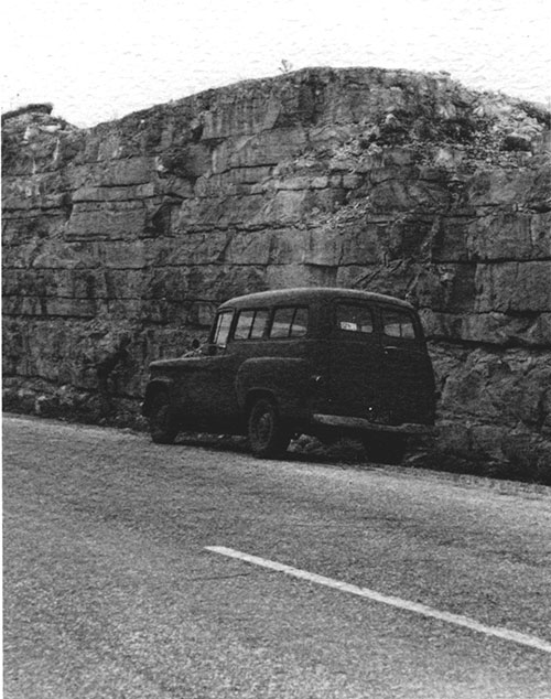
A Survey vehicle parked along a roadcut through the Fort Hays limestone in the early 1960's.
Change also took place in the subjects that Survey scientists studied. Throughout nearly all of its existence prior to 1960, the topic of oil and gas received the most attention. Though the Survey did basic work in stratigraphy and paleontology and, later, structural geology and geophysics, much of that work was done in support of oil and gas studies. Coal and metallic minerals received less attention. Beginning in the mid-1960s, other topics began to compete for attention at the Survey, mostly the result of problems faced by the state of Kansas. The Survey's ground-water effort changed from one that was largely dependent on cooperative studies with the U.S. Geological Survey to an independent research effort that was the largest program, at least in terms of full-time scientific staff, at the Kansas Survey. That switch in emphasis was the result of growing awareness of drawdowns, in some cases alarming drawdowns, in the water levels in the Ogallala aquifer in western Kansas. To a far less significant extent, the Survey also increased its efforts in environmental geology, primarily in response to concern about such issues as mined-land reclamation, storage of radioactive waste, and others. Changes also occurred in research methods, or at least in the Survey resources that went toward improving methods of studying geologic problems or producing geologic data. Mathematical geology, and as a natural outgrowth, the application of computers to geologic problems, received considerable attention. Geophysics, particularly seismology and magnetics and gravity, grew also, with much of that growth based on outside funding.
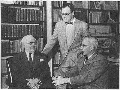
Three Survey directors. From left, Raymond C. Moore, William W. Hambleton, and Frank C. Foley.
All of those changes--in research direction, leadership, and facilities--as important as they were, came slowly enough. In the early 1960s, the Survey continued to generate major products, much as it had during the 1950s. In 1963, Daniel Merriam published The Geologic History of Kansas, a one-volume compilation of virtually everything that was known about the state's geology at the time (Merriam, 1963). A year later, he edited a two-part bulletin on cyclic sedimentation that summarized the ongoing argument about that topic (Merriam, 1964). That same year the Survey published a revised 1:500,000 geologic map of the state, something that had not been done for nearly 30 years. A few years later, Doris Zeller edited the Survey's bulletin on the Kansas rock column that provided the stratigraphic standard for the Survey's work (Zeller, 1968). Those, along with the other books and maps that appeared during that time, continued the Survey's role as a provider of basic geologic information.
At about the same time, however, the Survey was drawn into what was probably its most visible role ever in state politics. In the mid-1960s, the Atomic Energy Commission announced its intention to locate a nuclear waste-disposal plant in an abandoned salt mine on the edge of the central Kansas town of Lyons. The AEC's intention was to place the waste in canisters and store those canisters in the bedded salt. The work began with several projects designed to show the feasibility of such an approach, and was to be followed with larger amounts of waste. Originally the citizens, and most of the state, seemed to accept the idea as a boon for economic development. Concerns about the location began to surface, however, and they grew with the increased strength of the environmental movement in the late 1960s and early 1970s. The Survey was asked by then-Governor Robert Docking to take a look at the Lyons site, and did so. Though the Survey's report did not criticize the notion of placing waste in bedded salt, it was critical of the Lyons site, particularly because of the possibility of old, unrecorded and unplugged oil and gas wells in the area, thus allowing ground water to move into the mine (Angino, Bayne, and Halepaska, 1972; see also Angino and Hambleton, 1971). The combination of the Survey's report and growing statewide disenchantment with the location eventually convinced the AEC to abandon the project, but during that deliberation the Survey received considerable public exposure and was intimately involved with state and national politics (see Hambleton, 1981).
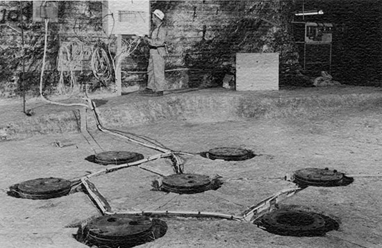
The Lyons salt mine and the AEC's demonstration project in the late 1960's.
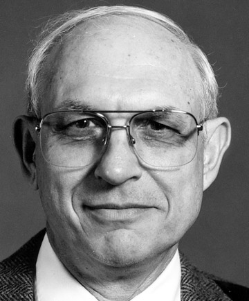
Perhaps the figure most identified with the Survey's involvement with the Lyons site was William W. Hambleton. The Survey's assistant director from 1956 to 1962, and associate director from 1962 to 1970, Hambleton was a native of Pennsylvania, had an undergraduate degree from Franklin and Marshall and a master's from Northwestern, and then came to KU to earn a Ph.D. in geology. Hambleton's research interests focused mainly on geophysics and he taught for a time in the KU geology department before joining the Survey. Working with Frank Foley, Hambleton dealt with a continually increasing realm of administration, so that by Foley's retirement in 1970, he was the obvious choice as Foley's replacement. Hambleton was involved with the Survey's study of the Lyons site and was its most visible spokesman during the political debate that revolved around radioactive waste. That identification was strong enough that Hambleton made it an area of expertise and served on national panels and committees that studied radioactive waste well into the late 1970s.
The Lyons mine was among the first of the Survey's brushes with environmental questions, and it was certainly the most visible and time consuming, but it was not the only one. In the late 1960s, the Kansas legislature passed laws requiring the reclamation of strip mines that produced coal in southeastern Kansas. Coal had been mined in southeastern Kansas since the mid-1850s; most of those early mines were on the surface, though underground mining had overtaken strip mining, in terms of coal production, by World War I. As the 20th century wore on, however, underground mines became more and more rare, to the point that strip mines were the only form of coal production in Kansas by the mid-1900s. Those years of mineral production left behind a scarred landscape of overgrown strip pits and, in some locations, contaminated ground water. The Kansas legislature moved to correct that practice even before the federal government, so that by 1967, the reclamation of mined-land was a requirement in the state. The Survey participated in that activity with several specific research projects and studies of the effectiveness of reclamation techniques (see, for example, Brady and others, 1977; and Welch and Hambleton, 1982).
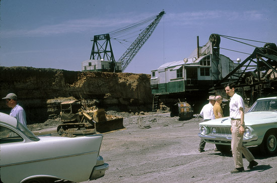
A southeastern Kansas strip pit and coal shovels in the 1960's.
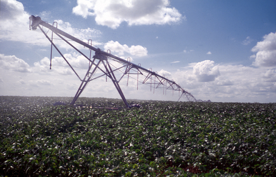
While environmental questions had an impact on Survey programs, growing concerns about water had an even greater affect. Improved irrigation technology had opened up parts of western Kansas to large-scale irrigation. With a seemingly unlimited source of ground water in the Ogallala Formation, irrigators tapped into the aquifer in growing numbers in the late 1960s and early 1970s. After only a few years, however, the impact of that pumping was clear. Ground water was being mined, pumped away far faster than it could be replaced naturally. The Survey beefed up its efforts in ground water by redirecting some staff members to study questions of ground-water quality--particularly by accumulating data on the chemical quality of irrigation water from western Kansas--and by adding more staff members and directing their efforts toward mathematical modeling of ground-water movement. For a time in the late 1960s and early 1970s, the Survey maintained a branch office in Colby, a symbolic recognition of the importance of western Kansas in the ground-water question.
The Survey's role in ground water grew throughout the 1970s. Its continued involvement with questions of energy were made more visible with the OPEC oil embargo and energy crisis of the early 1970s. The Survey had long been involved with energy research, primarily in oil, natural gas, and coal. The energy crisis continued that involvement.
Center-pivot irrigation changed the agricultural and economic landscape of western Kansas in the 1960's and 1970's.
At the same time that the Survey enhanced its efforts in ground water, energy, and environmental geology, it put a far greater emphasis on development of the tools used in geologic study. Perhaps the most notable of those efforts, and the one with which the Survey is most closely associated nationally and internationally, is the field of mathematical geology and the use of computers and automated techniques for studying geology. From its beginnings, the field of geology was associated with something of a qualitative approach to studying problems. Geologists went into the field, looked at and collected rock samples, measured sections, mapped areas, and then came back to ponder and write about their findings. The whole process was every much an art as a science. But in the mid-20th century, with the coming of computers and advances in geophysics, and the revolution of plate tectonics, quantitative approaches became increasingly important in geology. With that change came mathematical and statistical techniques for better understanding the numbers that measurements produced; at the same time, computers became an important way to help handle the numbers.
One of the best examples of such a quantified approach is the use of computers and appropriate programming to draw maps that show contours. Geologists generally produce maps by plotting a number of points, and then drawing in lines, usually contoured lines, of equal amounts. Scientists at the Survey, and in other organizations, developed complex statistical packages that could take the raw data and then plot the contours between the points, basing the contours on a series of mathematical formulae. The result was a somewhat more objective map--one based on objective means of determining the flow of a contour, as opposed to contours that relied on a scientific eye for extrapolation (as in most of science, no two geologists interpret data in exactly the same way, and it is often possible to identify the person who drew a map by the style of the contours). The Survey developed a contouring program, called Surface II, that not only provided an objective method of contouring, but allowed much of the work to be done automatically. John Davis, John Harbaugh, Dan Merriam, and Robert Sampson were all associated with the Survey's efforts in mathematical geology.
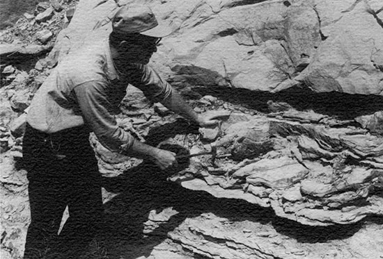
John Davis, head of the Survey's advanced projects section, in the field in the 1960's.
Those researchers, and others, collaborated on a Survey-published computer contributions series that delved into the applications of computers to geology. That series continued for only a few years, but, like Surface II, was highly visible. That visibility was related to a Survey emphasis on international activity. In the 1960s, the Survey began a program of annually bringing in a visiting researcher, usually from another country. That program continues today.
The work in mathematics led naturally to Survey efforts in cartography. While the Survey had produced maps for years, they were generally hand drawn. Maps that needed updating, such as those that detailed the drawdown in a western Kansas aquifer over time, had to be laboriously and slowly updated. Using automated methods to do the plotting, at first for research-oriented maps and later for those that were published, allowed much quicker and simpler graphic presentation of scientific data. Survey work in automated cartography later became nearly as well known as its work in mathematical geology.
Another field of quantitative endeavor was geophysics. In the mid-1960s, the Survey began major efforts in earthquake measurement, reflection seismology, and magnetic and gravity measurements. With funding from the Nuclear Regulatory Commission and the U.S. Army Corps of Engineers, Survey researchers Don Steeples and Frank Wilson developed in the 1970s a multi-station seismograph network in eastern Kansas; that network was designed to detect and record micro-earthquakes, those earthquakes so small that they could not be detected by most humans. The researchers were most interested in the Nemaha uplift, that zone of granite near the surface that had first been located by drillers during the time of Erasmus Haworth. Faulting on the flanks of that uplift was a source of earthquakes throughout Kansas history; the strongest recorded earthquake in Kansas history struck near Wamego in 1867, and would have registered about 6.0 on the Richter Scale. The Survey network, which became active in 1977, recorded a number of small earthquakes along the Nemaha and showed that the uplift was still geologically active.
Perhaps of more research import, the Survey began work in seismic reflection, the same technique used in the search for oil. Vibrations are set off at the surface, usually through a small explosion, and the resulting sound waves go underground, are reflected back to the surface by different rock layers, and then are recorded by microphone-like devices called geophones. Because different layers of rock reflect the sound in different ways, the technique produces an image of the location of underground rocks. The Survey experimented with a variety of energy sources, and focused particularly on shallow seismic reflection. Seismic reflection was applied extensively to locating underground void spaces, a technique that was helpful in Kansas where it was necessary to find cavities produced by salt dissolution or underground mining. The applications of seismic reflection were most closely pursued by Steeples, Ralph Knapp, and Richard Miller. At the same time, the Survey undertook an aggressive program of compiling gravity and magnetic data, eventually collecting magnetic data for the entire state and working on the same for gravity data.
All of those geophysical approaches, but particularly aeromagnetics and deeper reflection seismology, were instrumental in the eventual interpretation of the state's Precambrian geology, particularly in delineating a feature that became known as the Central North American rift system (it was also called, more cautiously, the Midcontinent Geophysical Anomaly). The CNARS was a billion-year-old split in the earth's crust, running from the Lake Superior region, down through Iowa and Nebraska, and into Kansas. That split, probably the result of a plate that began to break apart and then stopped, was the source of unusually high magnetic levels. Evidence for its existence also showed up in cuttings from oil wells drilled in the region, and through a deep seismic line that was run through northeastern Kansas.
That seismic line (produced by the National Science Foundation's Consortium for Continental Reflection Profiling, or COCORP, and brought to Kansas by a Survey proposal), also generated evidence for huge blocks of Precambrian sediments, a layer called the Rice Formation. Though the Rice Formation has not produced oil, it certainly provided an enticing drilling target, and in 1984 Texaco drilled a well 11,300 feet deep in Washington County, penetrating far into the Rice. The results of that well are only now being made public, showing interbedded layers of sediments and volcanic rocks (Berendsen and others, 1988). But it is clear that CNARS played an important role in the state's geologic history and may hold resources as well.
The Noel Poersch #1 was drilled by Texaco in late 1984 in southern Washington County. At 11,300 feet, it was the deepest hole in Kansas history.
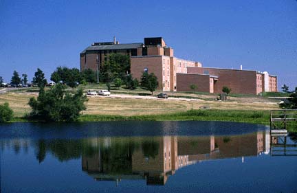
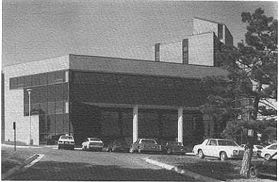
All of those activities--in energy, ground water, environmental geology, mathematical geology, geophysics--required a sizable staff. The Survey grew through the 1970s, topping out with slightly more than 50 full-time scientific specialists, a large number of support staff, and more than 70 part-time students. Those staff members, and the equipment they used, required considerable space. After several years of cultivating the legislature, a state appropriation led to a new building on KU's west campus. That building, completed in 1973 and named for Raymond C. Moore, provided the Survey with substantially increased square footage. It also took the Survey away from its Lindley Hall location with the KU geology department, and probably helped establish the Survey's sense of identity as more of a statewide entity and less a component of the geology department. At the same time, that move took the Survey off KU's main campus and probably hindered, at least in part, the Survey's cooperative ties with the KU geology department.
Moore Hall, completed in 1973 on KU's west campus, is the headquarters of the Kansas Geological Survey.
The additional space provided by Moore Hall was sufficient for a few years. In 1980 the Survey constructed a separate building a few hundred yards away from Moore Hall. This facility, designed to house the Survey's geohydrology effort, was named after Frank C. Foley. In 1984, the Survey used funds generated by the creation of a fee on intents-to-drill oil and gas wells in the state from 1981 to 1984 to build an addition on Moore Hall. That building was eventually named for William Hambleton, particularly appropriate because Hambleton had presided over the largest single increase in Survey facilities since the organization was founded at KU in 1889.
Hambleton Hall, named after the Survey's eighth director, was completed in 1983.
The increase in the need for space was directly related to the research that Hambleton had encouraged. Work in mathematical geology and geophysics, while it applied to geologic questions in Kansas, certainly reflected a change in direction from the times when the Survey emphasized county reports on geology and ground water. Hambleton argued that service activities to the state flowed directly from that research. He defended consistently the notion that part of the Survey's purpose was the development of "new tools for solution of problems and efficient and prompt services" (Hambleton, 1987, p. 15). Perhaps as a result of that approach, and perhaps in reaction to public cries for increased efficiency in state government, Hambleton regularly warded off attempts to consolidate the Survey into a proposed statewide department of natural resources, an organizational structure used in several other states. In a 1975 statement before a legislative committee, Hambleton argued that the Survey did its job well, and that part of its success was "a direct consequence of association with the University of Kansas under the authority and control of the Board of Regents" (Hambleton, 1987, p. 23).
Hambleton was successful in maintaining the Survey as a part of KU. He was also successful in refusing to allow the Survey to become a regulatory agency, arguing that the Survey's credibility was directly related to its role as an objective, neutral provider of information, a role that would be compromised if the Survey had to rule against the industries it regulated. Related to that stance was Hambleton's policy, which can be traced back at least as far as John Frye and the early 1950s (Frye to Malott, 29 March 1951, Mallot Collection, KU Archives) of not allowing Survey staff to consult within Kansas. Those policies steered the Survey into the 1980s. Hambleton retired in 1986, and was replaced by Lee C. Gerhard, another KU Ph.D. A native of New York, Gerhard came to the Survey from the Colorado School of Mines. Like Frank Foley, he had previously been state geologist of North Dakota. Gerhard's background was primarily in stratigraphy and oil and gas.
Lee C. Gerhard, the Survey's ninth director.
The ultimate significance of Hambleton's tenure, and of his successor Lee Gerhard, for the Kansas Survey cannot yet be measured. It is difficult to be certain just how much the pendulum moved from service to research since 1970, though some movement clearly took place. Certainly the past three decades have left the Survey a vastly different organization. One that focused on methods as well as subjects. One that was far larger than the days of the early 1950s, when staff members worked in two floors of Lindley Hall and remember today that they felt like a family. One that was at times a visible part of state government and is now less distinctly an arm of the University of Kansas.
These judgments, however, must remain provisional. The only thing that is clear is that the Survey has evolved far from its annual existence in the 1860s. It has come far from the days of the late 1880s, when a small staff depended largely on a group of volunteers to contribute what they could for credit at KU. It has come far from the time when R.C. Moore could almost single-handedly mold the organization into the likeness that he wanted and tower over it at the same time. It has come far beyond being an appendage of the KU geology department. It is now a full-fledged, autonomous academic unit that pursues its own research directions, at times with the blessing of the rest of state government, and at times on its own. The Survey had evolved and changed and, to some extent, adapted.
And yet, in 1988, the Survey's new director was instructed by the Survey Advisory Council to create a mission statement, one that demonstrated the Survey's role in the University and in state government. Gerhard drafted and submitted, then redrafted and resubmitted. In the end he borrowed heavily from a mission statement prepared in 1924 by Moore:
"The purpose of the state geological survey is to investigate areas, and mineral deposits, to undertake study of geologic problems within the state, and to bring together, correlate and preserve all possible information which will add to knowledge of state geology, and promote the best development of state mineral resources." (Moore, 1924, p. 2)
Gerhard's new version:
"The mission of the Kansas Geological Survey, operated by the University of Kansas in connection with its research and service program, is to conduct geological studies and research and to collect, correlate, preserve, and disseminate information leading to a better understanding of the geology of Kansas, with an emphasis on natural resources of economic value, water quality and quantity, and geologic hazards." (Lee C. Gerhard, 11 March 1988, Memorandum to the Kansas Geological Survey Advisory Council)
The statement was updated, certainly. It was different. But it was much the same. The same could be said of the Survey itself.
Prev Page--Post-World War II || Next Page--References
Kansas Geological Survey, KGS History
Web version February 2003. Original publication date 1989.
Comments to webadmin@kgs.ku.edu
The URL for this page is http://www.kgs.ku.edu/Publications/Bulletins/227/12_six.html