![]()
|
|
||
|
Start
From Haworth to Moore
|
7. From Haworth to MooreAfter its location at the University of Kansas, the Kansas Geological Survey existed for at least 20 years before it underwent its first transition in leadership. In 1915, when Erasmus Haworth resigned as head of the Survey (even though he retained his position as chairman of the KU geology department for another five years), he was the only director that the modern Survey had known. Survey leadership had changed hands before, in 1865, when George C. Swallow took over for Benjamin F. Mudge, but the Survey that Swallow directed was different, with a different mandate, than Mudge's. What's more, the Survey had existed for only a year when Mudge was replaced by Swallow. In contrast, Haworth had directed the Survey for 20 consecutive years when he announced his resignation (Haworth's resignation was not the only change during those years. In 1909, the Survey moved its offices from old Snow Hall, which was located north of Watson Library, to the new geology and mining building, which was subsequently named for Haworth; see Schoewe, 1965, p. 57).Haworth's departure was important, and not only because of its impact on the Survey. Since 1907, and the rechartering of the organization as the State Geological Survey of Kansas, the number of Haworth's publications had decreased significantly. Unlike his earlier years at the Survey when he was editing or writing books at the rate of better than one per year, he produced only two Survey publications in a period of eight years (Haworth, 1913, 1915), and those were the only two publications from the Survey between 1908 and 1917. Some of that lack of productivity may be simply the result of aging in a scientist. Studies have shown that individual scientific productivity often follows a curve that rises into middle age, and then falls as the scientist gets older. Perhaps Haworth, who was 60 years old when he left the Survey, was simply on the downhill side of the productivity curve. Perhaps also there was less legislative pressure to publish, with the appearance in the late 1800s and early 1900s of the nine Survey volumes that captured much about the geology of Kansas. Finally, consulting and other business interests, particularly related to oil and gas, may have taken increasing amounts of Haworth's time, perhaps to the detriment of his publication record (see R.C. Moore, Memorial Meeting of 23 February 1933, Haworth file, KU Archives). In addition to leading the Survey and teaching in the geology department, Haworth had been appointed as geologist in the State Irrigation Commission by the legislature of 1896 (Griffin, 1974, p. 255), and he continued to participate in that function into the 20th century. He was also head of the mining and mineralogy school at KU. Taken together, the sum of those activities obviously weighed heavily on Haworth, and probably had something to do with his resignation as head of the Survey. The works that Haworth did produce, however, were exceedingly interesting, all for various reasons. The first was called a "special report" on well waters. This was not a revision of the mineral-waters book the Survey had published a few years before but a guide to ground water that came about, Haworth wrote, because 1913 "has been the driest summer known for many years.... This little volume is brought out hurriedly in a hope of giving proper information on the subject" (Haworth, 1913, p. 7-8). It is difficult to gauge the effectiveness of the book. However, like the first volume that Haworth published in 1895, which was so influential in establishing the format of following Survey publications, the ground-water book set a similar, even more long-lasting pattern. It was the Survey's first bulletin, the first in a series of more than 225 books that continues to be published today and is considered the Survey's preeminent mode of publication. Like the Survey's earlier volumes, this first bulletin was aimed at a non-technical audience. "It is written expressly for the layman, rather than the scientist" (Haworth, 1913, p. 3). However, it looked dramatically different than earlier Survey work. The new bulletin was in a smaller format, less heavily illustrated, and thinner, comprising only 110 pages. On crystalline rocksThe report on well waters was followed, two years later, by a second bulletin, this one even shorter. On crystalline rocks in Kansas (Haworth, 1915), however, is one of the more scientifically interesting pieces of work in the Survey's history. Haworth focused primarily on what are today known as basement rocks, rocks of Precambrian age, which do not crop out in Kansas. With the beginning of extensive oil and gas drilling in the state, drillers bored deeper wells, and in different parts of Kansas, than before. The result was some important and surprising geologic information, not the least of which came from encounters with so-called crystalline rocks, or granite. Haworth knew that eastern Kansas strata dipped to the west. Thus, as drillers went deeper and deeper, he expected that they would encounter the same sedimentary formations--only farther west and deeper--that they had drilled through in eastern Kansas.But when the drillers reached the Flint Hills north of the Kansas River--in Nemaha, Wabaunsee, and Pottawatomie counties--they reported striking granite or crystalline rock, instead of the usual sedimentary formations that they were so accustomed to seeing. The drillers had discovered what is today known as the Nemaha Ridge, a buried range of granite mountains that extends from southeastern Nebraska, through eastern Kansas, and into Oklahoma (Merriam, 1963, p. 182). In places, these igneous basement rocks are within only a few hundred feet of the surface, far closer to the surface than drillers were accustomed to seeing at other locations in the state. Because drillers customarily stopped drilling when they encountered igneous or metamorphic rocks--oil is nearly always limited to sedimentary formations--the discovery of shallow granite was a blow to exploration in eastern Kansas. Haworth responded with Bulletin 2, saying that the granite discoveries had resulted in a "complete condemnation" of oil and gas prospects in a large part of eastern Kansas. "The more this subject was considered the more plainly it appealed to me, as a matter of duty, that I should make public what knowledge I possessed on the subject, and the conclusions which seemed properly to be drawn therefrom" (Haworth, 1915, p. 9). The conclusion that Haworth reached was absolute: the drillers were wrong. In no instance did they find granite. In one location, near the Riley County town of Zeandale, he did allow that they had found quartzite, "a modified form of hard sandstone" (Haworth, 1915, p. 33). But he refused to admit that drillers had encountered anything but quartzite and sedimentary rocks; the reports from those drillers, he wrote, "should not in any way discourage prospecting for oil and gas" (Haworth, 1915, p. 33). Even while Haworth denied the existence of any "ridge of ancient Archaean rocks," he did a magnificent job of marshalling evidence that they did indeed exist. He compiled a map of wells reporting granite, wells that outline the location of the Nemaha Ridge; under every well, he wrote "No Granite." And he drew a cross section from Kansas City to Manhattan, showing the eastern Kansas limestones with a uniform dip to the west; under Zeandale, he even drew a ridge and labeled it "Supposed Granite," in an uncanny near-recognition of the Nemaha. In short, Haworth identified, pinpointed, and even drew the Nemaha on a cross section. He did everything but acknowledge its existence. With that, Haworth made his last official published pronouncement as director of the Survey. A year later he announced his retirement from the Survey (see Strong to Haworth, 22 June 1915, Strong Collection, KU Archives). In 1920, he left his chair at the geology department, blaming a low salary and the need for additional outside income as the reason for his departure (Haworth to Strong, 26 February 1920, Strong Collection, KU Archives). TwenhofelAt the Survey, the transition from Haworth to a new director proved to be an unusual one. Haworth's immediate replacement was William Henry Twenhofel (1875-1957), a geology professor at KU who stepped in for a year, 1915-1916, before leaving Kansas for the University of Wisconsin. Twenhofel had undergraduate degrees from Lebanon College in Ohio and from Yale, along with a master's and Ph.D. in geology from Yale (Shrock, 1947, 1957). He came to KU in 1910 as a paleontologist, although his specialties at the time were the rather incongruous combination of the peridotite intrusive dome in Woodson County and vertebrate fossils from the Kansas Pennsylvanian (see, for example, Twenhofel, 1917, 1924). When he took over from Haworth as director of the Survey, he set down a series of conditions for then-chancellor Frank Strong, not the least of which was "If I find that the routine work connected with the position of State Geologist is so great as to seriously limit my (research) productivity, I wish, without question and with mutual good feeling to give up the position" (Twenhofel to Strong, 2 July 1915, Strong Collection, KU Archives). A year later, Twenhofel was gone.
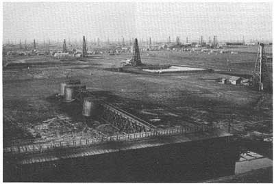
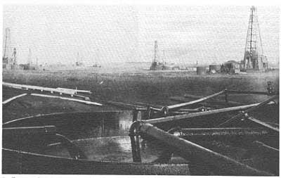
The arrival of R. C. MooreTwenhofel's departure from the Survey set the stage for the career of the man who, along with Samuel Williston, is arguably the most noted scientist associated with the Kansas Geological Survey. Raymond Cecil Moore was born in the state of Washington in 1892 (ironically, even as of this writing a native-born Kansan has never directed the Survey. Moore did have connections with Kansas, however. His mother was born in Kansas and one of his teachers at the University of Chicago was Samuel Williston). Moore earned an undergraduate degree in geology from Denison University, and in 1916 was awarded a Ph.D. in geology and paleontology from the University of Chicago (Dunbar, in Teichert and Yochelson, 1967, p. 5-7). Moore arrived in Kansas in 1916, and was named state geologist and director. The evidence of his energy was not long in coming.Moore moved to a Kansas that was prospering in the flush times of World War I. Commodity prices were up, and Kansas farmers were doing well. Drilling and production were booming in the oil fields of south-central Kansas, and coal production in southeast Kansas reached a peak that it has not matched since. Moore responded to that oil boom a year after his arrival in Kansas with an impressive publication--co-authored with Winthrop P. Haynes, another member of the Survey staff--called Oil and Gas Resources in Kansas. This book was largely an expanded revision of Haworth's earlier special report on oil and gas, done mostly in light of the volumes of additional evidence that had been produced by twentieth-century drilling. But it was far more than that. Stitched to the front was the first color geologic map of Kansas printed by the Survey. Drawn at a scale of 1 inch to 24 miles, the map showed the geology in far greater detail than ever before in a Survey publication, including breaking the Pennsylvanian sequence into seven different groups and the Cretaceous into four.
Following the map was a detailed discussion of oil and gas production and geology, Kansas stratigraphy, and a county-by-county description of oil and gas production, with a number of county geologic maps that also showed holes drilled for oil and gas. Among the most scientifically important pronouncements of that bulletin was once again on the subject of crystalline or granite rocks. Moore and Haynes examined the existing evidence, including the wells that Haworth had examined before 1915 along with a few more, and decided that granite did exist at shallow depths in northeastern Kansas. "The evidence seems to indicate clearly that the granite which has been encountered in the wells of central Kansas is an uplifted ridge forming an essential part of the crystalline basement which underlies all the stratified rocks of the region" (Moore and Haynes, 1917, p. 167). They named this ridge after Nemaha County, Kansas, where it was closest to the surface (see Jewett, 1951, p. 146). Moore's work on the Nemaha was important because of the Nemaha's role in Kansas geology--faulting along its flanks is the source of many of the state's earthquakes, and structures associated with the Nemaha have proved to be sources of oil and gas in eastern Kansas. Also, the Nemaha provided some of the first glimpses of the Precambrian basement that underlies all of Kansas, and thus gave Kansas geologists a new sense of the complexity of their subject. As a result of World War I and that newfound complexity, the Kansas Geological Survey grew sizably. Bulletin 3 lists 12 staff members, along with Moore, as making up the Survey, although one of them, Haworth, had given up the Survey and was primarily involved with the KU geology department, and another, paleontologist Herman Douthitt, was dead by the time that the bulletin was issued. Most of the work, then, fell to Moore and to geologists James Todd (who studied glacial geology in northeastern Kansas) and Winthrop Haynes, along with four chemists, three assistants, and a draftsman. The Survey staff was soon touched directly by World War I. In 1918, Moore published a bulletin on the geology of Camp Funston, today a part of Fort Riley near Manhattan. The work compared the geology and topography of the area to that of the World War I European theatre. The war probably also encouraged Survey geologists to focus even more on economically important resources, particularly oil. The discovery of the El Dorado field, and the production that resulted, has occasionally been noted as important in the war effort. At the same time, the Survey budget jumped dramatically, from $2,500 per year in 1914 to $25,000 by 1920, an increase that was reduced the following year and was undoubtedly related to information produced strictly for the war (Schoewe, 1965, p. 69).
Almost from the beginning of his tenure as state geologist, Moore changed the nature of the Survey. It became less of a state service bureau than it had been under Haworth, publishing less on whatever geologic problem was dominant at the time, be it ground water or oil. Instead, Moore pushed the Survey to produce regular reports of a more scientific nature, evident from Bulletin 3, a publication designed to appeal to those who already knew something of the state's geology. Certainly Survey reports and work maintained their pragmatic value; oil and gas was the dominant concern of publication and undoubtedly the dominant source of work for Survey geologists through the 1930s and 1940s. But the tone of the work had changed. Instead of producing reports that were scientifically valid but generally accessible, as did Haworth, Moore's Survey worried less about accessibility and more about the science of geology. Publications by Moore, N. Wood Bass, and A. E. Fath (whose work on the geology of the El Dorado field, published in 1921 as Bulletin 7, marked the first cooperative project between the Kansas Survey and the U.S. Geological Survey) were scientifically important reference books that, at the same time, met a practical and everyday need in the oil fields (for background on Bass, see Lohman, 1984; for background on Fath, see Small, 1978). It is difficult to discern just how conscious a decision this was on Moore's part. In Bulletin 3, he wrote that "the information which is presented must be that which is needed by those technically trained in the subject of geology ..." (Moore and Haynes, 1917, p. 18). While Moore acknowledged that he also tried to make the information accessible to non-geologists, it was clear that scientific discussion came first. This may have been the predilection of a scientist who was only a year out of a Ph.D. program. Or it may have been a conscious decision on the part of an administrator to make the Survey into something that it had not been under Haworth's leadership. Published or unpublished information about Moore's goals for the Survey is lacking. But the available information is clear. In 1924, long after he had begun the evolutionary reshaping the Survey, Moore wrote that a state survey was "first of all, a scientific research bureau" (Moore, "State Geological Surveys and the Oil Industry," 1924, p. 2, in Moore Collection, Kansas Geological Survey Archives, Moore Hall, University of Kansas, Lawrence, Kansas; hereafter referred to as KGS Archives). Those words are important, because the insertion of "research" into that phrase makes certain that Moore intended the Survey to be far more than a state agency that collected and disseminated information, though he recognized the importance of that role. He meant for the Survey to go beyond, to analyze and synthesize. "The purpose of the state geological survey is to investigate areas, and mineral deposits, to undertake study of geologic problems within the state, and to bring together, correlate and preserve all possible information which will add to knowledge of state geology, and promote the best development of state mineral resources." (Moore, 1924)Moore's intentions were clear, though perhaps not particularly well known. As he noted elsewhere (Moore, "Relation of the State to the Oil and Gas Industry," 1920 report to the Governor, in Moore Collection, KGS Archives), the state had already created several agencies to regulate and oversee the state's mineral operations, particularly oil and gas. What Moore may have been trying to achieve was the establishment of a separate, secure niche within state government for the Survey, a niche that would go hand-in-hand with the Survey's placement at KU and Moore's own academic background. Moore's approach had a dramatic and long-lasting impact on the Survey's direction.
Regulation?On several occasions, Moore tried to take those changes a step further and remove the Survey from the control of KU. In 1918, only a little more than a year after he became director, Moore discussed with Strong the possibility of separating the Survey from KU and placing it under the control of a "Geological Commission" that would consist of the Governor (who would serve as the ex officio chairman of the commission), the chancellor of KU, and the president of Kansas State. The Survey's charge, as Moore envisioned it, would be to "examine thoroughly all of the natural resources of the state" and ... "to maintain in effect a bureau of information concerning the mineral resources of the state" (Moore, State Geological Survey of Kansas, no date, unpublished manuscript in Moore Collection, KU Archives). Much of the rest of the Survey's statutory responsibility would remain the same under Moore's newly envisioned plan; the commission's composition makes it clear that Moore wanted to retain much of the Survey's academic bent, even though the Survey would now be directly in the mainstream of state government. However, Moore did suggest increasing the Survey's budget to $40,000 per year, and allowing Kansans to petition the Survey to study their area (50 signatures would make it the duty of the Survey to inspect a given area). Part of Moore's justification for the plan was based, again, on the impact of World War I. The reorganization would allow the Survey, Moore wrote, "to assist to the greatest possible degree the development of the state's natural resources for the present military purposes of the government and for the industrial and economic reconstruction following the war" (Moore, no date, State Geological Survey of Kansas, KU Archives). Moore even went so far as to discuss the subject with Kansas State officials, and it is unclear exactly why the plan did not come to pass (Strong to Moore, 4 December 1918, Strong Collection, KU Archives).Ten years later, under a different chancellor, Moore revived the idea, this time in a letter to Governor-elect Clyde Reed, saying that "probably the State Geological Survey should be abolished and entirely reorganized" (Moore to Reed, 8 December 1928, Lindley Collection, KU Archives). Moore hinted that the plan had the blessing of oilman and politician Alf Landon, and apparently then-Chancellor Ernest Lindley agreed, though again, nothing came to pass. Even though those reorganization schemes failed, Moore later was able to effect many of the changes he desired. However, he made one additional proposal for change that was radically different and never occurred. That was to involve the Survey in the regulation of the oil and gas industry. As drilling expanded in the early 20th century, state government took on increasing responsibility for its regulation, watching everything from the quality of the oil produced to the monopolistic tendencies of the large oil companies that operated in the Kansas. Moore proposed involving the Survey in the action. "I recommend that the Oil Inspection Department be consolidated with the Oil and Gas Division of the State Geological Survey, with offices at the state capital, that a single staff of competent engineers and assistants be organized, and that all of casing and plugging for the conservation of oil and gas, and prevention of water pollution, appraisal of oil and gas securities referred to the state for approval, and the inspection of petroleum products be made to it." (Moore, Efficient Organization of Oil and Gas Development, no date, Moore Collection, KU Archives)Such a change, had it occurred, would have drastically altered the Survey's character. Again, the circumstances of the proposal are unclear. So are Moore's motives. He may have been trying to carve for the Survey a larger stake in the realm of state government, though he would probably have done it at the expense of a number of his ideas about using the Survey as a scientific research bureau. Whatever the reason, the proposal failed and the Survey has remained (nearly always by choice) a state institution without regulatory power.
Regardless of such efforts toward statutory change, the Survey was much the same at the end of World War I as it was at the beginning. Moore continued to direct the Survey, and at the same time continued his own highly visible professional development. One of the best-known examples of that was his participation as a geologist in the survey of the Colorado River and the dam sites between Lees Ferry and Black Canyon, led by U.S. Geological Survey chief topographic engineer Claude H. Birdseye in the summer of 1923. Moore was chosen, read one account, because "he is an authority on the geology of the middle Colorado Canyon region, a former college athlete, and a veteran of many a hard summer's field work in the desert West" (Freeman, 1924, p. 473). The trip captured public interest, particularly when one of the party's boats was washed away in a flash flood in the Grand Canyon, and discovered 200 miles down river. "Exploration Party May Be Lost" said a headline on the front page of the University Daily Kansan (23 September 1923), but then followed with the news, a few days later, that Moore "arrived safely yesterday with all the party at Peach Springs, Ariz., according to a telegram received this morning..." (3 October 1923). The Kansas Survey of the late 1910s and l920s was more than Moore, however. The Survey employed, both full-time and part-time, a variety of scientists, some of whom were well-known in geology or in the oil and gas business. In 1926 the Survey hired Kenneth K. Landes (1899-1981), a Harvard Ph.D., who served as the assistant state geologist and occasionally as acting state geologist in Moore's absence. The Survey also maintained or initiated several cooperative relationships, including projects with the U.S. Geological Survey and a joint publication with the State Board of Agriculture. By the close of the 1920s, Raymond Moore had successfully brought the Survey through the transition from the waning days of Erasmus Haworth. He had nudged the Survey in new and different directions, redefining the Survey in far broader terms than before, all while substantially enhancing its scientific credibility. He had gathered around him a group of capable geologists and focused on several geologic problems and opportunities in the state. And he had prepared the Survey for a series of steps that would diversify its efforts beyond academic studies of oil- and gas-related geology. While the 1930s and 1940s were times of tribulation for the rest of the country, they presented opportunities that Moore and the Survey seized to become an increasingly important and relevant institution. |
|
Kansas Geological Survey, KGS History Comments to webadmin@kgs.ku.edu Web version February 2003. Original publication date 1989. URL=http://www.kgs.ku.edu/Publications/Bulletins/227/09_haworth.html | ||