![]()
Back to Typical Stanton Limestone...
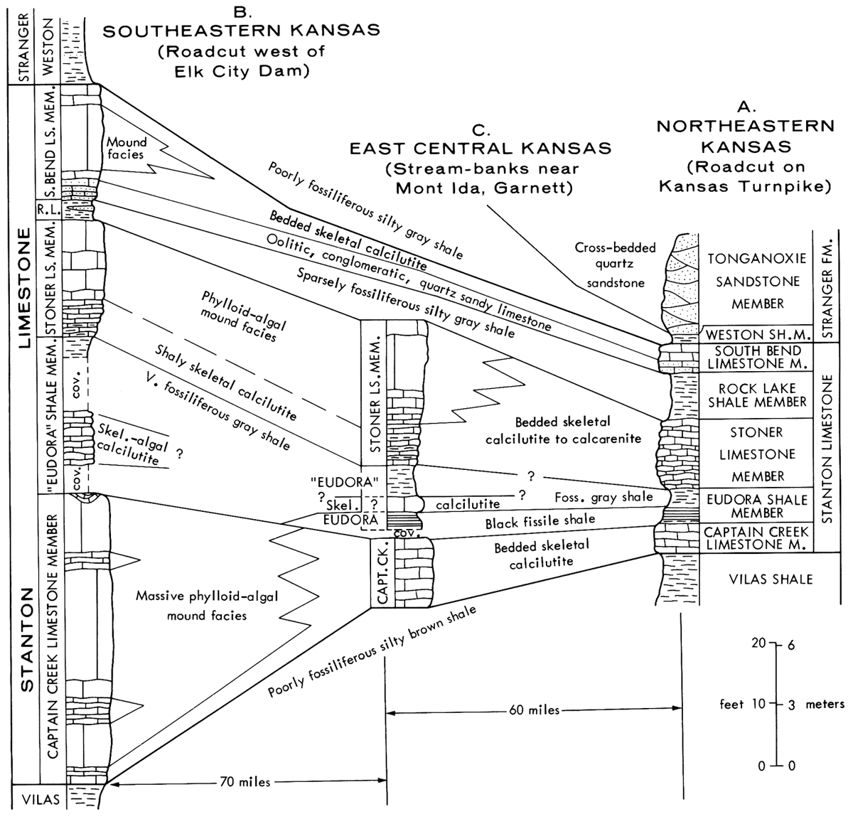
Figure 3
Figure 3--Measured sections of Stanton Limestone in eastern Kansas (located on Figure 2) showing both subdivision into five named members that are recognized from Nebraska to southeastern Kansas and their generalized component facies in Kansas; A. Standard section in northeastern Kansas on north side of Kansas Turnpike, 1.2 mile west of Bonner Springs interchange (sec. 18, T. 11 S., R. 23 E., Wyandotte Co.); B. Standard section in southeastern Kansas, on north side of road about 1 mile west of Elk City dam (south of ctr N half 7-32-15, Montgomery Co.); C. Section near Mont Ida in east-central Kansas in west bank of Cedar Creek just north of Missouri Pacific Railroad trestle (NW-SE-NE 17-21-19 Anderson Co.); Captain Creek Member measured in north bank of Pottawatomie Creek (ctr NE-NE 5-20-19) about 5 miles northwest of Garnett, Anderson County.
Back to Typical Stanton Limestone...
Kansas Geological Survey, Geology
Placed on web Jan. 20, 2009; originally published May 1975.
Comments to webadmin@kgs.ku.edu
The URL for this page is http://www.kgs.ku.edu/Publications/Bulletins/210/fig3.html