![]()
Prev Page--Quaternary || Next Page--Mineral Resources
Geologic Structure
Introduction
Below the comparatively thin veneer of post-Tertiary alluvium, loess and gravel, which mantles the eroded surface of the older rocks of Wallace County, lie Tertiary and Cretaceous deposits, which show various inclinations of their strata and occasional abrupt interruptions of the continuity of the beds. The character and the origin of these irregularities of the outcropping Tertiary and Cretaceous deposits will now be discussed.
Very little can be inferred as to the structural features of the underlying and unexposed formations, for very few deep wells have been drilled in Wallace County and the adjacent area.
General Features
The two larger outcropping stratigraphic units, the Ogallala of the Tertiary and the Pierre and Niobrara of the Upper Cretaceous, are separated by a distinct and pronounced unconformity, which indicates a prolonged erosional interval extending from the close of the Cretaceous to the end of the Miocene. During this time local tilting of the earth's crust occurred, which is indicated by the marked regional nonconformity between the Upper Cretaceous and the Ogallala. The Upper Cretaceous sediments show a distinct regional dip to the north in the eastern part of Wallace County and to the north and northeast in the western part. The rate of this dip is on the average about 20 feet to the mile. The overlying Ogallala deposits, on the other hand, have a distinct general inclination to the east with an average rate of about 20 feet to the mile in the western half of the county, but only about 5 feet to the mile in the southeastern quarter of the county.
As was stated in the chapter on the physiography of Wallace County, the river valleys descend only a little more steeply in an eastern direction than the dip of the sediments and thus cut gradually deeper into the great terrace of the High Plains, which is built of hard ledges of Ogallala and an overlying mantle of gravel and loess.
Owing to the apparent pre-Ogallala tilting of the Upper Cretaceous deposits and their subsequent differential erosion, the Ogallala rests upon various members of these older deposits in different parts of the area. In central Logan County Ogallala rests upon the topmost beds of Niobrara chalk and on various beds of the lowermost or Sharon Springs member of the Pierre, whereas in Wallace County the same Tertiary formation directly overlies the Sharon Springs member of the Pierre in the east and southeast areas and the higher Weskan, Lake Creek and Salt Grass members of the Pierre at various places in the northern and northwestern parts of the county. Taking into account the general gradual decrease of the thickness of the Pierre toward the east, which was discussed in the stratigraphic chapter, we may estimate the average amount of the regional nonconformity between the Upper Cretaceous and Ogallala to be about 5 or 6 feet to a mile in an eastern direction. The nonconformity in a northern direction is much more pronounced, being on an average about 15 feet to a mile.
Upon the block of Upper Cretaceous and Tertiary beds with the above-described regional inclinations and mutual relations there are superimposed folds and faults having various directions and magnitudes, as is illustrated on the accompanying structural map of Wallace County and on the two geologic sections across it.
Method of Structural Mapping
The structural map of Wallace County, which is shown on Plate XLII, is made by determining the altitudes of the outcropping beds subsequent to their correlation. The elevations taken on the several beds chosen as key beds were reduced to the two main key beds--the top of the Niobrara chalk of the Upper Cretaceous, and the top bed of the Ogallala, or the concentrically banded, pink algal (Chlorellopsis) limestone. The latter was used as the main key bed in the southern, western and northwestern parts of Wallace County, where the Cretaceous rocks are very poorly or not at all exposed.
The structural map is not based, therefore, on the local dips observed in the beds, as is sometimes done, but these dips, especially where persistent, were not altogether neglected, but were used for a better spacing of the structural contours in those areas where the outcrops are scant. Necessary caution was exercised in their use, and the local dips of some areas have been found so varied and in places so contradictory to the structural features established by observation of the altitudes of the key beds that they were entirely discarded for the purposes of the structural mapping. The unreliability of the observed local dips in the Cretaceous strata of western Kansas has been pointed out already by Twenhofel (Twenhofel, 1925) and other authors. The causes of the surficial and other local deformations of the outcropping beds of Wallace County that obscure their main structural features will be discussed below.
Key Beds in the Upper Cretaceous
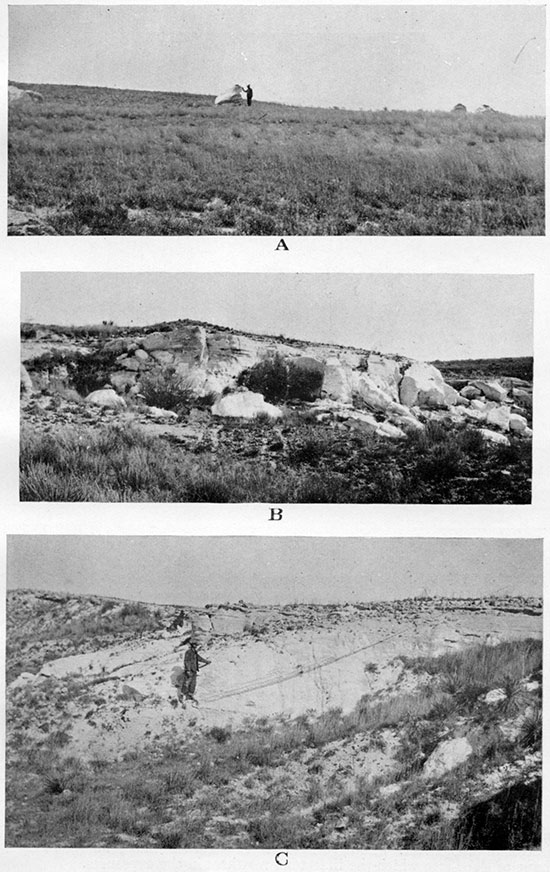
In Wallace County the top of the Niobrara chalk or the contact between the Pierre and the underlying Niobrara (Pl. III A) is exposed only in some canyons on the south side of the south fork of Smoky Hill river south and southeast of Wallace. [The recognition of the contact is discussed on pages 29-31 of this report.] The Niobrara is little exposed in Wallace County, and in the few uppermost scores of feet of thickness of the exposed chalk the writer did not find any particularly remarkable beds or zones that could be conveniently used as key beds.
The contact between the Pierre and Niobrara in the studied exposures appears to be quite conformable, and all the elevations taken on the various key beds in the Pierre have been reduced to the top of Niobrara on the assumption that the Pierre overlies the Niobrara conformably all over Wallace County. The top of Niobrara was used as the main key bed in the Cretaceous.
Key Beds in the Pierre
The Pierre shale is exposed in many more places than the Niobrara, and the key beds in the Pierre naturally have been much more used for the structural mapping than the rarely exposed top of the Niobrara chalk. Some of the most important concretionary zones of the Pierre, which form prominent escarpments in the outcrops of the formation, have been the only beds in the Pierre used for the structural mapping. Thanks to their prominence in the outcrops they can usually be found comparatively easily and their lithology can be readily studied. These zones also usually yield most of the fossils in the formation, and hence their correlation can be checked by the important paleontological method.
Following is a list of the most important key beds in the Pierre of Wallace County with their characteristics and a comparison with the somewhat similar beds for which they can be mistaken. The distances of these key beds to the top of the Niobrara chalk, adopted for the structural mapping of Wallace County, are added. The key beds are listed from bottom up:
- Zone of gigantic septarian concretions with veinlets 1 1/2 to 2 inches thick on the top of the Sharon Springs shale member (Pls. V A, V B, V C, VI A and VI B). Occasional presence of barite in large crystals in the fibrous and crystalline calcite veinlets of the concretions is typical. Few or no other fossils than fish scales and bones in shale and in the gray tough fine-grained limy matrix of the concretions. The large limy concretions on the top of the upper Weskan shale member have sometimes a net of calcite veinlets, but these veinlets are not more than one-fourth of an inch thick; besides these concretions are never as large as those of the Sharon Springs shale. Gigantic septarian concretions, as big as or bigger than those of the Sharon Springs shale member, are common in the Blue Hill shale of the Carlile. The zone of these concretions is about 25 feet below the base of Fort Hays (Bass, 1926, p. 63) limestone, or nearly 1,000 feet below the septarian zone of the Sharon Springs shale member.
- Zone of somewhat scattered limestone concretions about 30 feet below the top of the upper Weskan shale member. The concretions are about 6 inches thick and several times as much across and are made of tough finely crystallized bluish-gray limestone. They are much like the concretions of key bed No. 3 described below, having also occasional Anomia shells and fragmentary Inoceramus, but Ostrea shells have never been found in these concretions. Nor has Serpula (?) wallacensis been. found in this zone. The presence of scattered small "perforated concretions" in the shale helps to identify this zone, as well as the presence of comparatively thick (some 1 foot) bentonite streaks below the concretionary zone. This is the only zone in the Lower Weskan shale member which can be used, with some caution, as a key bed.
- Zone of limestone concretions in the middle of the Upper Weskan shale member (Pls. X A and X B). The concretions reach 6 inches in thickness and several times as much across and are made of bluish-gray to nearly white tough limestone. Anomia and Ostrea shells, many of them attached to large and nearly flat Inoceramus shells, are very abundant. Serpula (?) wallacensis is abundant in the surrounding shale. The concretionary zone usually consists of two or three layers of concretions within 10 to 20 feet thickness of the shale. The fauna is more abundant in the upper layers of the concretions. The only other key bed that resembles this zone is key bed 2. The two other limestone concretionary zones, one at the top and the other at the base of the upper Weskan shale member, contain a different, poorly preserved fauna. The top of this zone was largely used as the key bed for the structural mapping of Wallace County.
- Zone of dark-gray to brownish-gray tough limestone concretions on the top of the upper Weskan shale member. Siderite is usually mixed with calcite in the matrix of these concretions, owing to which the outer part of the concretions is brownish. Some of the concretions form long cylindrical bodies, the largest 1 foot in diameter, lying parallel and regularly spaced in a plane parallel to the bedding of the shale (Pl. XII A). Other concretions are round and are traversed by a net of veinlets (not more than one-fourth of an inch thick) of yellowish to orange calcite. Fossils are very rare and poor except fragmentary Inoceramus. Being situated at the base of the Lake Creek shale member, within which no reliable key bed can be chosen, this zone was occasionally used as a key bed for structural mapping.
- Zone of limestone concretions at the base of the Salt Grass shale member (Pl. XV A). Light-gray to nearly white concretions made of tough limestone, some of them 6 inches thick, and a few times larger across. Many of the concretions are only 2 inches to 3 inches thick, but are very broad and long, the mass resembling a regular limestone bed much broken by vertical cleavage. In some of these broad and fiat concretions cone-in-cone structure is developed. Fossils are found in fair quantity and consist chiefly of Baculites, Scaphites of the nodosus group and of small and medium-size Inoceramus. Bodies of the rough peculiar limestone (Pls. XV B and XV C), locally having a profusion of Lucina occidentalis shells, are present in places among the regular concretions of this zone. The zone was often used as a key bed.
- Zone of limonite streaks with buff to white lenslike cores of limestone and an abundance of medium-sized Baculites with ovate cross section. The zone is in the middle of the Salt Grass shale member and is 15 to 25 feet thick. The zone was occasionally used as a key bed.
- Zone of rusty limestone lenslike concretions usually with beautifully developed cone-in-cone structure (Pl. XVI E). In the few rare exposures where this cone-in-cone structure is absent the concretionary zone can still be recognized by the rusty-brown color of the limestone. The lenslike concretions are 1 to 2 feet thick and to 1 1/2 feet in diameter. No fossils are usually found in this zone, but in one place a lateral change to bodies of rough limestone with Lucina shells and other fauna was observed. The presence of small cores of septarian concretions (Pl. XVI A) made of compact marl in the limonite streaks above this zone or rarely below it is characteristic for the zone. This uppermost concretionary zone of the Pierre shale exposed in Wallace County was extensively used as the key bed for the structural mapping.
As said already, the elevations taken on all described key beds of the Pierre have been reduced to the main key bed, for which the contact of the Pierre and the underlying Niobrara was selected. The stratigraphic distances of the various key beds to this contact or to the main key bed were assumed to be constant throughout the county, though actually it is not so, because the thickness of the Pierre decreases gradually toward the east. There is reason to suppose that this decrease in thickness affects all the members of the Pierre formation proportionally to their thickness. However, this cannot be proved at present for every member of the formation, and therefore the mean stratigraphic distances were used in reducing elevations taken on various key beds to the main bed. It was noticed that some local visible variations in the thickness of members of the Pierre are apparently due to stretching and compression during the folding of the formation. The errors due to the difference between the actual local stratigraphic distances and the assumed mean stratigraphic distances will affect mostly the determined absolute elevations of the main key bed shown by the 50-foot contours on the structural map, but these errors will not effect very much the relative elevations of the neighboring anticlines and synclines. This is especially true of the structural depressions and elevations amounting to 50 or more feet in vertical distance.
Key Beds in the Ogallala and the Post-Ogallala Warping
In some areas of west-central Kansas the Tertiary beds are not thick, and their outcrops are widely separated by erosion. Owing to this and to their irregular unconformable contact with the underlying Cretaceous and other formations, they may be practically useless for the structural mapping in these areas, but they are of much more value in the extreme northwestern part of Kansas, where they are less eroded and contain some distinct and persistent key beds that are at least of local stratigraphic importance. The Tertiary beds in west-central Kansas are, furthermore, of little value for the structural mapping, because there the underlying Cretaceous rocks are extensively exposed, and being deeper-seated sediments have a more direct relation to the underground structures, with which the potential accumulation of oil is connected. However, in the extreme northwest part of Kansas the outcrops of Cretaceous beds are so scarce that the possible use of the overlying Tertiary beds for structural mapping is an important practical problem which can be gradually solved by detailed observations in the field and subsequent deep borings into the underlying formations.
The writer was able to observe in several places that a gentle folding (not merely slumping) of the Ogallala formation in Wallace County has a fairly apparent reflection in corresponding disturbances in the underlying Cretaceous beds. An account of these observations is given below. Other observations show that the apparent warping of Ogallala beds is not a mere reflection of the pre-Ogallala topography, but is a true folding of the formation subsequent to the deposition of the sediments. The presence of some fairly distinct and persistent beds in the Ogallala of Wallace County and the adjacent area has made these observations possible.
1. The outstanding good key bed is the pink, compact, tough limestone with a peculiar concentrically banded to pisolitic texture (Pls. XXI A and XXI B), which most probably represents an extensive sheet reef built chiefly by the precipitation of calcium carbonate by the minute fresh-water algae (Chlorellopsis bradleyi) in a great but a very shallow basin at the close of Ogallala time. The thickness of this bed is very uniform and measures 2 to 3Yz feet, the smaller figure probably being partly due to erosion of this bed in its position as capping rock of the Ogallala. The bed is underlain by white porous and cavernous sandy limestone (Pls. XX B and XX C), which grades downward into limy grit and loam arid finally into the common pink or buff grit and loam of the Ogallala. This bed, persistent in both lithology and in geographic extent, appears in the exposures of the Ogallala everywhere in Wallace County except the northeastern part. The bed furnishes a convenient stratigraphic datum from which the distances to the other key beds of the Ogallala and to the base of the formation can be measured. The post-Ogallala erosion has cut deeply into this and the underlying Tertiary beds and into the Cretaceous and has divided the once continuous sheet of pink algal limestone, which now outcrops on the high divides and in a few lower places on the slopes, where it was thrown by the post-Ogallala disturbances of the earth's crust.
Other less important and only locally occurring key beds of the Ogallala are the following, in descending order:
2. The bed of loose gravel composed of well-sorted round stones, chiefly of granite and pegmatite and of various porphyries, quartz, agate and other material from the Rocky Mountains. Thickness ranges from 5 to 20 feet. Stratigraphic position varies slightly, being 40 to 50 feet below the top of the formation (pink algal limestone.) The bed was observed in the southern and southwestern parts of Wallace County. Its possible equivalent in the southeastern part of the county is the hard sandy ledge described next.
3. The upper, cross-bedded, hard ledge of sorted and bedded coarse sand and fine gravel, which has a very sparse development south of Smoky Hill river in the southeastern part of the county, is 45 feet below the top of the formation and grades laterally into a common hard mortar grit.
4. Some of the most prominent "mortar beds" can be distinguished from the others by the abundance of tangled masses of rootlike fibers (Pls. XXVIII A and XXVIII B), many of them accompanied by small petrified fruits, but still more prominently characterized by the cherty "nodules" and elongated bodies, which concentrate in zones a few feet thick. The permanence of these zones with cherty bodies is not yet established for very long distances, but locally, for instance on the upper part of Goose creek, a zone of this kind furnishes a prominent and permanent key bed. Here this zone must be about 45 feet below the pink algal limestone of the top of the Ogallala, which along Goose creek is mostly eroded away.
5. The lower bed of gray sorted coarse sand and fine conglomerate with well-developed large-scale cross-bedding (Pls. XXV A and XXV B), which usually makes a prominent escarpment near the base of the more fully developed Ogallala sections, ordinarily has a well-defined top and base, being overlain by the unconsolidated and unsorted pinkish grit and underlain by the unconsolidated coarse sand and gravel. This hard cross-bedded ledge is therefore not the lowermost Ogallala bed, but it appears to be the first cemented bed' of the formation. Its thickness ranges from 5 to 12 feet. Owing to the magnitude of the relief upon which the Ogallala was deposited, this bed is absent from many of the less complete sections of the formation. In other areas, however, it seems as if the bed pinched out or possibly is not cemented and thus does not outcrop. The bed is 130 to 180 feet below the top of the Ogallala in Willow creek valley.
6. In the Ogallala of the northwest corner of the county, which differs somewhat lithologically from the Ogallala elsewhere in Wallace County, the snow-white ledge, of diatomaceous earth (Pls. XXXI A, XXXVII A, XXXVIII A, XXXVIII B and XXXVIII C), from 4 to 11 feet thick, capped by a thin hard ledge of limestone with gastropods, is an excellent local key bed. However, both the diatomaceous earth and the gastropod limestone are rarely observed in the Ogallala sections outside of this area.
Only the topmost Ogallala bed, the pink concentrically banded limestone, was used extensively as the key bed for the structural mapping of those areas of Wallace County in which the Cretaceous rocks are not exposed. Other beds of the Ogallala were used only as subsidiary key beds for the structural mapping of those limited areas in the northwestern part of Wallace County where the Cretaceous exposures are scarce, and the Ogallala, being folded together with the underlying Pierre shale, can be considered to be locally conformable with it, especially in an east-west direction.
Plate XXXVII--A, Syncline in Ogallala. In the NE, sec. 11, T. 11 S., R. 38 W., looking north and east. B, Synclinal fold involving both Ogallala and underlying Pierre, looking southwest along the axis of the syncline. The axis corresponds to the crest of the divide between Smoky Hill river and Willow creek near their junction. In the W2, sec. 17, T. 13 S., R. 41 W.
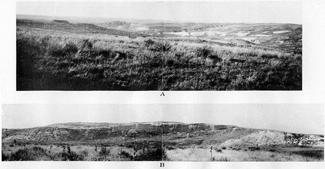
Plate XXXVIII--Diatomaceous marl of Ogallala. A, Remnants of slightly harder portions of the marl on the divide between two canyons. In the SW NE sec. 11. T. 11 S., R. 38 IV. B, Murl weathered into large blocks. In the NE SE, sec. 11, T. 11 S .. R. 38 W. C, Complete section of the bed shown in A and B with capping limestone above and chalky clay at the base. (The man stands on the contact.) Same locality.
Surficial Disturbance in the Upper Cretaceous and Ogallala
Though beds of the Upper Cretaceous and Ogallala, as usually observed, are only slightly inclined, and in many places nearly or quite horizontal, they are found locally to be much disturbed and very rarely show extremely steep inclination of the bedding planes, some reaching the vertical or even being overturned. Close examination invariably shows that the most violent disturbances are limited to small outcrops and, excepting the drag at some faults, are of surficial origin and have no direct relation to the major structural features of the formations. These violent though limited disturbances arrest the observing eye of a geologist as well as of a careful amateur student, and demand explanation.
One of the most common of the surficial disturbances is the slumping of masses of rock down the steep slopes of valleys and canyons. Heavy limestone concretions of the Pierre shale often slump down together with a portion of the underlying shale. On those valley slopes that are slightly steeper than the dip of the exposed shale, the gradual slump of an exposed concretionary zone develops a drag down the slope and tends to give the appearance of a steeper dip of the shale toward the valley bottom than the actual inclination of the strata. Many concretions break down during the slumping, which helps to show that this process is surficial. Where such slumping has taken place the apparent dip of the exposed concretionary zone must be checked and corrected by observation of the actual dip of the shale in the near-by ravines and canyons that cut deeper into the shale. That is to say, though the concretionary zone which is chosen as a key bed can be still used as such, and the elevation for the structural mapping should be taken on the top of it, the dip of the formation, which may be helpful for the structural mapping, is preferably taken on layers of shale farther down. The dip can be taken on the fine stratification of the shale or along the cracks parallel to it or still better on the bentonite and other differently colored streaks, but as a rule not on gypsum streaks, which may be secondary filling of the cracks and variously oriented in relation to the bedding of the shale. On steep bluffs and in deep canyons large masses of shale part along cracks, and when they slump change their orientation. Many of the slumped blocks are buried under the next portions of disintegrated shale, gravel and mud and may be exposed again later by a change of drainage and thus exhibit a local disturbance of the shale that may puzzle the observer. These slumped blocks of shale can be recognized by the twisted and cracked portions in them, often accompanied by irregularly distributed slickensides, also by veinlets of mud, sand and gravel and other secondary features which originate in the shale during slumping.
The slumping is particularly common on the edges of Ogallala escarpments. The atmospheric precipitation drains through the grit and other arenaceous Ogallala rocks and weakens the shale beneath, carrying part of it away and penetrating the rest along the cracks, until finally large blocks of Ogallala break away from the escarpment and slump down with a portion of the underlying shale. Still larger portions of Ogallala have been observed capping small mesas and separated from the continuous escarpment by erosion. Some of these outliers of Ogallala have a slightly but distinctly different inclination from that of the same formation in the continuous escarpment of which they were formerly a part. This phenomenon can be observed on the south side of Goose creek, in T. 12 S., R. 41 W. It appears as if differential erosion had removed the bentonitic clays, which are here observed at the base of the Ogallala, and probably also the underlying Pierre shale, and caused uneven settling of these "islands" of Ogallala with little or no breaking of the block.
The sink holes, or cave-ins, which are common in Wallace County and elsewhere in western Kansas and which are described in a separate chapter of this report, usually do not affect the dip of the beds in the walls around the hole, as is clearly demonstrated in the Smoky Basin cave-in and in some ancient sink holes of the county. However, in some cases they may cause a local abnormal dip in part of the wall. It seems that the cause of the abnormally steep inclination of the Ogallala on both sides of the "gate" at the old circular hole, apparently a cave-in, on the south side of the canyon in the SW, sec. 27, T. 12 S., R. 41 W., is the differential slump of Ogallala blocks at the edge of the escarpment toward the hole (Pl. XL C). Other unusually steep dips in some large blocks of Ogallala have been most probably caused by differential undermining and subsequent slumping. A large block of Ogallala with inclination over 45° was observed on the left side of the creek in NE NE, sec. 6, T. 13 S., R. 41 W., and a block with about 90° was observed on the south side of a small nearly circular canyon head in the NW sec. 7, T. 13 S., R. 41 W. (Pl. XXXVI C). In both localities the blocks are lower in elevation than the nearest Ogallala escarpments, a part of which they formerly were. These blocks probably overturned when undercut by local erosion. A 45° and even steeper dip of a considerable portion of the Ogallala escarpment in the SW NE sec. 3, T. 13 S., R. 41 W., is not so easy to explain (Pl. XXXVI B) . The steeply inclined portion of the Ogallala escarpment is here not inclined in the direction of the slope of the valley, but dips in the reverse direction. Comparison with the nearly horizontal position of the escarpment shows that the steeply inclined portion of Ogallala did not slump down more than a very few feet.
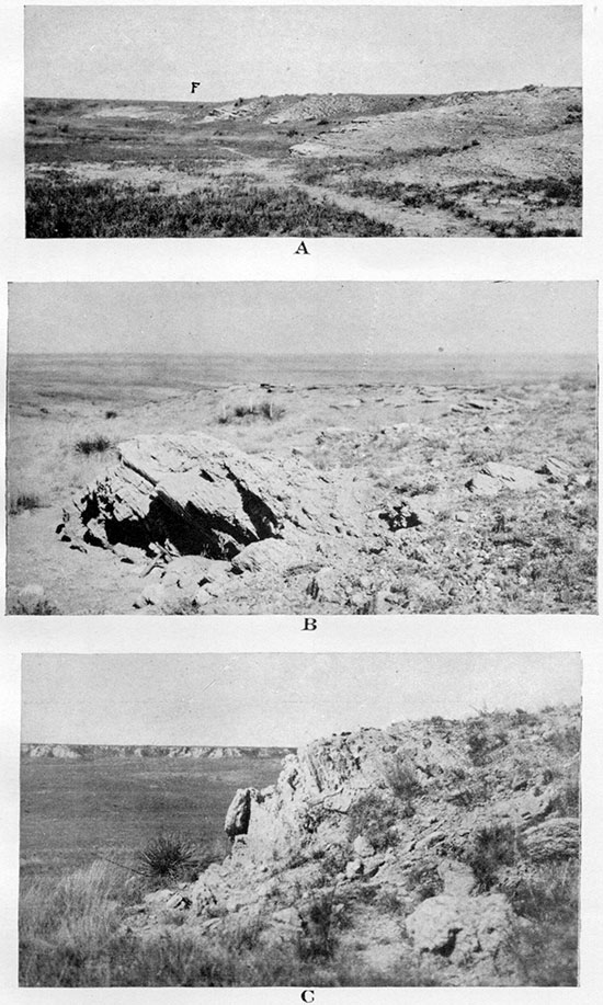
Plate XXXVI--A, Marked change of dip in Niobrara chalk, the steepest being near the edge of fault F. In the NW, sec. 1, T. 14 S., R. 38 W. B, Unusually steep local dip (not to be confused with still steeper cross-bedding) in the cliff of Ogallala coarse sandstone. Shows nearly horizontal position of the same ledge and on the same level in the distant continuation of the same bench. The ledge rests on Pierre shale. In the SW NE, sec. 3, T. 13 S., R. 41 W. C, Coarse sandstone of Ogallala in erect position. In the SW NE, sec. 7, T. 13 S., R. 41 W.
The direction of the steep inclination of the bed is to the east. This is the direction of the rushing water of Pleistocene age. Pleistocene gravels, in which some very large boulders occur, are not uncommon in Wallace County and are present here. The writer suggests as a possibility that ice jams comparable to those of the Mackenzie and other Arctic rivers of to-day could have occurred behind outcropping rocky ledges of the Ogallala, causing sufficient pressure against the edges of the escarpment to overcome the resistance and tear off and tilt large blocks of the rock. Part of the boulders and gravel carried by the ice would be dropped around the tilted blocks.
Some pronounced but purely local disturbances in the Pierre shale, which are apparently confined to the portions of this shale near the edges of escarpments of overlying Ogallala-for instance, in the SW , sec. 12, T. 13 S., R. 42 W.-may have originated in a somewhat similar way as the small-scale folds in the shale underneath the "erosion thrust" in the Appalachian mountains shown by Bailey Willis (Willis, 1893, p. 223 and Pl. LIV-7, opposite p. 232). A pronounced folding of the Ogallala, probably partly due to compression, was observed in this area and mapped in detail in 1927-'28. If the folding of these strata continued after erosion cut through the Ogallala beds, a small-scale folding could have been developed in the underlying Pierre shale, whereas the rigid Ogallala at the edge of the escarpment would slide along the contact with the shale and over the exposure of the shale. The minor folding of the Pierre below Ogallala could be explained, also, as a mere local plication of incompetent rocks (clayey shale) near contact with Tertiary grits in a competent fold (explanation suggested by K. K. Landes).
It remains to mention that the local steep dips in the Pierre shale and in the Niobrara chalk, which are closely connected with the faults in these formations, apparently represent the drag of the beds at the fault plane.
Folding of Upper Cretaceous and Ogallala
As was shown in one of the preceding chapters, there are many beds in the Ogallala which reflect the original subhorizontal deposition of the sedimentary material of the formation, and which thus can be used as key beds for structural mapping, the Ogallala being not different in this respect from ordinary sedimentary formations. The observations and the structural mapping of this formation prove that there was a pronounced, though possibly local, folding (PIs: XXIII B, XXXVII A and XXXVII B) and faulting of Ogallala together with the underlying Upper Cretaceous. There is good evidence that the Upper Cretaceous formation have been folded and faulted also in pre-Ogallala time, but for the most part the traces of earlier orogenic movements cannot be clearly differentiated from the marks of post-Ogallala deformations, and probably part of these movements took place along the same anticlinal and synclinal axes. Though the structural map of Wallace County (Pl. XLII), based on the scattered outcrops, is far from an exact representation' of the actual surficial structure of the area, the general features of the structure that it shows are not far from the actuality. This map reveals that, as a rule, the folds of Wallace County stretch in two general directions-one is from north to south and the other from west to east, or more exactly west-northwest to east-southeast.
The meridianal direction of the folds is the direction of the most pronounced folds elsewhere in Kansas, and most probably all of these folds that have approximately the same direction have a common origin. It is true that the meridianal anticlines of Wallace County, as they are manifested in the surficial formations, are of much less magnitude than, say, the famous anticline, the "granite ridge" of eastern Kansas, that covers the richest oil pools of the state. But if all the meridianal arches of the state are of the same origin, which appears to be most probable, it is only natural that the folds of western Kansas, which reflect the ridges buried by a much thicker series of sedimentary formations and are separated from the ridges by two additional erosional unconformities (one between the Permian and the Dakota of Upper Cretaceous and the other between the Upper Cretaceous and the Ogallala), are not so pronounced as their eastern equivalents. It is quite possible that the meridianal anticlines of western Kansas may prove to be more pronounced farther underground and thus represent more prominent underground structural features than their reflection in the surficial formation would suggest.
Two meridianal ridges, each representing a chain of several uplifts that are stretched along a north-south direction, can be recognized in Wallace County. One runs through Weskan and can be called the Weskan structural ridge or anticline. There is a slight topographic prominence, especially north of Weskan, which corresponds to this ridge and most probably is due to this structural uplift. The other structural ridge runs slightly west of Sharon Springs and can be called the Sharon Springs ridge or anticline. The eastern slope of this structural ridge has a distinct reflection in modern topography, especially in the high plateaus south of Sharon Springs. Still another, but much less pronounced, nearly meridianal structural ridge is possibly present between Sharon Springs and Wallace. This ridge with a north-northwest trend can be detected only for some distance north of Smoky Hill river. Naturally there are structural depressions or synclines, or rather chains of synclines, which separate the above-mentioned structural ridges.
A prominent system of folding, which cuts across the meridianal structural ridges and depressions, is most pronounced in the middle latitudinal stretch of Wallace County and chiefly north of Smoky Hill river. As will be related in the detailed description of the structures, the latitudinal folding effects both the Pierre and the Ogallala with nearly the same intensity. This indicates that the latitudinal folding is of late origin and that we may expect the Upper Cretaceous beds concealed under Ogallala deposits in the north and south parts of Wallace County to be probably hardly much more folded in this direction than the Ogallala sediments. This conclusion has also a strong support in the fact, which can be clearly observed on both the structural map and the north-south geologic section through the western part of the county, that the latitudinal folds of the central part of Wallace County form an anticlinorium with the most pronounced anticline in the middle and with series of gradually decreasing folds north and south of it.
The east-west series of folds enters Wallace County from Cheyenne county, Colorado, stretches through the whole of Wallace County and continues to Logan County on the east. These folds appear to be more pronounced in the west and to become less pronounced toward the east.
In the description of the details of the Wallace County structure the writer starts with the Weskan anticline and describes it from south to north and continues his description toward the east in the same manner, covering Sharon Springs anticline and the next structural features east.
In the southwest corner of Wallace County, on the high, slightly dissected plateau, there is an area of about nine square miles along the south fork of Ladder creek in which all the wells dug or drilled to the top of the Pierre shale are dry. This area is shaded on the structural map of the county. It seems to the writer that the absence of water in the wells can be accounted for by the presence of a very low and broad structural hill (Stockholm dome) of shale covered with Ogallala and loess. Unfortunately the exact depth of the wells and the record of the rocks that were encountered are mostly unknown at present. The depth of one dry well at the northeastern edge of the dry area is 140 feet (to shale). The water wells north of the dry area are 150 to 163 feet deep; the water well at Stockholm, southeast of the dry area, is 200 feet deep, and one water well west of the dry area has the same depth. The information on all the dry and water wells of the area was kindly supplied to the writer by J. August Johnson, of Weskan.
The above-described area, which has no water available at the top of the Pierre, is leased by an oil company, the geologists of which were led to this area while tracing structural elevations southwest of it in Colorado.
The absence of buildings and water wells southwest of Weskan and north of the Stockholm dome, together with evidence from the few outcrops of Ogallala north, east and south of Weskan, are suggestive of another structural dome of smaller area but of more pronounced height. Both this dome and the Stockholm dome lie in the line of Weskan structural ridge or anticline.
About one mile north of Weskan is a distinct and comparatively sharp syncline with approximately east-west direction of the axis, and beyond a narrow structural uplift farther north there comes the pronounced syncline that coincides with the broad valley of Smoky Hill river. On the north side of the river, east of Weskan road, both the Ogallala and the underlying Pierre, which is exposed in the left canyons tributary to Smoky Hill river, show a persistent though locally slightly variable inclination southward. Pierre shale is not exposed west of here either in the valley of Smoky Hill river or in the tributary draws.
The pronounced divide between Smoky Hill river and Willow creek north of it corresponds to the most prominent structural high of Wallace County. In the eastern half of this structural high, which was named Willow creek anticline, both Ogallala and underlying Pierre are exposed, but west of Weskan road Ogallala alone outcrops. The eastern half of the structure was studied and mapped first, and in it the stratigraphic and structural relations between these two formations examined. It was in this eastern area that the character and the degree of nonconformity between the two formations were established, and it was found that the major folding affects both Pierre and Ogallala in equal degree. There were discovered some local small-scale folds in the Pierre near the edges of the Ogallala escarpment, but these do not affect the major structural relation of the two formations and are possibly due to the development of erosional thrusts, as previously explained. It was established that the nonconformity between the Ogallala and. the Pierre develops here for the most part very gradually and amounts to about 10 feet to a mile in meridianal direction, the regional dip of the Pierre being as usual to the north. The nonconformity between the two formations in an east-west direction was found to be locally so small as to be unnoticeable within the three miles of the studied stretch of the exposures. The top of the middle limestone concretionary zone or bed No. 8, with typical Ostrea and Anomia, was used as the key bed in the Pierre exposures of the eastern half of the structure, and only in a few places have the top of the cone-in-cone zone No. 10 and the topmost heavy concretionary limestone or bed No. 12, all of the upper Weskan shale member, been used as the subsidiary key beds. Some prominent ledges of the Ogallala, chiefly the crossbedded, sorted gravel and sand or the first hard ledge of local Ogallala from the base, and one of the most prominent and at the same time very limy mortar beds, and rarely some other beds, have been used as the key beds in the Ogallala in the eastern half of the structure. This was not so much for the sake of the structural mapping of the eastern half as for the study of the relation of these Ogallala beds to the underlying beds of the Pierre, so that they could be used for the structural mapping of the western half of the Willow creek anticline, where the beds of the Pierre are not exposed. Owing to the excellent and continuous exposure of Ogallala beds on the south side of Willow creek, east of Weskan road (Pl. XXIV C), it was possible for the rodman to walk out the chosen most prominent "mortar-bed" escarpments of Ogallala, while the geologist and instrument man watched from the side so as not to let him lose the key bed where few interruptions. occurred or where the chosen bed began to. be less conspicuous compared with the neighboring "mortar beds" of the sections. Owing to the sufficient amount of Pierre exposures with the recognizable key beds, is is possible to map structurally this area without any help of Ogallala key beds, but In some parts of this half of the structure the Ogallala key beds helped to map some very interesting details of the structure and helped to establish the presence of a fault near the top of the divide between Willow creek and Smoky Hill river, where the Pierre is not exposed. The used key beds of Ogallala have been reduced to the key beds of the Pierre, taking into account the degree of nonconformity in meridianal direction. The latitudinal nonconformity was assumed to be zero on account of its negligible rate.
The western half of the structure, or the part west of the Weskan road, was mapped on the Ogallala key beds alone. The topmost bed of Ogallala, the concentrically banded limestone, the top of the heavy gravel bed 40 feet below it, the limy "mortar bed" and the cross-bedded prominent ledge near the base have been used as the key beds. The elevations taken on these beds have been reduced to that of the main key bed of the Pierre of the eastern half of the structure, the limestone No. 8 of upper Weskan shale member. The stratigraphic distance of the Ogallala beds to this Pierre bed was assumed to be the mean distance established for the east half of the structure and the nonconformity to be zero in all directions. This makes the structural map of the western half of Willow creek anticline less precise, so that the elevations reduced to the main key bed in the eastern half of the structure can be considered to be correct within an error of 10 feet in either direction, and the reduced elevations of the western half are correct within an error of 15 to 20 feet. The error in the eastern half is chiefly due to the impossibility of a more precise identification of the top of the concretionary zones of the Pierre, which have been used as the key beds.
Altogether about 200 elevations have been taken on the key beds within the Willow creek anticline. The following is the description of this structure.
The Willow creek anticline lies in the townships 13 south of ranges 41 and 42 west, Wallace County, Kansas. The center of the structure is five miles north-northeast of Weskan. On the south the structure is bordered by the valley of South Smoky Hill river. This valley has an easterly trend, but opposite the structure it makes a broad turn toward the south and runs parallel to the structural contours of the south flank of the anticline. The South Smoky Hill river flows through a syncline, which closes the Willow creek structure on the south: This syncline is named the Smoky syncline.
The northern closure of the structure lies in the divide between Willow creek and Schoolhouse draw. A deep and comparatively sharp syncline was found here at the heads of the several northern tributaries to Willow creek. This syncline was named the Bone syncline after Bone draw, which is at the east end of the syncline. The axis of Bone syncline makes a bow toward the north with the center of the bow at the head of Ammonite draw. The southwest end of this syncline comes down to Willow creek at the mouth of Bug gulch, its northern tributary. Here a structural depression is developed in which the uppermost part of the Ogallala formation is exposed. In this depression lies the northeast end of the next syncline, which closes the Willow creek anticline on the northwest. This syncline extends in a southwesterly direction with only a slight bend toward the northwest. The syncline apparently meets the Smoky syncline near the junction of the two large forks of South Smoky Hill river. This junction lies in an outstanding topographic basin, which indicates a reflection of a large structural depression at the meeting of Smoky and the northwestern synclines, and marks the extreme western end of the Willow creek anticline. The extreme eastern end of the structure lies near the junction of Willow creek and Smoky Hill river. Here Smoky syncline meets the syncline that closes the structure on the northeast.
The main structural highs, which constitute the Willow Creek structure, are Western anticline on the west, Swisegood dome on the north and Bat anticline on the south. These anticlines are connected by saddles and thus make up a larger structure, within which many minor structural highs and structural depressions can be recognized. The highest elevations of Western and Bat anticlines are marked by the 4,020-foot contour; the top of the Swisegood dome is apparently 20 feet higher and is considered from available data to be the highest point of the structure. Willow creek cuts across the Swisegood dome in the middle, and the alluvium of the broad valley of the creek conceals exposures. The top of the dome was found at the intersection of the axes of the two anticlines, Western anticline and the north-south minor anticline that runs one mile east of the Weskan road. The area covered by the lowest closing contour of the anticline is about 1,000 acres, and the closure is about 160 feet.
The detailed mapping of Willow creek anticline revealed many interesting features which help to understand the character and origin of the folding that produced it. The cross sections of the detailed structural map (which belongs to Etnyre Syndicate) show distinctly that the latitudinal synclines are sharper than the broadly rounded latitudinal anticlines. This shape is typical for the upper zone of the "parallel folds," to which type the latitudinal folds of Wallace County apparently belong. This shape, together with the observations that both Pierre and Ogallala are equally affected by the folding, seem to indicate recent folding of the lateral compression type.
The detailed map revealed the presence within the structure of several small closed saucerlike synclines. These are not sink holes, because they are not circular; many of them are shaped like somewhat rounded rhombs with the opposite angles in meridianal and latitudinal directions. These rhomblike closed synclines are arranged in rows in nearly meridianal and latitudinal directions and are spaced between the minor domes within the structure in checkerboard manner. The regular development of these closed synclines in rows within the Willow creek structure is probably due to the origin of the structure as an intersection of two systems of folds.
North of Willow creek structure lies another structural high, which reaches to Goose creek, and which is perhaps of not less importance than the former structure. Unfortunately a thick mantle of loess covers the whole top of this anticline and does not permit a better estimate of the closure than that obtained by extrapolation of the flanks of the anticline toward the center, and the study of these flanks is based on very few exposures. These were sufficient to establish, however, that the western slope of the anticline is steeper than the eastern slope, and that the northern slope is many times gentler than the southern slope. The outcrops are most plentiful northeast and east of the axis, and it was established that in these quarters the anticline gives out a group of noselike and fingerlike minor structures, which are parallel or nearly parallel to each other and run nearly northeast. On one of these "fingers" the minor dome of Salt Grass canyon, which was worked out in some detail, is situated. The Pierre shale of this dome furnishes many exposures of the type locality of Salt Grass shale member, and on the northwest side of the canyon can be observed an excellent overlap of the Pierre shale hill by the beds of Ogallala formation. (See Pl. XXIV B.)
West of Weskan anticline, between Willow and Goose creeks, the few Ogallala exposures with the prominent key bed furnished by the concentrically banded limestone permits establishment of the eastern flank of a prominent structural high, which enters Wallace County from Colorado. There are not very many exposures of the Ogallala and none of the Pierre north of the valley of Goose creek on the line of the Weskan anticline, and the northern continuation of this important structural ridge was not established by the writer.
The structural mapping based on the concentrically banded limestone of Ogallala, as the key bed in the high plateau south of Sharon Springs, revealed the presence of a considerable dome south and southwest of Sharon Springs. This dome, which has a comparatively sharp slope eastward, is connected through a noselike structural ridge with the structural elevation south of Weskan. Northwest of Sharon Springs. the broad topographic low of the junction of Smoky Hill river with Goose creek is structurally a medium-size high. This structural high was established in the exposures of Pierre shale alone and is the eastern end of a comparatively long latitudinal structural and topographic ridge of the divide between Smoky Hill river on the south and "Schoolhouse draw" on the north. A smaller latitudinal ridge parallel to this is in the next divide north, between "Schoolhouse draw" and "Collins draw."
A long structural ridge which belongs to Sharon Springs anticline was established between the mouth of "Schoolhouse draw" and Lake creek. The northern continuation of this anticline was not mapped on account of the absence of exposures of Pierre shale. The few Ogallala exposures of this area, in the eastern part of R. 41 W. and the western part of R. 40 W., do not contain easily recognizable key beds. The valley of the upper part of Goose creek corresponds to a gentle latitudinal syncline, the valley slopes being steeper than the flanks of the syncline.
The high plateau south of Wallace is also a structural flat, at least as far as Ogallala deposits are concerned, but within the exposures of the Pierre and the Niobrara on the south side of Smoky Hill river and southeast of Wallace there is a distinct latitudinal structural ridge. This ridge is cut by several faults, only one of which, the most prominent, is shown on the structural map. This ridge appears to be connected with a longer and a more prominent anticline, which runs east-southeast, and the axis of which nearly touches Wallace. The structural high on this ridge was drilled by Wulfekuhler in 1926. The location for the well was chosen with the aid of geologic reconnaissance. The elevations taken by the writer on the top of the septarian zone of Sharon Springs shale member, which outcrops in a few places in the area, and the more reliable dips that have been observed and established by the differences in elevation of the key beds enabled the writer to show that the crest of the structural high is probably about two miles southwest of the Wulfekuhler well.
North of the well lies the area in which the normal regional dip in the shale is observed, but a few miles south of Lake creek there is a topographic depression, which corresponds to a syncline. North of this syncline is a medium-sized structural (as well as topographical) ridge, on which the Robidoux well is situated. However, this dry well was drilled about in the middle of a pronounced graben or structural trough between two faults of nearly latitudinal direction. West of the Robidoux structure there appears to be a broad dome, the center of which is about 1 1/2 miles southeast of Madigan ranch.
The Ogallala that is exposed on the south side of north fork of Smoky Hill river in the northeast corner of the county and that contains a continuous bed of diatomaceous earth capped by a thin but persistent limestone, is folded and faulted (see Pl. XXXVII A), but these local and not very pronounced disturbances have not been worked out structurally in detail.
Prev Page--Quaternary || Next Page--Mineral Resources
Kansas Geological Survey, Geology
Placed on web Nov. 14, 2014; originally published April 1, 1931.
Comments to webadmin@kgs.ku.edu
The URL for this page is http://www.kgs.ku.edu/Publications/Bulletins/18/05_struct.html