![]()
Prev Page--Introduction || Next Page--Stratigraphy
Geography
Location and Culture
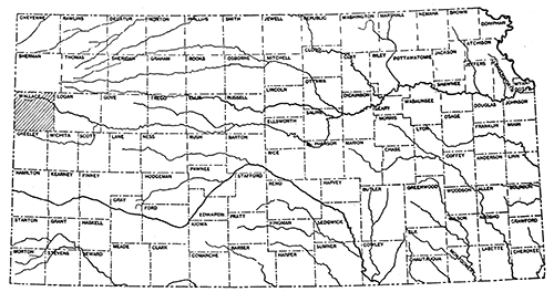
Wallace County, one of the most western counties in the state (Fig. 1), is in the third tier south from Nebraska and is bordered by Colorado on the west. The county was created in 1868 and was named in honor of Gen. W. H. L. Wallace, a veteran of the Mexican War. At first it included the territory now forming Logan County, the next county east. This explains some early references to localities in Wallace County which are now in Logan County. Logan County was separated from Wallace in 1881 and was named St. John, the name being changed to Logan in 1885.
Figure 1--Index map of Kansas showing location of Wallace County.
Fort Wallace, which had a central position in the original Wallace County, was established in September, 1865, and was first known as Camp Pond Creek. Pond Creek, named after Major Pond, joins south fork of Smoky Hill river 3 miles west of the fort. In 1866 the name was changed to Fort Wallace in honor of General Wallace, mentioned above. During the building of the Union Pacific railroad, which was completed to the fort in 1868, Fort Wallace was an important military post, but it was abandoned in 1882, no more military protection being needed from the activities of Indians. The memorial monument within the ruins of the fort and at Wallace cemetery is shown in Plate XXXIX. Time has little affected the ornamentation and inscription, the major damages being done by unknown vandals. Restoration of the monument and the walls at the cemetery was started in 1930, the necessary appropriation being provided by the state.
The town of Wallace, erected north of Wallace railroad station, was the county seat of the original Wallace County. Since 1887 the county seat of Wallace has been Sharon Springs, situated in the center of the county and on the Union Pacific railroad. The presence of a never-failing supply of pure water in the springs near the old Eagle Tail station was an important factor in the selection of the site in 1886, as a supply of good water is not everywhere available in western Kansas. The third station on the Union Pacific railroad, which traverses the middle of Wallace County, is Weskan, serving the smallest of the three towns of the county. According to the 1930 census the population of Sharon Springs is 792, and the population of the whole of Wallace County is 2,882.
The county is traversed by United States highway No. 40S, which runs parallel to the Union Pacific railroad and was recently greatly improved, several new bridges being erected. State highway No. 27 traverses the middle portion of the county in a north-south direction and is kept in good condition, though it is not graveled. Other important dirt roads run in a north-south direction through Wallace and Weskan. The road north from Weskan goes to Kanorado in Sherman County. Owing to the low cement bridge over Smoky Hill river on this road, the river, ordinarily having only underflow, flows over the road after heavy rains and stops travel. The road south from Wallace is nearly always open, as a small bridge has been built over Smoky Hill river. These and other less important roads and trails are shown on the accompanying map.
Topography and Drainage--Highest Point in Kansas
Wallace County lies within the High Plains of the west-central United States, which are bordered by the Rocky Mountains piedmont on the west and by the low plains of the Missouri and Mississippi river valleys on the east. The High Plains slope gently toward the east, the slope within Wallace County being 25 feet per mile except in the southeastern part, where it is only about 5 feet per mile.
The High Plain is dissected by a well-developed river system. In places the stream valleys have quite steep and rocky northern slopes, but in most parts there is a gentle topography, and the valley bottoms are easily reached by automobiles. The divides between the major streams rise 180 to 200 feet above the bottom of the valleys, and south of the south fork of Smoky Hill river the surface of the High Plains rises 250 to 350 feet (south of Wallace) above the valley (Pl. II A). The highest point within Wallace County and probably the highest point of Kansas is, according to barometric leveling by the writer, in sec. 12, T. 12 S., R. 43 W. This place is on "the divide between the two Smoky forks on the 102d meridian, near the head of the draws of Goose creek," which area was considered, by Robert Hay (Hay, 1896, p. 644) "to be the highest land in Kansas." The height of this "highest part of the 102d meridian" within the area explored by Hay was estimated by him to be "about 4,000 feet above sea level."
On the topographic map of Kansas compiled under the direction of Henry Gannett in 1898 (Gannett, 1898, supplementary map) the contour representing 4,100 feet elevation above sea level is shown to traverse the southwestern corner of Wallace County, which is apparently an error. The highest elevation in this part of Wallace County was found by the writer not to exceed 3,950 feet above sea level, which is in agreement with the earlier topographic map of the western part of Kansas published by Robert Hay (Hay, 1896, map opposite page 642).
The above-mentioned highest point of Wallace County and probably of Kansas is a small separate hill on the high, slightly rolling divide between the basins of Goose creek and Willow creek and is in the SW SE, sec. 12, T. 12 S., R. 43 W., about one-eighth of a mile from the state line. The hill, except its apex, consists of the topmost beds of the Ogallala formation, the capping rock of which, the pink, concentrically banded, algal limestone, outcrops on the northern slope of the hill; the apex of the hill is formed by loess.
The elevation of the top of the hill, as well as of some other points of the surrounding area, was taken with a Paulin altimeter and, after due corrections for change of atmospheric pressure and for the temperature of the air, was determined to be 4,059 feet above sea level. Though this figure cannot be considered exact, it is not far from correct, because the point appears to be about 15 or 20 feet higher than the nearly level surface on the east line of the SE, sec. 12, whose elevation is 4,040.12 feet, according to the instrument (transit) survey of 1928 by topographer O. R. Smith, of the Etnyre Syndicate.
The lowest point in Wallace County is the channel of the south fork of Smoky Hill river, where it crosses the eastern county line in sec. 25, T. 13 S., R. 38 W. The elevation of this point, deduced from altimeter reading, is about 3,165 feet above sea level. The comparison of the highest and lowest points of Wallace County shows the maximum relief within the county to be nearly 900 feet.
The rivers and creeks of the area belong to the Smoky Hill river system, which drains finally into the Mississippi river. The direction of the larger streams is from west to east or parallel to the Arkansas river 70 miles south. Many of these streams, by an abrupt turn to the south, meet a larger river at an angle of 60° to 90°. In this fashion Goose creek joins the south fork of the Smoky Hill river in sec. 9, T. 13 S., R. 40 W. At a similar angle the north fork of the Smoky Hill joins the south fork in Logan County, Kansas. Another branch of the south fork of Smoky Hill river joins it at all angle approaching 70° near the boundary between Kansas and Colorado. The detailed geological survey has revealed that many of the larger streams, especially in the west, correspond to the larger latitudinal synclines of the area. These rivers run in a general easterly direction, parallel to the outstanding topographic and structural ridges, until they suddenly break through, apparently at structural lows or saddles. These lows in places develop within a structural ridge and may mark the point of closure of an anticline or an elongated dome.
Smaller drainage channels-for instance, Willow creek, Collins, and Schoolhouse draws-have a general direction from west-northwest east-southeast, but a closer study reveals that a west-east direction of parts of these streams is predominant, and that step like turns in a south-southeast direction bring these streams gradually to the southeast until they join the larger rivers of the area previously described.
Willow creek, with its broad and well-developed valley, is to some extent an exception to this rule, running very straight in an east-southeast direction. This creek has an interesting relation to the outstanding structural feature of the area, which is here designated as the Willow creek anticline. Willow creek cuts this structural high across its highest elevation through the crest of the dome.
Another example of a stream cutting through a structural high is, Salt Grass creek, which cuts the Salt Grass dome, a minor structural high, near the center. The minor creeks of the area run in various directions, but with them also a certain relation to the local structural features' usually can be noticed. As previously stated, the larger river valleys, especially in the western part of the county, correspond to the larger synclines. The slopes of many of these valleys are the dip-slopes of the exposed rocks or nearly the same, and many of the outstanding topographic ridges are anticlines.
The south fork of Smoky Hill river runs along the Willow creek anticline, an outstanding structure. The northeastern side of this structure is marked by the lower portion of Willow creek valley, and the middle portion of Willow creek valley borders another outstanding structural high of the area, which enters Wallace County from the northwest between Willow creek and Goose creek. Goose creek flows in a syncline along practically its entire eastern course, but this structural depression is more pronounced in the Pierre strata and is only gently reflected in the overlying beds of the Ogallala, so that the slopes of the Goose creek valley are steeper than the dip of the Ogallala beds. Thus the chief escarpments of the Ogallala beds project through the southward slope of the valley, giving an impression of horizontal strata. The abrupt turn of Goose creek from an easterly to a southerly direction is a reflection of a change in the direction of the strike in the Pierre strata (Cretaceous), as revealed by the study of the exposures on the northeastern slope of the valley at Halsey School, in the northeast corner of sec. 11, T. 12 S., R. 42 W.
Physiographic Expression of Formations
In the local area there are five different rock types, each of which is characterized by certain distinctive peculiarities of the relief of its exposure. These types are:
- The Niobrara chalk,
- The Pierre shale and the bentonitic clays of the lower Ogallala,
- The resistant "mortar beds" of the Ogallala formation,
- The loess and gravel of Sanborn formation and redeposited loess of valley flanks,
- The river gravels and sands of recent origin.
Recent river gravels, sands and silts cover the valleys of the larger streams (Pls. I and XXXI C). Extensive deposits of loess are usually also washed into the river valleys and in many places constitute the highest beds of alluvium. Nearly all the high land of the region is covered by loess (Pl. XXIV B), which forms the smooth or gently rolling surface of the High Plains. The loess where exposed is characterized by vertical escarpments (Pls. XX A, XXIV B, XXXV A and B), and in many places the loess outcrops have a step-like profile.
The hard "mortar" sand and gravel beds of the Ogallala formation build the most prominent escarpments of the area (Pls. II A, XXB, XXIII, XXIV, XXX, XXXVII and XLC). Usually these beds outrop on the southern side of the valleys; elsewhere their relation to topography is varied. The most prominent and the most continuous escarpments are situated on the south side of south fork of Smoky Hill river valley (Pl. II A) and of Goose creek valley from Salt Grass creek (Pl. XXIV B) to the turn of Goose creek to the south. This escarpment forms a high erosional terrace or "step" on the south slope of the Goose creek valley, 100 to 140 feet above the valley bottom. The abrupt step of the Ogallala plateau south of Smoky Hill river stands 300 feet above the bottom of the valley.
The Pierre shale furnishes the least conspicuous exposures of the region (see Pls. III A, VIII A, X A, XV A and XXIV B), but these are the most valuable for an oil geologist. This shale is exposed occasionally on both sides of the larger and smaller valleys where erosion has removed the overlying loess, gravel and Ogallala beds, and it may be seen in the bottom of some valleys at the base of river-channel escarpments. Pierre shale exposures may be recognized by the series of small, bare, dark-colored hills, which occasionally occur in the lower half of valley or canyon slopes; usually the foothills of prominent Ogallala or loess escarpments are made up of Pierre shale.
The bentonitic clays of the Ogallala formation give the same type of exposures as the Pierre shale (Pl. XXX), but these outcrops are usually brightly colored in light-green or chocolate-brown shades, or both. The Niobrara chalk, of light-brown to orange color, is exposed only in the valley of the south fork of Smoky Hill river southeast of Wallace, where it makes more prominent and brightly colored escarpments than the overlying Pierre shale (Pls. III and XXXVI A).
Climate
(Chiefly after Coffey and Rice, 1912.)
The mean annual temperature in Wallace County is about 55° Fahrenheit, and the climate is of semiarid type with an average annual precipitation of about 17 inches. The summer temperature rarely rises above 100° Fahrenheit, and the extreme recorded winter minimum is -31° (recorded at Colby). Owing to the dryness of the atmosphere on the plains the heat and cold are more endurable than the same temperatures would be farther east.
The lowest temperatures occur in cold waves or blizzards, usually lasting from three days to a week. The highest temperature in summer may last a week or more, but the nights are generally cool even after the warmest days. The interval between the last killing frost in the spring and the first in the fall is about 160 days, the average date of the last frost being April 22 and of the first frost October 2 (according to the records at Wallace).
Precipitation is least during the winter and increases until July, but the variation in the rainfall for any month from year to year is great. Usually the heaviest snow comes in March, April or even in May, but sometimes heavy snowstorms come as early as November. Unfortunately the low average moisture from precipitation is further decreased in its usefulness by the excessive evaporation due to low humidity of the air. The use of the best methods of conserving the soil moisture is, therefore, extremely necessary for successful farming in this area, which is not infrequently visited by years of drought.
The prevailing wind is southwest, especially in the summer months. This wind is dry and accelerates the removal of moisture by evaporation. It is a source of danger from the time when the land is broken for planting until the crop is matured. Dense clouds of dust are raised by the wind from dry, broken fields, especially on the high lands. Other common winds are northwest and south, the former being the wind of winter blizzards.
Vegetation
The flora of Wallace County is typical prairie vegetation of the semiarid High Plains. The county is treeless except along the valleys and canyons (Pls. II A and C, and XXXI A), where cottonwood, willow and (rarely) hackberry grow. These are the only native trees now growing in Wallace County. Among shrubs, also restricted to valleys and canyons, Rhus trilobata and Prunus besseyi are most common (identification by W. C. Stevens, of the University of Kansas).
The herbaceous vegetation of the prairie is of the typical condensed type. The following extract from "Flora of Western Kansas" is applicable to the prairie flora of Wallace County:
"Most of the plants are composites, which are usually yellow or purplish, while the grayish tint of the prairies is largely due to the hairiness of the leaves, as most plants are more or less hairy, scabrous or resinous in this region. . . One will also find the leaves of almost every plant either finely divided or very much reduced. . . In fact the whole plant is reduced and often less than one-fourth the size of sister species in the eastern part of our state." [Reed, 1893, p. 92]
The chief native grasses of the prairie are the short, bushy and monotonous gray buffalo grass, Bulbilis dactyloides Engelm., and the gramma grass, Bouieloua oligostachya Torr. Many other grasses are common, among which the reddish Aristida purpurea adds much color to the prairie in the late summer and fall. Among other herbs of the prairie the writer recognized Lithospermum linearifolium of the Borage family, the representatives of which are only sparsely distributed, being usually met near the edges of the canyons. The Borage family was more richly represented both in the number of species and in the number of individuals in the local prairie of the Lower Pliocene time.
Soap weed, Yucca angustifolia Ph., can be seen nearly everywhere in Wallace County, but is especially common on the slopes of the valleys and canyons. Where yucca grows cactuses also grow (Pl. II C), plants whose leaves are reduced to spines or minute scales and whose thick and fleshy stems contain green chlorophyll, which makes them look like leaves of ordinary plants. In fact, these stems perform the function of leaves, their epidermis being furnished with stomata or breathing openings. Among the cactuses the prickly pear, Opuntia missouriensis DC, is very common. Two species of the ordinary round type (Mamillaria), one with orange and the other with pink flowers, are also quite common in some parts of the county.
The Russian thistle, introduced in this country, is very common among the weeds. Sagebrush, Artemisia tridentata, the firewood of the pioneers of the west, is restricted to sandy areas, nearly all of which have their source of sand in the disintegrating rocks of the Ogallala formation.
The large content of alkali in the poor, clayey soil at and around the majority of exposures of the Pierre shale limits the vegetation of these places to the common salt grass, Distichlis spicata, and other "salt grasses." Such places are Salt Grass canyon and some other smaller creeks and canyons of the area. Only a few small spots of entirely bare "bad lands" are developed at the exposures of the Pierre shale. One of these places is the bluffy "Devil's half acre" about in the center of sec. 36, T. 13 S., R. 40 W.
Prev Page--Introduction || Next Page--Stratigraphy
Kansas Geological Survey, Geology
Placed on web Nov. 17, 2014; originally published April 1, 1931.
Comments to webadmin@kgs.ku.edu
The URL for this page is http://www.kgs.ku.edu/Publications/Bulletins/18/03_geog.html