![]()
Plates
- Plate I--Geologic map and sections of Wallace County
- available as an Acrobat PDF file, 4.2 MB
- Plate XXXII--Geologic sections of the Ogallala formation.
- available as an Acrobat PDF file, 1.8 MB
- Plate XXXIII--Geologic sections of the Ogallala formation.
- available as an Acrobat PDF file, 1.4 MB
- Plate XLII--Structural Map of Wallace County.
- available as an Acrobat PDF file, 2.3 MB
Plate II--A, Valley of south fork of Smoky Hill river south of Wallace. On the sky line is the rocky escarpment of the High Plains plateau composed of Ogallala. There is a veneer of Sanborn loess farther south. B, Sharon Springs looking north. Negative by Maddy, Sharon Springs. C, Valley of south fork of Smoky Hill river northwest of Sharon Springs. On the right is a typical combination of yucca and prickly-pear cacti, abundant on the valley slopes formed of loess.
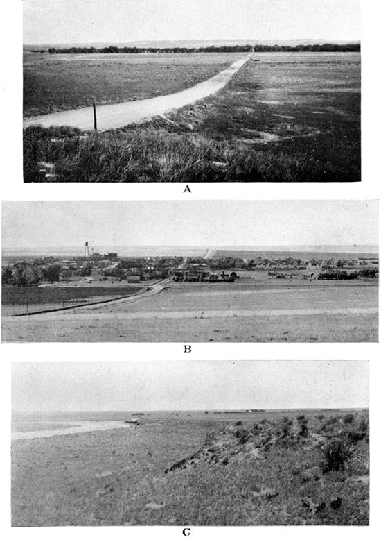
Plate III--A, Contact of Pierre and Niobrara in the NE, sec. 1, T. 14 S., R. 38 W. Shows more pronounced bench of Niobrara chalk (at the left) compared with the overlying Pierre shale. B, Fine cleavage in Niobrara chalk with inclination about 45 degrees to the bedding planes. From the SE SW sec. 31, T. 13 S., R. 38 W. Above is reworked loess full of Niobrara debris.
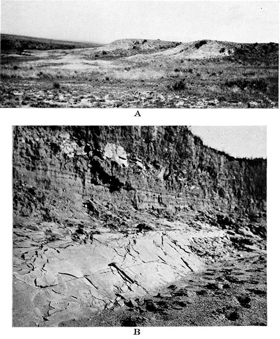
Plate IV--A, Fault in Niobrara chalk with crystalline calcite filling the fault fissure. From the NW, sec. 36, T. 13 S., R. 38 W. B, Slickensides in crystalline calcite which fills the fault fissure. Photographed on the other side of the little knob shown in A.

Plate V--A, Upper Sharon Springs shale member, two miles east of McAllaster, Logan County. B, Detail view of part of the exposure shown in A. Shows gigantic septarian concretions in flaky shale. C, Gigantic septarian concretion of the exposure shown in A and B.
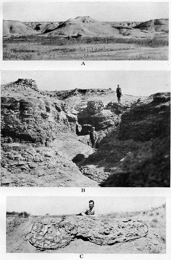
Plate VI--A, Detail view of the structure of a septarian concretion having a crust of crystalline gypsum. From a locality two miles east of McAllaster, Logan County. B, Kidneylike incrustations of the fibrous calcite that constitutes the first crystalline generation of the septarian fissures. Natural size. Negative by Charles Rankin.
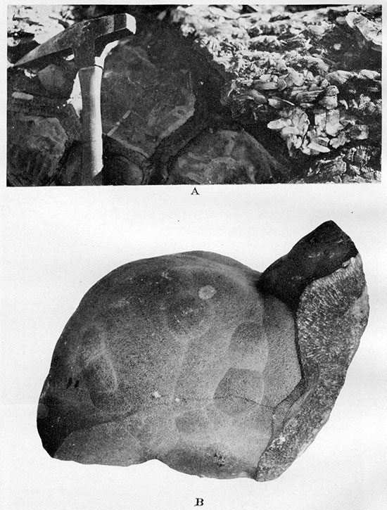
Plate VII--A, "Chop-wood" weathering of cone-in-cone crust around large concentric concretions near the top of Sharon Springs shale member. From a locality two miles east of McAllaster, Logan County. B, Concentric concretions with fibrous gypsum crust and clayey limonite core. Same exposure as A. C, Oval and biscuit-shaped concretions of gray compact limestone in flaky shale in lower part of Upper Sharon Springs shale member. From a locality one mile northeast of McAllaster, Logan County. Shows toadstool weathering of concretions and shale.
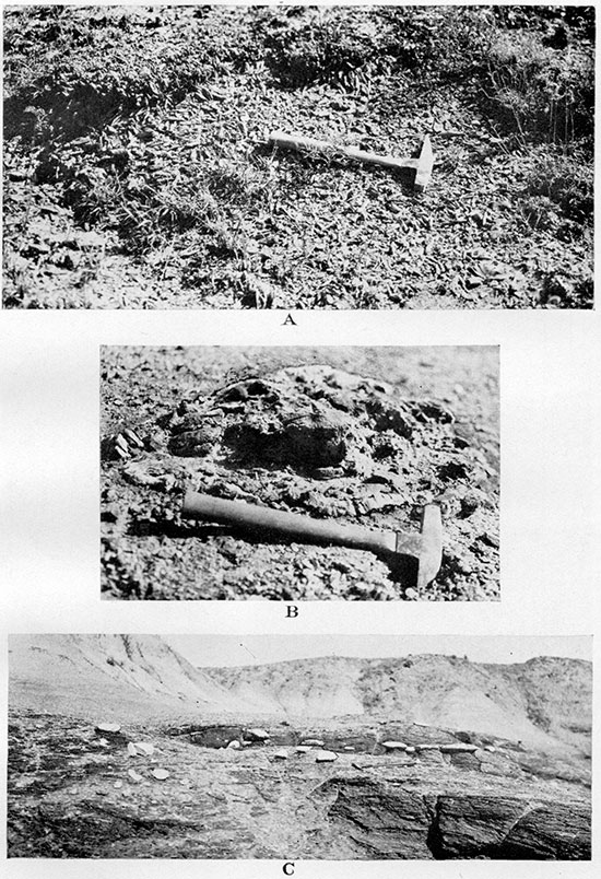
Plate VIII--A, Exposure of Lower Weskan shale member at type locality, in the SW SW, sec. 4, T. 13 S., R. 40 W. White streaks represent bentonite. B, Detail of an exposure at the same locality. C and D, "Perforated" concretions from Lower Weskan shale member in the northwest corner of sec. 24, T. 12 S., R. 38 W.
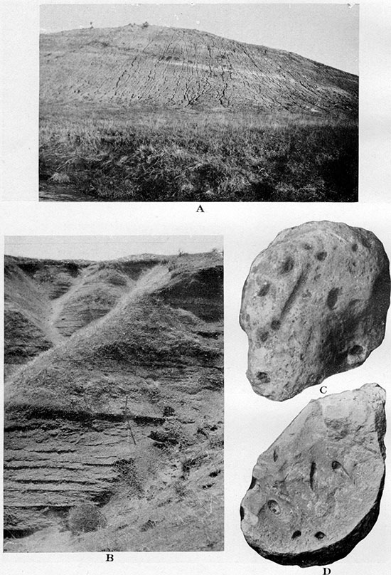
Plate IX--Geologic sections of the Sharon Springs member, Pierre formation.
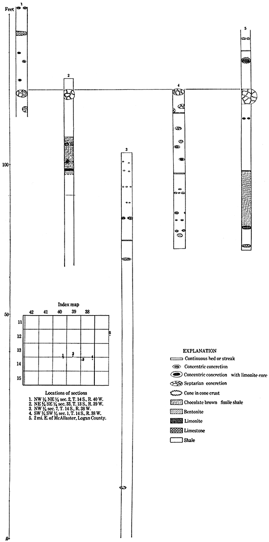
Plate X--A, Concretions of gray to white compact limestone of bed No. 8, the top bed of the middle concretionary zone of Upper Weskan shale member. From the center of the NW, sec. 18, T. 13 S., R. 41 W. B, Detail of a concretion like those shown in A. C, Cast of a large Inoceramus shell in a concretion of the bed shown in A. From the SE NW of the same section.
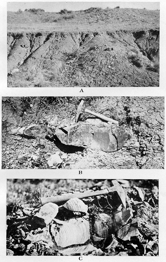
Plate XI--A, Ostrea congesta and Anomia cf. subtrigonalis (at the right) attached to a large and nearly flat Inoceramus shell. From the top of a large limestone concretion of bed No. 8, Upper Weskan shale member, in the center of the NE, sec. 11, T. 13 S., R. 42 W. Slightly enlarged. B, Large concretion of hard compact limestone with skeleton of Platecarpus. From base of Upper Weskan shale member in the northeast corner of sec. 11, T. 13 S., R. 42 W.
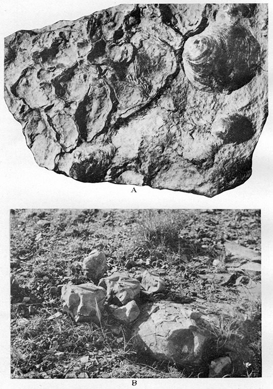
Plate XII-A, Long oval concretions in parallel and regular arrangement along a bedding plane of shale on the top of Upper Weskan member at the type locality in the NE NW sec. 11, T. 13 S., R. 42 W. The concretions consist of very tough dark-gray ferruginous limestone and are often "sliced" across into thin and broken plates. B, Serpula ? wallacensis, n. sp., in natural position in shale in the center of the SE, sec. 12, T. 13 S., R. 42 W. The circular fragment in lower right corner is planted to show the characteristic cross section of the fossil. Upper part of Upper Weskan shale member. One-half natural size. Negative by Charles Rankin.
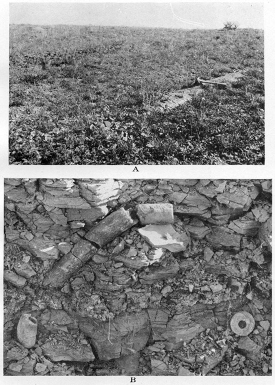
Plate XIII--A, Skeleton of a large fish (Empo sp.) in shale near the top of Lake Creek shale member, in the NE SE, sec. 33, T. 12 S., R. 41 W. B, Rosette of gypsum in shale near the top of Lake Creek shale member, in the SW NW, sec. 11, T. 12 S., R. 41 W. C, Rosettes of gypsum in shale of the lower part of Upper Sharon Springs shale member. From locality two miles east of McAllaster, Logan County.
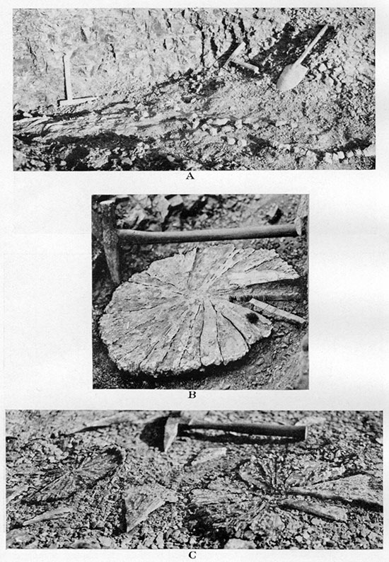
Plate XIV--Geologic sections of Weskan and Lake Creek members.
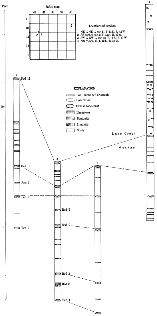
Plate XV--A, Zone of gray to white limestone concretions at the base of Salt Grass shale member in the southwest corner of sec. 6, T. 13 S., R. 41 W. B, "Lucina limestone" in a columnar body near the base of Salt Grass shale member. From a ditch on the east side of the road, in the SW NW, sec. 11, T. 12 S., R. 41 W. C, Casts of Lucina occidentalis in cavernous "Lucina limestone." From the NW NW, sec. 3, T. 13 S., R. 41 W. Natural size. D, Cast of Baculites compressus var. reesidei on the top of a large limestone concretion near the base of Salt Grass shale member. From the NW NE, sec. 3, T. 12 S., R. 42 W.
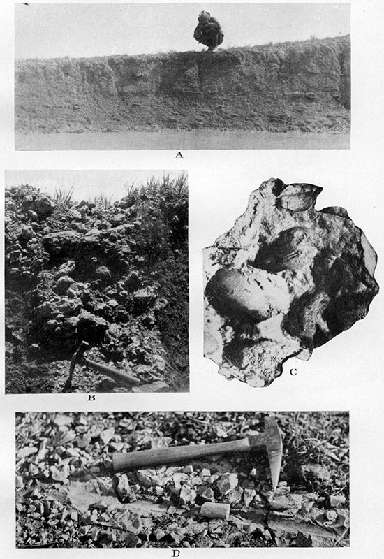
Plate XVI--A, Limonite concretion with a septarian core of calcareous limonite and with veinlets of calcite. Natural size. From the upper zone of Salt Grass shale member in the NE, sec. 12, T. 12 S., R. 42 W.
Rusty marl concretions with cone-in-cone structure. From the upper zone of Salt Grass shale member in the same locality: B, Craterlike depressions in place of fallen-out or weathered cones. Six-tenths natural size. C and D, Cone-in-cone structure broken across; cones are on the piece above (C) and their impressions on the piece below (D). Natural size. E, Lenslike concretion with cone-in-cone structure throughout, except in the core.
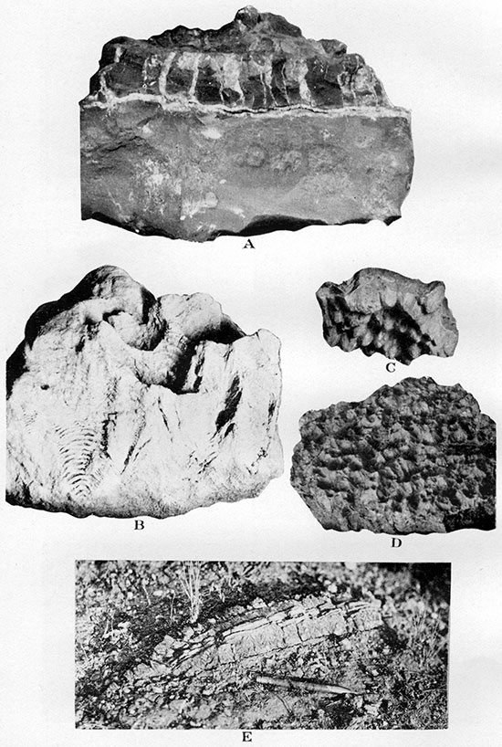
Plate XVII--Rusty marl concretions with cone-in-cone structure. "Grand Canyon" style of weathering in the outer crust of the structure. Natural size. From upper zone of Salt Grass member in the NE sec. 12, T. 12 S., R. 42 W.
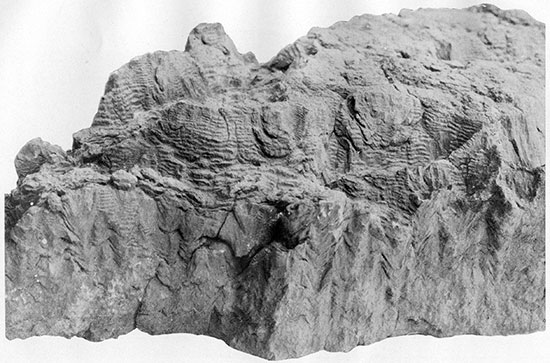
Plate XVIII-Rusty marl concretions with cone-in-cone structure. Natural size, A, B, and C from upper zone of Salt Grass shale member in the NE, sec, 12, T. 12 8., R. 42 W. A, Typical sample. B and C, Typical weathering of cone-in-cone structure. D, "Chopwood" weathering of nearly fibrous variety of cone-in-cone structure. From lower zone of Salt Grass shale member in the NE, sec, 12, T. 12 S., R. 42 W.
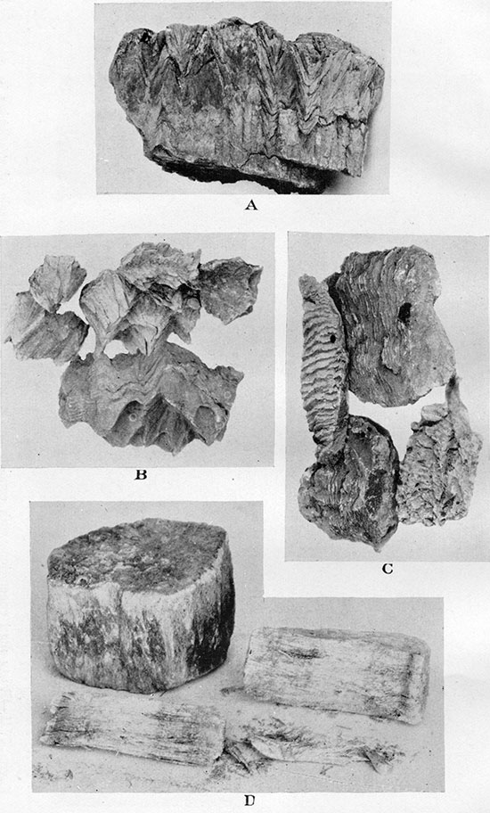
Plate XIX--Geologic sections of Salt Grass and Lake Creek members.
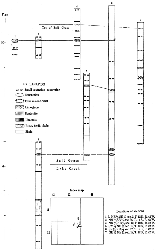
Plate XX--A, Bench of upper Ogallala grit capped with algal (Chlorellopsis) limestone shown on the skyline. Below are steep cliffs of stratified redeposited loess with cobbles of algal limestone. In the SE SE, sec. 29, T. 15 S. R. 39 W. B, Upper part of Ogallala with capping algal (Chlorellopsis) limestone marked a. Shows perfectly parallel stratification of all beds of the section, including the algal limestone. On north side of south fork of Smoky Hill river half a mile west of Kansas-Colorado state line. C, Algal (Chlorellopsis) limestone on the top of exposure. Shows sharp but somewhat irregular contact of the limestone with underlying calcareous loam, a softer and darker rock distinctly but somewhat irregularly stratified. In railroad excavation three miles east of Kanorado, Sherman County, Kansas.
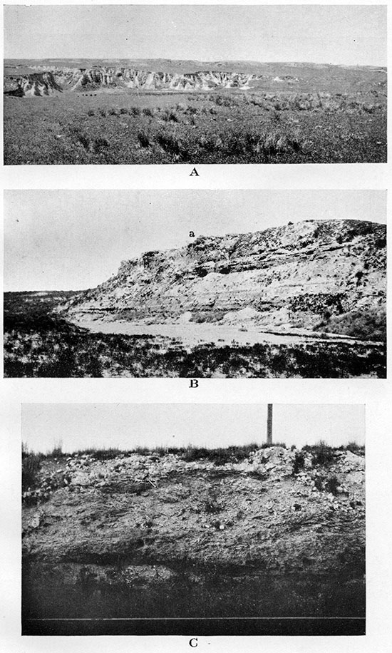
Plate XXI--A, Algal (Chlorellopsis) limestone outcrop showing weathered surface of the reef with occasional embedded cobbles of same limestone. In the NE sec. 3, T. 12 S., R. 40 W. B, Algal (Chlorellopsis) limestone. Polished section.
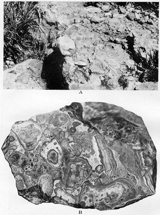
Plate XXII--A, Algal (Chlorellopsis) limestone. Upper surface of a boulder with etching produced by the roots of living grasses and other herbs, four-tenths natural size. In the NE sec. 3, T. 12 S., R. 40 W. B, Algal (Chlorellopsis) limestone. Lower surface of a boulder covered with small dripstones, three-tenths natural size. Same specimen as A.
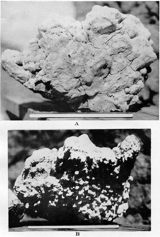
Plate XXIII--A, Upper part of Ogallala in the cut of abandoned road on the line between secs. 12 and 7, T. 14 S., Rs. 39 and 38 W., looking east. Compare diagrammatic columnar view of the section on Plate XXXII-2. Algal (Chlorellopsis) limestone marked a. B, Syncline in Ogallala with axis running southwest and across a large intermittent unnamed creek. In the SE, NE, sec. 6, T. 13 S., R. 41 IV., looking southwest. Shows mantle of loess completely covering Ogallala beds and forming gently rolling prairie in the distance.
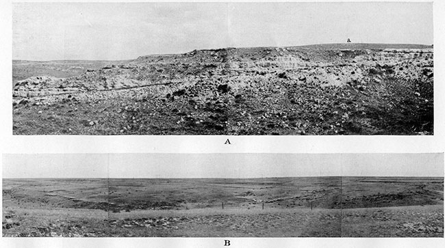
Plate XXIV--A, Series of many parallel thin "mortar beds" in sand and loam of Ogallala. In the SW SE, sec. 6, T. 12 S., R. 41 W. B, Unconformity and overlap of Ogallala (To) over the Salt Grass shale member of the Pierre (Ksg). On the upper right side are vertical cliffs of Sanborn loess with lighter arenaceous and calcareous portion at the base. In the SW, sec. 6, T. 12 S., R. 41 W. C, Apparent dip of Ogallala on the south side of Swisegood dome of Willow Creek structure. In the SE. sec. 11. T. 13 S., R. 42 W., looking east.
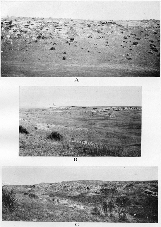
Plate XXV--A, Ogallala hurd stratified and cross-bedded ledge of sorted coarse sand to fine conglomerate. Pleistocene (?) gravel above. In the SW NW, sec. 35, T. 11 S., R. 40 W. B, Same bed in the SW NE, sec. 3, T. 13 S., R. 41 W. C, Ogallala fine semicemented micaceous sand with ripple marks. In the SE NE, sec. 2. T. 12 S., R. 42 W.
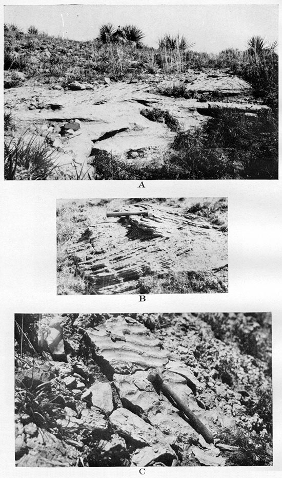
Plate XXVI--A, Ogallala porous limestone with admixture of diatom molds of gastropods (Planorbis and rarely others) and molds of roots (?) B, Ogallala porous limestone with admixture of diatoms and molds of Planorbis.
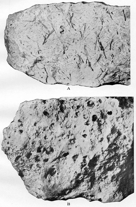
Plate XXVII--A, Cluster of Celtis willistoni stones in Ogallala grit about 50 feet below Chlorellopsis limestone. One-half natural size. In the SW SE, sec. 11, T. 13 S., R. 42 W. B, Celtis willistoni in grit about 15 feet above the base of Ogallala at Beecher Island, Yuma county, Colorado. Natural size. Negative by Charles Rankin. C, Krynitzkia coroniformis Elias, n. sp. Nutlets in calcareous loam about 20 feet above the base of Ogallala at Beecher Island, Yuma county, Colorado. Natural size.
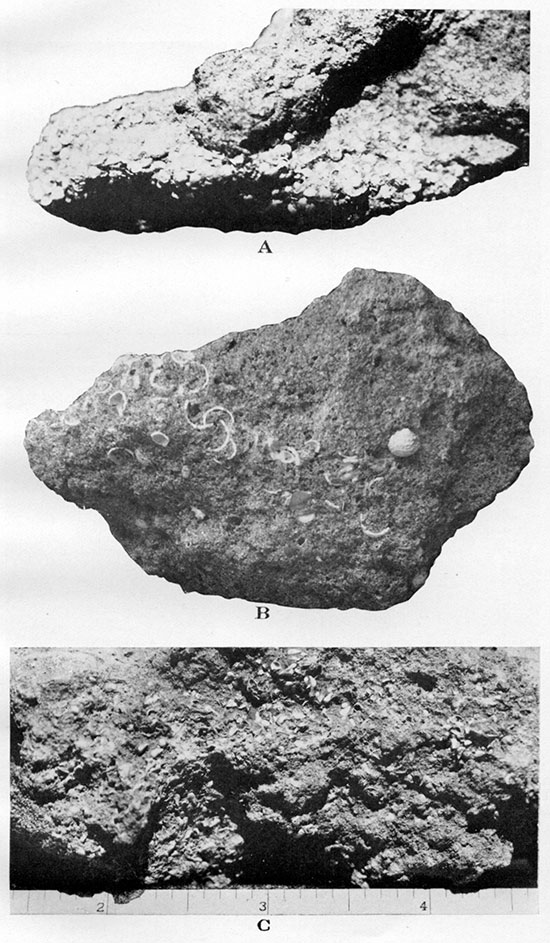
Plate XXVIII--A, Petrified (calcareous) roots in grit and living roots, marked by arrows, about 30 feet above the base of Ogallala at Beecher Island, Yuma county, Colorado. B, Same bed as shown in A with an addition of larger rootlike bodies made of chert. Same locality.
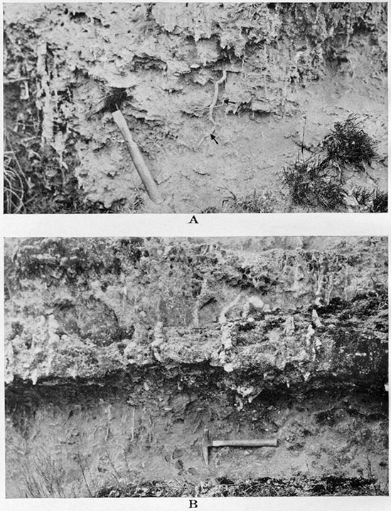
Plate XXIX--A, Mold of bark of a tree (7) in grit of Ogallala. B, Part of carapace of the turtle Testudo (Xerobites) cf. orthopigia in grit about 90 feet below Chlorellopsis limestone of Ogallala. In the NE SE, sec. 3, T. 12 S., R. 42 W.
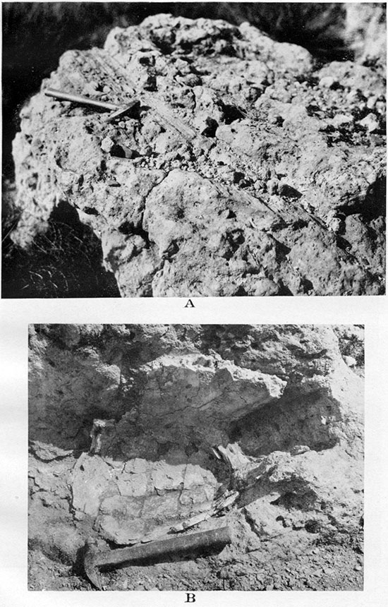
Plate XXX--A, General view of type locality of Woodhouse bentonitic clays of Ogallala. For columnar section see Plate XXXIII-3. In the NW NW, sec. 8, T. 12 S., R. 41 W., looking southwest. B, Detail of the same exposure as A. White sandstone is shown at the base of green bentonitic clay. C, Detail of southwestern part of the locality shown in A. Green bentonitic clay below; white streak corresponds to limy nodules and infiltrations; on the top are "mortar beds."
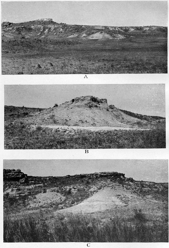
Plate XXXI--A, Diatomaceous marl of Ogallala. Exposures west of Rhinoceros Hill on south side of north fork of Smoky Hill river, in the NE SE. sec. 11, T. 11 S., R. 38 W. B, Diatomaceous marl of Ogallala, with flattened cases of caddis worms made of sand grains. Natural size. Same locality.
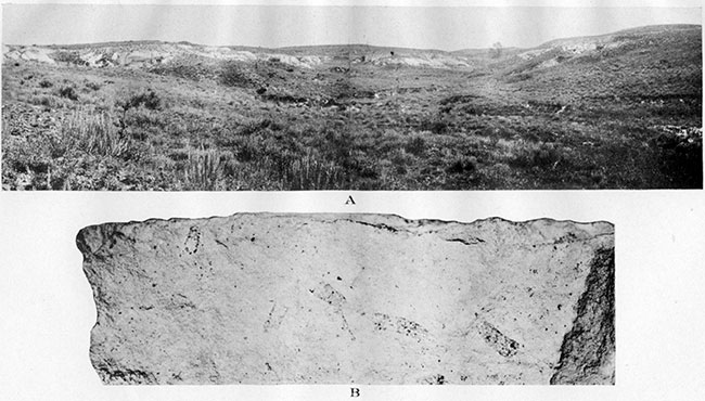
Plate XXXIV--Pleistocene gravel. A, Boulder of tough, greenish, coarse arcose with siliceous cement. From the NE SW, sec. 27, T. 12 S., R. 41 W. B, Boulder of gray to brownish cavernous arcose. From the NW NW, sec. 32, T. 12 S., R. 41 W. C, Scratched cobbles of porphyry. Two-thirds natural size. From the NW, sec. 35, T. 11 S., R. 40 W.
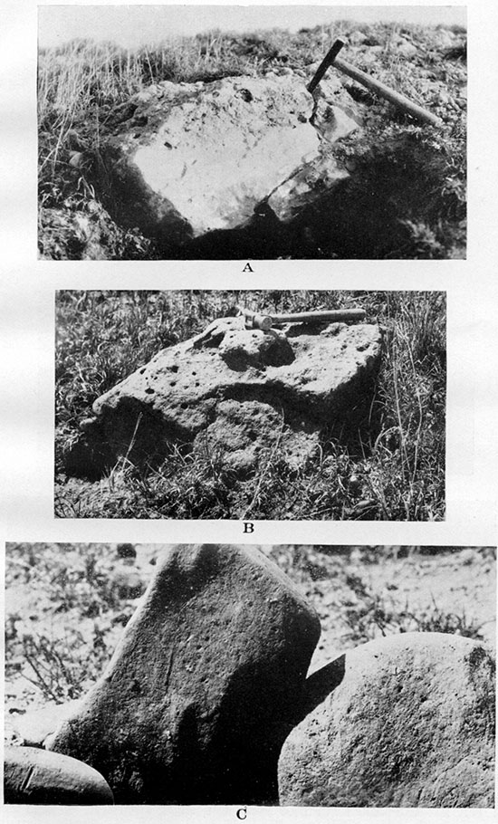
Plate XXXV--A, Sanborn formation. Typical loess with vertical cleavage resting upon Pierre shale. In the center of the NE, sec. 12, T. 13 S., R. 42 W. B, Redeposited stratified loess with slight admixture of sand and gravel. In the SE SW, sec. 12, T. 13 S., R. 42 W. C, Sandy alluvium with cross-bedding. In the channel of Goose creek, in sec. 36, T. 11 S., R. 43 W.
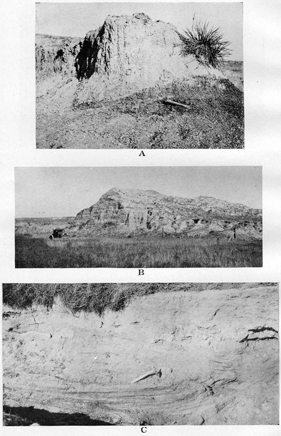
Plate XXXVI--A, Marked change of dip in Niobrara chalk, the steepest being near the edge of fault F. In the NW, sec. 1, T. 14 S., R. 38 W. B, Unusually steep local dip (not to be confused with still steeper cross-bedding) in the cliff of Ogallala coarse sandstone. Shows nearly horizontal position of the same ledge and on the same level in the distant continuation of the same bench. The ledge rests on Pierre shale. In the SW NE, sec. 3, T. 13 S., R. 41 W. C, Coarse sandstone of Ogallala in erect position. In the SW NE, sec. 7, T. 13 S., R. 41 W.
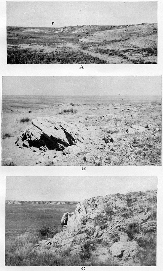
Plate XXXVII--A, Syncline in Ogallala. In the NE, sec. 11, T. 11 S., R. 38 W., looking north and east. B, Synclinal fold involving both Ogallala and underlying Pierre, looking southwest along the axis of the syncline. The axis corresponds to the crest of the divide between Smoky Hill river and Willow creek near their junction. In the W2, sec. 17, T. 13 S., R. 41 W.
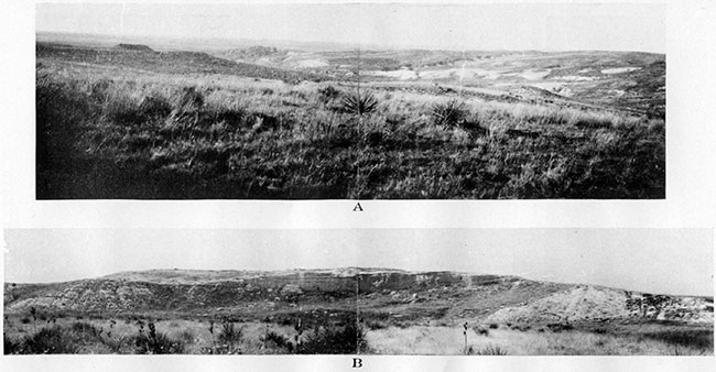
Plate XXXVIII--Diatomaceous marl of Ogallala. A, Remnants of slightly harder portions of the marl on the divide between two canyons. In the SW NE sec. 11. T. 11 S., R. 38 IV. B, Murl weathered into large blocks. In the NE SE, sec. 11, T. 11 S .. R. 38 W. C, Complete section of the bed shown in A and B with capping limestone above and chalky clay at the base. (The man stands on the contact.) Same locality.
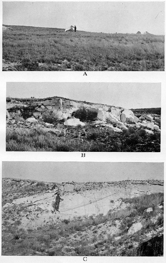
Plate XXXIX--A, Memorial monument made of Niobrara chalk, erected in 1867 at Fort Wallace. B, Small quarry opened in algal (Chlorellopsis) limestone of Ogallala. Shows comparatively small size and somewhat irregular shape of slabs into which the limestone weathers in the exposures.
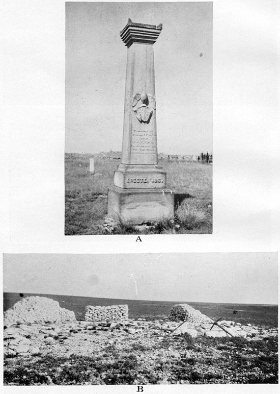
Plate XL--A, Smoky Basin cave-in as it appeared in 1929. View of eastern wall of the basin, showing traces of the initial subsidence and the line of fault. In tile NE SE, sec. 33, T. 13 S., R. 39 W. B, Thirty-year-old cave-in across the channel of a small intermittent creek. In the S2, sec. 1, T. 12 S., R. 39 W., looking southeast. C, Circular basin and "gates" in Ogallala. In the NE SW, sec. 27, T. 12 S., R. 41 W., looking south.
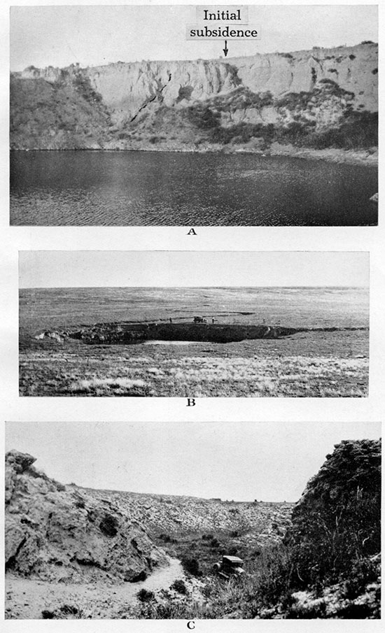
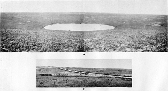
Plate XLI--A, Old Maid's Pool, an old cave-in. In the northeast corner of sec. 30, T. 12 S., R. 40 W. B, Recent subsidence. which undermined county road in the northeast corner of sec. 22, T. 25 S., R. 43 W., in Hamilton County, Kansas. Photograph taken in May, 1930.
Kansas Geological Survey, Geology
Placed on web Nov. 17, 2014; originally published April 1, 1931.
Comments to webadmin@kgs.ku.edu
The URL for this page is http://www.kgs.ku.edu/Publications/Bulletins/18/09_plates.html