![]()
Back to Sub-Cretaceous Surface...
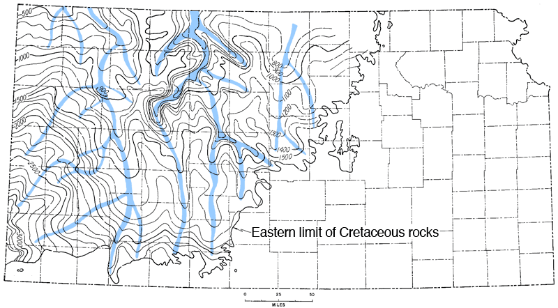
Figure 25
Figure 25--Map of Kansas showing present configuration of surface at base of Cretaceous beds, i.e., topographic features that were developed on pre-Cretaceous surface. Three major northward-trending valleys and their tributaries are shaded. Contour interval 100 feet. Additional detailed work was done on this surface by Schuman (1963); Jesse McNellis (personal communication, August 13, 1963) believes the valley as shown in Rush County is due to a miscorrelation of placing the Cretaceous-Permian contact.
Back to Sub-Cretaceous Surface...
Kansas Geological Survey, Geologic History of Kansas
Comments to webadmin@kgs.ku.edu
Web version April 2006. Original publication date Dec. 1963.
URL=http://www.kgs.ku.edu/Publications/Bulletins/162/fig025.html