![]()
Figure 19
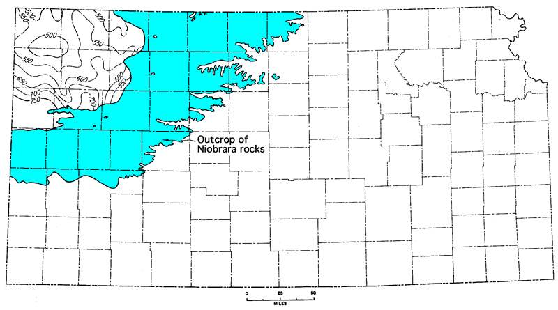
Figure 19--Isopachus map of Niobrara Formation in Kansas. Contour interval 50 feet.
Kansas Geological Survey, Geologic History of Kansas
Comments to webadmin@kgs.ku.edu
Web version April 2006. Original publication date Dec. 1963.
URL=http://www.kgs.ku.edu/Publications/Bulletins/162/fig019.html