![]()
Back to Cretaceous Deposits...
Figure 16
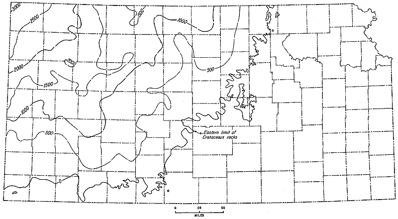
Figure 16--Map of Kansas showing thickness of Cretaceous deposits, a wedge-shaped mass of material between Permian, Triassic, or Jurassic units beneath and Tertiary beds above. Contour interval 500 feet.
Back to Cretaceous Deposits...
Kansas Geological Survey, Geologic History of Kansas
Comments to webadmin@kgs.ku.edu
Web version April 2006. Original publication date Dec. 1963.
URL=http://www.kgs.ku.edu/Publications/Bulletins/162/fig016.html