![]()
Back to Sub-Cenozoic Surface...
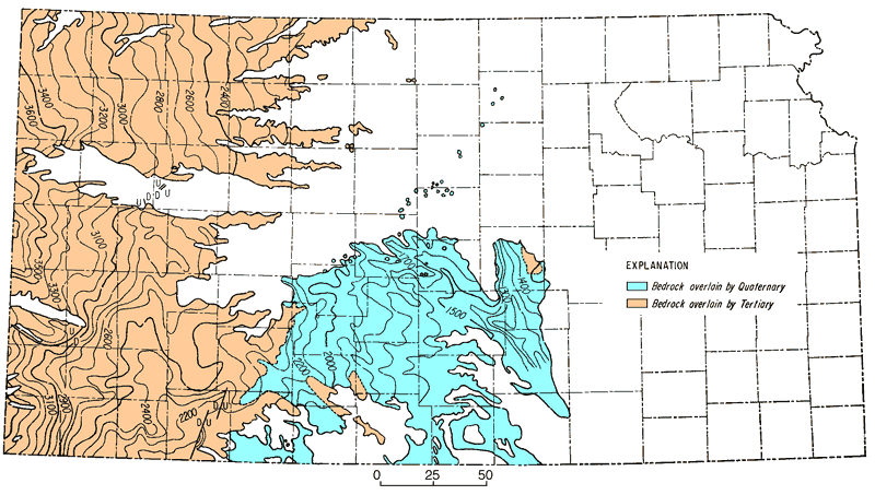
Figure 11
Figure 11--Map showing topography of surface below Cenozoic deposits of western Kansas (adapted from Merriam and Frye, 1954). Contour interval 100 feet.
Back to Sub-Cenozoic Surface...
Kansas Geological Survey, Geologic History of Kansas
Comments to webadmin@kgs.ku.edu
Web version April 2006. Original publication date Dec. 1963.
URL=http://www.kgs.ku.edu/Publications/Bulletins/162/fig011.html