![]()
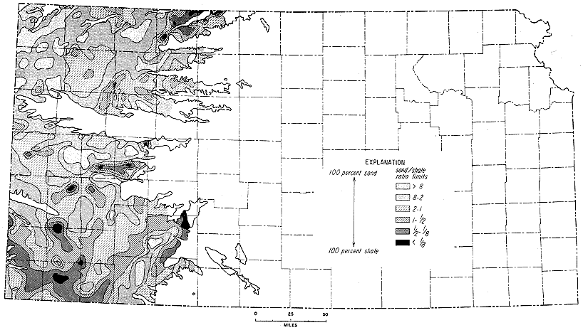
Figure 10
Figure 10--Map of Kansas showing clastic ratio limits of sediments in Ogallala Formation (Pliocene). Note elongated areas of coarser clastics, which indicate general areas of channel deposition.
Kansas Geological Survey, Geologic History of Kansas
Comments to webadmin@kgs.ku.edu
Web version April 2006. Original publication date Dec. 1963.
URL=http://www.kgs.ku.edu/Publications/Bulletins/162/fig010.html