![]()
Figure 7
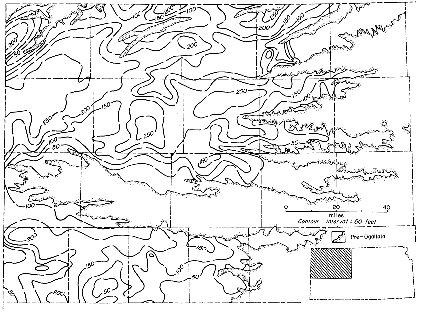
Figure 7--Isopachous map of Ogallala Formation in northwestern Kansas. Outcrop has been intricately dissected by westward-heading streams and almost severed in Kansas by Smoky Hill River in Wallace, Logan, and Gove Counties.
Kansas Geological Survey, Geologic History of Kansas
Comments to webadmin@kgs.ku.edu
Web version April 2006. Original publication date Dec. 1963.
URL=http://www.kgs.ku.edu/Publications/Bulletins/162/fig007.html