Summary of Year 3
Additions to Atlas
Content
As the DPA began, the primary task was gathering data at the
field and well scale and placing this data online. As a home page,
we created an interactive map of Kansas linked to all the counties
in the state (Figure 1). The Kansas
DPA Home Page remains the primary portal, and provides numerous
paths to access Kansas petroleum information and technology at
the various geographic scales and topical areas. Access is provided
to reviews of the regional geological setting, overviews of oil
and gas plays and to information and technology at the county,
field and well levels. The total number of static web pages exceeds
6,000, but this is a decrease from previous years. Pages constructed
using programs that access relational databases are replacing
static web pages.
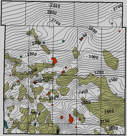
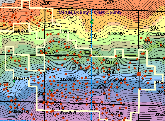
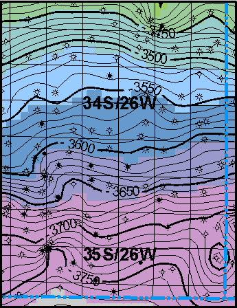
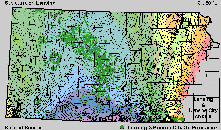 The DPA provides access to a number
of regional maps, studies and data sets (e.g., gravity and magnetics,
and discussions of Kansas oil and gas provinces). In year 3, the
major addition to regional maps was an extensive linked set of
statewide structure and isopach maps with overlays of oil and
gas production (Figure 15). These
regional maps permit the user to toggle among a number of maps
covering all major oil and gas producing intervals. The user can
also select map type (i.e., structure or isopach), and type of
production overlay (i.e., oil or gas).
The DPA provides access to a number
of regional maps, studies and data sets (e.g., gravity and magnetics,
and discussions of Kansas oil and gas provinces). In year 3, the
major addition to regional maps was an extensive linked set of
statewide structure and isopach maps with overlays of oil and
gas production (Figure 15). These
regional maps permit the user to toggle among a number of maps
covering all major oil and gas producing intervals. The user can
also select map type (i.e., structure or isopach), and type of
production overlay (i.e., oil or gas).
As part of third year of the DPA project, studies were undertaken
at two Kansas fields and producing areas. These were added to
the previously existing field studies. The two additions are:
|
McKinney Field (Producing Formations: Kansas City Group--multiple
zones, Marmaton Group--multiple zones, Pleasanton, Morrow, and
Mississippian) in Meade County |
|
|
|
|
Figure 2 |
Figure 17 |
Figure 18 |
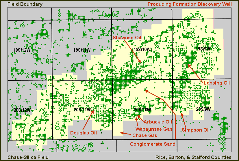
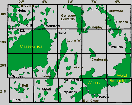
The Chase-Silica Field is notable because of its geographic
extent (eight townships), number of wells (> 10,000) and development
of new methodologies to reduce the number of static web pages.
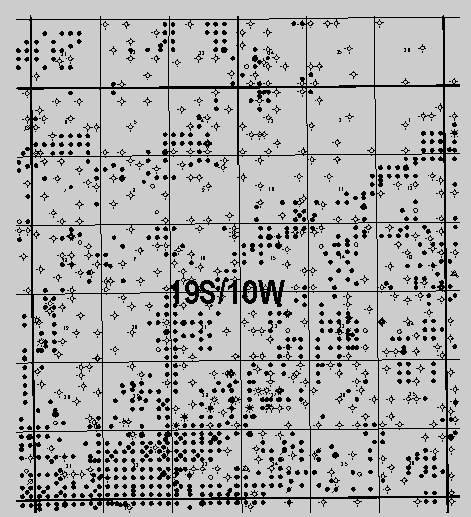
The McKinney Field provided the first application of "zoom"
and "pan" to access and navigate detailed geologic and
field maps (Figure 18).
New data and research products continue to be added to each
field study, as they become available. Publication in the DPA
is an ongoing process that continuously updates the data and technology
associated with each field study. The addition of the ability
to query relational databases increased the efficiency of updating
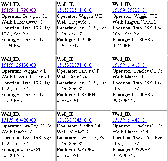
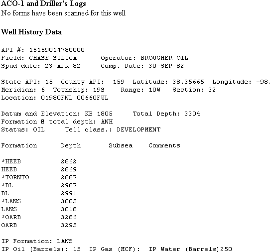
previously completed field studies. Each field study homepage
provides a map of the field area, basic field and discovery information,
and a standardized set of links to additional geologic, geophysical,
engineering and production data.
For each county and field page in the DPA a paper mockup of
a standard set of field pages was created on a bulletin board.
The paper mockup allowed for flexible thinking in terms of button
layouts, numbers of buttons, and basic navigation issues. Based
on trial and error a basic page style evolved and appears to be
stable.
This page maintained by the
Kansas Geological Survey.
Updated June 1999
Comments to webadmin@kgs.ku.edu
URL=http://www.kgs.ku.edu/PRS/publication/99_19/9919additions.html