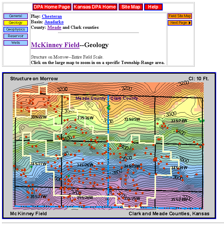
Figure 17. Sample field page covering McKinney Field, Meade County from the Digital Petroleum Atlas. Map shows navigation buttons, page layout, field outline. The field page contains links to topical data, maps, cross-sections and technical discussions. Clicking on a selected township provides a detailed geologic map (Figure 18). Not shown is stratigraphic column that controls selection of horizon for structure or isopach map.