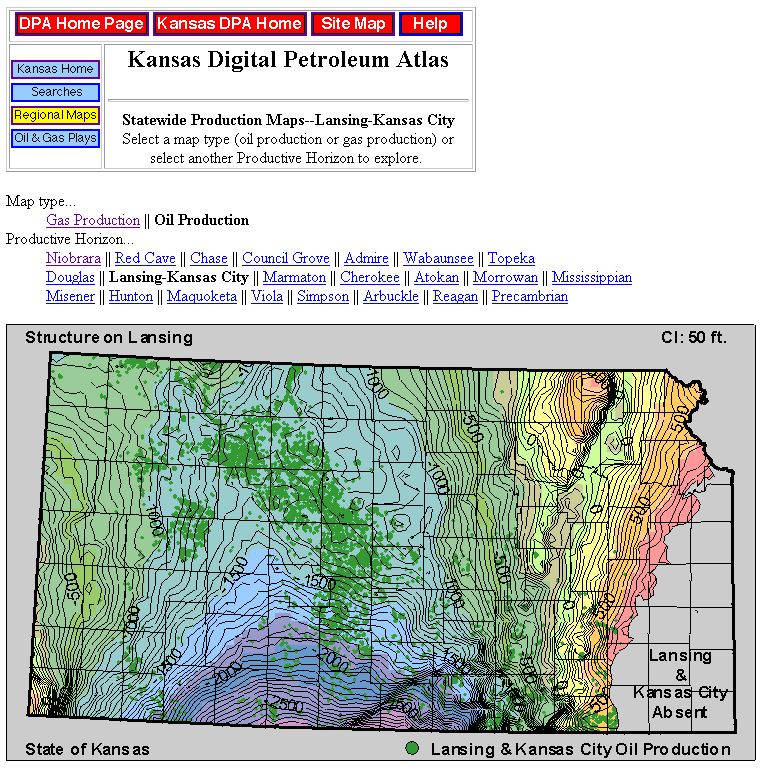
Figure 15. Regional structure map on the top of the Lansing Group showing the distribution of all leases in Kansas that reported oil production from Lansing and Kansas City groups. Similar structure and isopach maps with overlays of oil and gas production are available for all major-producing intervals (http://www.kgs.ku.edu/DPA/Plays/ProdMaps/lgkc_oil.html).