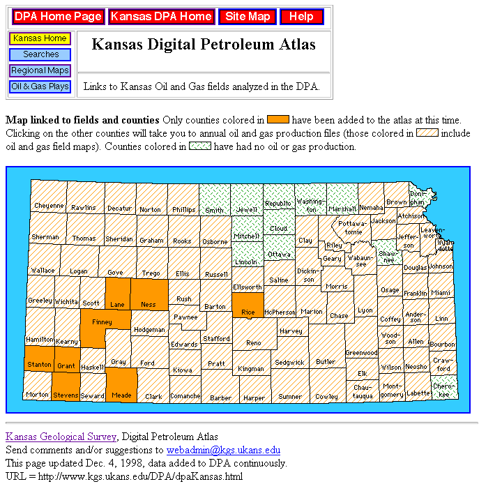
Figure 1. Interactive map of Kansas Digital Petroleum Atlas (DPA) showing counties that contain fields and plays that have been added to the DPA. Regional maps on key horizons are available for all highlighted counties. Counties not added to the DPA have oil and gas field maps and links to annual field production. During year three, county-scale maps were added covering Meade and Rice counties, and access to current production and well data was automated.