
|
| Standalone Applets |
GEMINI Tools Applet Descriptions |
Single Well Profile Plot Applets |

|
The Profile Plot Applet was created to assist the user in locating,
organizing and plotting well data, rock measured & observational data
and formation tops data by depth. This Applet is an interactive web
application that allows the user to search, load, parse geological data
from the user's PC or from the Kansas Geological Survey (KGS) database &
file server. This Applet also provides edit data dialogs to add or
modify geological data in the profile plot. |

|
The LAS File Viewer Web Site was created so that users may view
digital LAS Files (Log ASCII Standard version 2) on their PCs.
This new version adds a number of new features. The older version restricted the
number of plot tracks that could be displayed at any one time. This version
automatically reads and parses the digital LAS file and groups the log curves
into standard KGS log curve types, i.e. Neutron Porosity, Bulk Density, etc.
The program then determines the type of log, i.e. Neutron/Density Log and
automatically displays a number of standard plot tracks. Although the program
displays a set number of standard plot tracks, the program also has a control
dialog that allows the user to turn plot tracks on or off and even change the
order of the plot tracks. The user can save that image as a Portable Network
Graphics (PNG) image file.
Author: John R. Victorine Released: July 2007 Modified: August 2010 |
|
The detection of cyclicity in sedimentary strata can be important to the
understanding of the factors controlling sediment depositions. The presence
of cyclic patterns and changes in their character have important consequences
for geological interpretation, changes in wavelength may indicate changes in
depositional facies. Author: John R. Victorine Released: September 2009 |
|
This web application is a well profile presentation of the well data plotted against acoustic travel time in millisec with synthetic seismic plot tracks. In the same manner as Proile this program allows the user to turn plot tracks on or off or reorder the plot tracks. This web application requires sonic log curve data. The synthetic seismogram is a seismic trace that has been contructed from well log data. It represents the idealize trace that should be observed with the seismic method at the location of the well. The Synthetic Seismic can be compared with the seismic trace actually measured at the well to improve the picking of seismic horizons, and to improve the accuracy and resolution of formations of interest. The observed seismic trace is primarily a record of the ability of interfaces between formations
to reflect elastic waves, which is called the reflection coefficent R. The reflection coefficient
depends on the properties of the rock at the interface of the beds and in particular on its
acoustic impedance. The acoustic impedance is the product of the seismic velocity and the
density of the rock. |
|
KIMELEON is an interactive colorlith plot applet, which was created to
allow the user the ability to interact with the digital LAS data from
purely a visual sense. This web tool was created to assist the geologist
in analyzing regions of the subsurface to better understand the geology.
The digital LAS Log curves are combined in different means to produce
color image tracks, by changing the magnitude ranges of the colorlith
tracks the geologist can bring out more subtle variances in the data and
hence a better understanding of the region of interest. The user can create
Portable Network Graphics (PNG) images of the displayed plots. |
Multi Well Profile Plot Applets |
|
The Cross Section Plot Applets allows the user to place multiple well profiles
or rock outcrops on one plot to better pick the horizons and a better understanding
of the subsurface geology over an area.
"Correlation of petroleum reservoirs is a fundamental task in reservoir
characterization used to establish the geometry of the reservoir and
strata surrounding it and to delimit the distribution of flow units that
comprise the reservoir. Correlations are primarily accomplished via
construction of cross sections through the reservoir using wireline logs
where depth patterns, trends, and surfaces define probable continuity
within the reservoir between well locations. The correlations are
validated through analyses of fluids recovered, flow tests, and possibly
seismic surveys, in the later case if the reservoir is sufficiently thick
to be seismically resolvable. Cross sections display the log curves at
various scales and, to be effective, should show formation and reservoir
tops, correlation surfaces, intervals of tests, perforations for
production, and intervals that are considered flow units that are
correlatable and connected between wells."
GEMINI Project |
|
This web app starts with the Cross Section app and restricts the data only to gamma
ray log curves and tops. This reduced the memory needed to display multiple wells.
The Cross Section Web app is restricted to 4 wells or regions only because of the
memory size of the well data that is displayed. This program is presently restricted
to 50 wells, which is large enough to paint a picture of the subsurface. This program
reads a Log ASCII Standard (LAS) version 2.0 or 3.0 file for each well considered. The
user can display a map of the wells to verify ordering and save the basic information
needed to reproduce the Gamma Ray Colorlith Cross Section in a Extensible Markup Language (XML).
The XML file saves the location of the LAS File for each well as well as the Well Header
Information and the Tops. The user can edit the tops in this web app to correct any issues
and when saved to the XML, will reproduce your changes.
Author: John R. Victorine Released: 29 April 2014 |
Cross Plot Applets |
|
The Cross Plot Applet was created to assist the user in plotting Log ASCII
Standard (LAS) Data and Measured Core Data in a standard 2D Plots. This Applet
is an interactive web application that allows the user to search, load, parse
geological data from the user's PC or from the Kansas Geological Survey (KGS)
database & file server. The user can display the following plots,
Author: John R. Victorine Released: 19 September 2011 |
|
The 3D Cross Plot Applet was created to assist the user in plotting Log ASCII
Standard (LAS) Data and Measured Core Data in a standard 3D Plot. This Applet
is an interactive web application that allows the user to search, load, parse
geological data from the user's PC or from the Kansas Geological Survey (KGS)
database & file server. The user can display the following plots,
Author: John R. Victorine Released: 28 September 2011 |
Log Analysis & Fluid Flow Applets |
|
PfEFFER-java will replace PfEFFER Pro which is a practical tool for the real-time,
interactive log analysis. "Spreadsheet" database and graphic features allow both
rapid interaction and comparative evaluation of multiple interpretations or best
case/worst case extremes. In addition, multiple zones are easily managed.
This Applet is an interactive web application that allows the user to search
& load data from the user's PC or from the Kansas Geological Survey (KGS)
database & file server. |
|
This web application was created to allow the user the ability to determine the Archie parameters though graphical means. The Hingle (1959) & Pickett (1973) Plots developed graphical solutions to Archie's equation, i.e., Water Saturation (Sw), Formation Water Resistivity (Rw), Archie Cementation factor (M), Archie Saturation Exponent (N) from the log data without numerical calculations. Pickett & Hingle Plots allows the user to add Water Saturation (Sw) Lines to the plot. Pickett Plot also allows the user to include Bulk Volume Water (Bvw) and Permeability (K) Lines. The web application was designed to help the user to create a best fit for the 100% Water Saturation Line
by varying the product of Archie constant, Formation Water Resistivity (a*Rw) and varying the Archie
Cementation factor (M). |
|
Depth Constrained Cluster Analysis is an interactive plot applet, which
was created to allow the user the ability to pick Zones from log data
using digital Log ASCII Standard (LAS) version 2.0 & 3.0 files which are
ordered along the dimensions of depth. This constraint can be used to
limit the analysis to the consideration of stratigraphically neighboring
units, thus only vertically adjacent zones and clusters may be merged into
larger clusters. Depth Constrained Cluster Analysis appeared in PfEFFER
Pro an Excel Spread Sheet Program developed by the Kansas Geological
Survey, released 1998. It also appeared in GEMINI ( Geo-Engineering Modeling
through INternet Informatics ) web application developed by Kansas Geological
Survey 2000 - 2003. The user can create Portable Network Graphics (PNG)
images of the displayed plot. |

|
This Java Applet allows the user to enter or import Drill Stem Test (DST) Data directly into the program. There are essentially no standard ASCII DST data files formats existing that will allow the user to read and process DST Data. This program was written to assist the user in entering DST data, perform quantitative analysis on the shut in pressure data and then to save the information into a Log ASCII Standard (LAS) version 3.0 File developed by the Canadian Well Logging Society. This program has a built in digitizer to allow the user to digitize shut in pressure-temperature-time data from a DST pressure vs. time image file directly to the program to create a Horner Plot and to do Quantitative Analysis.
Note: The DST Pressure vs. Time Image must be a PNG (Portable Network Graphics),
JPEG (Joint Photographic Experts Group) or GIF (Graphics Interchange Format) image file. |

|
The Brine Plot & Data Entry Web Application was created to provide a means to manually
insert the brine data or to import brine data from the Kansas Geological Survey Database or to
import/export brine data from/to ASCII Files, i.e., Log ASCII Standard (LAS) version 3.0,
Comma Separated Values (CSV) and Extensible Markup Language (XML) Files. The web application
also provides a number standard brine plots to present the most common Anions and Cations as
a Piper Diagram and Brine Sample Plot, which displays a Stiff and Collins Bar Diagrams. |
|
The production plot & decline curve analysis web application allows the user to access production data from the Kansas Geological Survey (KGS) Database for Leases, Fields, Operators and Counties. The web application was designed to read production from the user's PC as an ASCII Extensible Markup Language (XML) file or as a comma-separated values (CSV) file. See examples for format, XML (Arroyo Field) and CSV (Arroyo Field). A "spread sheet" like table was provided to display the data retrieved, but editable to allow the user to add data to the existing list, i.e., download production data from the KGS Database and insert missing months or previous years that may not be recorded. The Program allows the user to save the raw production data as an ASCII Extensible Markup Language (XML) file or as a comma-separated values (CSV) file, see examples above. The Program allows the user to save the Production Plot Java Image to their PC as a Portable Network Graphics (PNG) Image, the Program will then display a web page with the image file with a link at the top of the page that will allow the user to launch the PDF Web Applet to convert the PNG Image File to a Portable Document Format (PDF) File. A decline curve analysis dialog was included to allow the user to predict the economic limit for a specific
lease, field, operator and county. This analysis uses three methods for predicting the deline of a reservoir,
exponential, harmonic and hyperbolic. |
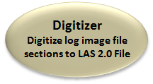
Image Well Log Digitizer Applet |
|
The electric well log image digitizer tool was created to provide a simple method to digitize small sections of well log images into a digitize Log ASCII Standand (LAS) File. The user may only be interested in a short stratigraphic section for a specific study, i.e., to do a PfEFFER Analysis over a depth range and needs to digitize 100 to 200 feet from a Resistivity well log and a Neutron-Density well log. This program allows the user to digitize the well log curves over the depth range needed and to save that data in a LAS version 2.0 format. The program allows the user to import a PNG (Portable Network Graphics), JPEG (Joint Photographic Experts Group) or GIF (Graphics Interchange Format) image file. NOTE: The program can not handle the complete well log image, only small image captures in the above image formats. This web application was primarily created to digitize small sections of scanned well log images, but the web application will do the following,
Released: 26 July 2012 |
DOE CO2 Database Tables |
|
This web page presents the Database Tables for the Type Log Project. The Table holds
all the data necessary to build and display the Log ASCII Standard (LAS) 3.0 files
of the wells in this project. |
DOE CO2 Applet Descriptions |

|
The Profile Plot Applet was created to load Log ASCII Standard (LAS) version 2.0
or 3.0 Files from the Kansas Geological Survey (KGS) Server, to retrieve the DOE
CO2 Tops Data and create a profile plot by depth. The user also has the ability
add an ASCII geologist report (measured section, core or cuttings descriptions) file.
The user can verify the data is complete before creating a LAS version 3.0 file of
the selected well. The user can also create Portable Network Graphics (PNG) file
of the profile image, which is automatically displayed in a HTML with the option
to create a Portable Document File (PDF). Author: John R. Victorine Released: 15 April 2013 |

|
The General Cross Section Plot Map Applet allows the user to place multiple well profiles
on one plot (4 Maximum) to view the wells with Log ASCII Standard (LAS) version 3.0 files.
NOTE: This program will launch another applet with the KID's representing the
Wells selected. The browser will consider this as a pop-up and will require you to temporarily
disable your pop-up blocker.
|
|
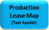
The General Production Lease Map Applet allows the user to select area by field or by
latitude & longitude minimum & maximum. It is my test routine like the Cross Section Map.
It allows the user to test the Bubble Map without the ESRI Map viewer. Note that when an
area is selected the web page will consider the launch of the General Production Bubble Map Applet
as a pop up. A warning will appear at the bottom of the General Production Lease Map HTML web page
requesting that you allow running once, etc., which you can click. Then you will have to select your
area again in order to see the bubble map movie.
Author: John R. Victorine Released: 07 February 2014 |
|
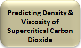
This Predicting the Density and Viscosity of Supercritial Carbon Dioxide Applet allows the user to import a comma delimited file containing columns of pressure and temperature for supercritical carbon dioxide which will then create a comma delimited file with the contents of the first file with two new columns containing the density and viscosity. The user only needs to identify the header section, the start of the data and the pressure and temperature columns. The program will then parse the pressure and temperature from the file and compute the density and viscosity using Liang-Biao Ouyang equations. This program uses the equations created by Liang-Biao Ouyang paper to predict the density and viscosity of supercritical carbon dioxide under conditions in carbon capture and sequestration operations. Liang-Biao Ouyang cites examples between the pressures of 1100 to 9000 psia and at temperatures between 40 to 100 deg C. This method uses the Java BigDecimal Math package to compute the density and
viscosity.
|