
Updated 17-May-2004
|
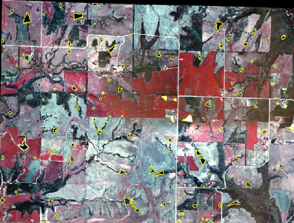
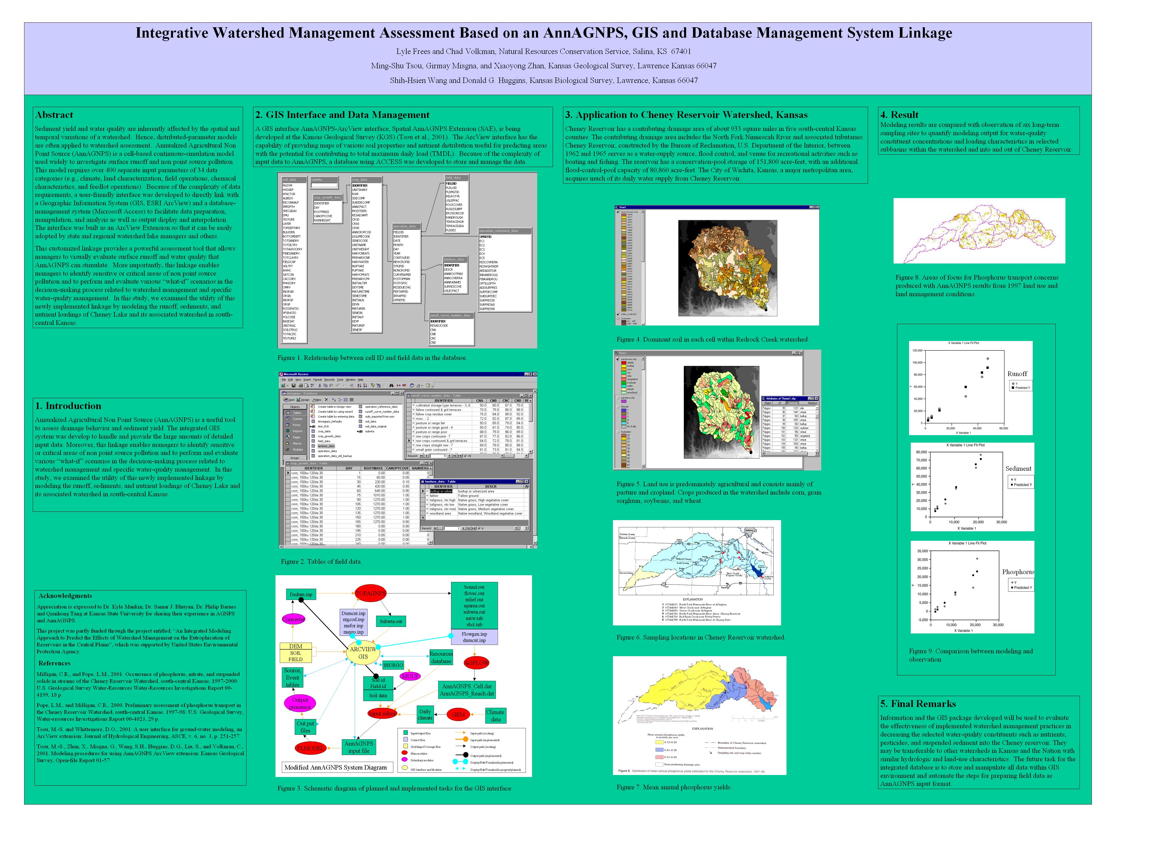
METHODS ---General Images of the two study areas (the Midland quadrangle, Jefferson Co., KS, and Allen SE quadrangle, Lyon Co, KS) were assembled (and scanned, registered and rectified, and digitized if necessary). These images consisted of (1) historical air photos from a variety of sources, (2) existing electronic database images (e.g, the DOQQ and other images served by DASC), (3) multispectral (DuncanTech camera) images of the Midland Quadrangle available from recent KBS survey flights over that area, (4) available satellite images (Landsat ETM and ASTER) for the study areas, and (5) derived products such as the Kansas Surface Water Database (KSWD) and the Surface Waters Information Management System (SWIMS). A sixth data acquisition effort supported a specific aerial photo mission over the Allen SE quadrangle in the Lyon Co study area (yielding 560 DuncanTech multispectral camera images covering 56 sq. mi. and 541 ponds). Pond Inventory Aerial photos (hard copy and digital) that provided historical coverage at multiple times from the 1940s to the present were obtained, scanned (>1700 images), and registered/rectified (>2200 images). Ponds were identified and digitized (>3700 images for Lyon Co., and >2000 for the Midland quadrangle). Time histories of pond numbers for the two areas were constructed and compared; although current densities are similar, the historical trajectory of pond development has been quite different in the two areas. Pond Characterization Local pond characterization (field, or km, scale) -- Field mapping, sampling, and classification. Meso-scale characterization (10s - 100s of km) -- A major challenge in evaluating cumulative or aggregate effects of multiple small, dispersed features is effectively relating detailed field measurements and classifications to the more generalizable but coarser and less detailed map and image data available. An exciting new development is multispectral aerial photography -- satellite technology applied from elevations and paths under the experimenter's control, yielding precisely targeted, controlled resolution images that contain not only mapping and geomorphic information but biological, ecological and water quality information as well. Click here for specifications and image descriptions; click here for a color multispectral image album of ponds in Douglas Co., KS. (clicking on the thumbnails will open a larger image); and click here for a brief review of the method prepared by F. J. deNoyelles, Jr. Regional and large-scale inventory and system-level assessment (1000s of km) -- [in development] Modeling and Extrapolation of Biogeochemical Function -- A research team at KGS is developing front-ends and automated applications for the AnnAGNPS model package as part of a project to characterize nutrient budgets of various watersheds. The curent effort does not include ponds smaller than the target impoundment, but the modeling software supports their addition, and will be used to characterize sediment, water, and CNP fluxes into and through ponds, and their effect on overall watershed function. To view a poster describing the current project activities, click here for a JPEG image (browser viewable) or here for a Powerpoint file. [Note -- in both cases a large, single image appears -- use your software zoom or magnification controls and scroll bars to navigate through the poster.]
|
|||||||||||