Using Multispectral Aerial
Imaging to Monitor Rural Ponds


System
Hardware:
Cessna 182 airplane
DuncanTech multispectral digital
camera
Image
Specifications (from 7,500 ft AGL):
Spatial resolution = 0.75 meters
Image size = 1044 x 780 meters (.65
x .48 miles)
Imaging
Capabilities:
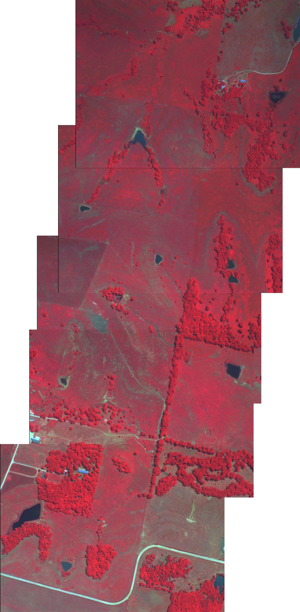
Multispectral imaging is an easy and cost effective
method to obtain information for large areas (Figure 1). Detailed information about vegetation conditions
in and around ponds as well as information about turbidity and sedimentation
can be seen in the following images.
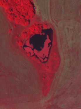
Figure 2. Relatively
clear water pond with little or no aquatic vegetation.
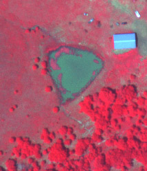
Figure 3. Relatively
clear water pond with substantial aquatic vegetation.
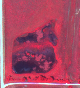
Figure 4. Farm
pond with turbid water and moderate aquatic vegetation.
Figure 5. Pond
inundated with aquatic vegetation and sediment build-up.
Aerial photography allows for increased control of
the imaging area and the time(s) at which the imagery is acquired.
System
Costs:
The plane, pilot, and imaging
technician total about $250 - $300 per hour.
For example, to image an area approximately 8 miles
x 7 miles (56 sq miles) it takes about 3 hours (Figure 6).