
Updated 13-Sep-2005
|
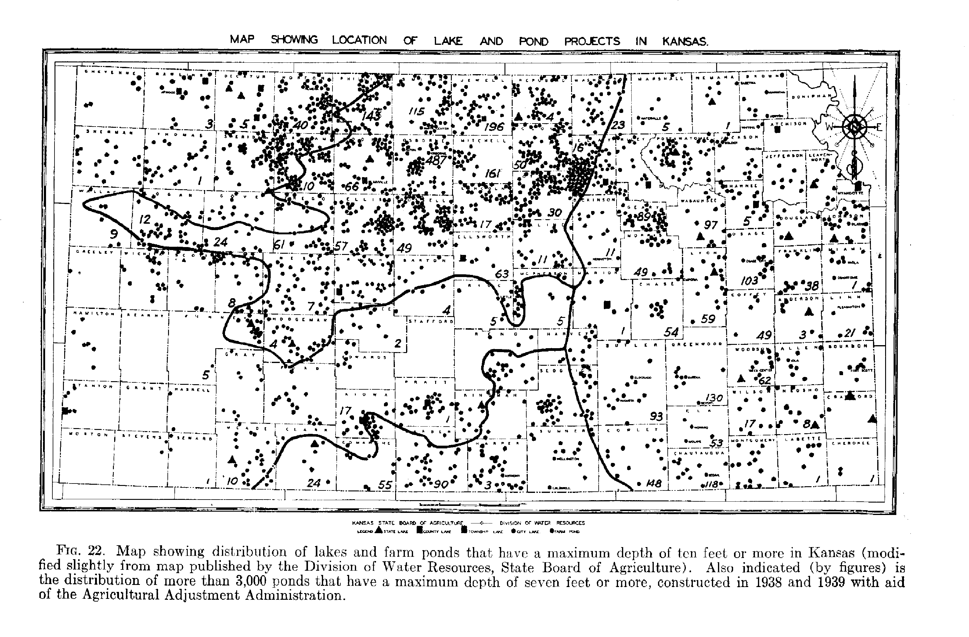
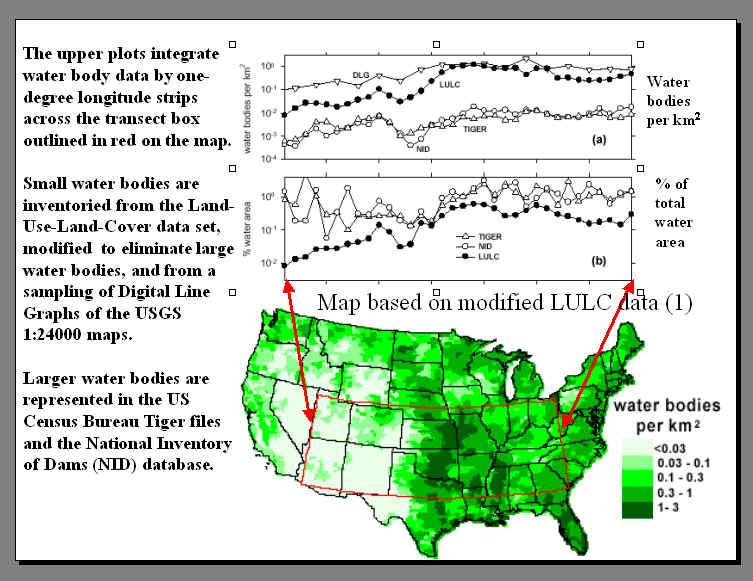
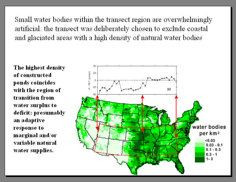
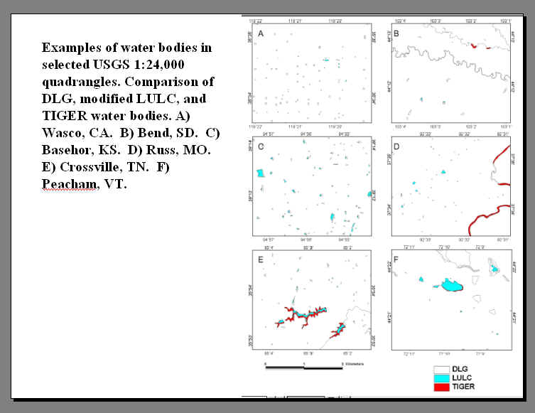
IMAGES ---Ponds and bovines with time in the Midland and Allen SE Quadrangles, Kansas (preliminary). Distribution of pre-1940 ponds in Kansas (from Moore, R.C., 1940. Ground-water resources of Kansas, KGS Bulletin 27, p. 55). Distribution maps for US ponds, with the densities derived from different data sources plotted along an E-W transect (see also the references and the slide show linked from the index page). Distribution maps for US ponds, with the densities compared to water balance along an E-W transect (see also the references and the slide show linked from the index page). Maps of 6 local areas, comparing the water body density retrieved from different data sources (see also Smith et al 2002).
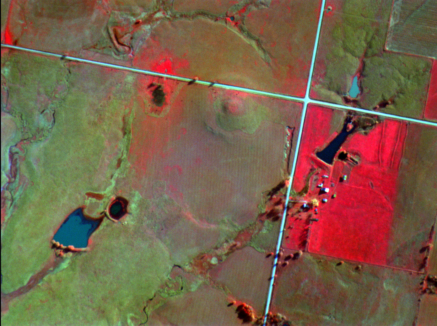
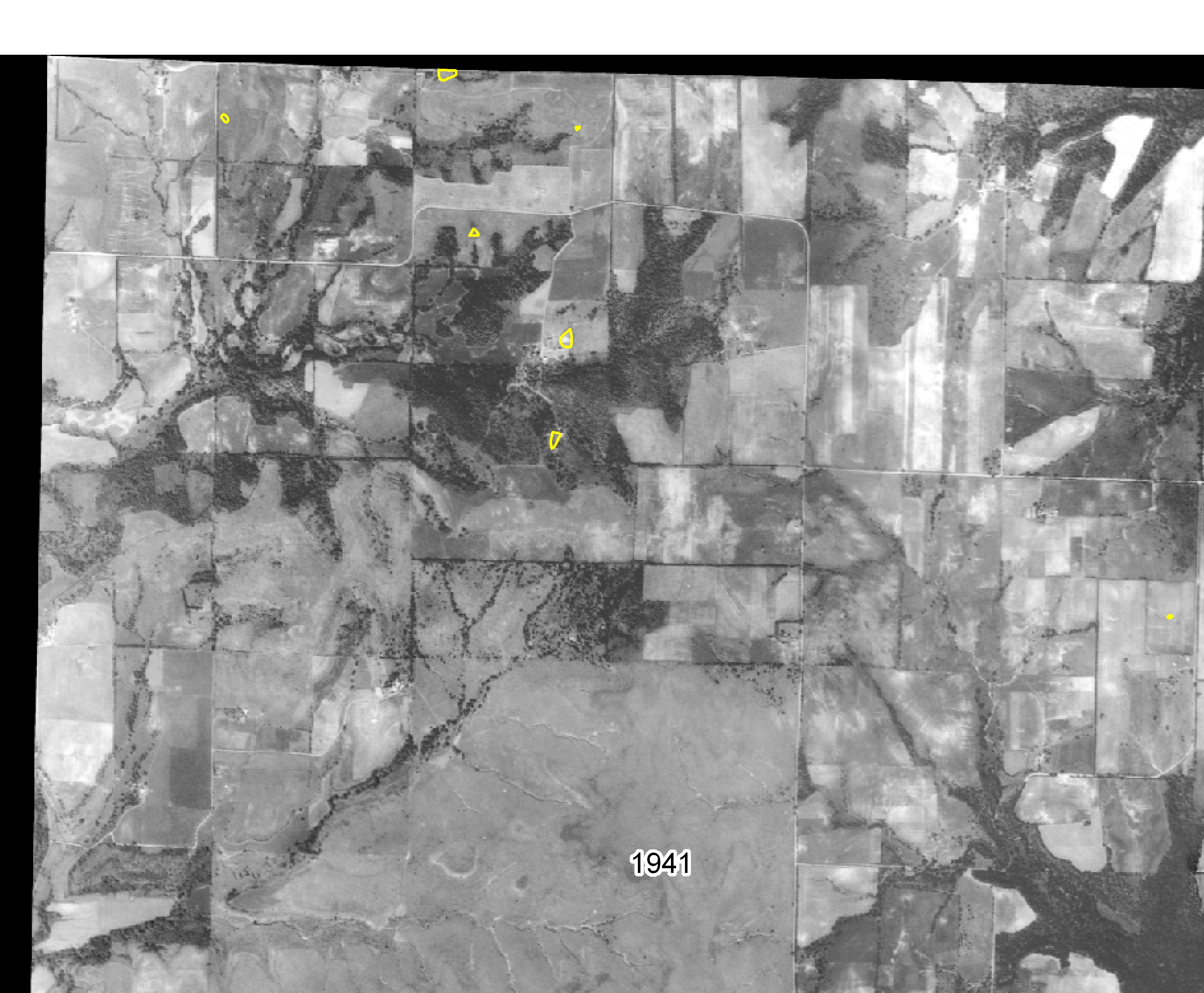
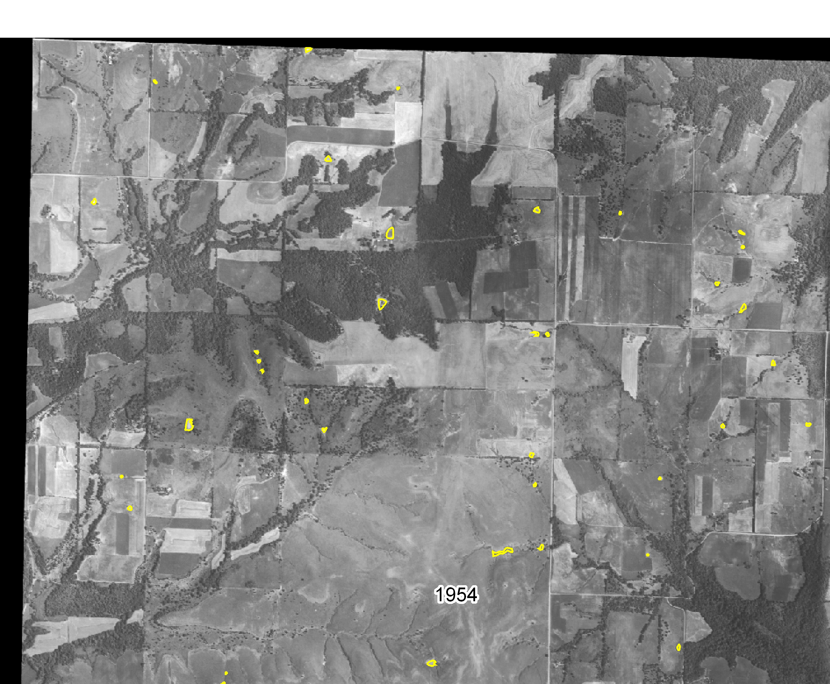
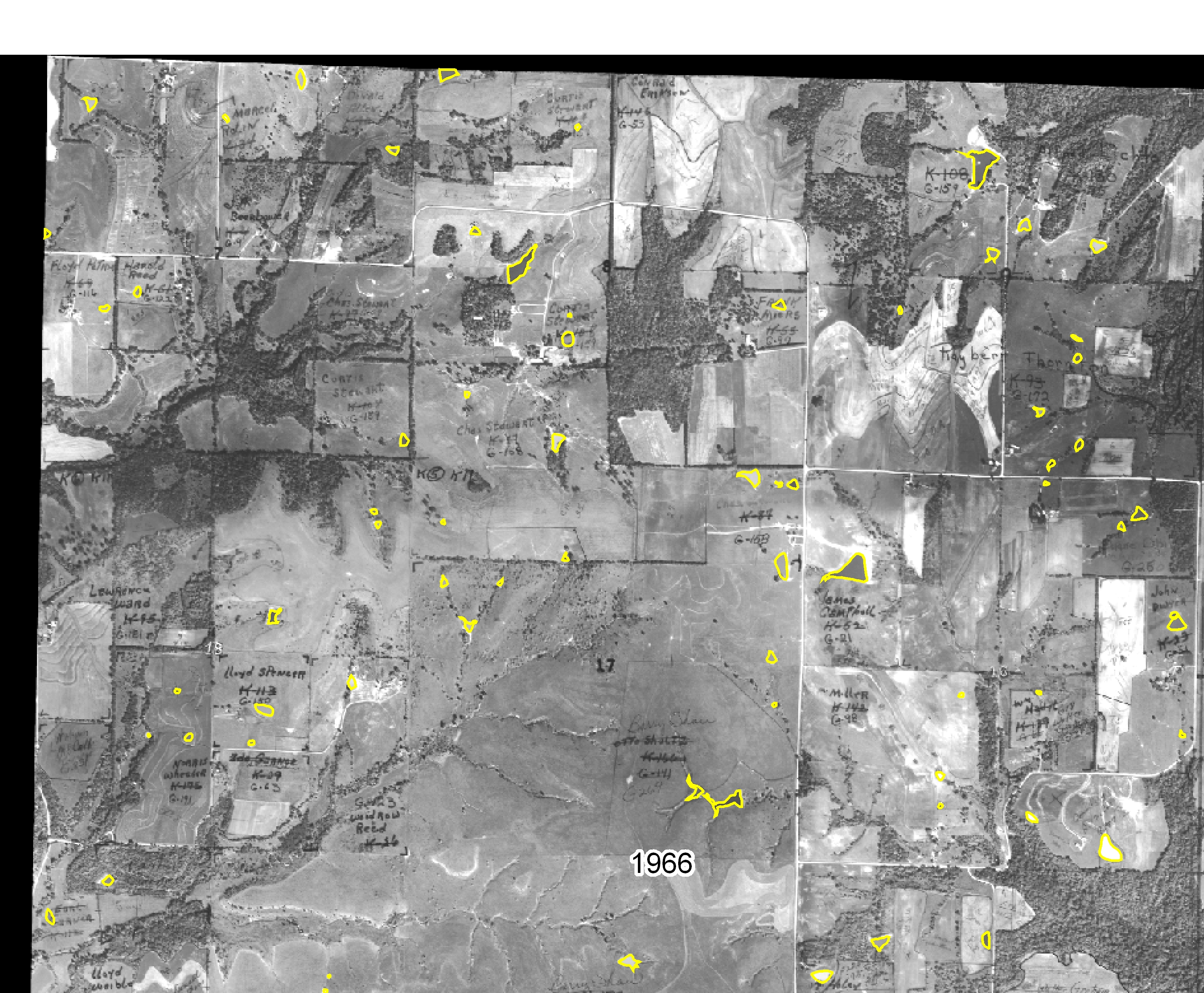
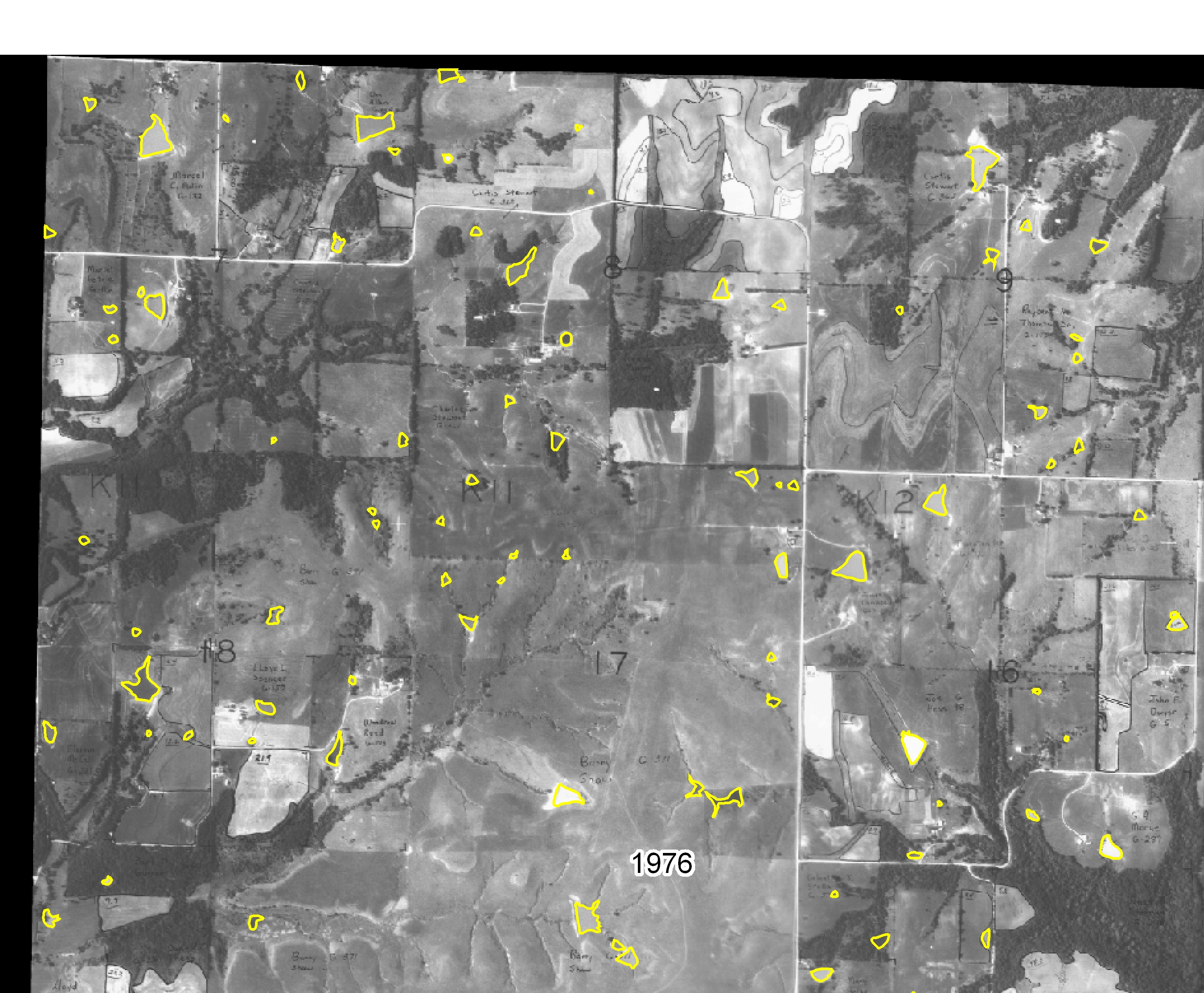
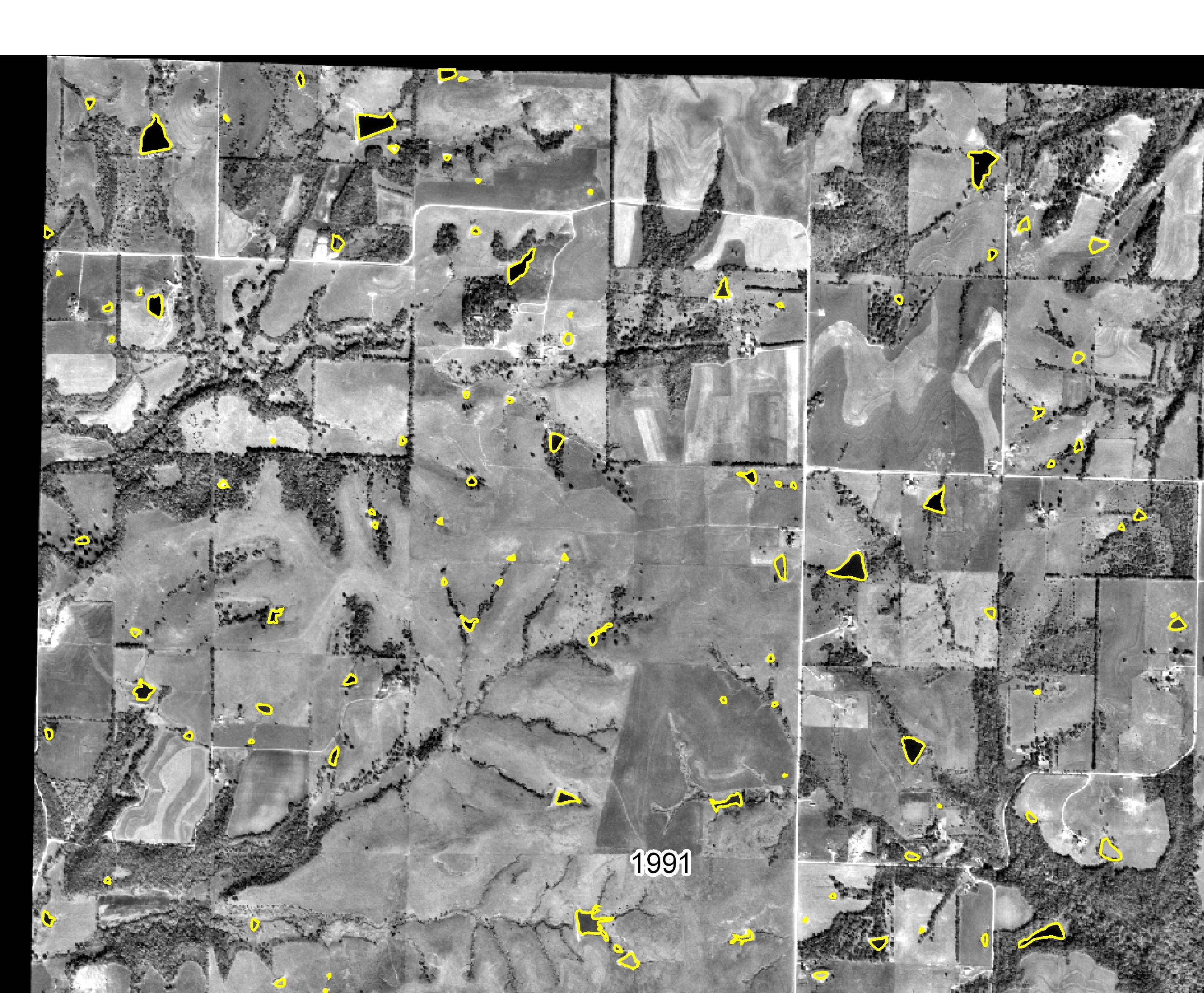
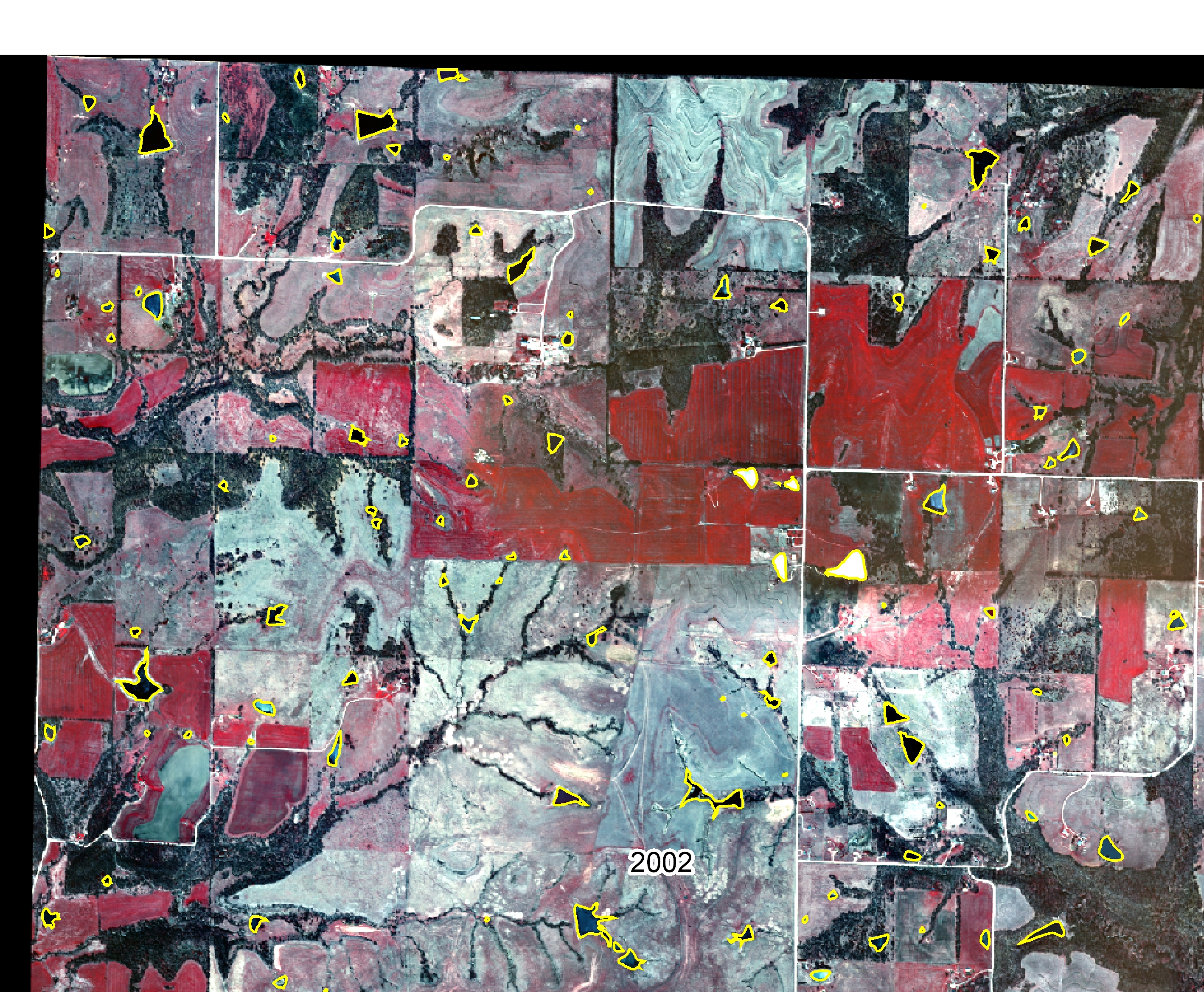
Aerial Photography Midland Quadrangle - Kansas: Midland Quadrangle historic pond inventory - newly digitized ponds
overlaid on aerial photography for a 6 square mile area in the Midland
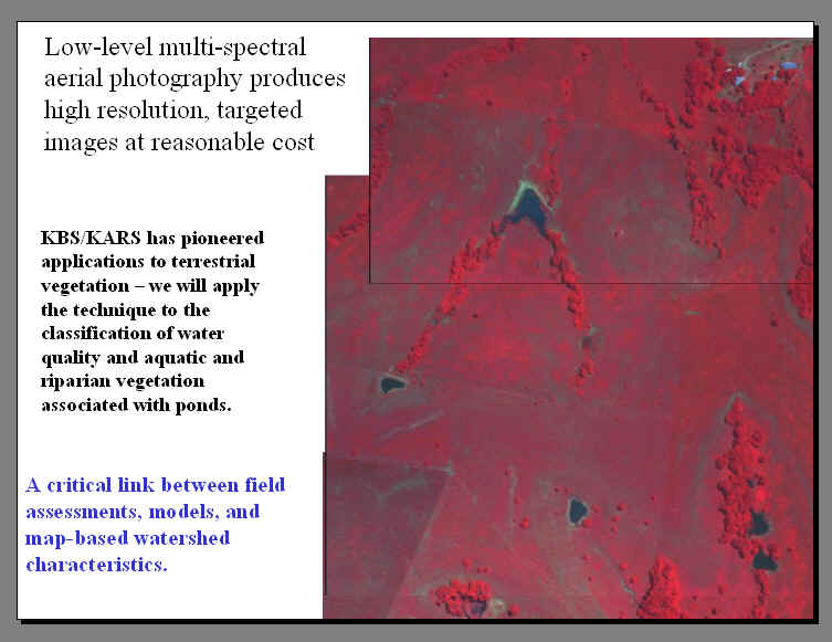
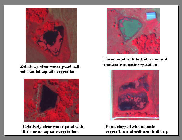
Quadrangle: Multispectral aerial photography as a pond characterization tools: Intermittent natural ponds (playas) in western and central Kansas
|
|||||||||||