Index Well Program
(High Plains Aquifer Calibration Monitoring Well Program)
The index well program is an improved approach to measuring hydrologic responses at the local level. The program is expected to make a significant contribution to understanding the aquifer dynamics at scales appropriate to the definition and management of aquifer subunits, and ultimately, providing cost-effective improvements for long-term management. A subsidiary goal is to directly examine issues and areas of particular interest to the GMDs and the Kansas Department of Agriculture, Division of Water Resources (KDA-DWR).
Information is also available on the Survey's Barometric Response Function Software, which computes a function describing the influence of barometric (atmospheric) pressure variations on water levels in wells and uses that function to filter atmospherically induced fluctuations from observed water levels. The software can also compute earth tide response functions and correct water levels for the influence of earth tides.
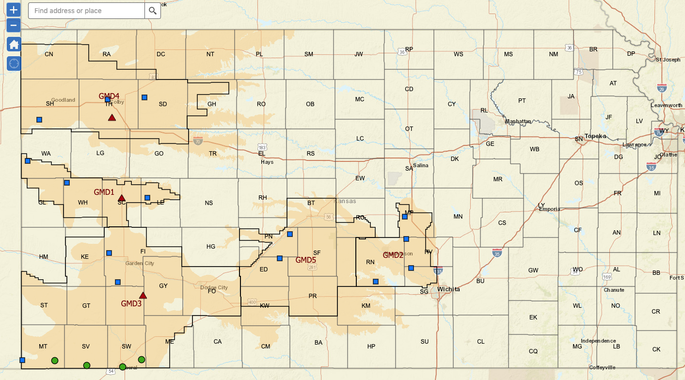
Three index wells have been installed in the Ogallala-High Plains aquifer, one in each of the three western Kansas GMDs, and are being continuously monitored. The sites are located in Haskell (GMD3), Scott (GMD1), and Thomas (GMD4) counties (see red dots on map below). In 2012 the KGS installed continuous data loggers in four wells along the Kansas-Oklahoma border. These sites are located near Cimarron, Hugoton, Liberal, and Rolla (see green squares on map below). Two of these sites, Liberal and Hugoton have two wells each which in addition to being continuously monitored are also on near real-time telemetry like the original three index wells. In 2014 two additional wells (green squares) were added to the index well network, Belpre in GMD5 and Colby located at the KSU-NWREC facility in GMD4. These wells are on the telemetry system as well.
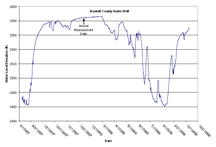
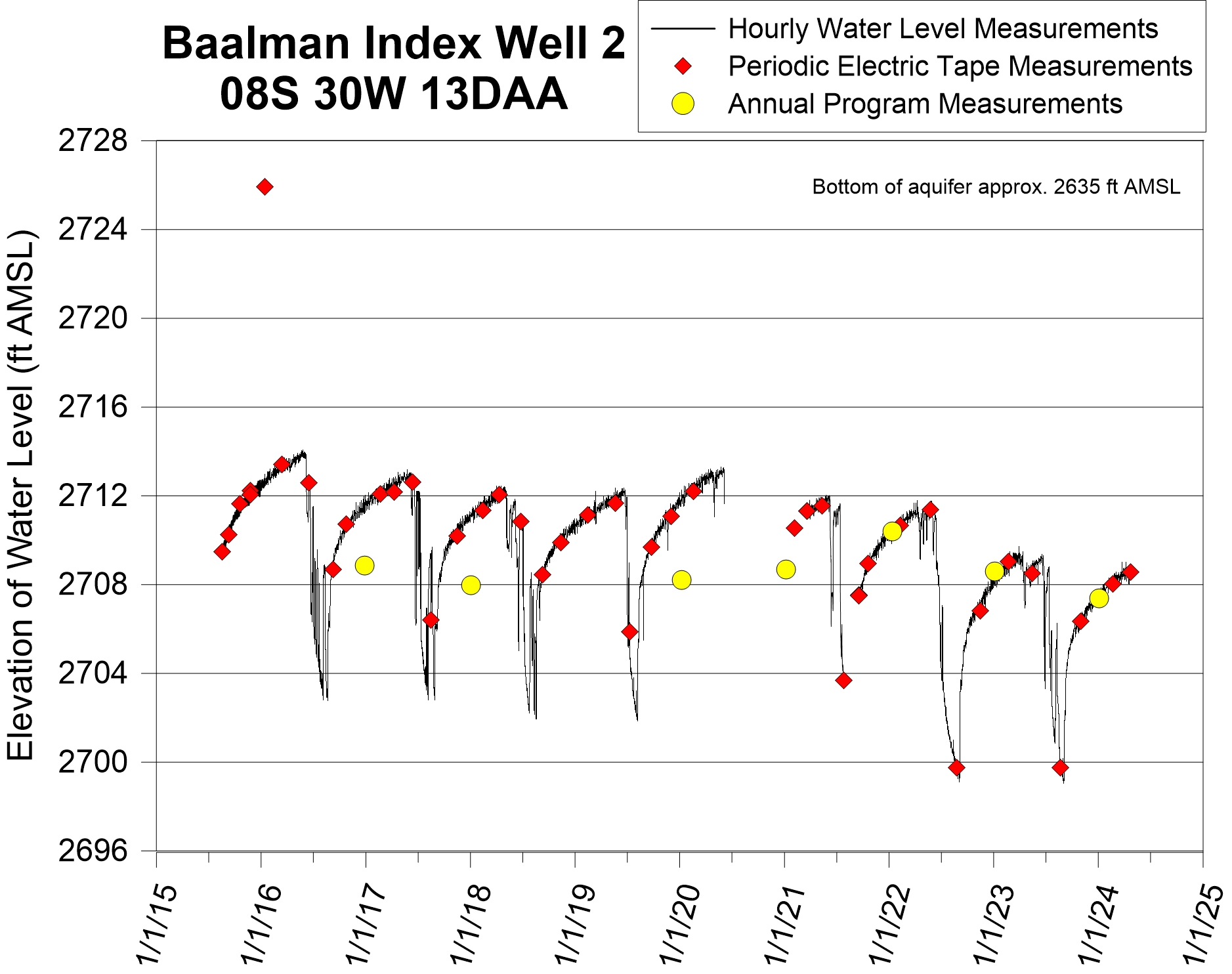
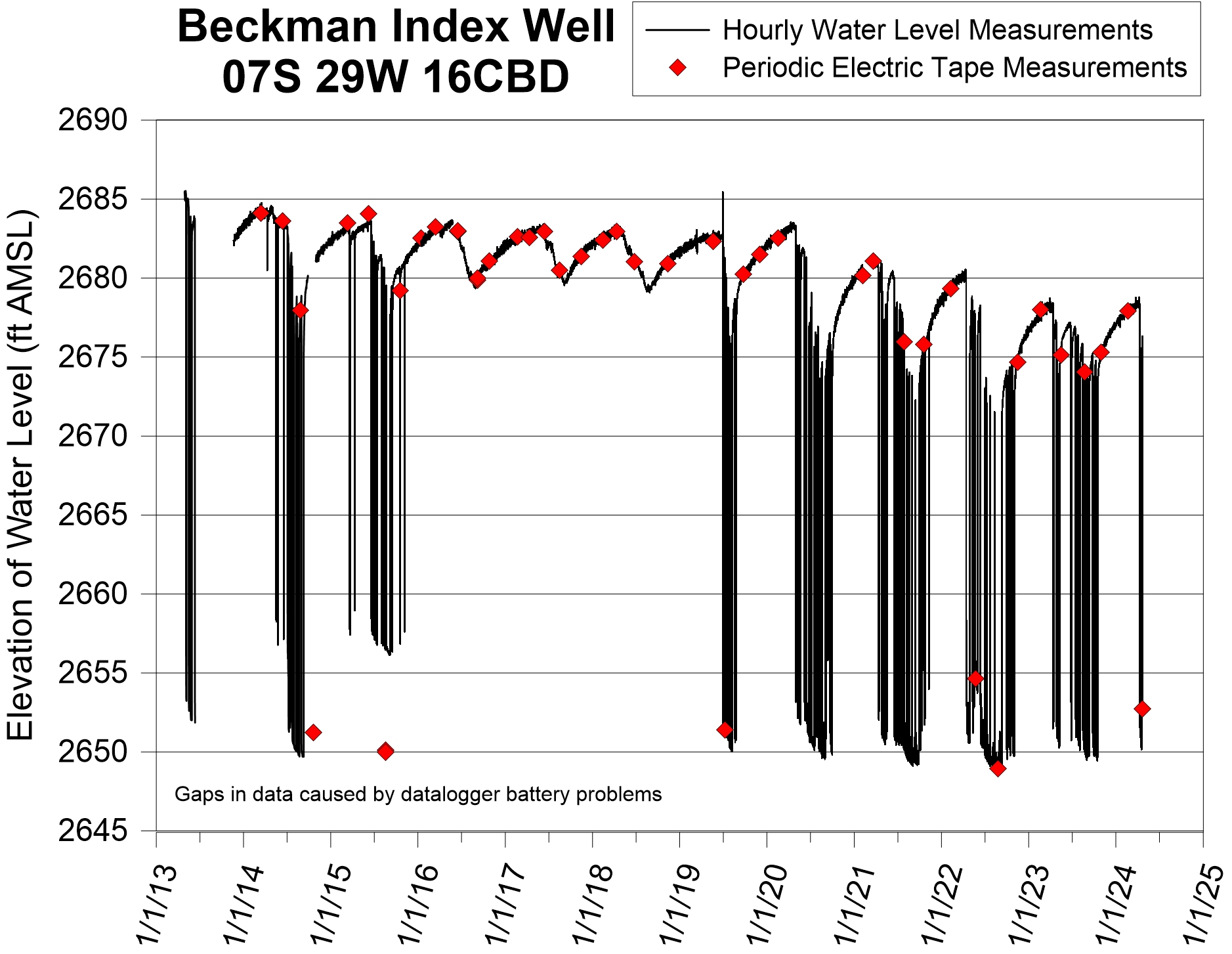
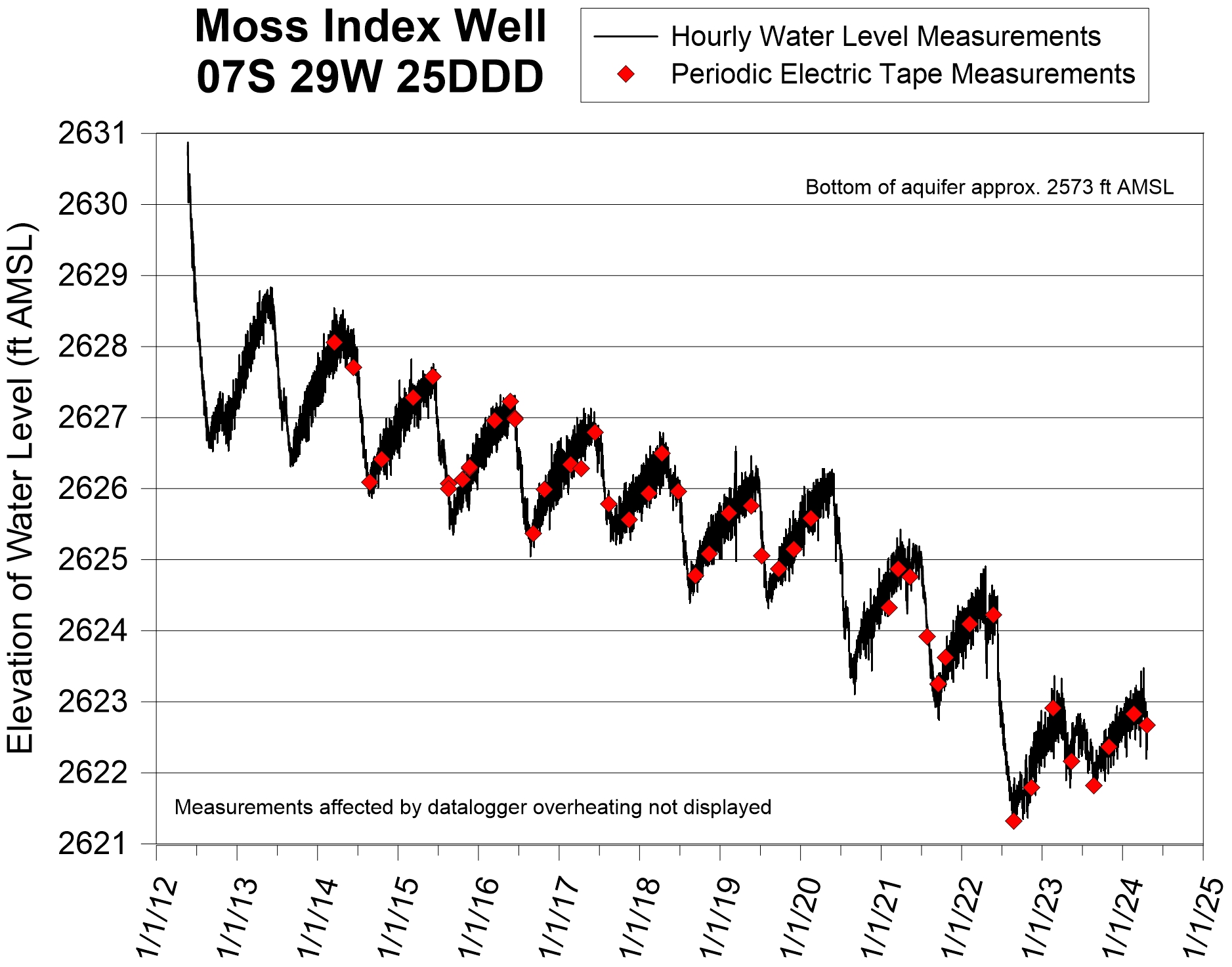
Results of the continuous monitoring are shown as hydrographs for each of the sites. The Haskell County hydrograph shows drawdowns greater than 120 ft during the pumping season. The Haskell County well is screened in a (semi-)confined zone at the base of the aquifer. In contrast to the Haskell County hydrograph, the hydrographs for the Scott County and the Thomas County wells show drawdows of on the order of 5 ft. These wells are screened in essentially unconfined portions of the aquifer.
Interactive Map
Click on the map to explore the data.
Data
Presentations
PDF of Index Well Program Update Presentation at the Kansas Water Office April 5, 2011
PDF of Index Well Program Update Presentation at the Kansas Water Office March 3, 2009
Progress and Annual Reports
- KGS OFR 2025-58: 2024 Annual Report, August 2025
- KGS OFR 2024-32: 2023 Annual Report, August 2024 (View Tables)
- KGS OFR 2023-55: 2022 Annual Report, August 2023 (View Tables)
- KGS OFR 2022-27: 2021 Annual Report, December 2022 (View Tables)
- KGS OFR 2021-8: 2020 Annual Report, July 2021 (View Tables)
- KGS OFR 2020-2: 2019 Annual Report, July 2020 (View Tables)
- KGS OFR 2019-19: 2018 Annual Report, June 2019 (View Tables)
- KGS OFR 2018-17: 2017 Annual Report, August 2018 (View Tables)
- KGS OFR 2017-10: 2016 Annual Report, May 2017
- KGS OFR 2016-4: 2015 Annual Report, June 2016
- KGS OFR 2015-3: 2014 Annual Report, May 2015
- KGS OFR 2014-1: 2013 Annual Report, May 2014
- KGS OFR 2013-1: 2012 Annual Report, March 2013
- KGS OFR 2012-2: Year 5 Progress Report, March 2012
- KGS OFR 2011-4: Year 4 Progress Report, March 2011
- KGS OFR 2010-3: Year 3 Progress Report, March 2010
- KGS OFR 2008-29: Year 2 Progress Report, December 2008
- KGS OFR 2007-30: Year 1 Progress Report on Well Installation and Aquifer Response
Also available...
GMD 1 Continuous Monitoring Wells Expansion Project—Data from wells with continuously recorded water levels located in GMD 1.