![]()
Prev Page--Table of Contents || Next Page--Geography
Introduction
Purpose and scope of the investigation
The Geological Survey, United States Department of the Interior, and the Kansas Geological Survey started a program of groundwater investigations in the western part of Kansas in July 1937. In this program was enlisted the cooperation of the Division of Sanitation of the Kansas State Board of Health and the Division of Water Resources of the Kansas State Board of Agriculture. The execution of the program thus far has been concentrated largely in the western part of the State where groundwater problems have been deemed most pressing, although critical areas in central and eastern Kansas also have been investigated.
The investigation of the occurrence, quantity, and quality of ground water available in Seward County was undertaken during July and August of 1940 by Byrne. The project was under the immediate supervision of S. W. Lohman, Federal geologist in charge of groundwater investigations in Kansas, and was under the general administration of R. C. Moore, K. K. Landes, and J. C. Frye, State Geologists of Kansas, and 0. E. Meinzer, Geologist in Charge of the Division of Ground Water of the Federal Geological Survey.
During the first field season, measurements of the water levels in more than 150 wells were made to determine the configuration of the water table in all parts of the county, the depth of the water table below the land surface, and the probable aquifers supplying the wells. Such data are accurate bases for comparative measurements of water levels in the same wells at some future time. Eleven wells were selected as observation wells, four of them being abandoned subsequently, and monthly water-level measurements were made by Richard B. Christy, Woodrow W. Wilson, Allan Graffham, and Howard Palmer. Samples of water were collected from 18 wells to determine the chemical quality of the water; the analyses were made by Robert H. Hess in the Water and Sewage Laboratory of the Kansas State Board of Health. Analyses of the municipal water supplies of Liberal and Kismet, the two incorporated cities in the county, were obtained from the files of the State Board of Health.
The field study also included an investigation of the geological formations exposed at the surface in the county with particular regard to their water-bearing qualities. Information relative to the underlying formations was obtained through the logs of water and gas wells already drilled and from the cuttings supplied from 17 test holes drilled by a portable hydraulic-rotary drilling machine (Pl. 4) owned by the State Geological Survey and operated in 1940 by Ellis Gordon, Perry McNally, and L. P. Buck, in 1942 by Ellis Gordon, James B. Cooper, and Oscar S. Fent, and in 1944 by Oscar S. Fent, Milford Klingaman, and Harold Rector.
The report was begun by Byrne and was partly completed when he entered the armed forces. In order to complete the report it was necessary for McLaughlin to do additional field work in that area to familiarize himself with the geologic and hydrologic problems. Additional field work, therefore, was done during the summer of 1943. Most of the base data had been collected during the first field season so that during the second field season special emphasis was placed on the geology in the Cimarron Valley in southeastern Seward County and southwestern Meade County. The report was then completed by McLaughlin. The section on Geologic formations and their water-bearing properties and the section on Recharge were prepared by McLaughlin; all other sections were prepared by Byrne.
Location and size of the area
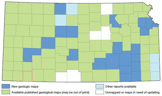
Seward County is situated in the southwestern part of the State of Kansas, in the first row of counties north of Oklahoma and in the third row of counties east of Colorado. The county is bounded on the north and south by parallels 37 degrees 23 minutes and 37 degrees 00 minutes north latitude, respectively, and on the east and west by meridians 100 degrees 38 minutes and 101 degrees 04 minutes west longitude (Fig. 1). The county has an area of 411,520 acres, or 643 square miles, is rectangular in outline, and measures 26.8 miles from north to south and 24 miles from east to west.
Figure 1.--Index map of Kansas showing area described in this report and areas covered by other geologic maps, as of Feb. 2001. For additional information, the KGS Geologic Maps of Kansas Page.
Previous geologic and hydrologic investigations
In 1895, Hay undertook a water-resources study of a portion of the central Great Plains. Although the area studied did not include Seward County, Hay named several formations exposed in this area and advanced theories for their origin. Cragin (1896) described and named three formations of Meade and Clark Counties, these being of significance here because the same horizons have been encountered in Seward County.
Comprehensive treatment of the area was given by Haworth (1897; 1897b) when he described the physiography of western Kansas, including Seward County, and generalized on the occurrence of ground water. In a later section of the same volume (1897c), Haworth discussed the Tertiary geology of the region, the origin of sand dunes and surficial gravels, and cited the log of a State well drilled near Liberal as evidence bearing on the subsurface geology of the area. In another paper the same author (Haworth, 1897a, facing p. 44) gave with considerable accuracy the depth to water in Seward County on a map of the general region.
Darton (1898, p. 734) named the Ogallala formation, which is extensively developed in southwestern Kansas, in his report on the geology and water resources of western Nebraska. The High Plains were described both geologically and hydrologically by Johnson (1901; 1902), following which he gave his conclusions as to the limits of their utilization. Darton (1905, pp. 288, 316, 317) described, as then known, the geology and hydrology of the county in his preliminary report on the central Great Plains. The log of a deep well at Liberal was included in the report.
Parker (1911, pp. 182-183, 305-311) discussed the hydrology of Seward County and gave tables indicating the chemical quality of the waters from eight local wells. Haworth (1913, pp. 57-68) summarized the groundwater resources of western Kansas in a non-technical report prepared for the interested layman.
The report of a survey made by Theis, Burleigh, and Waite (1935) summarized the supplies of ground water available in the southern portion of the High Plains and described the principal aquifers. The results of a soil survey of the southern High Plains were published by Joel (1937) in a report that includes a useful soils map of Seward County. Smith (1940) published his studies on the Tertiary and Quaternary geology of Seward and other counties of southwestern Kansas. Frye and Hibbard (1941) made an important contribution to the detailed geology of the southwestern Kansas region in the report of their investigations in Meade County. Investigations have also been made of the geology and groundwater resources of areas adjacent to Seward County (Schoff, 1939; Frye, 1942; Latta, 1944; McLaughlin, 1946; and Schoff and Stovall, 1943).
Methods of investigation
The highway map of Seward County issued by the Kansas State Highway Commission, in cooperation with the State Planning Board, was used as the base map for recording field observations and in the preparation of Plates 1 and 2. Revisions of roads and railroads were made on the base map as such changes were encountered in the field. The drainage lines were transposed from aerial photographs and mosaics obtained from the Agricultural Adjustment Administration of the United States Department of Agriculture.
The contacts of the geologic formations exposed at the surface were added to the base map directly from field observations and were checked against aerial photographs and the soils map of Seward County prepared by the Department of Agriculture, Soil Conservation Service. The areal distribution of the geologic formations and the form of the water table as indicated by water-table contours based on sea-level datum are shown on Plate 1.
The depth to water in all parts of Seward County is shown on Plate 2. The locations of the wells measured during the field season or for which reported measurements were recorded are indicated by small circles on this map. The position of each well within a section was determined by odometer reading. The wells from which water samples were taken for analysis are designated by brackets around the well numbers. The wells are numbered in order by ranges from east to west and by townships from north to south. Within each township the order of well numbers follows the numbering of the sections.
Acknowledgments
Much of the information included in this report was supplied by farmers, ranchers, county and municipal officials, and businessmen of Seward County. Their generous assistance was further implemented by Gene Harris, County Farm Agent; by H. W. Hillis, Chief Engineer of the Chicago, Rock Island, and Pacific Railway; and by officers of the Soil Conservation Service. Lee Larrabee of Liberal contributed considerable of his time and knowledge of Seward County. John C. Frye and Stuart L. Schoff, then of the United States Geological Survey, aided with their suggestions on problems of hydrology and geology.
The writers are greatly indebted to Claude W. Hibbard, formerly Curator of Vertebrate. Paleontology of the Dyche Museum, University of Kansas, whose studies of the faunas of the Tertiary and Quaternary formations in southwestern Kansas have greatly facilitated the mapping of the geology of that area. Dr. Hibbard spent many weeks in the field in Seward County in 1940 and 1943 and assisted in mapping most of the geology in Cimarron Valley in the southeastern part of the county.
The illustrations included in this report were prepared under the supervision of Robyn Ashby Addis of the State Geological Survey. The manuscript was reviewed by members of the Federal Geological Survey; by R. C. Moore, State Geologist; by George S. Knapp, Chief Engineer of the Division of Water Resources of the Kansas State Board of Agriculture; and by Paul D. Haney, Director, and Ogden S. Jones, Geologist, of the Division of Sanitation of the Kansas State Board of Health. The manuscript was edited by Betty J. Hagerman of the State Geological Survey.
Prev Page--Table of Contents || Next Page--Geography
Kansas Geological Survey, Geohydrology
Web version Sept. 2001. Original publication date March 1948.
Comments to webadmin@kgs.ku.edu
The URL for this page is http://www.kgs.ku.edu/General/Geology/Seward/02_intro.html