![]()
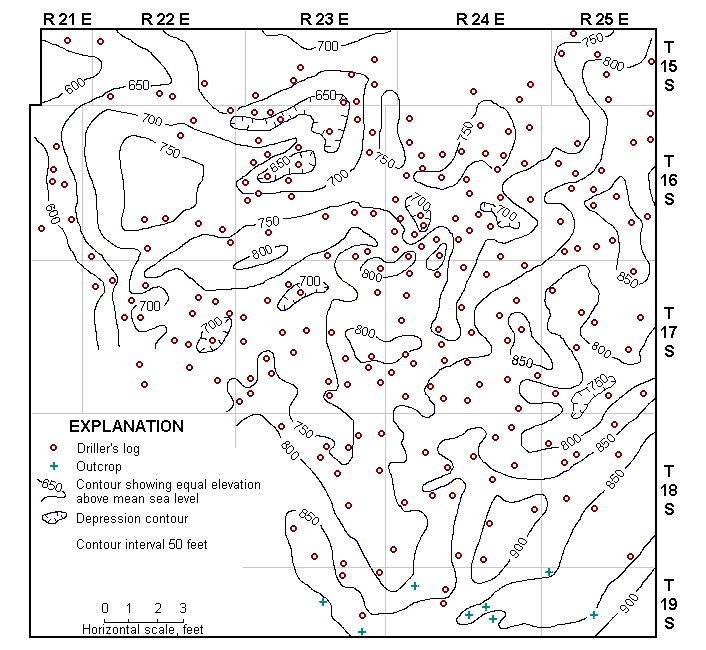
Figure 3
Figure 3--Structural contour map on the base of ther Kansas City Group in Miami County, Kansas. (Based on data from surface outcrops and from well logs in files of State Geological Survey of Kansas.)
Kansas Geological Survey, Miami County Geohydrology
Comments to webadmin@kgs.ku.edu
Web version June 2002. Original publication date June 1966.
URL=http://www.kgs.ku.edu/General/Geology/Miami/fig3.html