![]()
Figure 3
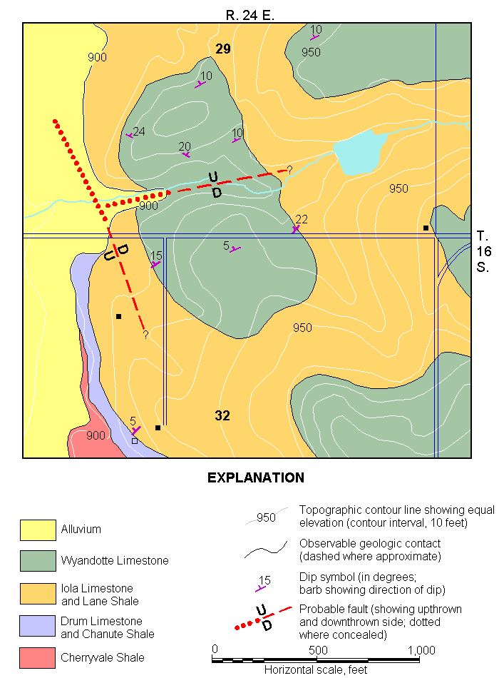
Figure 10--Geologic map of a structureally deformed area north of Somerset in secs. 29 and 32, T. 16 S., R. 24 E., Miami County, Kansas.
Kansas Geological Survey, Miami County Geohydrology
Comments to webadmin@kgs.ku.edu
Web version June 2002. Original publication date June 1966.
URL=http://www.kgs.ku.edu/General/Geology/Miami/fig10.html