![]()
Prev Page--Stratigraphy--Permian || Next Page--Mineral Resources--Outcropping Rocks
Stratigraphy of Outcrops, continued
Pennsylvanian System
Virgilian Series
Wabaunsee Group
Brownville Limestone
The Brownville limestone ranges from about 1.5 to 3 feet in thickness and has an average thickness of about 2 feet. It is a massive, hard, blue-gray limestone which occurs as a single ledge or occasionally with one or two thin partings. Abundant fusulinids, the brachiopods Marginifera wabashensis and Chonetes granulifer, the bryozoan Meekopora, and crinoid fragments are the characteristic and abundant fossils. The Brownville is not an important aquifer; however, a few wells do obtain small supplies of water from it at shallow depths.
Pony Creek Shale
The average thickness of the Pony Creek shale is about 10 feet in the northern part of Lyon County and 11 feet in the southern part. It comprises mostly gray and olive silty or sandy micaceous shale. Fossiliferous shale containing brachiopods and bryozoans occurs just below the Brownville limestone in many places. Locally a thin coal bed occurs just below the fossiliferous zone. It supplies little or no water to wells in this area. The Caneyville limestone consists of two named limestone members and an unnamed shale. Thickness of the formation ranges from 10.5 to 20 feet. It is not an important aquifer, although a few wells do obtain small amounts of water from this formation.
Grayhorse limestone member--The Grayhorse limestone is a gray to brown coarsely crystalline to sandy and silty chiefly molluscan bed which ranges in thickness from about 0.5 to 2.5 feet.
Unnamed shale member--Shale beds separating the Grayhorse and Nebraska City limestone members range in thickness from about 10 to 17 feet. The shale beds are mostly gray or green gray in color, locally sandy and micaceous. Some exposures in the northern part of Lyon County exhibit a yellow-brown "boxwork" limestone in the upper part, locally overlain by a thin red shale. Some southern outcrops show a sandstone or thin conglomerate adjacent to the Grayhorse limestone.
Nebraska City limestone member--The Nebraska City limestone is a single bed of somewhat shaly, shelly weathering gray or gray-brown limestone, 1 to 3 feet thick in exposures in northern Lyon County. In exposures near the middle of the county a shale parting divides the member into two separate limestone beds. The upper bed is massive to slabby, gray to gray-brown limestone about 1 foot thick containing abundant Osagia algae and brachiopods, together with other fossils. The lower bed is olive to gray in color, silty to shaly, and much less resistant to weathering. It ranges in thickness from about 1 to 1.5 feet and contains chiefly a molluscan fauna. The shale separating the limestone beds thickens southward to about 5 feet near the Greenwood-Lyon County line. Locally the Nebraska City may be cut out by a disconformity in the unnamed shale of the Caneyville limestone.
French Creek Shale
Measured sections of the French Creek shale range from about 25 to 40 feet in thickness. It progressively thickens southward across the county. The persistent Lorton coal occurs below the Nebraska City limestone separated from it by a shale which ranges in thickness from a featheredge to about 8 feet. The coal ranges in thickness from a featheredge to about 20 inches (Schoewe, 1946, p. 102). Occasionally there are two coals in the upper part of the French Creek shale. Gray sandy micaceous shale containing plant remains or sandstone and sandy shale occur below the coal. The lower part is gray to olive blocky shale, generally more argillaceous than shale beds of the upper part. Claystone and limestone concretions occur in the basal part in many exposures. Locally, sandstone or sandy shale-filled channels originating in the French Creek shale cut downward into underlying beds.
Sandy zones in the French Creek shale are a source of small supplies of ground water for shallow stock and domestic wells.
Jim Creek Limestone
The Jim Creek limestone is a thin but persistent light- to medium-gray fine-grained hard limestone which ranges in thickness from about 0.5 to 1.5 feet. The top becomes red or red brown from limonite or hematite in the upper part and the weathered ledge becomes shelly in many exposures. It contains fusulinids, brachiopods, crinoids, bryozoans, and other fossils. Locally the formation is cut out by a disconformity in the French Creek shale. It is of little importance as an aquifer.
Friedrich Shale
Outcrops of the Friedrich shale in northern and central parts of Lyon County are chiefly gray, green, and olive argillaceous shale averaging 10 to 12 feet in thickness. A thin carbonaceous zone is observed near the base in a few exposures. At the SE corner. sec. 9, T. 17 S., R. 12 E., a conglomerate of shale and limestone pebbles was observed about 4 feet below the Jim Creek limestone. The formation is 8 to 25 feet or more in thickness south of Cottonwood River, where it becomes gray, tan, and buff sandy micaceous shale with abundant carbonized plant remains. Sandstone-filled channels 25 feet or more thick locally cut nearly to the Dover limestone. Alternating very thin beds of dark carbonaceous shale and tan or buff sandy shale give the appearance of varved shale in some exposures.
The Friedrich shale yields small supplies of generally hard water to wells where the formation contains beds of sandstone, especially in T. 21 S. Elsewhere it yields little or no water to wells.
Grandhaven Limestone
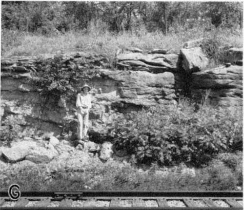
There are commonly two limestones separated by a few feet of shale in the Grandhaven limestone. It ranges in thickness from about 3.5 to 12 feet. The upper limestone ranges in thickness from less than 1 to more than 8 feet. In some exposures south of Cottonwood River the upper limestone is absent. The upper bed is characterized by abundant Osagia algae together with less numerous clams, bryozoans, brachiopods, and crinoids. It is light gray, tan, or buff in color, weathering nearly white in most exposures. Crossbedding is evident in many exposures (Pl. 5D).
Plate 5D--Cross-bedded upper bed of Grandhaven limestone in quarry face, SW SW sec. 29, T. 19 S., R. 11 E.
Middle beds are mostly gray, yellow, or green silty or calcareous shales but locally red shale or brownish-green sandy micaceous shale occurs between the limestones.
The lower limestone averages 2 to 3 feet in thickness in northern and central outcrops but thins to 0.5 to 1 foot in southern outcrops. Where thick it is massive gray to yellow-brown limestone containing fusulinids, crinoids, bryozoans, brachiopods, and occasionally horn corals or algae. Where thin the bed is medium-gray, hard, massive limestone which contains mollusks, brachiopods, bryozoans, and crinoids but no fusulinids. The bed, where thin, is very similar to the Jim Creek limestone. Locally part or all the Grandhaven limestone is cut out by a post-Grandhaven disconformity.
The Grandhaven limestone generally yields little or no water to wells, but in a few areas small supplies of good quality water are obtained.
Dry Shale
The Dry shale is gray and tan thin-bedded to blocky shale with silty, sandy, and limy zones. Fossils, including clams, snails, brachiopods, crinoids, ammonites, and bryozoans, while not observed, in all outcrops, locally are abundant. Locally a part of the fauna, especially Yoldia, Leda, Ambocoelia, and ammonites are replaced with limonite and are distinctive of the Dry shale. Some exposures of the Dry shale are chiefly dark-red and green shale. Thickness, except in Ts. 20 and 21 5., is about 8 to 10 feet.
The Dry shale in T. 21 S. and most of T. 20 S. is considerably different than in areas north of T. 20 S. It is thicker, as much as 26 feet thick, along Verdigris River. At the top a rather persistent thin coal occurs just below the lower Grandhaven limestone. Myalina and other pelecypods, brachiopods, crinoids, and bryozoans occur in the thin shale above the coal in some exposures. Frequently 5 to 10 feet from the top there is a yellow-brown or gray siltstone or crossbedded algal and molluscan limestone separated from the coal by gray, tan, olive, or green shale. These beds formerly (Jewett and O'Connor, 1951, pp. 11, 14, 15) were erroneously included as a part of the Grandhaven limestone. Below the algal-molluscan limestone zone are several feet of olive or green silty to sandy shale beds. About 5 to 8 feet from the base a medium-gray to nearly black very fossiliferous limestone about 0.8 foot thick is present. Some exposures show a purple-red cast on the top surface. It is underlain by 1 to 2 feet of gray shale. Both the shale and limestone contain abundant fossils, chiefly Chonetes and Derbyia with fewer crinoids and bryozoans. The basal 4 to 6 feet is gray micaceous sandstone and gray thin-bedded sandy shale with abundant carbonized plant remains.
Locally, in sec. 28, T. 21 5., R. 11 E., and adjacent areas sandstone beds in the Dry shale fill deep channels cut into underlying beds as low as the Pierson Point-Willard shale. Where thick sandstone beds are present good stock and domestic wells can be developed; elsewhere the Dry shale yields little or no water to wells.
Dover Limestone
The average thickness of the Dover limestone is about 2 feet, but it ranges in thickness from less than 0.5 to nearly 3 feet. It is light gray to yellow brown in color, weathering yellow brown. In some exposures part of the bed has a green cast. It occurs as massive limestone, silty and sandy somewhat impure limestone, or as limy sandstone in various outcrops. In exposures where it is sandy, it frequently overlies massive beds of sandstone in the Langdon shale. It is evident in many such instances that percolating ground water has locally redeposited much of the Dover limestone as large sand-calcite crystals in the underlying sandstone. In such places the boundaries of the Dover limestone are poorly defined. Large robust fusulinids, which in northern outcrops frequently weather free of the matrix, Osagia and Cryptozoon algae are the most abundant fossils. Crinoids, brachiopods, horn corals, and bryozoans are present in less abundance. The formation generally yields little or no water to wells.
Langdon Shale
In Ts. 15, 16, and 17 S. the Langdon shale ranges in thickness from about 30 to 35 feet. In most exposures it comprises massive to shaly gray or brown sandstone beds in the upper part underlain by sandy, micaceous, gray, tan, or olive, thin-bedded shale, parts of which contain plant remains and ferruginous concretions. The lower one-third of the formation is blue-gray, blocky, argillaceous shale. In T. 18 S. and the northern part of T. 19 S. the formation thins rapidly southward. Outcrops of the formation in Emporia show it to have thinned to about 3 or 4 feet of gray silty and olive argillaceous shale. South of Emporia in Ts. 19, 20, and part of 21 S. the underlying Maple Hill and Tarkio limestones are absent and shale beds, 50 to 60 feet thick, between the Dover and Elmont limestones are considered as the Langdon-Willard shale. In part of T. 21 S., especially the southern part, the Maple Hill limestone is recognized and the Langdon can be differentiated. The Langdon ranges in thickness from a featheredge to about 5 feet in this area, and is gray to green, argillaceous, blocky shale. Small supplies of well water are obtained locally from sandstone beds in the Langdon shale. Non-sandy beds yield little or no water to wells.
Maple Hill Limestone
Exposures of the Maple Hill limestone range in thickness from 1 to 1.5 feet except in T. 21 S. where some exposures show it to be slightly more than 2 feet thick. It is absent in T. 20 S. and parts of Ts. 19 and 21 S. Where present the Maple Hill is easily recognized. It is light to medium gray in color, weathering brown gray or gray, frequently with a red top, hard, massive and has widely spaced joints unlike the overlying Dover which cause it to weather out along outcrops in large rhomb-shaped blocks. Joints are locally much enlarged by solution. It becomes shelly on weathering in some exposures. Fossils include numerous small fusulinids, brachiopods, crinoids, bryozoans, and Cryptozoom algae, together with less numerous clams, snails, and horn corals. The Maple Hill limestone is not an important aquifer.
Pierson Point Shale
Strata, chiefly shale beds, averaging between 25 and 35 feet in thickness between the Maple Hill and Tarkio limestones are designated the Pierson Point shale in northeastern Lyon County. South of the point where the Tarkio limestone pinches out, strata between the Maple Hill and Elmont limestones are termed the Pierson Point-Willard shale and the thickness of the unit ranges from 45 to 55 feet. In areas where the Maple Hill limestone is also absent, the formation cannot be differentiated from overlying and underlying shales and is included as a part of the Langdon-Willard shale.
As far south as Emporia the Pierson Point or Pierson Point-Willard shale everywhere contains a thin coal, coal smut, or carbonaceous zone just below the Maple Hill limestone. In many exposures gray to tan micaceous sandstone or sandy shale underlies the coal. Three thin limestones or limy siltstones occur near the middle of the shale and are characterized by abundant fossils. The upper two fossiliferous zones contain abundant Leda, Yoldia, Pharkidonotus, Euphemus, Myalina, Bellerophon, and Worthenia, as well as other snails and clams, bryozoans, and crinoids. South of Emporia these two thin limestones are less well represented but can still be identified although the fauna comprises chiefly bryozoans, crinoids, and brachiopod remains. The lower of these three limestones, near the middle of the Pierson Point shale, averages 1 to 4 feet in thickness. This limestone is persistent at least across Osage and Lyon counties.
The name Stormont limestone is here proposed for this bed, named for exposures along the road and in ravines in the NW sec. 9, T. 14 S., R. 14 E., about 1 mile northwest of the former Stormont post office, Osage County, Kansas, where the overlying Maple Hill and underlying Tarkio limestones are also typically exposed. The Stormont limestone occurs about 12 feet below the Maple Hill limestone and 13.5 feet above the Tarkio limestone at the type locality. It is also very well exposed in the NE sec. 15, T. 15 S., R. 13 E., along Dragoon Creek.
The Stormont limestone occurs about 12 to 18 feet above the Tarkio limestone where the Tarkio is present, and about 10 to 20 feet above the Elmont where the Tarkio limestone is absent. The Stormont is variable in character, but generally is sandy or silty and very nonresistant to weathering. Mollusks, crinoids, brachiopods, fusulinids, and calcareous algae are the commonly observed fossils but microscopic inspection of one sample of this bed showed ostracodes, gastropods, foraminifers, sponge spicules, and echinoderm fragments also. Because of its position between the Elmont and Maple Hill limestones, it has been erroneously called Tarkio limestone in parts of Lyon County where the Tarkio is absent.
The Pierson Point shale below the Stormont limestone comprises blue-green and dark blue-gray blocky to massive shale, the lower part of which contains dense siltstone concretions and septaria. The septaria commonly have vein fillings of sphalerite and white, red, or orange calcite.
The basal 2 or 3 feet of the Pierson Point-Willard shale frequently contains abundant crinoids and brachiopods.
The Pierson Point-Willard shale is not an important aquifer.
Tarkio Limestone
The Tarkio limestone is recognized in one small outcrop along Salt Creek along the Lyon-Osage County line. It comprises about 2 feet of gray hard limestone which weathers yellow brown. Fossils include large fusulinids which weather in relief, crinoids, bryozoans, and Cryptozoon. In T. 15 S., R. 13 E., it very closely resembles the Reading limestone in color, thickness, and fossil content, and could be easily confused with Reading limestone where associated overlying or underlying beds cannot be observed. It apparently thins to a featheredge in the area between Salt Creek and Marais des Cygnes River and is absent to the south of this area. It is unimportant as an aquifer.
Willard Shale
The Willard shale comprises about 12 to 15 feet of gray or tan shale in northeastern Lyon County. Where the Tarkio limestone is absent it is included with the Pierson Point shale as the Pierson Point-Willard shale.
It is unimportant as an aquifer.
Elmont Limestone
The Elmont limestone ranges in thickness from about 1.5 to 6 feet, averaging about 3 feet. The upper limestone, about 1 to 1.5 feet thick, is a dense, hard, brittle, gray bed which characteristically has numerous very closely spaced joints and includes abundant small fusulinids, together with brachiopods, bryozoans, crinoids, and Cryptozoon algae. A thin zone of blue-gray fine-grained pebbles or conglomerate included in the Elmont by Moore (1936, pp. 226-227) occurs at the base of the formation and is separated from the overlying fusulinid bed by 0.5 to 4 feet of gray or olive shale. This pebble zone or conglomeratic limestone ranges from less than 0.1 foot to about 2 feet in thickness.
The Elmont limestone is of little importance as a source of ground water.
Harveyville Shale
Gray and olive shale beds ranging from about 0.5 to 6 feet in thickness are included in the Harveyville shale. Locally Myalina and other invertebrates occur in the shale or in a thin limestone in the shale. The Harveyville is of little importance as a source of ground water.
Reading Limestone
The Reading limestone averages about 3 feet in thickness and nearly everywhere consists of one massive gray-blue limestone which weathers yellow brown. Most exposures of this limestone show a parting near the top, above which no fusulinids or algae occur. The entire bed contains crinoids, brachiopods, bryozoans, and echinoid remains. Locally in T. 21 S., a crossbedded algal-molluscan limestone as much as 5 feet thick occurs above the persistent fusulinid limestone and is separated from it by 1 to 2 feet of gray shale.
The Reading limestone ordinarily yields little or no water to wells.
Auburn Shale
The Auburn shale comprises gray, olive, and tan shale beds, and several thin gray or tan limestones which together have an average thickness of about 44 feet. Most outcrops of the upper half of the Auburn shale are gray and tan shale with three to five thin limestones which contain abundant Linoproductus, bryozoans, and crinoid and mollusk remains. Locally, as in secs. 28 and 33, T. 21 S., R. 12 E., sandstone occurs near the middle of the formation and is overlain by sandy shale containing one or two thin coals and a limestone conglomerate at the top directly under the Reading limestone. The lower half comprises calcareous shale with one to five generally unfossiliferous shaly or silty limestones that have little resistance to weathering. The basal 2 or 3 feet is fossiliferous in some exposures, however. The Auburn shale is not an important source of ground water, although a few wells obtain small supplies of water from it at shallow depths.
Wakarusa Limestone
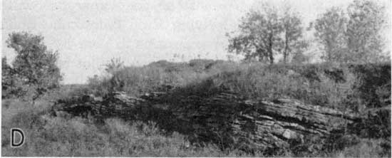
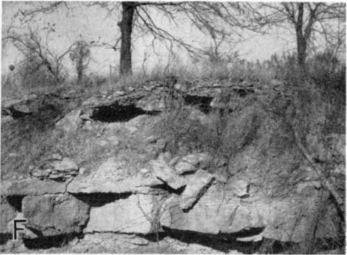
Massive, thick-bedded, hard, blue-gray, unevenly colored limestone which commonly weathers brown and contains a large and varied assemblage of fossils comprises the Wakarusa limestone. Typically it consists of two or three beds of limestone separated by partings or thin shale breaks and has an average thickness of about 4.5 feet (Pl. 5F). Large fusulinids, Cryptozoon, Ottonosia, Dictyoclostus and other brachiopods, horn corals, crinoids, and bryozoans are the common fossils.
Plate 5F--Wakarusa limestone, Soldier Creek shale, and Burlington limestone along road cut, SW sec. 25, T. 18 S., R. 12 E.
In Lyon County the Wakarusa limestone is as effective in producing a topographic bench as is the next lower Burlingame limestone to which the bench is usually attributed. Because only a few feet of shale separate the two limestones a single bench is usually all that is present.
Except for a few wells which obtain small water supplies from joints or fractures in the Wakarusa limestone, it generally is of little importance as an aquifer.
Soldier Creek Shale
The Soldier Creek shale occurs between the Wakarusa limestone and the Burlingame limestone. It ranges from about 1 to 7 feet in thickness, is olive green, gray, or buff, and frequently contains a thin coal and carbonized plant remains in the middle or upper part (Pl. 5F).
It is not important as a source of ground water.
Burlingame Limestone
Measured sections of the Burlingame limestone range from about 2 to 8 feet and average about 3 feet in thickness (Pl. 5F). In many exposures the Burlingame limestone is a somewhat massive, brecciated, uneven-colored, light-gray to buff limestone in which the fossils weather tan or light gray and the limestone matrix weathers a rich brown. Other exposures of the bed are nonresistant and make little or no bench along its outcrop. Locally, as in the NW sec. 35, T. 17 S., R. 13 E., it is represented by thick, slightly crossbedded, coquinoid algal molluscan limestone. Mollusks, together with Derbyia and Juresania, sometimes occur in the lower part. Small fusulinids occur in many, but not all, outcrops and Osagia algae are abundant in nearly every exposure. Bryozoans, crinoid fragments, and brachiopods are generally associated with the fusulinid and algal beds.
The Burlingame is not an important source of ground water; however, a few shallow wells obtain small supplies, chiefly from joints and fractures.
Silver Lake Shale
The Silver Lake shale comprises olive, gray, or nearly black sandy micaceous shale and sandstone containing carbonized land plant remains and locally thin coal beds or coaly streaks. Some exposures show the upper part to be nonsandy and contain a thin "boxwork" or conglomerate limestone. Measured sections of the Silver Lake shale range from 30 to 40 feet in thickness. Outcrops of this shale and underlying shale and limestone beds along the Neosho River valley near Neosho Rapids suggest a local disconformity in the lower part of the Silver Lake shale. Some of these exposures show a limestone conglomerate a few feet above the underlying Rulo limestone in this area. In other good exposures in nearby ravines and gullies the Rulo limestone cannot be found and in the same area the Happy Hollow limestone also seems to be absent. Where the Rulo and Happy Hollow limestones are absent there is present locally a crossbedded, detrital, or conglomeratic limestone as much as 21 feet in thickness (Pl. 5A and G), the base of which is cut into the middle or lower part of the White Cloud shale. Also, at the SW corner sec. 18, T. 19 S., R. 13 E., along the north bank of Neosho River (Pl. 5B) massive sandstone beds at least 30 feet thick are observed to cut out the Happy Hollow limestone. It is uncertain whether this disconformity and sand-filled channel is of Silver Lake or Cedar Vale age; however, good exposures of the limestone conglomerate were observed in the Atchison, Topeka, and Santa Fe Railway cut (NE corner sec. 30, T. 19 S., R. 13 E.) and in the river bed in SW SE and center NW sec. 19, T. 19 S., R. 13 E.
Plate 5A--Channel-filling cross-bedded limestone conglomerate of Silver Lake shale exposed in Neosho River bed, C NW sec. 19, T. 19 S., R. 13 E.
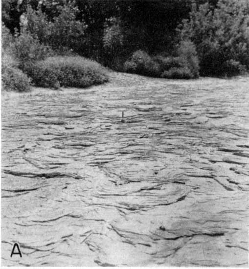
Plate 5B--Channel-filling sandstone of Silver Lake or Cedar Vale shale age, more than 30 feet thick, exposed in cut bank of Neosho River, SW sec. 18, T. 19 S., R. 13 E.
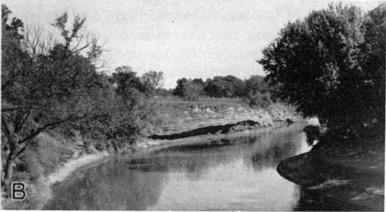
Plate 5G--Channel-filling limestone conglomerate (20 feet thick) of Silver Lake shale age cut into middle White Cloud shale; exposed in railroad cut, NE NE sec. 30, T. 19 S., R 13 E.
The conglomerate or detrital limestone consists of fragments of gray-and-yellow brown or buff limestone, similar to the Rulo and Happy Hollow limestones. Lithified shale fragments, coal, and fossil detritus including fusulinids, Osagia, bryozoans, and brachiopods occur in the bed also. The detritus ranges from sand size to pieces 1 foot or more in maximum length. Smith (1903, p. 99) named this conglomerate the Neosho limestone and gave its thickness as 30 to 40 feet in the vicinity of Neosho Rapids. Smith (1903, p. 99) states the limestone is "well exposed in the ravines to the north and northeast [of the railroad cut], and is also found 40 feet thick in a well at the foot of Chicago mound, five miles southwest of this locality."
Inasmuch as no single exposure was found in which one disconformity could be observed to cut out the Rulo limestone, Cedar Vale shale, Happy Hollow limestone, and part of the White Cloud shale, it is possible that there is a local disconformity in the Silver Lake shale, cutting just into the Cedar Vale shale and overlying an area in which the Happy Hollow has been removed by Cedar Vale erosion. This would mean a slightly older age for this thick congbomeratic limestone.
A few wells obtain small supplies of ground water from sandy parts of the Silver Lake shale and locally from the conglomerate at its base.
Rulo Limestone
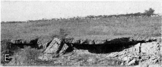
Measured sections of the Rulo limestone average 1.5 to 2 feet in thickness. It comprises a single massive bed of gray to brown-gray limestone which has rather widely spaced joints allowing it to break into large blocks. It becomes shelly on weathering, and makes little outcrop except in actively eroding areas such as along creeks and gullies (Pl. 5E). It contains Dictyoclostus, Neospirifer, and other brachiopods, crinoid, and echinoid fragments, Cryptozoon (?),a few snails and clams, and occasionally small horn corals. A feature distinctive of this limestone is the nodular or nobby appearance slightly weathered surfaces have, probably caused by slightly different weathering characteristics of the algal (?) and nonalgal parts of the limestone.
It is not important as a source of ground water.
Plate 5E--Typical shelly weathering of Rulo limestone, SE SE sec. 12, T. 19 S., R. 12 E.
Cedar Vale Shale
Gray, olive-green, and tan shale, sandy micaceous shale, and sandstone beds, together with the persistent Elmo coal which occurs a few inches or a few feet from the top, comprise the Cedar Vale shale. Average thickness is about 25 feet. Plant remains occur commonly in the sandy shale and shale parts. Locally where the formation is a nearly complete sandstone section, it yields small supplies of water to shallow wells from sandy zones. Elsewhere it yields little or no water to wells.
Happy Hollow Limestone
Measured sections of the Happy Hollow limestone range from about 2 to 10 feet in thickness. It is not observed in all outcrops of this part of the stratigraphic column, however. It is best developed in Ts. 20 and 21 S., where locally it makes a noticeable bench along its outcrop. It ranges from a hard, massive, brown, sandy limestone to a soft, silty or sandy, gray-green to pink-brown or buff limestone. Fossils include abundant large fusulinids and Osagia in most of its outcrops as well as crinoids, brachiopods, and pelecypods. In the area around Reading the limestone becomes thicker, has several shale partings, and contains few or no fusulinids.
It ordinarily yields little or no water to wells.
White Cloud Shale
The White Cloud shale consists of about 80 feet of gray, olive, and tan or buff shale, sandy shale, and sandstone. It contains few or no fossils in most outcrops except land plant remains. Locally, as in the SW sec. 35, T. 21 S., R. 12 E., the lower part contains numerous ocherous concretions filled chiefly with sphalerite.
The White Cloud yields little or no water to wells ordinarily and is not an important aquifer.
Howard Limestone
The thickness of the Howard limestone ranges from about 20 to 28 feet. It supplies small quantities of water to a few shallow wells, chiefly from joints and fractures in the limestones.
Utopia limestone member--The thickness of the Utopia limestone ranges from about 5 to 8 feet. It generally comprises three limestones separated by thin shales. The upper bed is a slightly shaly gray or gray-brown limestone having an "oatmeal" texture. It contains abundant fusulinids and Osagia as well as bryozoans, brachiopods, and crinoid fragments. The shale beds are gray, olive, or buff, the upper one sometimes containing small clams and ostracodes. The middle and lower limestones are gray to gray-brown, shelly or shaly limestones. Mollusks, Osagia, and bryozoans are the most abundant fossils.
Wimzeler shale member--The Winzeler shale comprises 5 to 7 feet of gray to tan shale. Most outcrops of Winzeler shale in Lyon County are very poorly exposed. No fossils were observed.
Church limestone member--The Church limestone is a distinctive easily recognized part of the Howard limestone. It ranges from about 1.8 to 2.3 feet in thickness and occurs as a single massive bed of deep-brown weathering, blue or blue-gray, brittle, hard limestone. Cryptozoon, crinoids, and brachiopods are the characteristic and abundant fossils. Fusulinids, bryozoans, and sparse mollusks are observed in a few outcrops.
Aarde shale member--The average thickness of the Aarde shale is about 7 feet. The upper part, comprising beds above the persistent Nodaway coal, is generally blue-gray or yellow-buff argillaceous shale. Locally a thin gray limestone 0.5 foot or less in thickness, containing Cryptozoon, crinoids, and brachiopods, occurs above the coal in this shale and is overlain by a few inches of black fissile shale. The Nodaway coal ranges from about 0.5 to 1 foot in thickness and generally occurs near the middle of the member but locally it may occur in the lower or upper part. The coal commonly is underlain by an underclay. Strata below the coal or undercbay consist of gray or tan sandy micaceous shale.
Bachelor Creek limestone member--The basal member of the Howard limestone comprises gray or blue-gray, very sandy limestone which weathers yellow brown. Fossils are not abundant in any of the outcrops but sparse crinoids, bryozoans, and brachiopod fragments are generally observed. Mollusks occur in some outcrops. The thickness of the Bachelor Creek limestone ranges from about 1.5 to 5 feet and averages about 3 feet.
Severy Shale
On the basis of partial and rather poor outcrops of the Severy shale observed in Lyon County, it is chiefly gray and tan shale, in part sandy and micaceous, together with beds of shaly sandstone. The formation has a thickness of about 65 to 80 feet. Sandy parts may yield small supplies of ground water to a few shallow wells.
Shawnee Group
Topeka Limestone
The Topeka limestone crops out in a small area along Eagle Creek. Of the nine named members of the formation only the lower two limestones are easily identified. The thickness of the formation is about 25 to 30 feet. The Coal Creek limestone member and Holt shale members are absent in Lyon County.
A few wells obtain small supplies of water from shallow wells in the Topeka limestone.
Du Bois limestone mernber--Silty or earthy gray limestone about 2 feet thick occurs in the uppermost part of the Topeka limestone and may represent the Du Bois limestone. It contains numerous clams including Myalina, Pinna, Aviculopectin, and Leda together with sparse snails, Linoproductus, and crinoid remains.
Turner Creek shale member--Shale beds thought to correlate with the Turner Creek shale comprise about 4 feet of gray clayey and calcareous shale, with a thin mudstone near the middle. Fossils were not observed in the member.
Sheldon limestone member--One exposure of light-gray to cream-weathering limestone mottled with brown probably represents the Sheldon limestone in Lyon County. It has a thickness of about 2 feet. Small clams were the only fossils observed.
Jones Point shale member--Greenish-gray shale beds about 1 foot thick probably represent the Jones Point shale member in this area.
Curzon limestone member--Interbedded limestone and limy shale 8 to 10 feet thick comprise the Curzon limestone. Abundant fusubinids throughout nearly the entire member make this limestone easily recognized. The fusulinids weather free in the shaly parts and are conspicuous along its outcrop. Bryozoans, echinoderm and crinoid fragments, several species of brachiopods, and Osagia occur in parts of the limestone also.
Iowa Point shale member--No shale beds correlatable with the Iowa Point shale in its type area are believed present in Lyon County. The Curzon limestone directly overlies the Hartford limestone.
Hartford limestone member--The lowermost member of the Topeka limestone is represented by 6 to 9 feet of light-gray to nearly white brecciated-appearing uneven-bedded limestone with brown limonitic or ocherous stains on fractures and as replacement material of fossils. Darker gray, dense, nonbrecciated limestone occurs in the lowermost part and contains conspicuous Cryptozoon algae. Together with the Curzon limestone it makes a prominent bench in the topography.
Calhoun Shale
Only a few feet of the upper part of the Calhoun shale crops out in Lyon County. It comprises chiefly sandy micaceous olive to gray shale and sandstone containing carbonized plant remains.
It yields small supplies of water to a few wells.
Prev Page--Stratigraphy--Permian || Next Page--Mineral Resources--Outcropping Rocks
Kansas Geological Survey, Lyon County Geohydrology
Web version Sept. 2001. Original publication date March 1953.
Comments to webadmin@kgs.ku.edu
The URL for this page is http://www.kgs.ku.edu/General/Geology/Lyon/pt1_penn.html