![]()
Prev Page--Table of Contents || Next Page--Stratigraphy--Quaternary
Part 1--Rock Formations of Lyon County
by Howard O'Connor
Introduction
This is the second of a series of reports on the stratigraphy, economic geology, and ground-water resources of eastern Kansas counties, consisting primarily of maps (Pls. 1, 2, and 3 of printed volume), but containing brief descriptive stratigraphy and discussions of minerals and ground-water resources.
Location and Geography
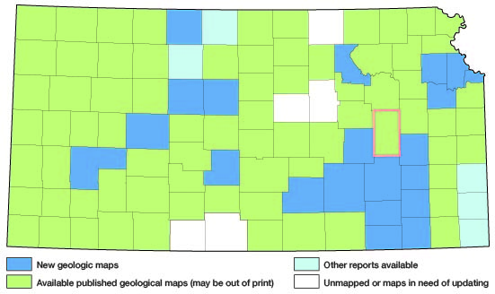
Lyon County is located in central eastern Kansas (fig. 1). It is bordered on the north by Wabaunsee County, on the east by Osage and Coffey counties, on the south by Greenwood County, and on the west by Chase and Morris counties. It contains about 23 2/3 townships and has an area of about 852 square miles.
Figure 1.--Index map of Kansas showing area described in this report and areas covered by other geologic maps, as of Feb. 2001. For additional information, the KGS Geologic Maps of Kansas Page.
The population of Lyon County is 26,576 (1950 census). Emporia, the county seat, has a population of 15,669 (1950 census). Other city population figures, according to the 1950 census, are: Admire, 181; Allen, 241; Americus, 339; Bushong, 93; Hartford, 395; Neosho Rapids, 204; Olpe, 293; and Reading, 289.
Land surfaces in Lyon County range from approximately 1,050 to 1,450 feet above sea level. Physiographically the area is a part of the Osage Cuesta Plains section of the Central Lowlands province. Schoewe (1949) describes the main topographic features as the Osage Cuesta Plains and the Flint Hills Upland. Most of Lyon County is drained by the Cottonwood-Neosho River system, but smaller parts are drained by the Marais des Cygnes and Verdigris rivers.
Field Work
The field work on which this report is based was done by me during parts of 1948, 1949, and 1950. I was assisted at various times by Raymond K. Mann, James Keller, and Ralph E. O'Connor. Areal geology was mapped on aerial photographs (scale 1:20,000). Rock sections were measured in detail, using a rule, Locke level with stadia, and telescopic level with a 12-foot rod.
Previous Geologic Work
The earliest geologic map and report on the geology of Lyon County were published by Smith (1903). Earlier Haworth and Kirk (1894) published a geologic section along the Neosho and Cottonwood rivers across the county. The sequence of rocks that crop out in Lyon County and adjacent areas has been described in several publications (Prosser, 1895; Smith, 1901; Wooster, 1915; Moore, 1936, 1949; Elias, 1937; Schoewe, 1946, 1951; Mudge and Burton, 1950; Moore, Jewett, and O'Connor, 1951; Jewett and O'Connor, 1951; O'Connor and Jewett, 1952).
The subsurface geology has been described by McClellan (1930), and by Lee and others (1946). Mineral resources were described briefly by Landes (1937).
Acknowledgments
Residents of the area were very cooperative in allowing access to their land, supplying information about their wells and quarries, and permitting test drilling on their land and pumping tests on their wells.
Special thanks are expressed to Paul Fairchild, Weldon Julander, George Galensen, George Emrich, and the late W. D. Jones for time spent and aid in study of stratigraphic problems. Appreciation is expressed to Hazen Bledsoe and C. W. Kippy, drillers, for information on several water wells in the area.
Prev Page--Table of Contents || Next Page--Stratigraphy--Quaternary
Kansas Geological Survey, Lyon County Geohydrology
Web version Sept. 2001. Original publication date March 1953.
Comments to webadmin@kgs.ku.edu
The URL for this page is http://www.kgs.ku.edu/General/Geology/Lyon/pt1_strat.html