![]()
Plates
- Plate I—Geologic section from Galena to Grenola.
- Available as an Adobe Acrobat file, 2 MB
- Plate II—Geologic section from Fort Scott to Reece.
- Available as an Adobe Acrobat file, 1.8 MB
- Plate III—Geologic section from Baxter Springs to White Cloud.
- Available as an Adobe Acrobat file, 4.3 MB
- Plate IV—Geologic section from Kansas City to Topeka.
- Available as an Adobe Acrobat file, 1.3 MB
- Plate V—Geologic section from Atchison to Barnes.
- Available as an Adobe Acrobat file, 1.3 MB
- Plate VI—Generalized section of coal measures.
- Available as an Adobe Acrobat file, 1.9 MB
- Plate VII—A Map Showing Limestone Outcroppings.
- Available as an Adobe Acrobat file, 17 MB
Plate VIII—A Coal Map of Kansas
This Coal Map is designed to show how the coal bearing formations of Kansas pass under each other to the west. To understand the map properly the reader should cut out the portions in white from each of the first five leaves, so that the colored parts only remain. In that way the borders will fall in proper places so that each individual sheet will represent one formation passing under those above it. The decrease in intensity of shading represents the decreasing probability of finding coal in anyone of these formations by prospecting for it to the west of the areas where it is exposed to the surface.
Plate IX accompanies Plate VIII and represents the coal bearing area in the Cretaceous rocks of north central Kansas. The heavy lines bound the surface exposures of the Dakota formation and the shaded areas within locate the Cretaceous coal.
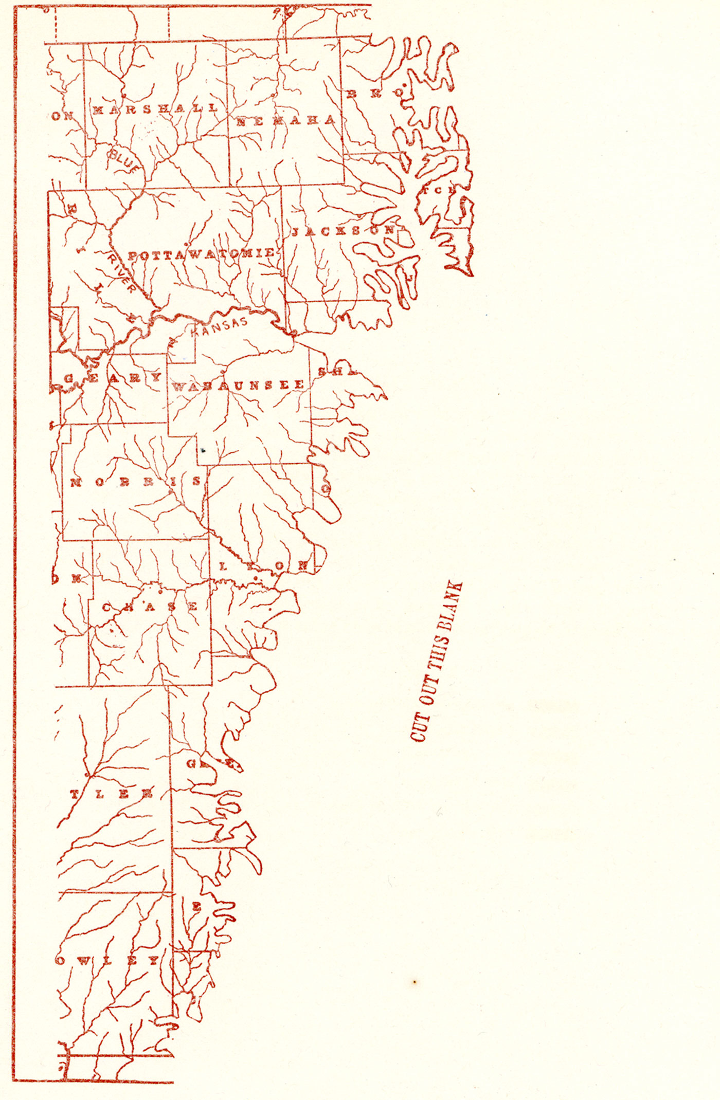
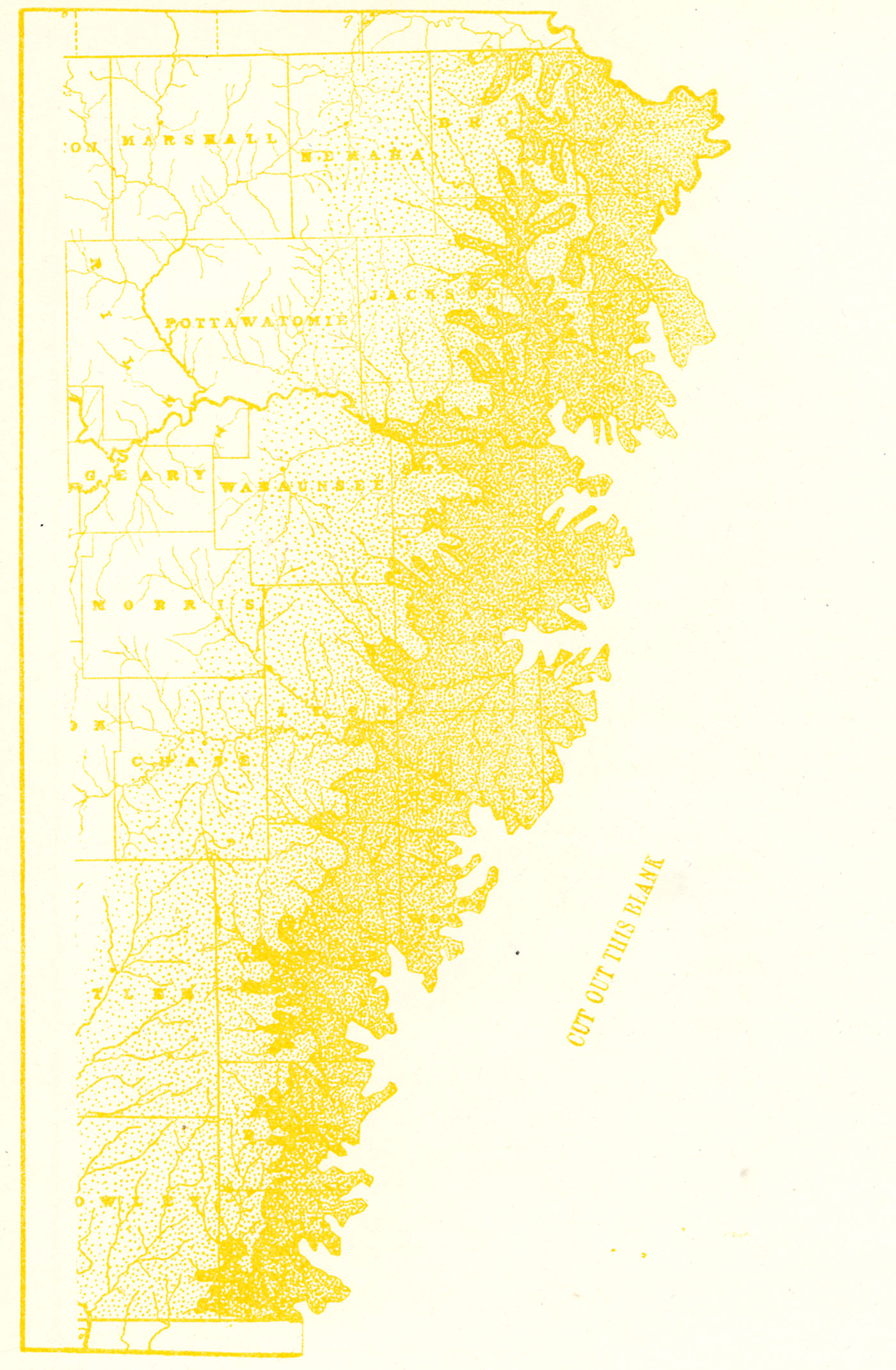
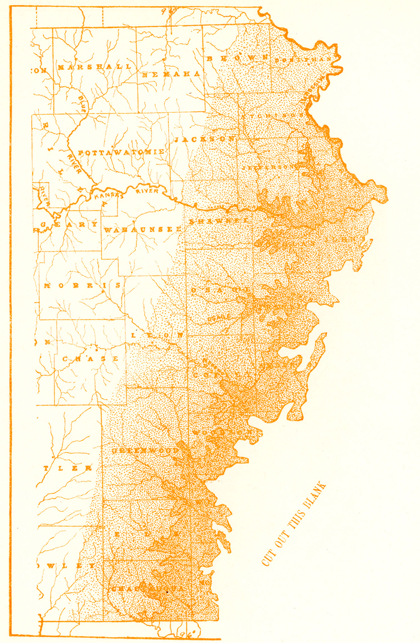
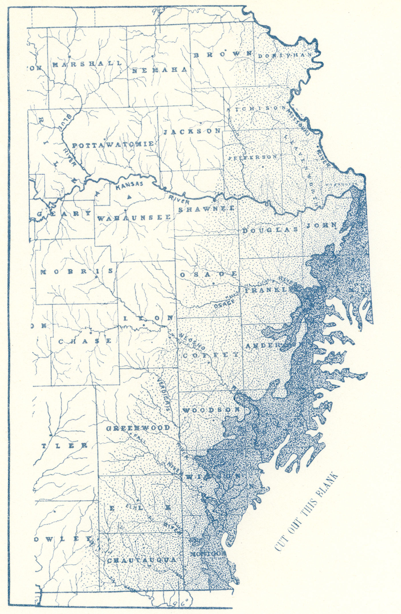
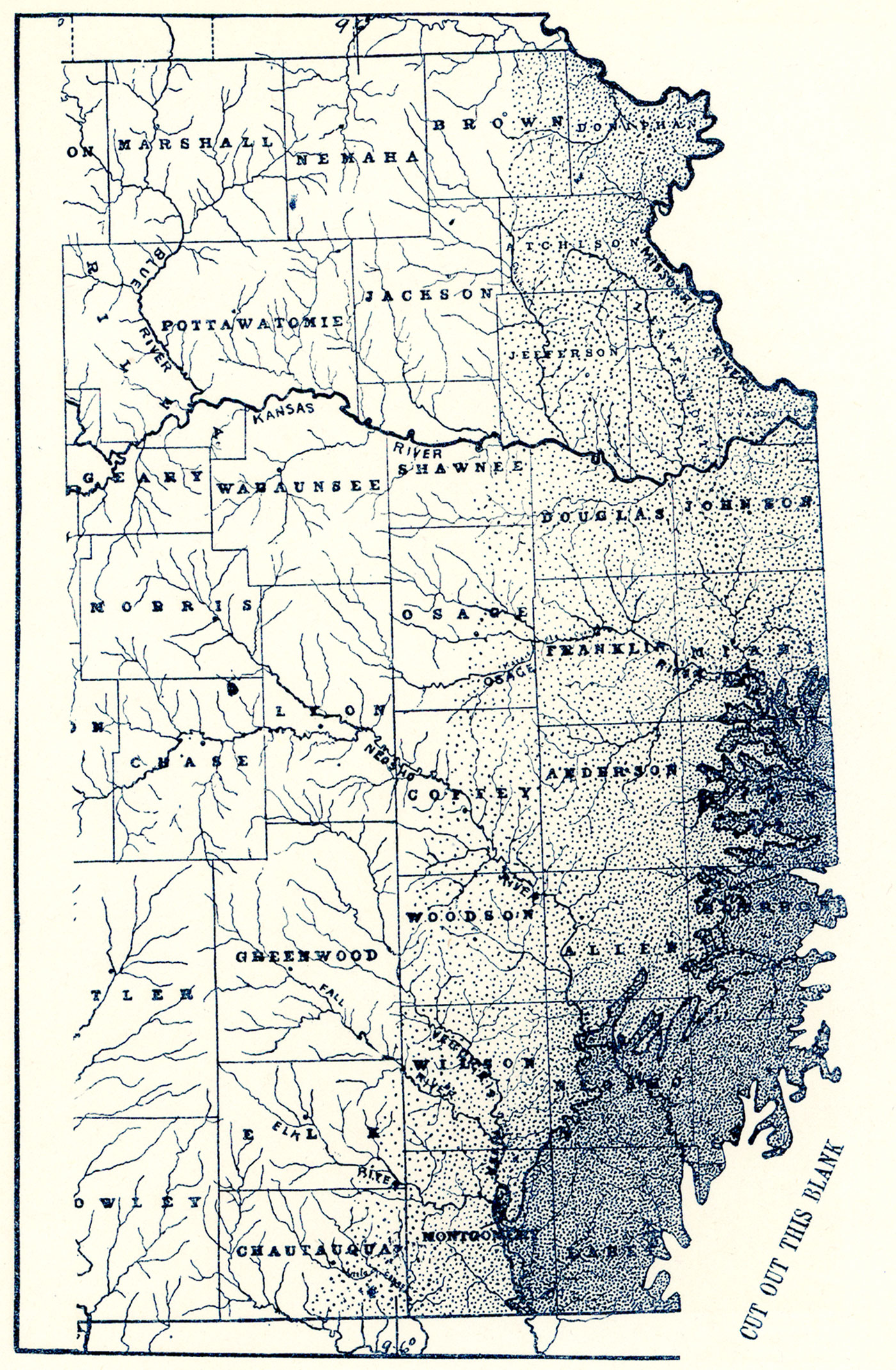
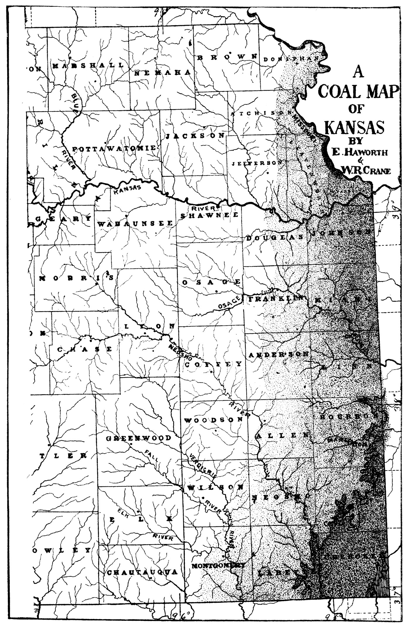
Plate IX—Coal Map of the Dakota Cretaceous. The heavy lines limit the Dakota areas, and the shaded parts show the locations of coal.
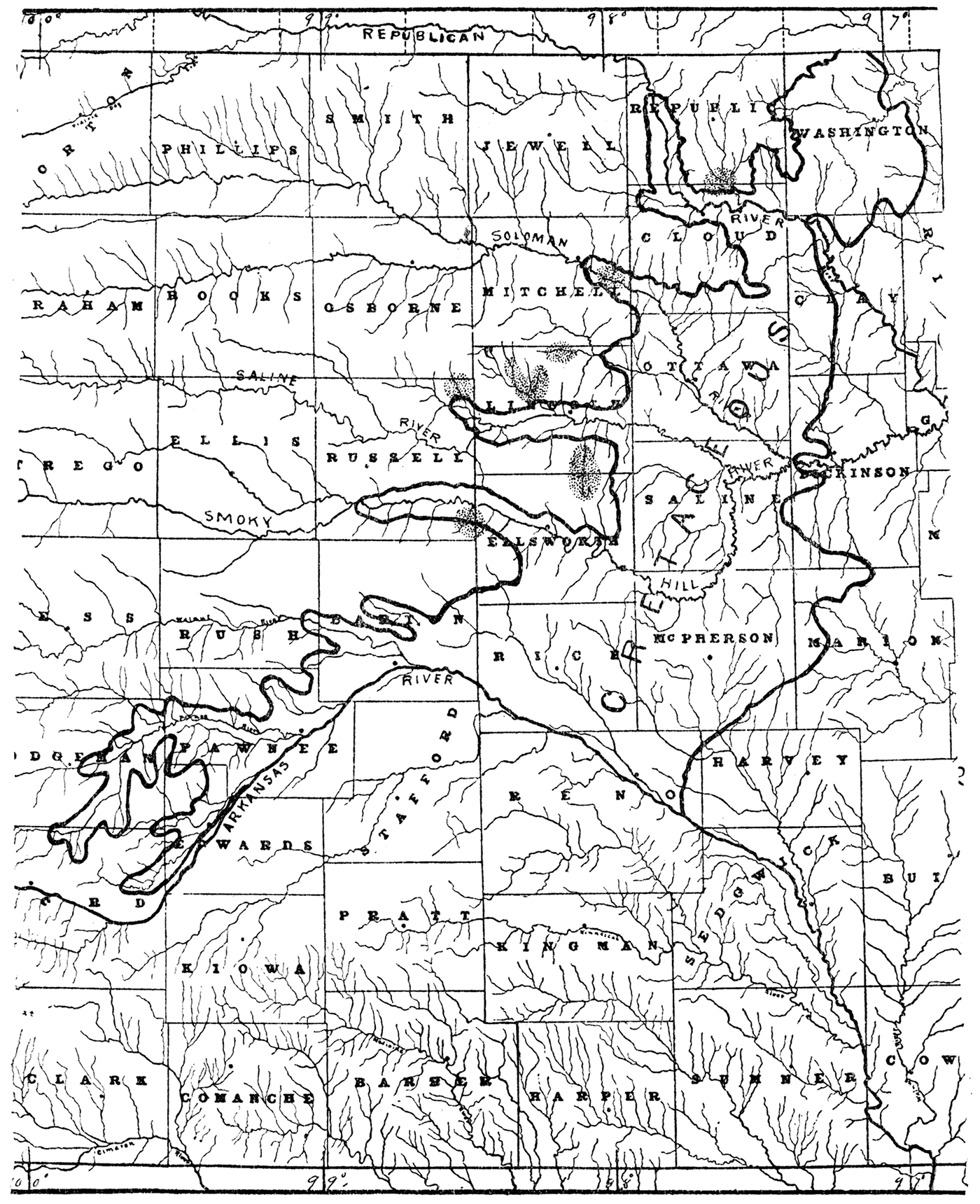
Plate X—Mound Valley Limestone. Hill northwest of Mound Valley. (Photographed by Adams, 1894.)
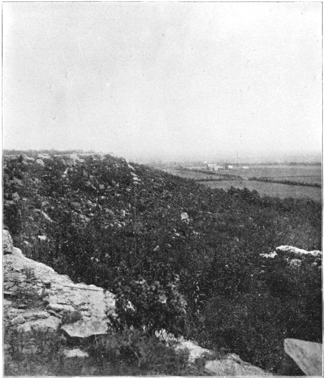
Plate XI—Verdigris River and Independence Limestone. Independence. (Photographed by Adams, 1894,)
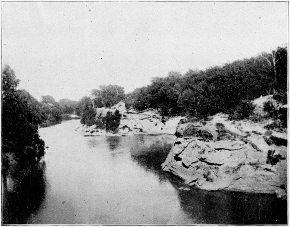
Plate XII—Mound south of Cherryvale capped with Independence Limestone. (Photographed by Haworth, 1894.)
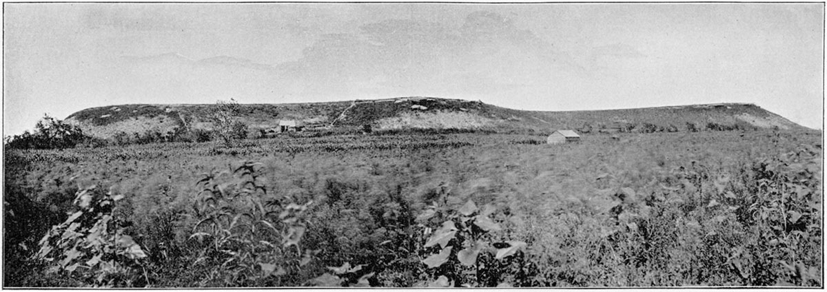
Plate XIII—Surface exposure of Independence Limestone. Southwest of Cherryvale. (Photographed by Adams, 1891,)
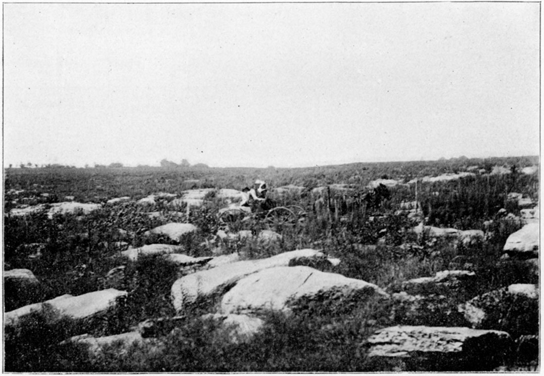
Plate XIV—Hill north of Cherryvale capped with Independence Limestone. (Photographed by Haworth, 1894,)
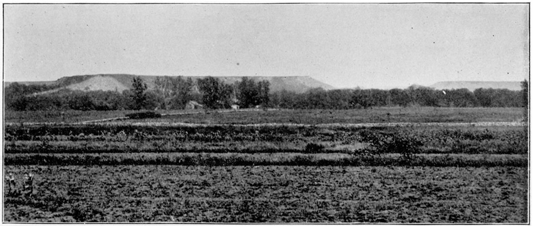
Plate XV—Hill capped with Independence Limestone. North of Cherryvale. (Photographed by Adams, 1894.)
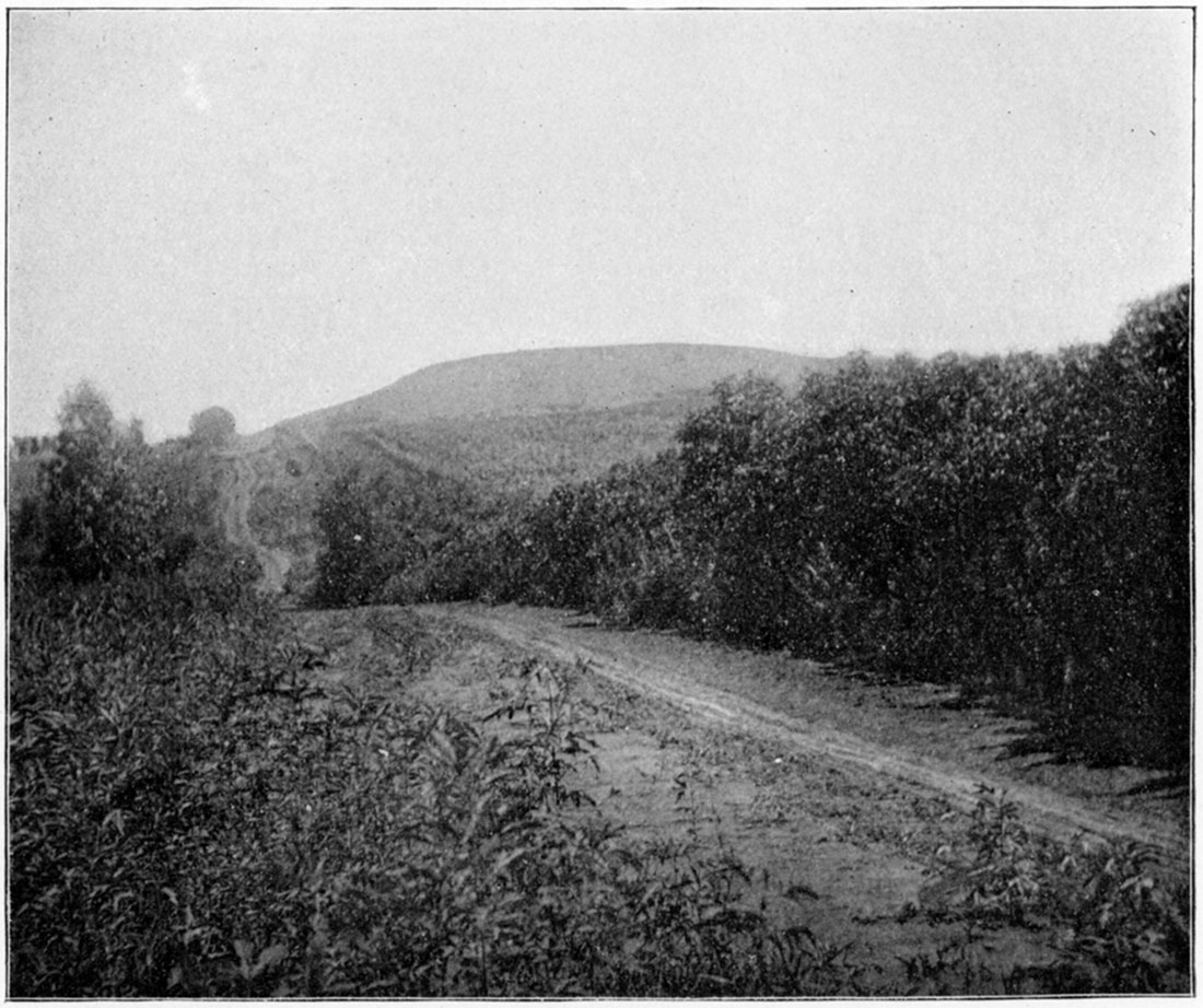
Plate XVI—Table Mound, near Independence, capped with Iola Limestone. (Photographed by Adams, 1894.)
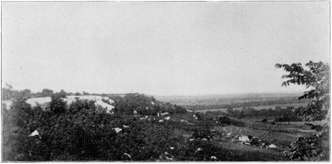
Plate XVII—Table Mound, near Independence, capped with Iola Limestone. (Photographed by Adams, 1894.)
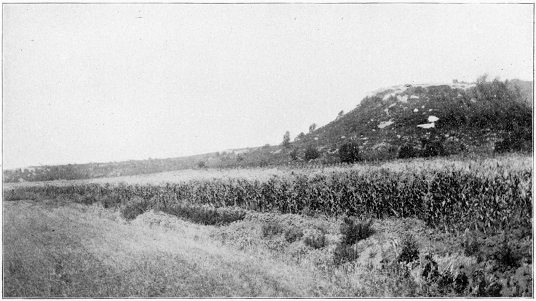
Plate XVIII—Kansas River scene, Lawrence. (Photographed by Stevens, 1894.)
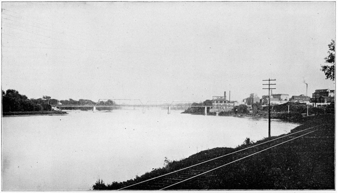
Plate XIX—Chautauqua Sandstone along the Wakarusa. (Photographed by Marcy, 1896.)
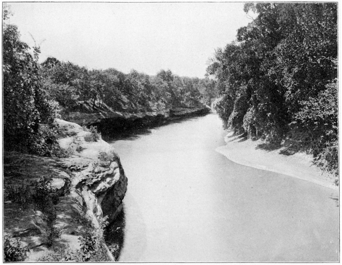
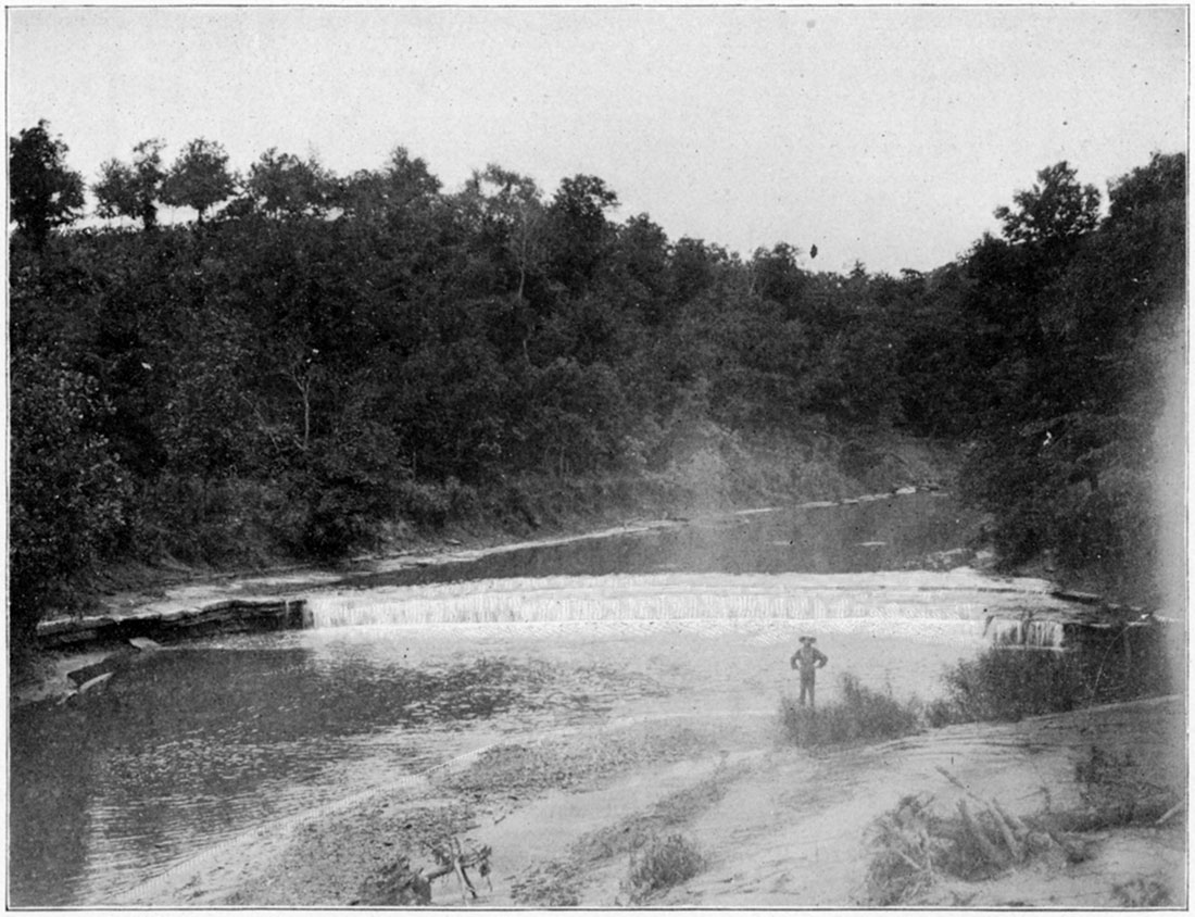
Plate XX—Osage Shales and inclosed thin limestone, Cedar Falls. (Photographed by Riederer, 1898.)
- Plate XXI—Record of a deep well at Oswego, Labette County. Record of Mound Valley Artesian Well, Labette County.
- Available as an Adobe Acrobat file, 877 KB
- Plate XXII—Record of Cherryvale City Well, Montgomery County. Record of the Neodesha Well, Wilson County.
- Available as an Adobe Acrobat file, 1.3 MB
- Plate XXIII—Record of Humboldt Well No. 1, Allen County. Record of Well at La Harpe, Allen County.
- Available as an Adobe Acrobat file, 1 MB
- Plate XXIV—Record of the Niotaze Well, Chautauqua County. Record of the Fredonia Well, Wilson County.
- Available as an Adobe Acrobat file, 923 KB
- Plate XXV—Record of the Fall River Well. Record of a Well at Chanute, Neosho County.
- Available as an Adobe Acrobat file, 951 KB
- Plate XXVI—Record of the Penitentiary Coal Shaft, Leavenworth City Well and Lansing Coal Shaft.
- Available as an Adobe Acrobat file, 1.1 MB
- Plate XXVII—Record of Topeka Well. Record of a Deep Well at Lyndon, Osage County.
- Available as an Adobe Acrobat file, 2.3 MB
- Plate XXVIII—Record of a Deep Well at Emporia, Lyon County.
- Available as an Adobe Acrobat file, 1.3 MB
- Plate XXVIII—Record of a Deep Well at Emporia, Lyon County.
- Available as an Adobe Acrobat file, 1.3 MB
- Plate XXIX—Record of a Deep Well at Toronto, Woodson County. Record of a Deep Well at Howard, Elk County.
- Available as an Adobe Acrobat file, 1 MB
- Plate XXX—Record of McFarland Well.
- Available as an Adobe Acrobat file, 1.2 MB
Plate XXXI—Section through Arcadia.
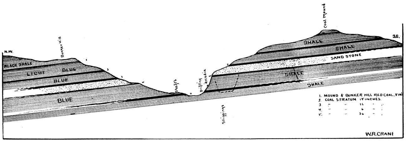
Plate XXXII—Intersection of Horsebacks 1 and 2, as seen in Nesch Brick Yards, Pittsburg. (Photographed by Crane, 1897.)
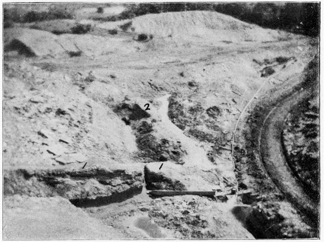
Plate XXXIII—Intersection of Coal and Horseback, as seen in Mine in Weir City. (Photographed by flash light by Crane, 1897.)
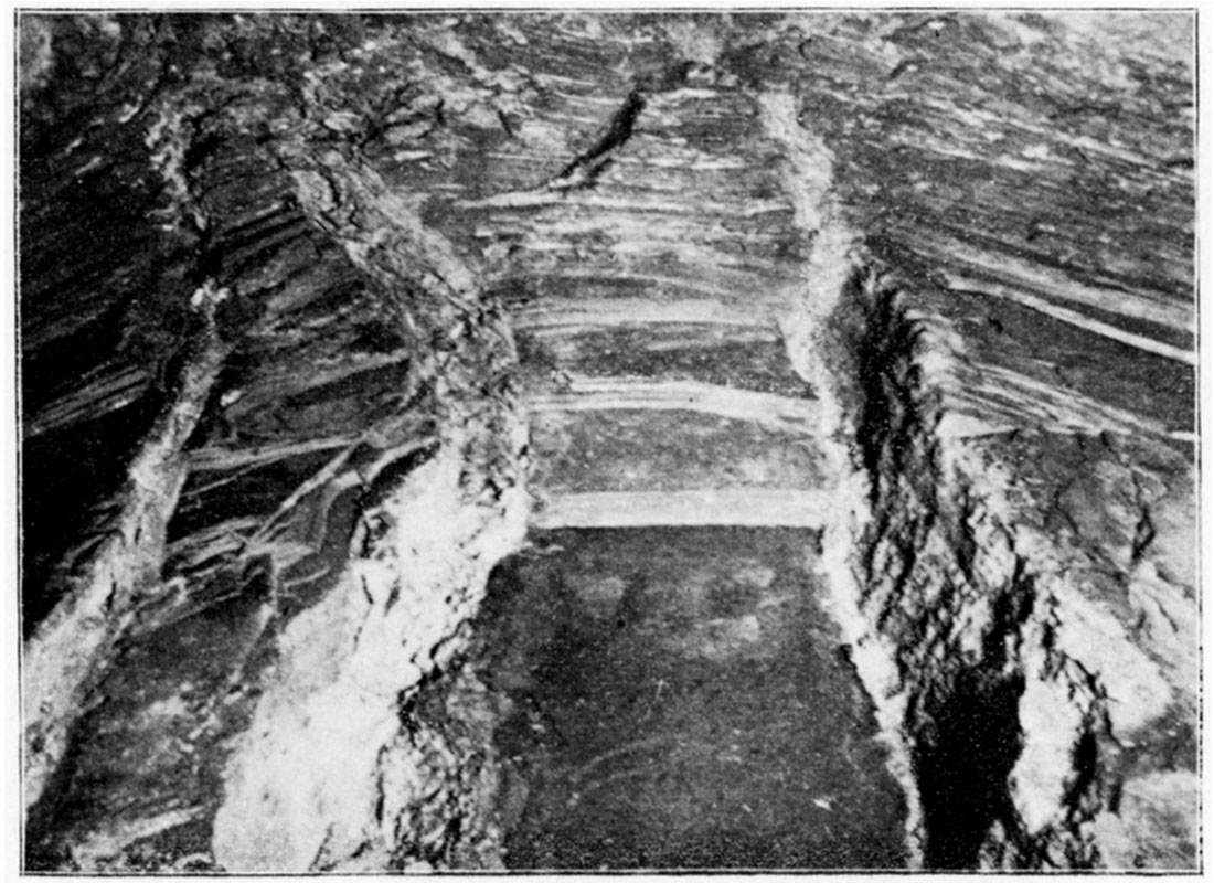
Plate XXXIV—Plan of long wall system of mining.
Heavy solid lines represent entries, hauling roads, and air passages; light solid lines and broken lines represent new and old rooms; numbered dotted lines represent faces of coal at different stages of the growth of mine. Arrows represent direction of air currents and show method of ventilation. This plate represents the system of long wall mining by advancing, that is, the coal is removed, wholly, as the face of the coal advances.
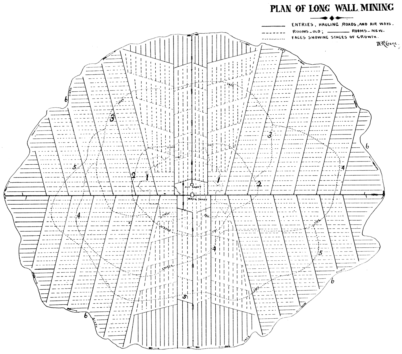
Plate XXXV—Vertical section and horizontal plan of long wall system of mining.
The black represents the coal; the cross-hatched, worked-out portions of mine; open spaces, entries and air passages; and the arrows represent air currents. In the vertical section, the entry is seen open in the middle of section; the opening for mining operations and air passage is seen next to face of coal at the left-hand side. The gob or wall-packing is also shown in the vertical as well as horizontal section and plan.
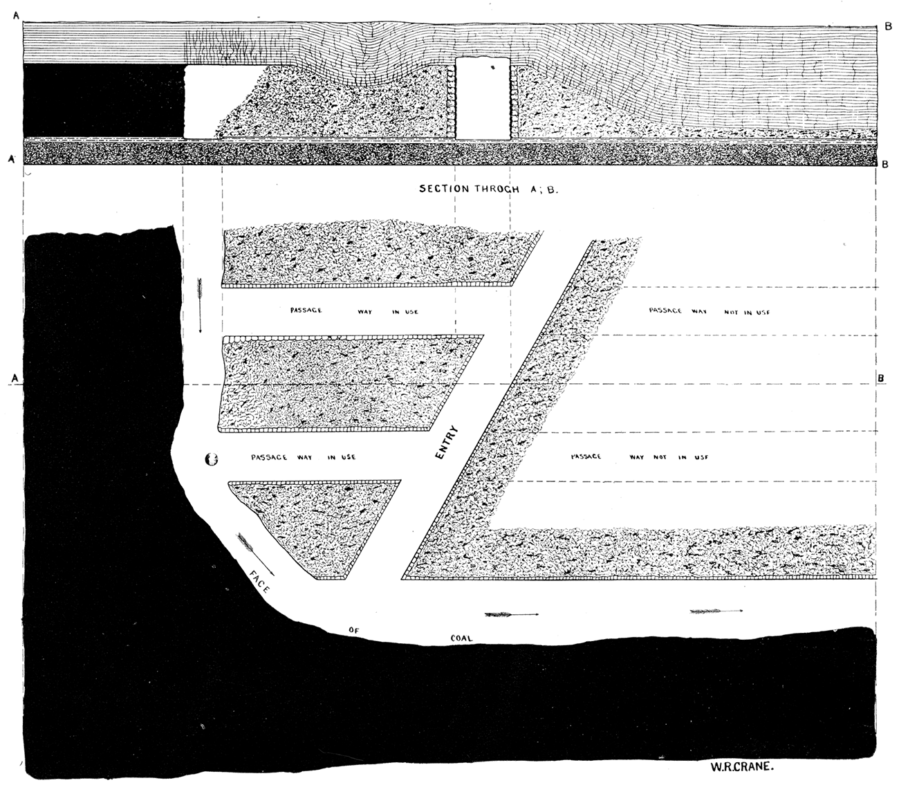
Plate XXXVI—Double entry method-room and pillar system.
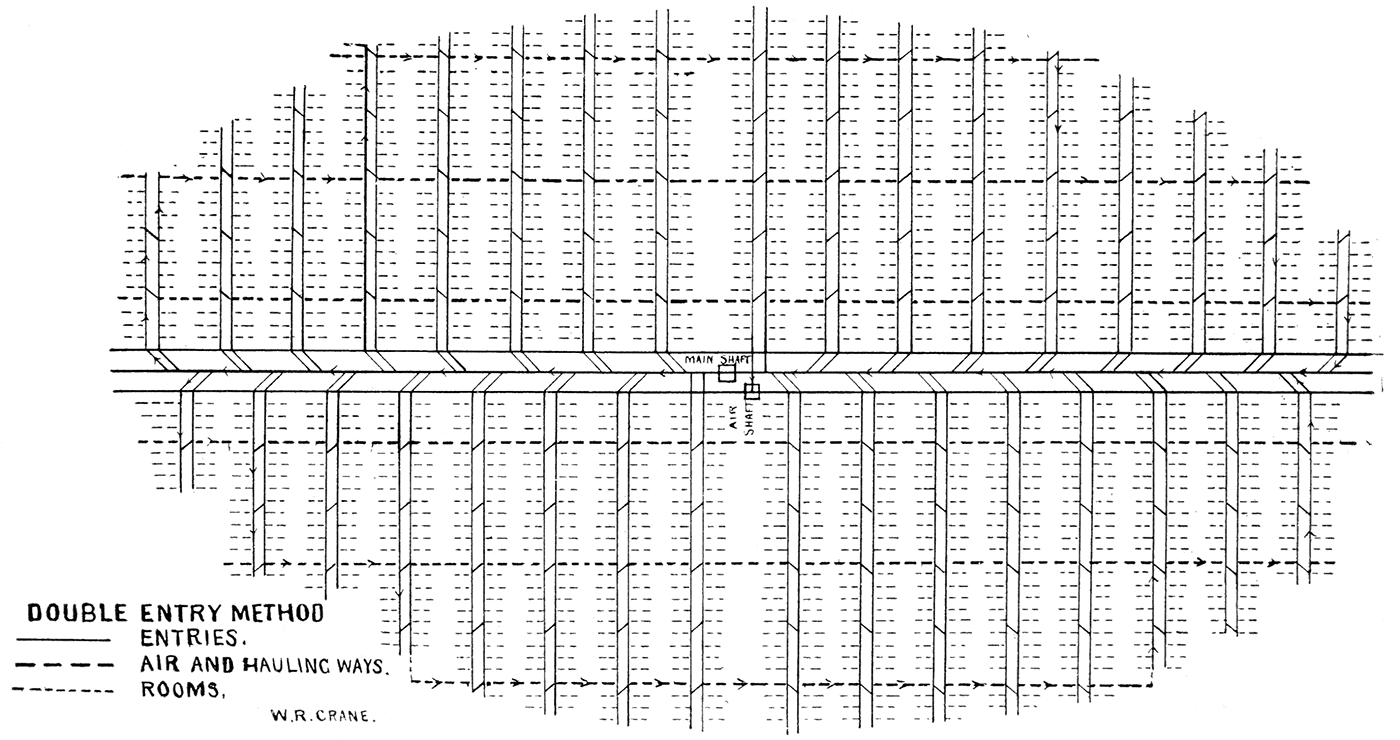
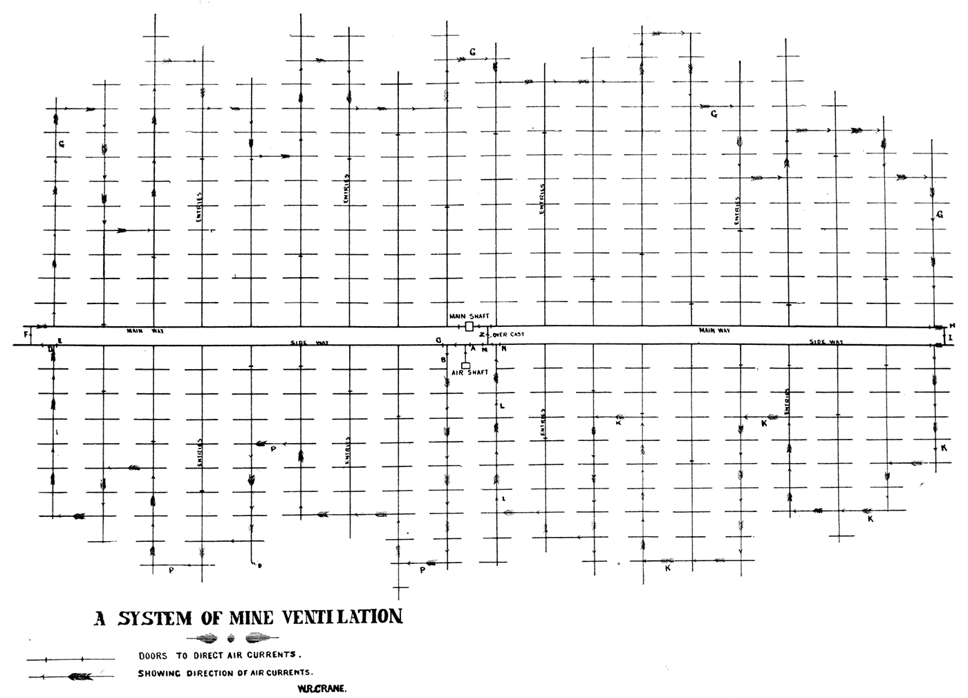
Plate XXXVII—Plan of single entry method, room and pillar system, showing system of mine ventilation.
- Plate XXXVIII—A plan of room and piller system of mining, double entry method.
- Available as an Adobe Acrobat file, 3.4 MB
- Plate XXXIX—Vertical section and horizontal plan of a small portion of a room and pillar working showing a horseback intersecting the coal and accompanying strata.
- Available as an Adobe Acrobat file, 3.3 MB
Plate XL—Old strip pit, Pittsburg. (Photographed by Crane, 1897.)
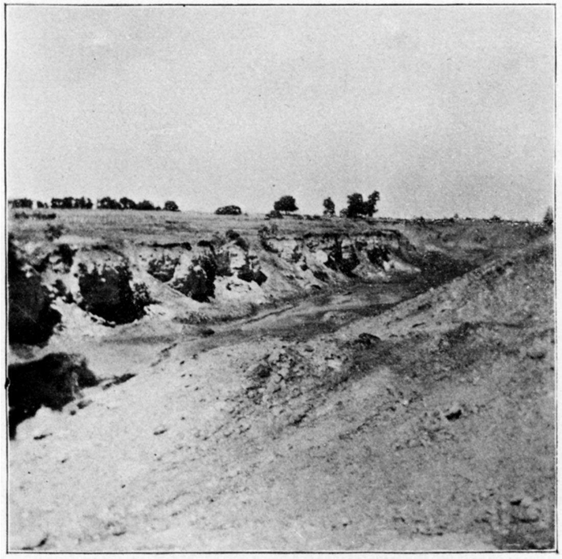
Plate XLI—Strip pit mining, Scammon. (Photographed by Crane, 1897.)
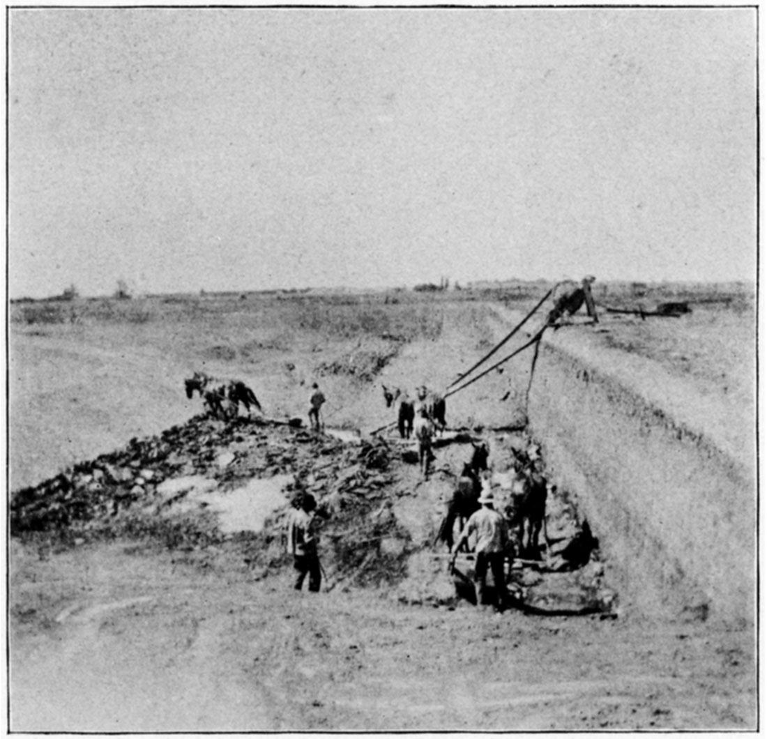
Plate XLII—Drift-slope mine in clay pits, Nesch Brick Yards, Pittsburg. (Photographed by Crane, 1897.)
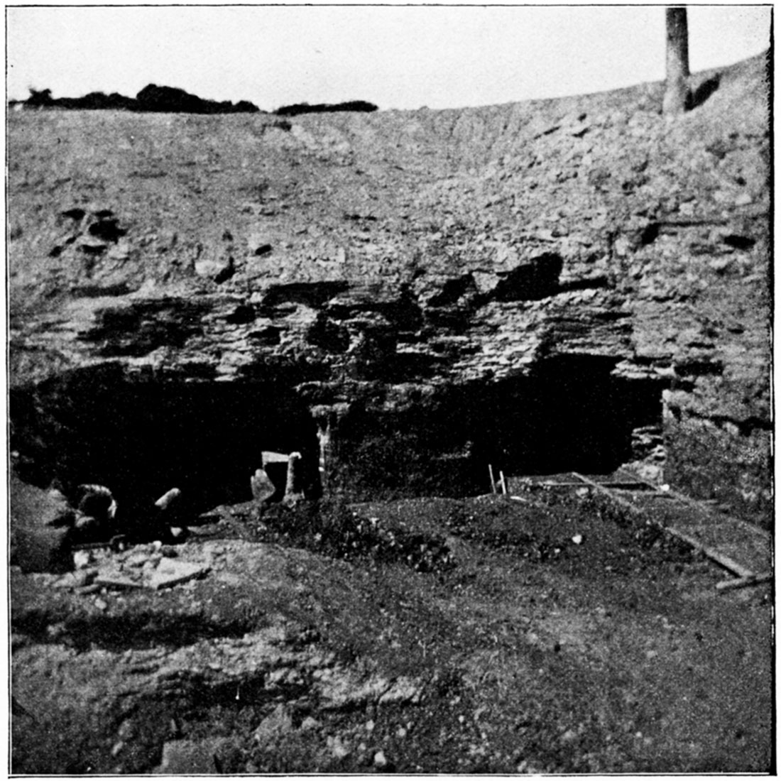
Plate XLIII—The Carr electric coal mining machine, showing cutting wheel.
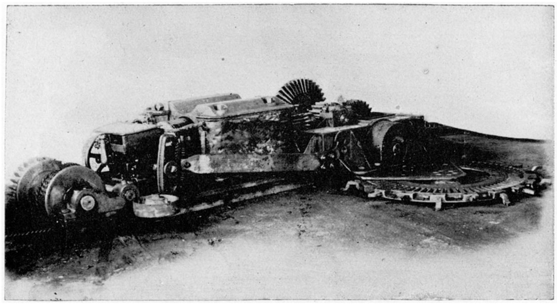
Plate XLIV—The Carr electric coal mining machine, front view, showing winding reel for cable.
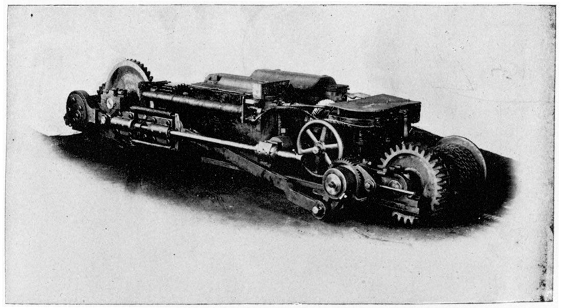
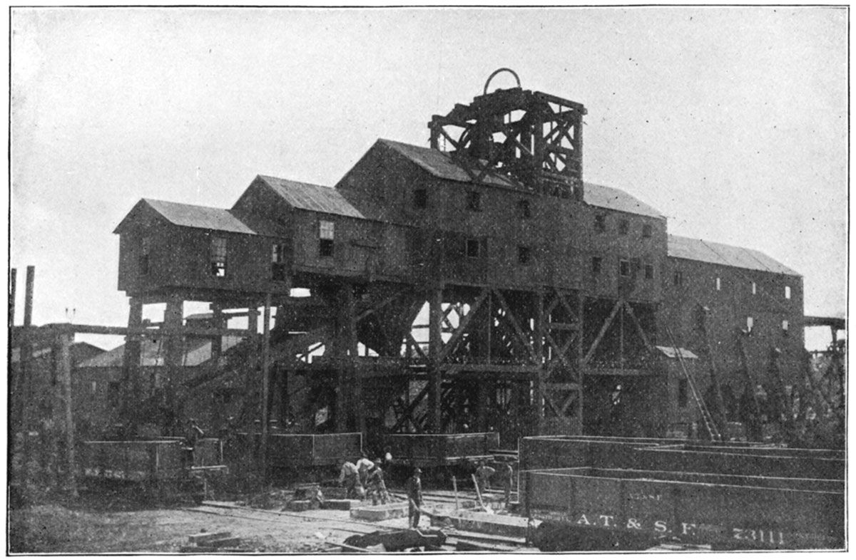
Plate XLV—Top Works of Typical Shaker Shaft.
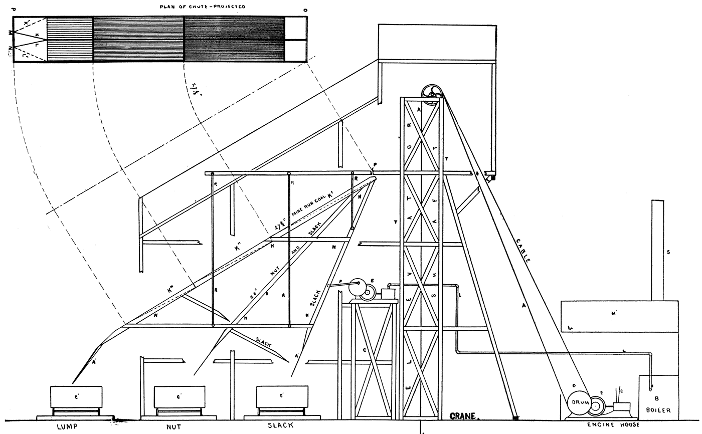
Plate XLVI—The Crawford and McCrimmon double hoisting engine.
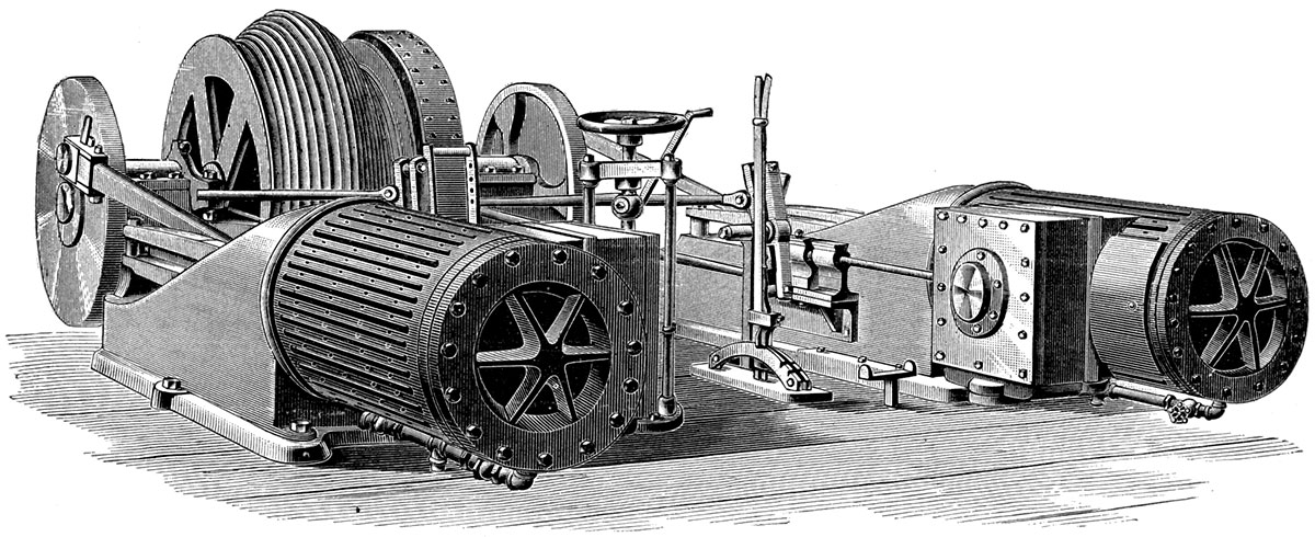
Plate XLVII—Typical parallel screen shaft.
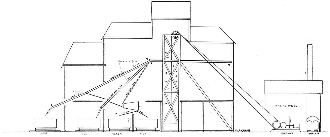
Plate XLVIII—Revolving screen, showing the sorting of coal, as generally used in the coal mines of the state.
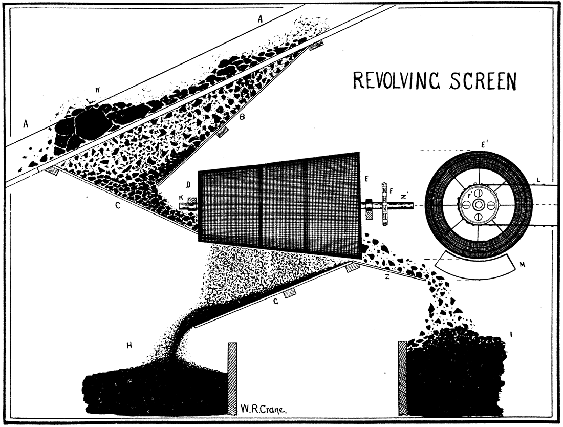
Plate XLIX—Steam strip-pit pumps, as generally used to remove water from pits about Pittsburg and Weir City.
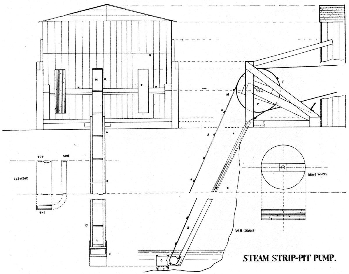
Plate L—Team strip pit pump, Weir City. (Photographed by Crane, 1897.)
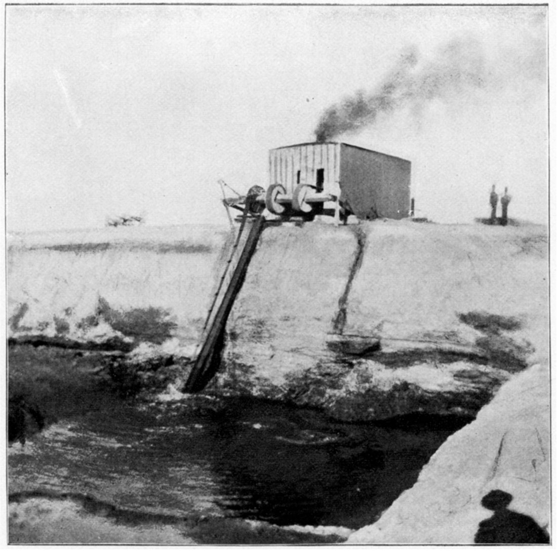
Plate LI—Fan House, as seen at mine near Weir City. (Photographed by Crane, 1891.)
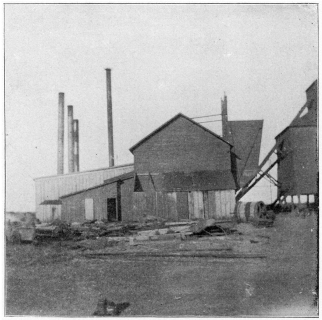
Plate LII—Diagrams showing decrease in percent of fixed carbon in coal of the state.
The percent of fixed carbon is marked off at the bottom of the chart, and the distance in miles on the sides. The percent of fixed carbon found in the coals of a certain locality with the distance in miles of the locality from an initial or starting point, give the means of platting the curves or diagrams. No. 1 shows the decrease in value of coals in passing from Columbus on the south to Cloud county on the north. No,2 shows the decrease in value of coals in passing from Pittsburg on the east to Cloud county on the west.
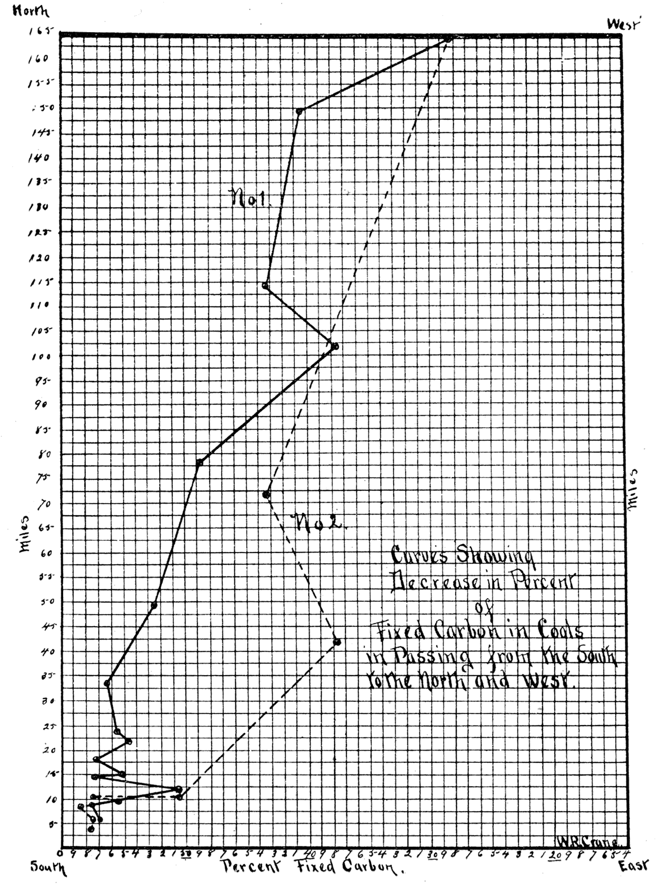
Plate LIII—Diagrams showing decrease in percent of calorific power of coals of the state.
The percent of calorific power, or the number of pounds of water evaporated per pound of coal burned, is marked off at the bottom of the cbart, the distance, in miles, of the locality on the sides, from an initial or starting point, give the means of platting the curves or diagrams. No. 1 shows the decrease in heat producing value of coals in passing from Columbus on the south to Leavenworth on the north. No. 2 shows the decrease in value in passing from Pittsburg on the east to Osage City on the west.
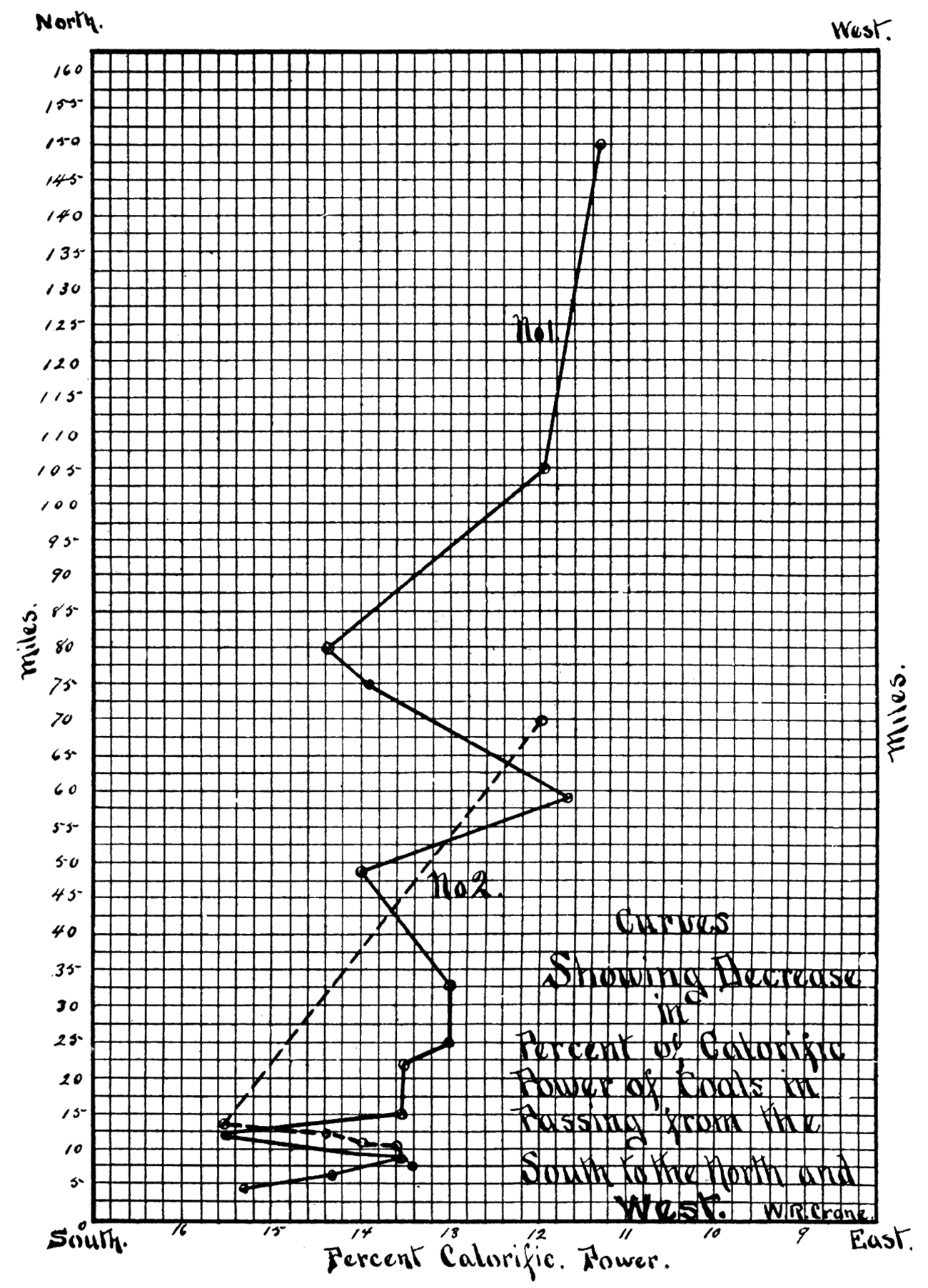
Plate LIV—Mine of Central Coal and Coke Company, near Weir City. (Photographed b, Crane, 1897.)
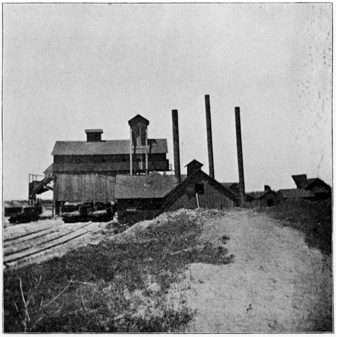
Plate LV—Coking oven, Weir City. (Photographed by Crane, 1897.)
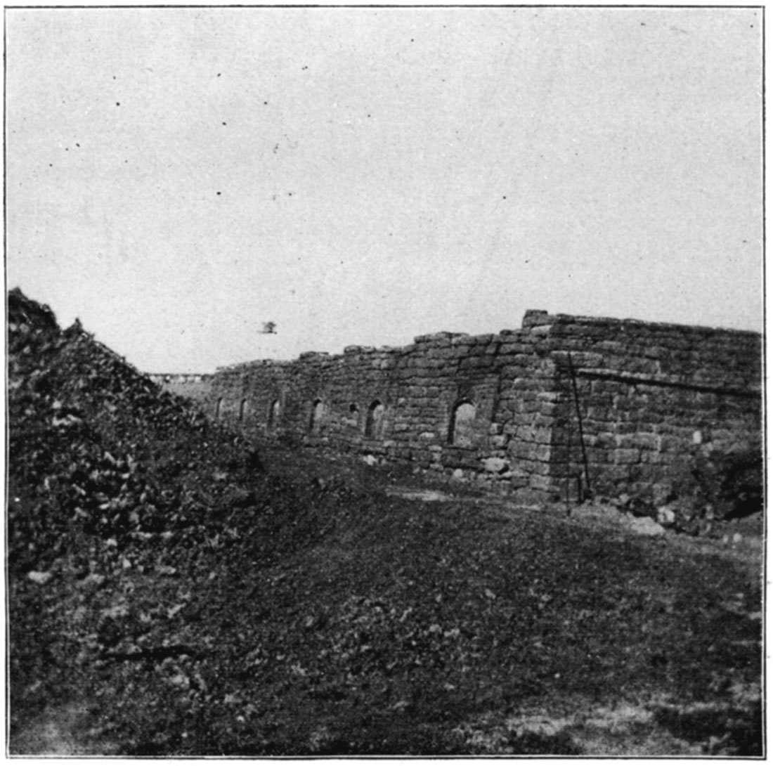
Plate LVI—Drift Slope Mine, Weir City. (Photographed by Crane, 1897,)
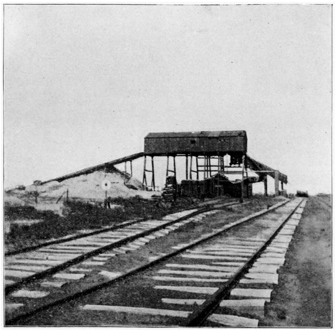
Plate LVII—Coke Washing Plant, Weir City. (Photographed by Crane, 1897.)
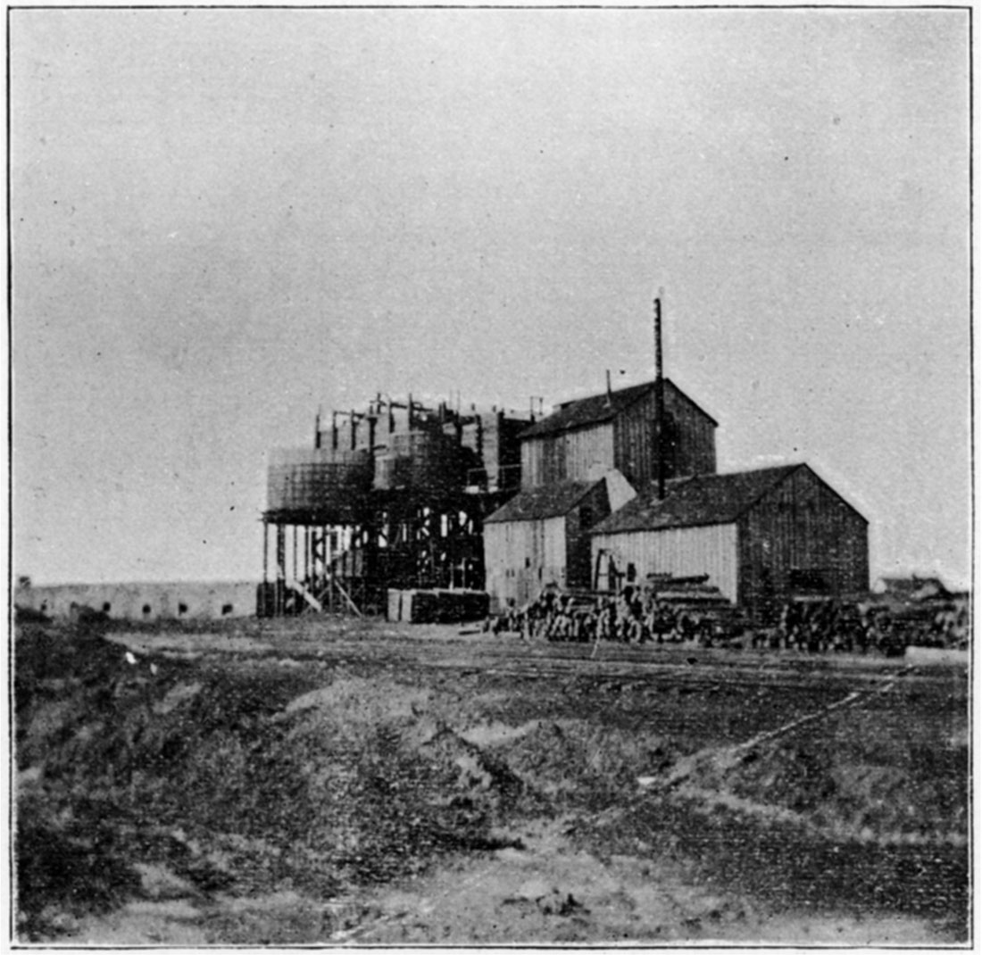
Plate LVIII—Entrance to drift slope mine, Weir City. (See Plate LVI.) (Photographod by Crane. 1897.)
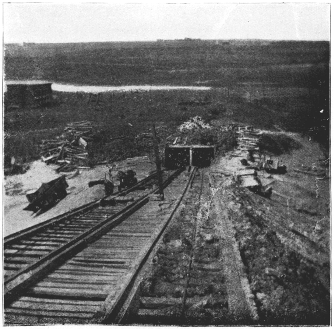
Plate LIX—Small power shaft near Pittsburg. (Photographed by Crane, 1897.)
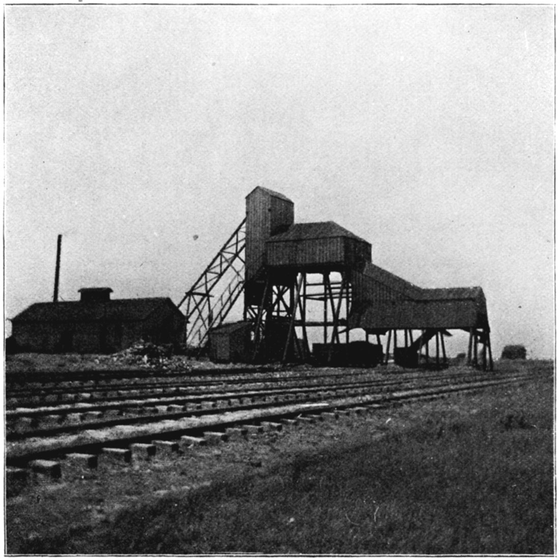
Plate LX—Folding of strata as seen in clay pits, at Nesch Brick Works, Pittsburg. (Photographed by Crane, 1897)
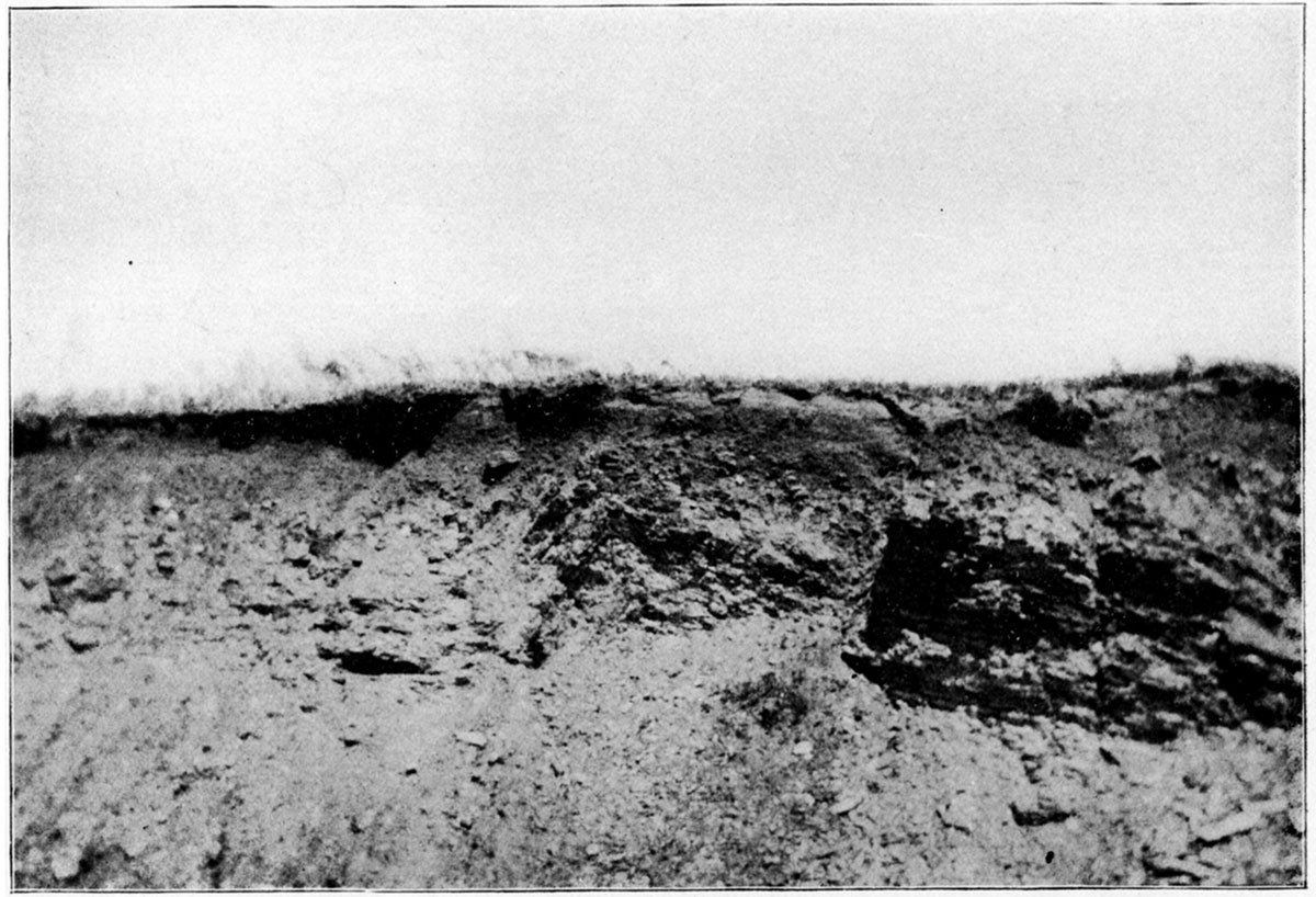
Plate LXI—M. K. & T. coal mine, at Mineral City. (Photographed by Crane, 1897.)
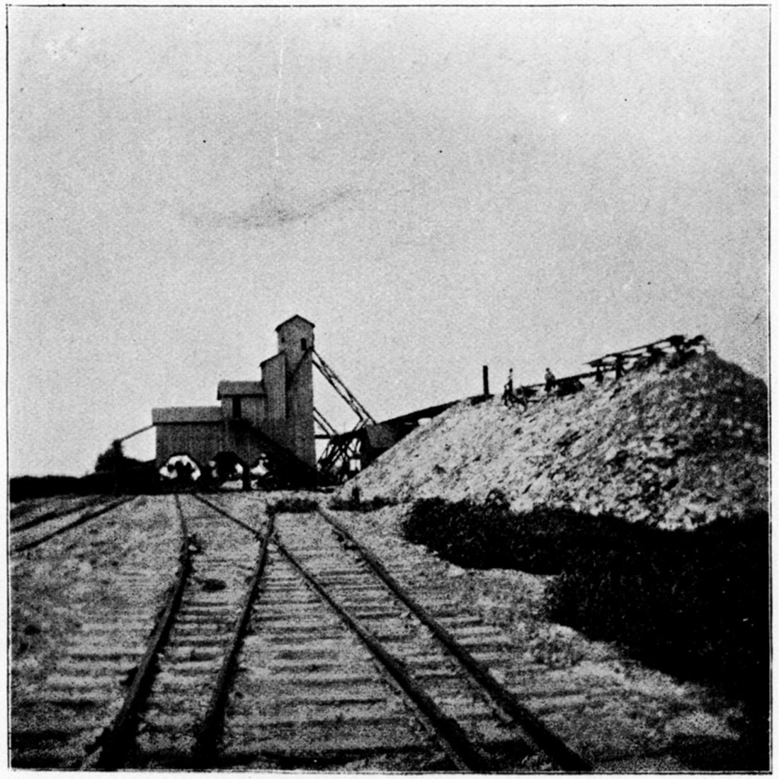
Plate LXVI—Home-Riverside Coal Mining Company, Plant No. 2, Leavenworth. (Photographed by Crane, 1897.)
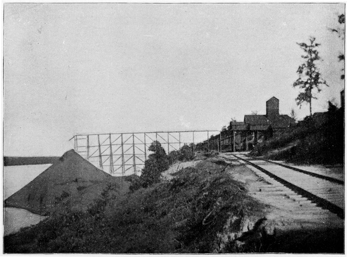
Plate LXVII—Leavenworth Coal Company's Mine, Leavenworth. (Photographed by Crane, 1897.)
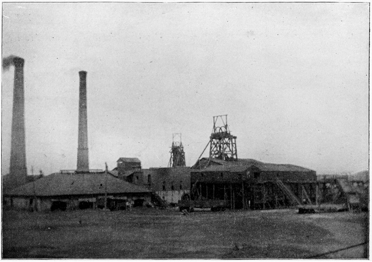
Plate LXVIII—Annual output and value of coal, from 1880 to 1897, inclusive. The output is represented by the solid black, and value by the open spaces.
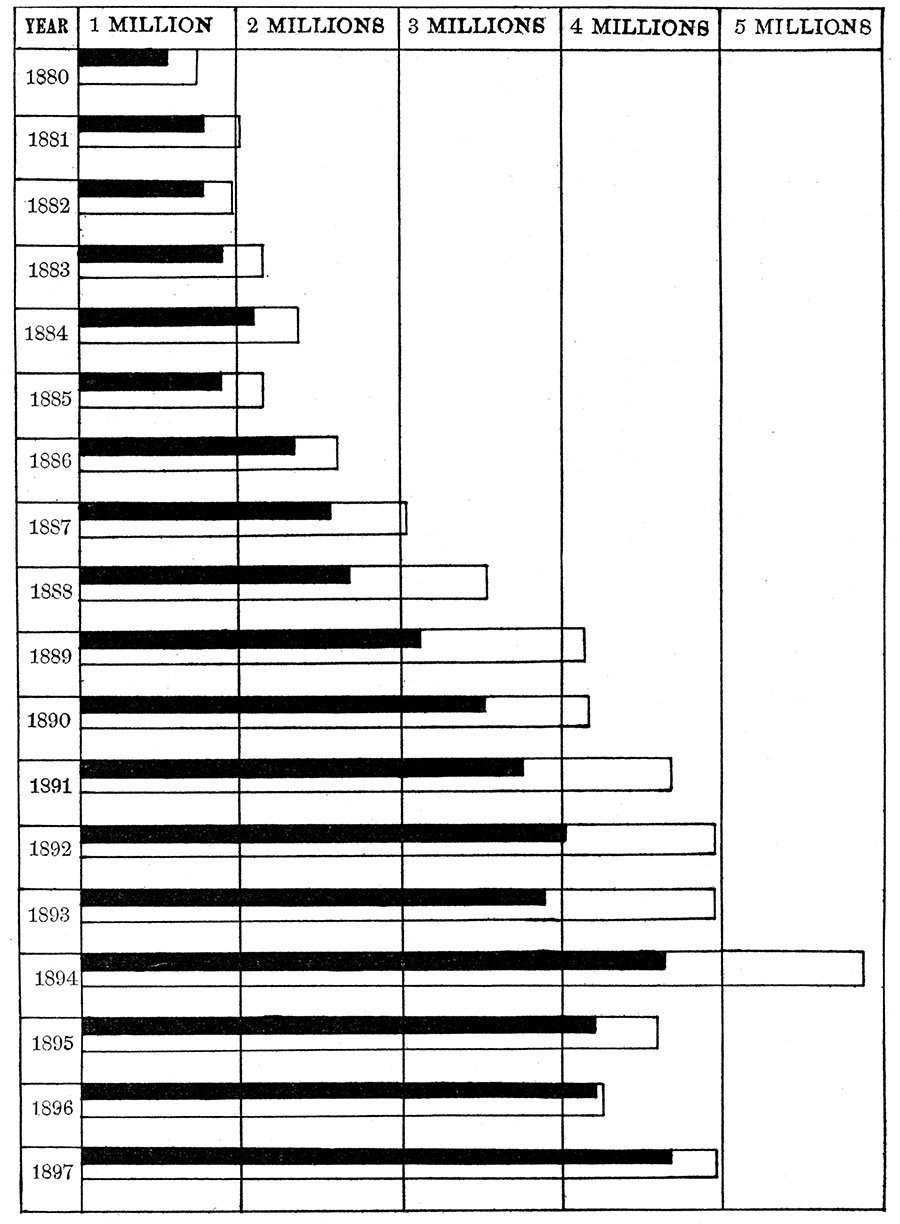
Plate LXIX—Mine of Western Coal and Mining Company, near Fleming.
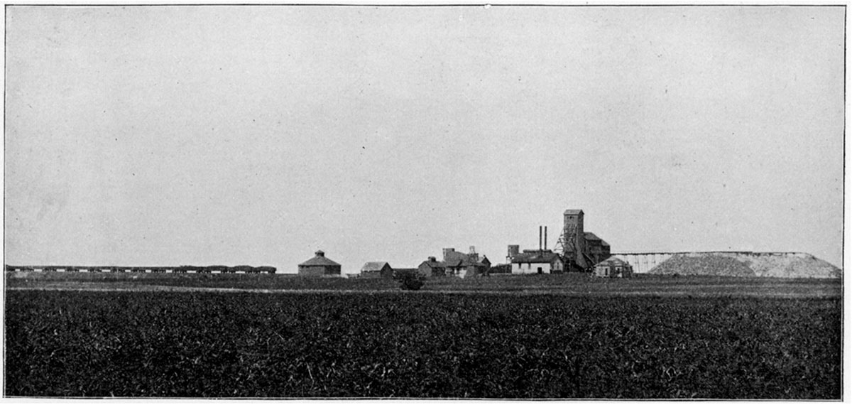
Plate LXX—Mine No. 5 of Mount Carmel Coal Company, Chicopee.
Kansas Geological Survey, Geology
Placed on web Sept. 12, 2018; originally published 1898.
Comments to webadmin@kgs.ku.edu
The URL for this page is http://www.kgs.ku.edu/Publications/Bulletins/Vol3/99_plates.html