![]()
Plate 1
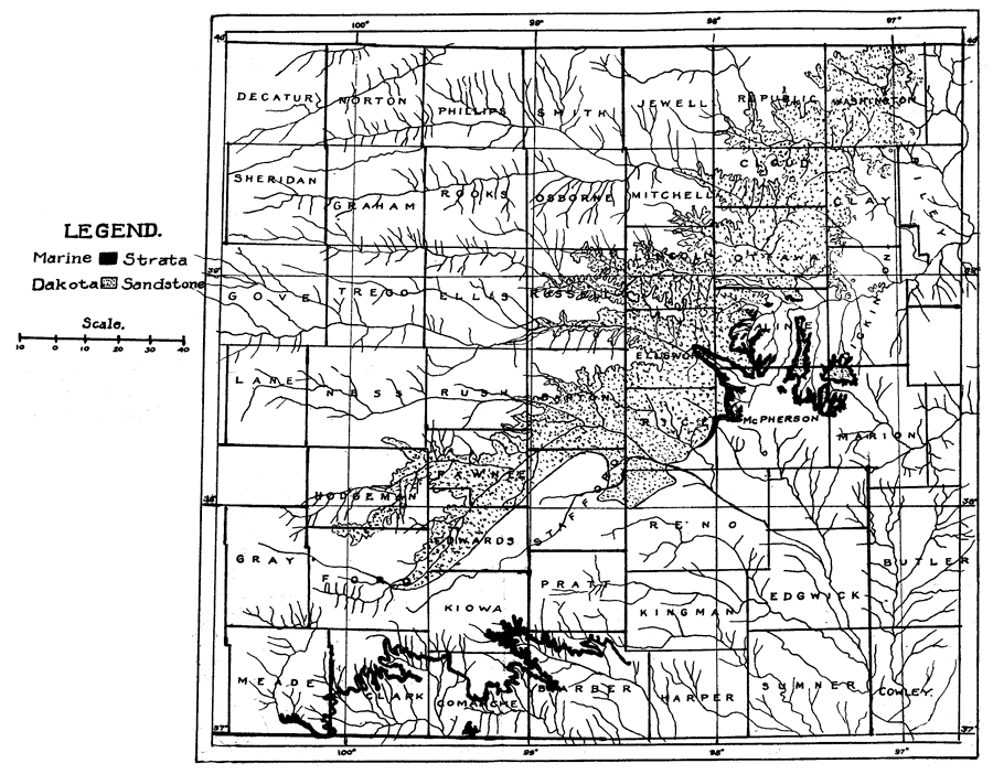
Plate I--Map showing distribution of the Commanchean and "Dakota" strata of Kansas. The distribution of the Dakota is taken from the map of the Kansas Geological Survey, vol IX. An Acrobat PDF (1.8 MB) of this figure is available.
Kansas Geological Survey, Geology
Placed on web February 2006; originally published 1924.
Comments to webadmin@kgs.ku.edu
The URL for this page is http://www.kgs.ku.edu/Publications/Bulletins/9/plate1.html