![]()
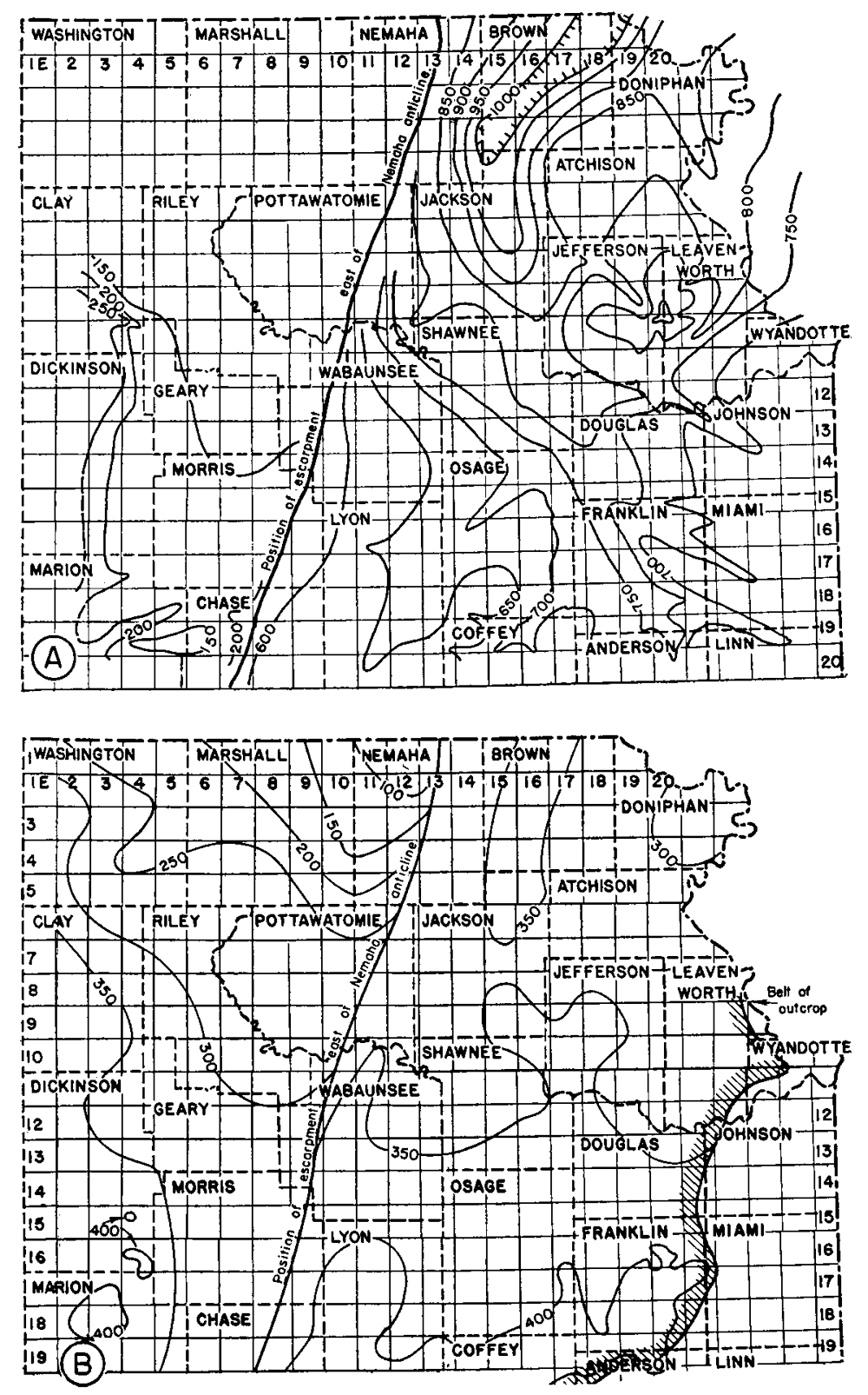
Figure 17--Maps of northeastern Kansas showing thickness of (A) rocks of Cherokee, Marmaton, and Bourbon age, and (B) rocks of Bronson, Kansas City, and Lansing age. Isopachus lines connecting points of equal thickness are drawn at intervals of 50 ft.
Kansas Geological Survey, Forest City Basin
Comments to webadmin@kgs.ku.edu
Web version July 2005. Original publication date Dec. 1943.
URL=http://www.kgs.ku.edu/Publications/Bulletins/51/fig17.html