![]()
Prev Page--Additional Chapters
Plates
Plate 1--Surface features of Kansas. The diagram represents the topographic characteristics of different parts of the state, many of which depend closely on geologic structure and influence conditions of ground-water occurrence. Eastward-facing escarpments formed by west-dipping beds of differing hardness distinguish the eastern Kansas region. The Smoky Hills Upland and Blue Hills Upland are formed by Cretaceous rocks. The Great Bend Plain is a nearly level sandy area that is locally dotted by dunes. Father south is the red-rock country of Permian outcrops, which is relatively rugged. The western Kansas High Plains region is mostly a very gently sloping area, but it is intersected by many valleys that are bordered by low bluffs. [A larger Acrobat PDF version of this plate is available.]
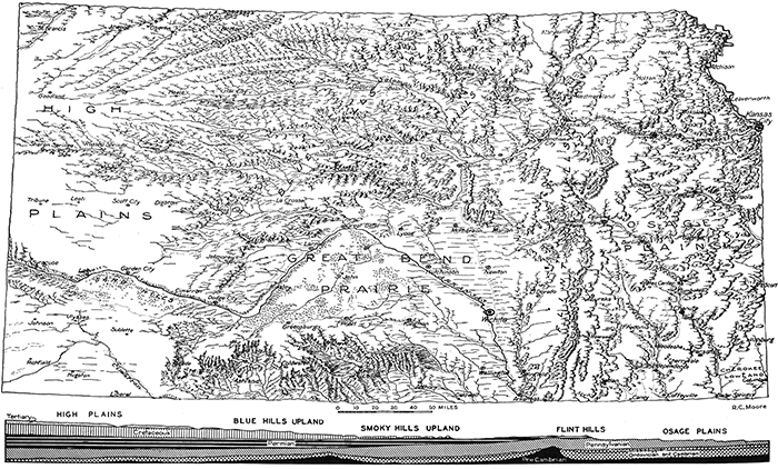
Plate 2--Portable drilling machine belonging to the Ground-water Division of the Geological Survey (cooperative state and federal). This is an invaluable tool for study of the ground waters of Kansas. It is operated by a crew of specially trained young geologist-engineers. (Oren Bingham.)
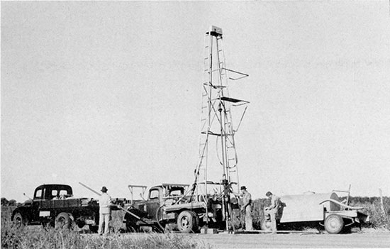
Plate 3--Left, Exposure of coarse gravelly Ogallala deposits in Meade County (SE sec. 17, T. 33 S., R. 28 W.), showing type of stream-borne materials that is very pervious. Right, Field workers in Sedgwick County putting down an observation well, using hand driver. (S. W. Lohman.)
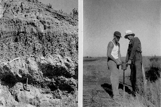
Plate 4--Ground-water level automatic recorders. The well at left is one mile south of Scott City; installation of the Water Resources Division, State Board of Agriculture. The well at right is a Geological Survey installation in northern Ford County. (H. A. Waite.)
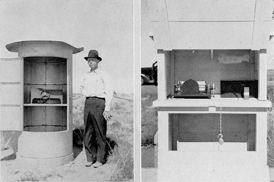
Plate 5--Left, Portable chemical laboratory, testing chlorides in ground water north of Wichita. Right, Apparatus used in Survey work to test permeability of sedimentary materials. (S. W. Lohman.)
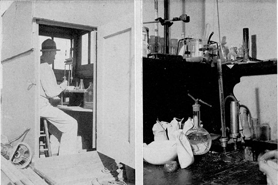
Plate 6--Left, One of the new water wells of the city of Wichita, which will develop a supply located by the Geological Survey near Halstead. Right, A brine-disposal well in the Burrton field. The salt water is conducted to porous rock far below the surface where it cannot contaminate fresh water supplies. (S. W. Lohman.)
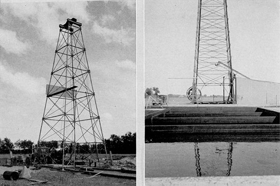
Plate 7--Salt water containing about 50,000 parts per million of chlorides in the Burrton field. Contamination of fresh water by the sinking of this brine into the pervious ground is not actually visible here, but it is none the less real. (S. W. Lohman.)
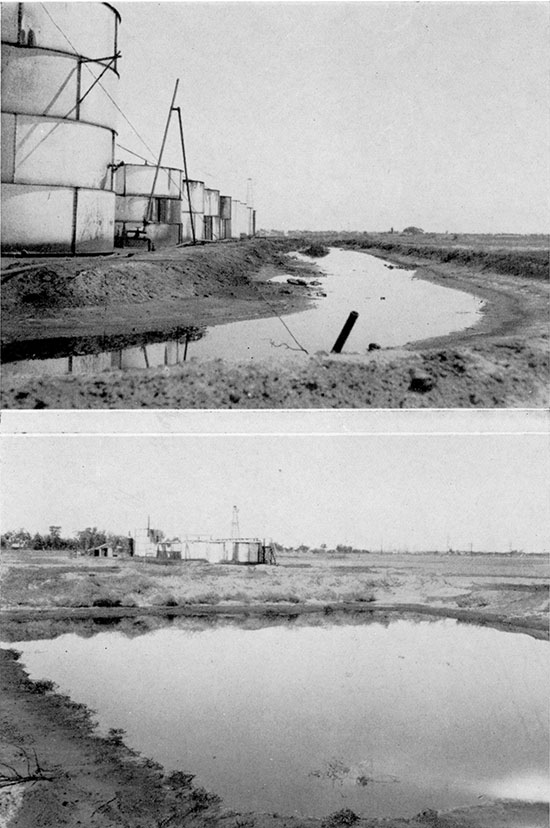
Plate 8--Engineering work of several sorts is an important adjunct of ground-water investigations. Upper, Level party in Sedgwick County area. Lower, Testing the flow of a Ford County well with the Collins meter (Geological Survey in cooperation with Division of Water Resources). (S. W. Lohman, H. A. Waite.)
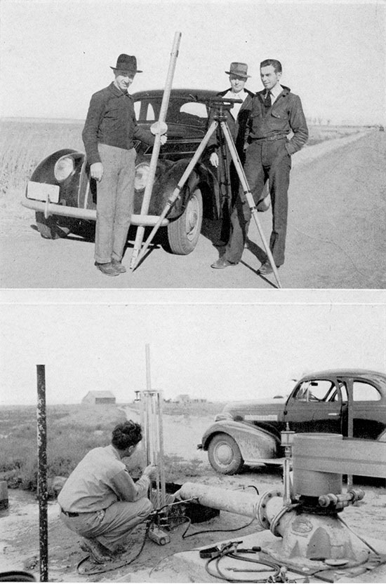
Plate 9--Upper, Truck equipped for chemical analysis of ground-water samples in field, at work in McPherson County. Lower, Rotary shaker and screens for making mechanical analysis of sediments obtained at various depths in test wells; designed by S. W. Lohman. (S. W. Lohman.)
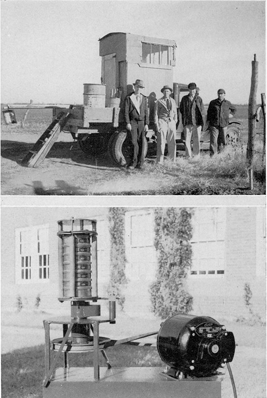
Plate 10--Upper, Apparatus for filtering and testing of water samples in the field, Harvey County, Kansas. Lower, Trailer and large water tank, used with the Geological Survey drilling machine, on location in McPherson County. (Fred Holden, S. W. Lohman.)
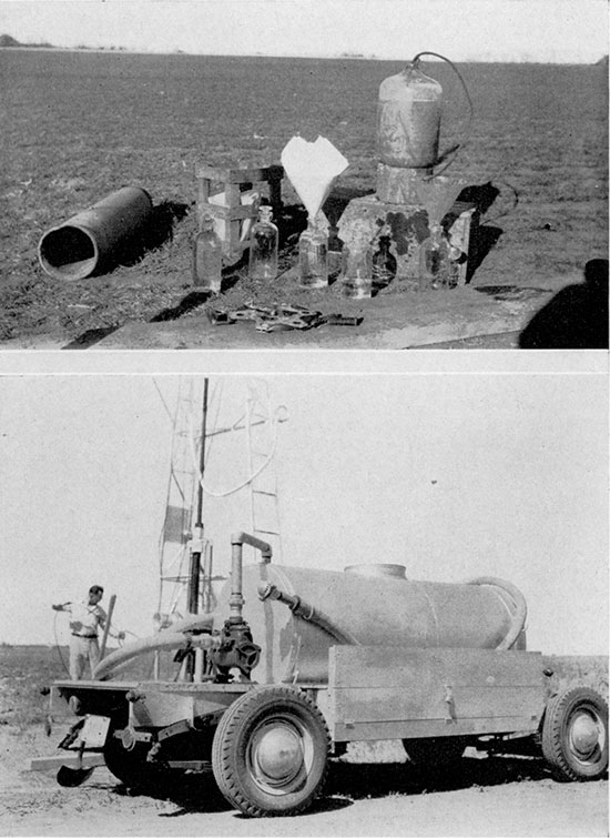
Plate 11--Upper, The first Wichita city well in the new supply area near Halstead, located by Geological Survey investigations. This well tested 1,600 gallons a minute; the flow is from a 10-inch orifice. The drawdown in the well at the close of a 36-hour pumping test was 25 feet. Lower, Measuring the flow of water obtained from shallow wells in the Arkansas river alluvium near Dodge City (Geological Survey in cooperation with Division of Water Resources). (S. W. Lohman, H. A. Waite.)
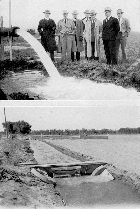
Plate 12--Upper, Water pumped from the Ogallala beds in Meade County. Lower, Pond on the Marrs farm in the Meade artesian basin, fed from a naturally flowing well, shown in center background, which yields about 75 gallons a minute. (J. C. Frye.)
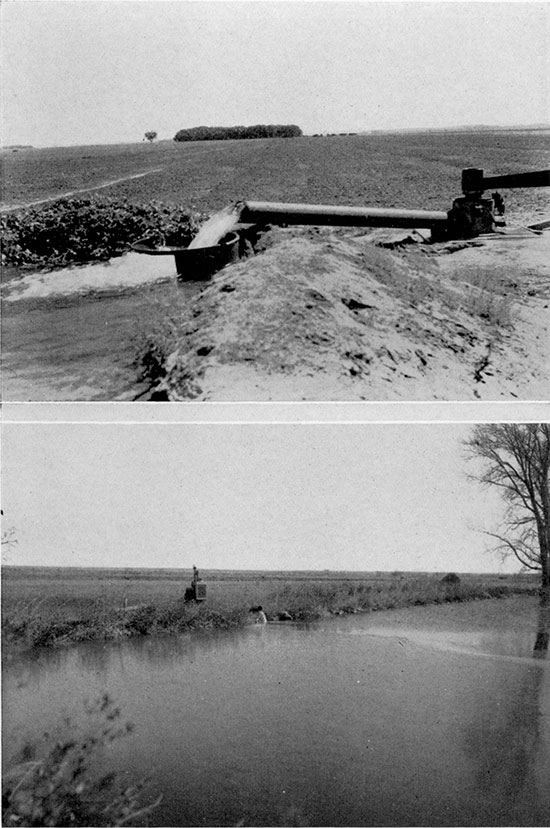
Plate 13--The Kansas river valley, a well-watered alluvial plain, bordered by bluffs of Pennsylvanian rocks; view near Bonner Springs. (K. K. Landes and Oren Bingham.)
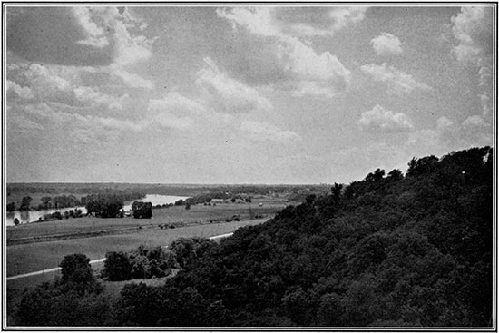
Plate 14--Glacial deposits, which cover most of the land in northeastern Kansas, produce the gently rounded surfaces of this Doniphan County landscape. Ground-water supplies are good. (K. K. Landes and Oren Bingham.)
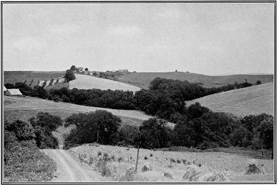
Plate 15--St. Jacob's Well, a picturesque sink in Meade County, formed by underground solution of rock, followed by local collapse of the surface to a position below the water table. (K. K. Landes and Oren Bingham.)
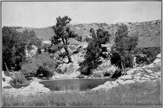
Plate 16--The High Plains region in western Kansas is characterized by its treeless and generally featureless surface; view near Garden City. (K. K. Landes and Oren Bingham).
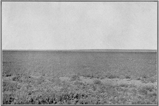
Plate 17--Upper, Exposure of loess in Republic County. This is part of a widespread cover of relatively impervious sediment that was deposited by winds; it retards seepage of rainfall into ground-water reservoirs. (M. E. Wing.) Lower, A typical exposure of alluvium in a small valley (One Mile creek) tributary to Republican river. Deposits of this sort are relatively pervious.
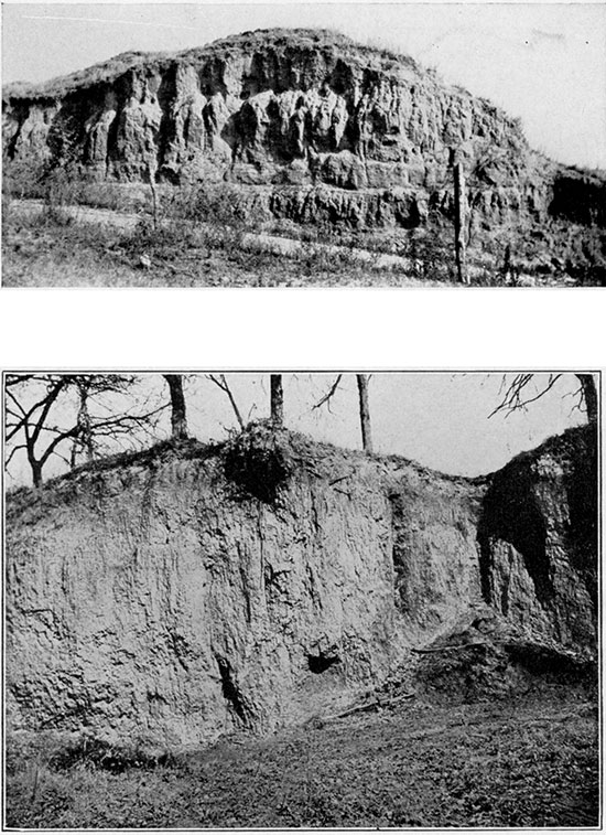
Plate 18--Upper, Sand dunes about five-miles northwest of Hutchinson. Rainfall in the dunes area sinks readily into the ground and a proportionally large part of the precipitation may become ground water. Lower, Alluvial plain of a western Kansas stream (Sawlog creek), bordered by a Dakota sandstone hill that is capped by a remnant of Ogallala beds. The Ogallala is not a source of ground water in isolated outcrops, but the Dakota of this region yields large quantities of water. (J. C. Frye, H. A. Waite.)
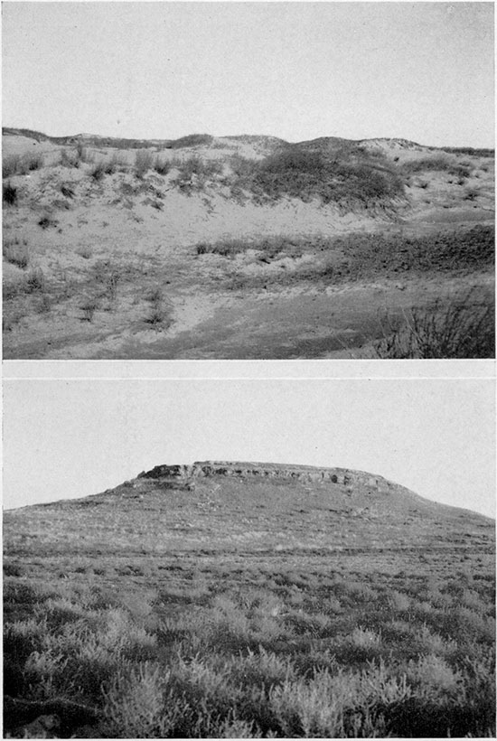
Plate 19--Upper, Exposure of typical "mortar beds" of the Ogallala formation about three miles west of Dodge City (H. A. Waite). Lower, Basal Ogallala deposits resting unconformably on Cretaceous shale belonging to the Dakota group, on Bear creek, Stanton County (SW sec. 15, T. 29 S., R. 43 W.) (S. W. Lohman.)
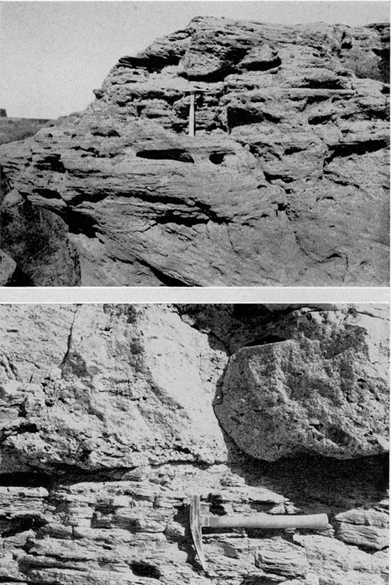
Plate 20--Sinks in the High Plains area near Sharon Springs. A. A cave-in formed in 1929. B. A sink in sec. 27, T. 12 S., R. 41 W., developed in 1901. (M. K. Elias.)
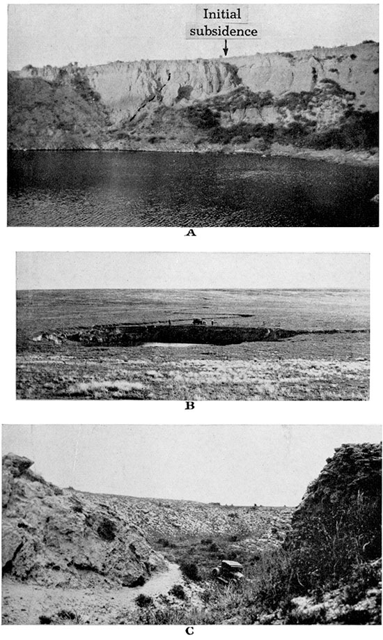
Plate 21--Upper, Exposure of Greenhorn limestone, Cretaceous. The alternating thin limestone and shale beds of the formation are well shown. Lower, Impervious clay shale belonging to the Carlile part of the Cretaceous deposits; a large concretion, formed by concentration of calcareous matter, is shown. The thick shale divisions of the Cretaceous system in Kansas yield virtually no ground-water supplies.
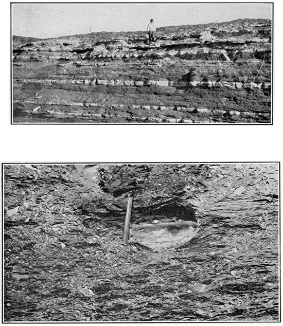
Plate 22--Upper, Outcrop of basal Niobrara formation consisting of even-bedded Limestone (Fort Hays), underlain by water-bearing sandstone (Codell), in Ellis County (N. W. Bass). Lower, A salt-water pond in a marshy area near Jamestown, Cloud County, located on outcrops of the Dakota group. The salt water is derived from the Dakota beds. (M. E. Wing.)
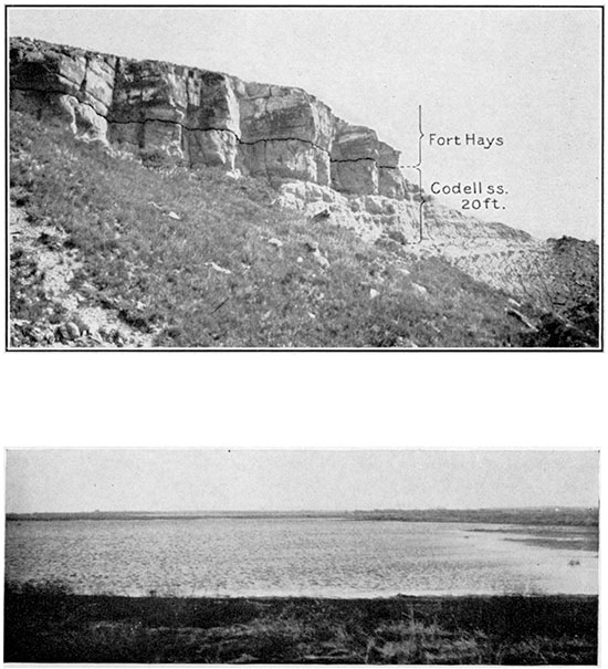
Plate 23--Upper and lower. Exposures of Dakota sandstone in Russell County. The sandstone is yellowish-brown in color, owing to the iron oxide that covers the grains, cementing them together. The rock is pervious and it both collects rainfall in areas of its outcrop and yields ground water thus derived from local precipitation and from distant sources. (W. W. Rubey and N. W. Bass.)
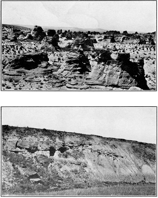
Plate 24--Upper, Red shale and thin silty sandstone of the Nippewalla group, of Permian age, near Medicine Lodge, Barber County. The bedrock of this region contains little usable ground water. (S. W. Lohman.) Lower, Flowing well in Richfield, Morton County. The water, which is derived from Upper Permian strata, is highly mineralized, containing more than 2,600 parts per million of solids. (H. A. Waite.)
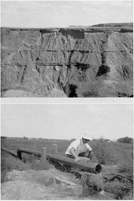
Plate 25--Bluffs of Niobrara chalk in Logan County. This type of Cretaceous rock, which underlies thousands of square miles in western and north-central Kansas, is almost impervious to ground water. (K. K. Landes and Oren Bingham.)
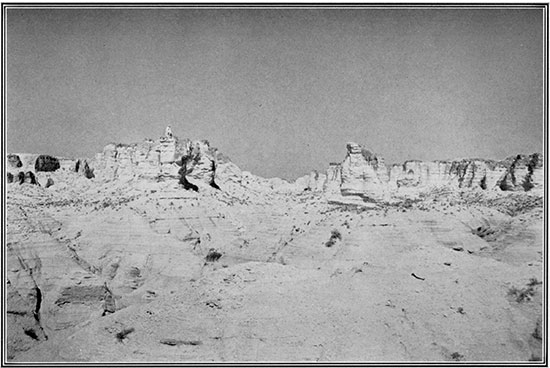
Plate 26--Gypsum-capped hills in the Permian red-beds country near Medicine Lodge, Barber County. Ground-water supplies are difficult to find or lacking here. (K. K, Landes and Oren Bingham.)
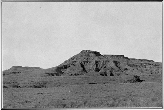
Plate 27--Exposures of Wreford limestone in Cowley County. The upper view shows very clearly the effects of solution of the limestone by rain water. The lower photograph also shows cavities in the rock formed by solution, and in addition, indicates the manner in which beds of very hard, relatively insoluble chert (or flint) occur with the limestone. (N. W. Bass.)
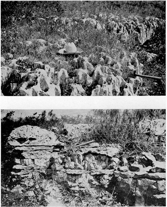
Plate 28--Upper and lower. Typical outcrops of limestone belonging to the Chase group, Lower Permian, in Riley County. The wall-like outcrop is made by the upper division (Fort Riley) of the Barneston limestone. Water is conducted along joint cracks and other crevices in the limestone and it emerges at places along the contact of the limestone and underlying shale.
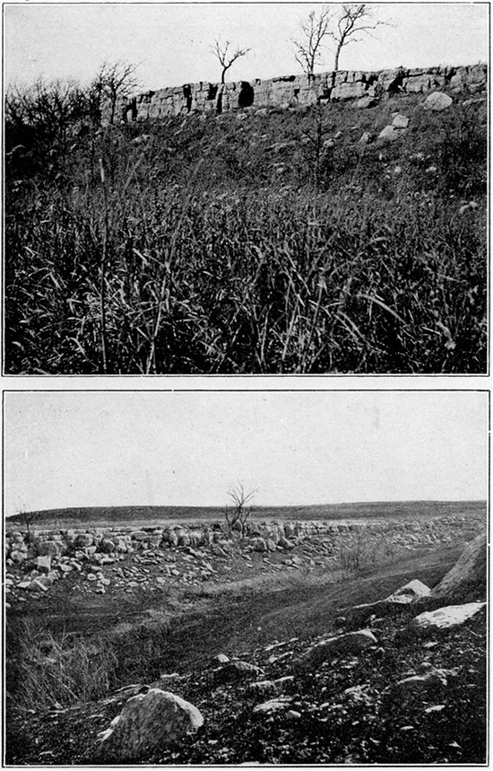
Plate 29--Pennsylvanian shale and limestone in Leavenworth County. The upper view shows interbedded thin limestone and shale beds, which are mostly valueless as ground-water reservoirs, even locally. The lower view shows the manner in which limestone is rendered pervious by the widening of bedding surfaces through solution (Lansing group, near Bonner Springs). (N. D. Newell and J. M. Jewett.)
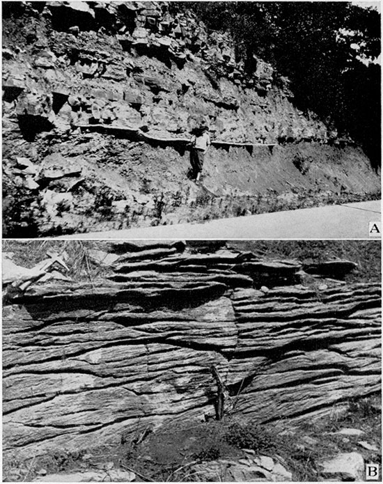
Plate 30--Exposures of the Drum limestone, a typical subdivision of the Pennsylvanian rocks of eastern Kansas. Note the joint cracks that have been widened by solution. Miami County. (N. D. Newell.)
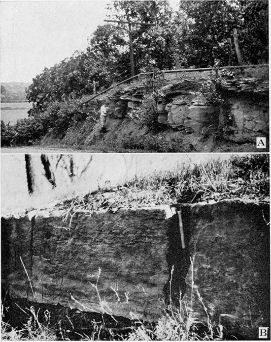
Plate 31--Ponds and lakes, such as this one in Leavenworth County state park, near Tonganoxie, are important aids in conserving and utilizing water resources of Kansas.
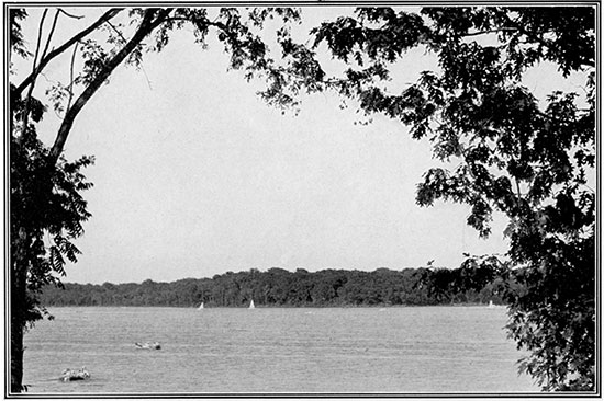
Plate 32--Flood waters are a menace to life and property, to be avoided as far as possible by practices that retard run-off and add to ground-water supplies. These views show parts of Kansas river valley during the flood of 1903.
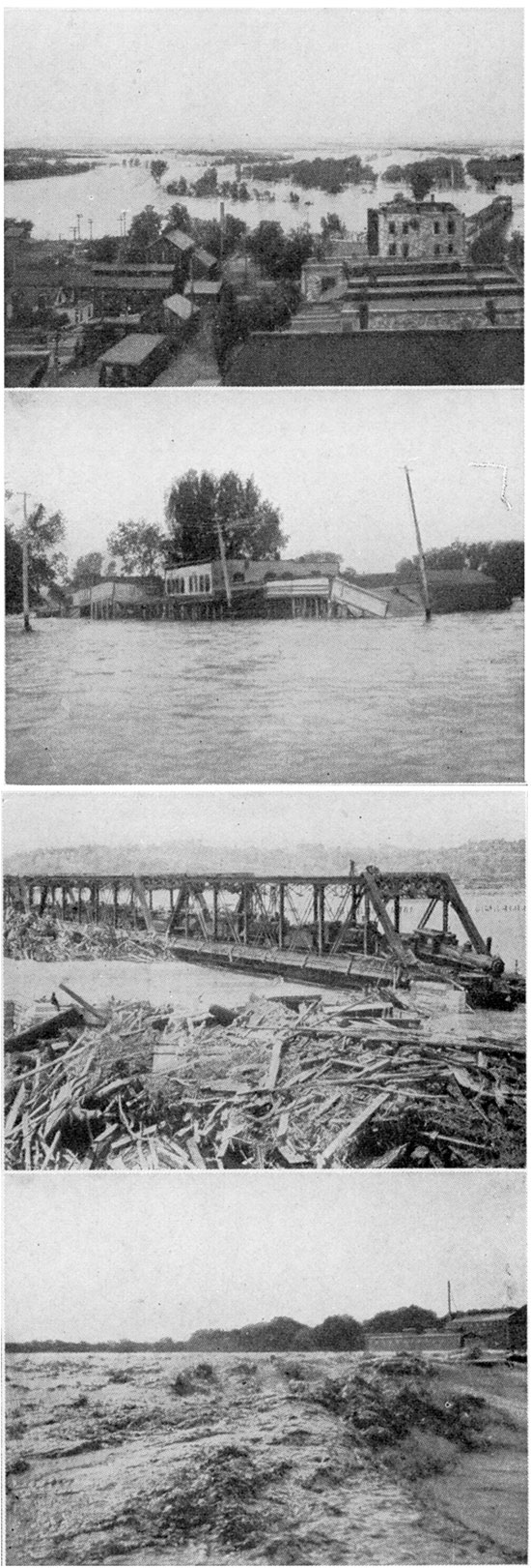
Plate 33--Left. Exposure of loess of Pleistocene age in Kansas City, Kan. Right. Smoothed and scratched surface of bedrock exposed by stripping of glacial deposits in a quarry in Wyandotte County. The bedrock was eroded by a glacial ice sheet. (N. D. Newell and J. M. Jewett.)
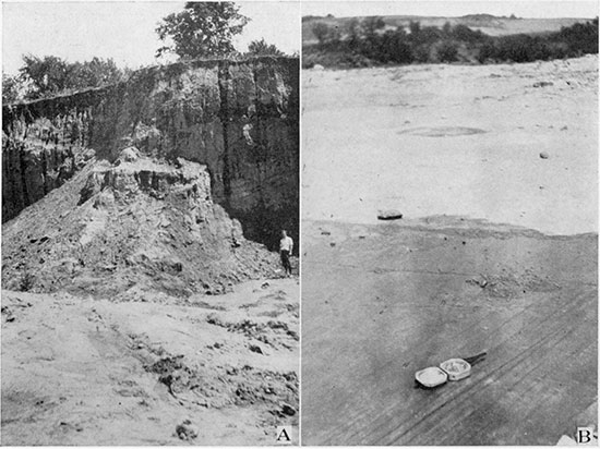
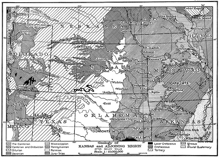
Plate 34--Geologic map of Kansas and surrounding states. The areas of outcrops of rocks belonging to the geologic systems are dependent mainly on regional structure, topography, and the thickness of the systems. This distribution affects local ground-water conditions importantly. [A larger Acrobat PDF version of this plate is available.]
Prev Page--Additional Chapters
Kansas Geological Survey, Geohydrology
Placed on web Dec. 11, 2015; originally published June 25, 1940.
Comments to webadmin@kgs.ku.edu
The URL for this page is http://www.kgs.ku.edu/Publications/Bulletins/27/08_plates.html