Overview
The forensic and archaeology geophysics program utilizes non-invasive, near-surface geophysical methods to address research problems. Geophysical methods have been recognized in these fields for their speed, cost-efficiency, and reliability in detecting buried targets and features. The forensic and archaeology geophysics research program focuses on combining different types of near-surface geophysical methods to locate unique targets, in particular (but not limited to) bone remains and prehistoric features.
Both archaeological and forensic targets are unique because they range in depth of burial, size of the target, physical properties, and age since burial. This means that there is not one single geophysical method that can be used to locate or detect these types of targets. However, by utilizing multiple geophysical methods, important archeological features such as foundations, earthworks, ditches, graves, house features and hearths have been located. These non-invasive methods help assist archaeologists to delineate targets before an excavation or at sites where excavation is not allowed, to monitor site preservation, or to help protect a site or feature from any future disturbances. In forensic investigations, geophysical methods can be used to locate graves and/or buried evidence.
What methods are used?
The KGS currently houses several instruments that can assist in these research investigations, including:
- Ground-penetrating Radar (GPR)
- Magnetics
- Electrical Resistivity
- Electromagnetic Induction (i.e. Electrical Conductivity)
These four methods utilize electrical, magnetic, and electromagnetic measurements to evaluate changes in the shallow sub-surface. Depths of investigation vary based on each method, which are described below.
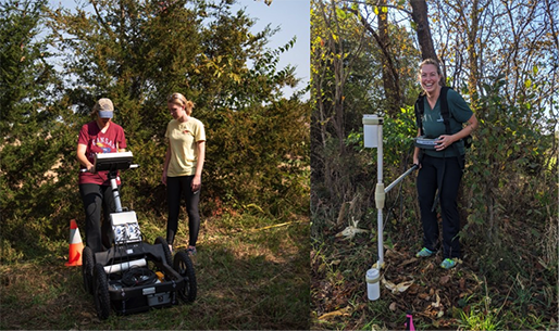
- GPR uses electromagnetic waves in the frequency range of 10-1000 MHz to detect changes in the electrical properties of the subsurface. Changes in the electrical properties of the ground create interfaces that reflect part of the transmitted signal, which is detected by the receiving antenna and stored for data processing and analysis. For archaeological and forensic exploration, higher resolution frequencies are common (200 MHz-1000 MHz) which can provide increased resolution at shallower depths. The KGS operates a MALA ProEx system with three available frequency ranges: 200 MHz, 400 MHz, and 800 MHz shielded antennae. Depth of investigation ranges from 0.1 m - 3 m with these higher frequency antennae.
- Magnetometers measure the Earth's magnetic field. The Earth's magnetic field ranges across the globe from approximately 30,000 nT at the Equator to 60,000 nT at the magnetic poles. Proximal and/or buried objects with high magnetic susceptibility or remnant magnetization, such as buried metallic pipes, rebar, steel drums, or materials that have been burned, enhance the localized magnetic field. The KGS operates a cesium fluxgate gradiometer, which can be adapted to measure the magnetic field at very shallow depths (<1 m).
- Electrical resistivity applies direct current or low-frequency alternating current at the ground surface through metal probes to measure the potential difference between them. The electrical resistivity is calculated from that information using Ohm's law. When evaluating the shallow subsurface, there are three dominant factors that control how resistive a material is: the amount of water present, the salinity of the water, and the soil grain size. The KGS operates an ABEM Terrameter LS2 with up to 48 cable takeout's as well as a Geoscan RM85 Resistance meter. Both systems can be adapted to measure the electrical properties for a wide range of depths (0.5 m - 50 m).
- Electromagnetic induction measures the change in mutual impedance between a pair of coils on or above the earth's surface. The transmitter coil is used to generate an electromagnetic field at a specific frequency, also referred to as the primary field. The primary field causes electrical currents to flow in conductive materials in the subsurface. The flow of currents in the subsurface, called eddy currents, generate a secondary magnetic field. The magnitude of the secondary field depends upon the type and distribution of conductive material in the subsurface. Both the induced secondary field, along with the primary field, are detected at the receiver coil. The KGS operates a GEM2 system, which can measure up to 10 frequencies at once at depths ranging from approximately 0.5 m - 10 m.
Please contact Dr. Blair Schneider at blair.schneider@ku.edu to learn more.