![]()
Prev Page--Contents || Next Page--Geography
Introduction
Purpose and Scope of the Investigation
An investigation of the geology and ground-water resources of Hamilton and Kearny counties was begun in September, 1939, by the United States Geological Survey and the State Geological Survey of Kansas, with the cooperation of the Division of Sanitation of the Kansas State Board of Health and the Division of Water Resources of the Kansas State Board of Agriculture. The work done under the general administration of R. C. Moore and K. K. Landes, state geologists, J. C. Frye, acting state geologist, and O. E. Meinzer, geologist in charge of the Division of Ground Water of the Federal Geological Survey, and under the direct supervision of S. W. Lohman, federal geologist in charge of ground-water investigations in Kansas.
Ground water is one of the principal natural resources of Kansas. In Hamilton and Kearny counties, almost the entire population obtains its water supply from wells. In addition, wells supply water for livestock and for the irrigation of more than 10,000 acres of land (includes also land irrigated by surface water and by a supplementary supply of ground water). Ground water acquires its great value as a natural resource because it is replenished continuously or at frequent intervals by precipitation, by streams, or by both. If withdrawals of ground water are kept within safe limits, the supply should last indefinitely.
There were repeated crop failures in western Kansas between 1931 and 1939 as a result of an extended drought accompanied by severe dust storms. The precipitation was far below normal, resulting in a cumulative deficiency in rainfall of more than 30 inches for the 9-year period. These conditions have caused a lower farm income and an increased interest in irrigation.
The investigation in Hamilton and Kearny counties was made to determine the quantity, quality, movement, and availability of ground water, the quantity of water that can be withdrawn without permanently diminishing the ground-water storage, and the feasibility of further development of irrigation from wells. It is hoped that the data given herein will facilitate the safe development of the ground-water resources of these counties.
Location and Extent of the Area
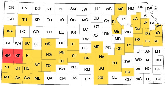
Hamilton and Kearny are adjacent counties in southwestern Kansas (fig. 1). They are bordered on the north by Greeley and Wichita counties, on the east by Finney County, on the south by Stanton and Grant counties, and on the west by Prowers County, Colorado. Most of the area lies between parallels 37° 45' and 38° 15' north latitude and meridians 101° 7' and 102° 2' west longitude. It comprises about 51.5 townships and has an area of 1,856 square miles.
Figure 1--Index map of Kansas showing area described in this report and areas covered by other online geologic reports, as of July 2007. For additional information, please visit the KGS Geologic Maps of Kansas Page.
Previous Investigations
Geologic and hydrologic studies in western Kansas were first made in 1895 by Haworth (1897), who discussed the regional geology and the occurrence of ground water in the Dakota and younger formations. Johnson (1901; 1902,), in his reports on the utilization of the southern High Plains, made special reference to the source, availability, and use of ground water in western Kansas. A few years later, Darton (1905) made a study of the geology and ground-water resources of the central Great Plains including the western part of Hamilton County, and the following year he published a report (Darton, 1906) on the geology and underground-water resources of the Arkansas river valley in eastern Colorado. This report includes a discussion of the artesian wells in the vicinity of Coolidge in western Hamilton County. A survey of the Arkansas valley in Kearny and Finney counties was made by Schliter (1906) in 1904 to determine the source of the ground water, its chemical character, its rate and direction of movement, and the effect of rainfall and floods on the recharge of the ground-water reservoir. Parker (1911) briefly described the geology and ground-water resources of Hamilton and Kearny counties in his report on the chemical character of the water supplies of Kansas. Haworth (1913) briefly described the ground water of this area in 1913.
The first detailed study of this area was made by Darton (1920) in his description of the geology and ground-water resources of the Syracuse-Lakin quadrangles, which include most of the southern half of Hamilton and Kearny counties. His report includes maps showing geology, topography, and depths to water level. A few years later, Bass (1926) described the geology of Hamilton County with special reference to Cretaceous stratigraphy. More recently the Hamilton and Kearny area was briefly described by Theis, Burleigh and Waite (1935), who made a reconnaissance of the ground-water resources of the southern High Plains; and by Smith (1940), who made a reconnaissance of the Tertiary and Quaternary geology of southwestern Kansas.
In 1939 Latta (1941) made a detailed study of the geology and ground-water resources of Stanton County, which borders Hamilton County on the south. The report includes maps showing the geology, depths to water level, and configuration of the water table. Other detailed county reports describing the geology and ground-water resources of southwestern counties include Morton County (McLaughlin, 1942), Ford County (Waite, 1942), and Meade County (Frye, 1942).
Methods of Investigation
Preliminary investigations were made in Hamilton and Kearny counties during parts of September and October, 1939. During this time about 40 representative wells were selected for periodic depth-to-water-level measurements. Most of these wells have been measured monthly since that time in order to obtain information concerning the fluctuations of the ground-water table and their relation to precipitation and to floods.
Field work was resumed in August, 1940, and continued until December, 1940. During this period, data were obtained on about 320 wells. About 175 of these wells were measured with a steel tape to determine the depth of the well and the depth of the water level below some fixed measuring point (generally the top of the casing). Additional data were obtained from well owners concerning the yield and draw-down of wells and the character of water-bearing materials. Only reported data were obtained for an additional 145 wells. This included the depth of the well, the depth to water level, the yield and draw-down of the well, and the character of the water-bearing materials. Forty-eight samples of water were collected from representative wells and were analyzed by E. O. Holmes, chemist, in the Water and Sewage Laboratory of the Kansas State Board of Health.
Twenty-four test holes were drilled at strategic points in the county by the portable hydraulic-rotary drilling machine of the State and Federal Surveys, operated by Ellis D. Gordon, Perry McNally, and Laurence P. Buck. The locations of the test holes are shown in figure 2.
The drill cuttings were collected and studied in the field by Perry McNally and examined later with a microscope in the office. The altitudes of the measuring points of most of the measured wells and of the test-hole locations were determined with a plane table and alidade. Those in Kearny County were determined by a level party headed by John B. LaDuex. The level work in Hamilton County was done as a part, of the regular cooperative topographic mapping program of the Federal and State Geological Surveys. F. S. Bradshaw and Fay Mann directed the level parties. A Federal and State Survey level party headed by H. S. Hall determined a few altitudes of measuring points on wells in northeastern Kearny County as a part of their level work on the Leoti quadrangle.
The field data were recorded on maps prepared for the Kansas Highway planning board by the Kansas Highway Department (pls. 1 and 2). The roads and drainage were corrected by field observations and from aerial photographs obtained from the United States Department of Agriculture. Inasmuch as the geology of most of the area had been previously described by Darton (1920) and Bass (1926), much time in searching for outcrops in the field was saved by reference to their maps. The areal extents of the Cretaceous outcrops were more accurately defined by the use of the aerial photographs. Most of the outcrops of Cretaceous rocks were examined, but no attempt, was made to study them in detail. A more detailed study was made of the Tertiary and Quaternary deposits, which are the principal sources of ground water.
The wells shown on plate 2 were located within the sections by use of the speedometer, and the locations are believed accurate to within about 0.1 mile. The wells in each county are numbered by townships from north to south and by ranges from east to west, and within a township the wells are numbered in the same order as the sections. The Hamilton County wells are numbered from 1 to 164; the Kearny County wells are numbered from 165 to 359. For each well shown on plate 2 the number above the line corresponds to the number of the well in the well tables and the number below the line is the depth to the ground-water table below a fixed measuring point.
Acknowledgments
Residents of the area were very cooperative in supplying information about their wells, in permitting test drilling on their land, and in allowing pumping tests to be made on their wells. G. L. Howell supplied information on the wells south of Deerfield that supply water for the Great Eastern irrigation canal. M. T. Barnes furnished data on the municipal-water supply at Lakin, and David Millsap gave similar data on the Syracuse municipal supply.
The manuscript for this report has been reviewed critically by S. W. Lohman, O. E. Meinzer, and W. D. Collins, of the Federal Geological Survey; J. C. Frye, assistant state geologist; Edith H. Lewis of the State Geological Survey; Paul D. Haney, director, and Ogden S. Jones, geologist, of the Division of Sanitation of the Kansas State Board of Health; and George S. Knapp, chief engineer of the Division of Water Resources of the Kansas State Board of Agriculture, The maps and cross sections were prepared under the supervision of Dorothea Weingartner, chief draftswoman of the State Survey.
Prev Page--Contents || Next Page--Geography
Kansas Geological Survey, Geology
Placed on web Oct. 25, 2007; originally published December 1943.
Comments to webadmin@kgs.ku.edu
The URL for this page is http://www.kgs.ku.edu/General/Geology/Hamilton/02_intro.html