Previous--Report Start || Next--Overview of Petroleum Geology
1Kansas Geological Survey and 2Department of Geology and Geophysics, University of Missouri-Rolla
This article available as an Acrobat PDF file (1.1 Mb).
The efficacy of geophysical methods in the search for petroleum in the midcontinent was summarized in two previous dedicated volumes published by the Kansas Geological Survey (Hambleton, 1959; Steeples, 1989). Hambleton (1959) presented several early case studies that utilized the reflection seismic method for petroleum exploration, in addition to presenting local and regional studies using electrical resistivity, magnetics, and gravimetry. Steeples (1989), in an update volume, summarized more recent advances in reflection seismology and data-processing techniques. The recent advances included the use of higher-frequency sources for shallow-depth seismic investigations, and the use of computer enhancement for aeromagnetic and gravity studies of the entire state.
The present atlas, a cooperative project by the Kansas Geological Survey and the Kansas Geological Society, emphasizes case studies in the application of reflection seismology in Kansas. Most of these studies relate to petroleum exploration, but also included are papers illustrating the wider use of reflection seismology in understanding salt dissolution (cf., two papers by Anderson et al.), hydrogeologic problems (Keiswetter et al.), and geomorphologic phenomena (Miller et al.). The application of high-resolution reflection-seismic profiles to stratigraphic investigations also is discussed in the context of recognition of depositional systems (Franseen et al., Knapp and Anderson, Knapp et al.) and detection of shallow fluvial-deltaic channel ("squirrel") sandstones (Miller and Weis). Stratigraphic investigations such as these are a component of this volume because the broader use of geophysical methods in areas other than the search for petroleum should be recognized.
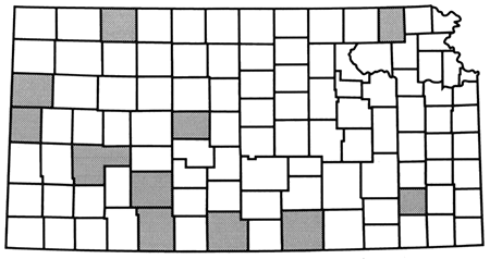
The Geophysical Atlas of Selected Oil and Gas Fields in Kansas is composed of 28 papers. Notwithstanding this introduction, included are 10 exploration case histories, 10 test-site seismic studies, two potential-field case studies, two methodology papers, and three overview papers. These studies also encompass a broad range of geologic features that can be observed by reflection seismology, including sand bars, beaches, channel sandstones, deltas, carbonate banks, karsts, faults, folds, and salt-dissolution features. The papers are arranged so that the earlier articles set the stage for the later case studies. Articles 2 through 6 establish the Precambrian geologic framework for Kansas and illustrate that much hydrocarbon production can ultimately be correlated to structural and topographic relief on the Precambrian basement. These papers also illustrate that Precambrian tectonic zones may be extremely long-lived and that these zones influence many subsequent geologic events. The seventh and eighth papers are methodology-oriented and provide the reader with an appreciation of how seismic data tie to subsurface geology. Articles 9 through 17 are test-site seismic studies that illustrate the utility of the seismic technique, particularly recent development and application of high-resolution methods in various localities in Kansas (fig. 1). Papers 18 through 28 complete the atlas. These articles are case studies utilizing reflection-seismic lines over petroleum fields in Kansas, with each paper containing a geologic overview and at least one interpreted template seismic profile (fig. 1).
Figure 1--Location of case studies presented in this atlas.
By documenting a selected group of petroleum fields and geologic features that are discernable by reflection seismology, this atlas aims to circulate knowledge of this geophysical tool to the energy industry, academia, and to other potential users of the seismic method. With continually improving technology, geoscientists need to access the accumulated technical experiences of their predecessors. A presentation of this knowledge will fulfill some of this need and stimulate new ideas on how reflection seismology may be used. The benefits of "scientific cross-pollination" can therefore be enjoyed by all.
In addition to disseminating information about geophysical methods to a wider audience, this atlas also serves as a "still photograph," as it were, to document how geophysics is presently being used in the midcontinent. Hopefully, others will reap the benefits of this knowledge and apply its methods and results toward their own research. In this way, the past and present state of the science of geophysics will partly influence its future.
Since the 1940's, petroleum-exploration activities have become increasingly dependent on the capabilities of the geophysical interpreter. Although interpretation of well data, guided by experience and creative geologic insight, is still the principal method for finding oil in Kansas, geophysical data are also incorporated in these studies. Correlation-point seismic data were the norm in the 1950's, but multi-fold reflection-seismic profiling, first with analog and then digitally processed data, became more common in the 1960's. Reflection seismology is probably now the most commonly used method to supplement subsurface geologic mapping, but in some plays it has been the principal impetus behind exploration efforts. For example, the drilling of the Texaco #1 Poersch well in Washington County, Kansas, in 1984-the first major petroleum-exploration test of the midcontinent rift (see Berendsen et al., 1988; Woelk and Hinze, this volume), was primarily based on data obtained from reflection-seismic lines. Furthermore, this exploration effort was originally prompted by geologic structures seen on a COCORP reflection-seismic line shot between 1979 and 1981 (Steeples, 1989). Seismic-reflection lines also are critical for defining depositional geometries for developmental drilling in channel sandstones in the Morrow Formation of southwestern Kansas and southeastern Colorado (see Rummerfield and Rummerfield, 1989; Richardson and Hedke, this volume; Miller et al., this volume).
Although geological methods will remain important both in finding new oil and efficiently recovering "old" oil in existing fields, an ever-increasing reliance on geophysics in energy exploration will probably occur. Similarly, a wider application of geophysics in hydrogeologic surveys and environmental remediation projects will be necessary. In the future, 3D seismic-data surveys may become more important for both the exploration and production of petroleum in Kansas (see Rutter, 1993). The economics of such complex surveys are still marginal; however, advances in computational and seismic hardware, together with progress in processing techniques, continually improve the feasibility of such enterprises so that even small petroleum plays and the small producers that chase them may eventually benefit from such advanced technology.
Knowing exactly where the future will send us is difficult, and even if we could know, the timetable of when we get there is mostly unclear. If achieving a perfect perspective on things to come were simple, and if precognition were common, years ago we would have easily foreseen that companies once making cash registers and adding machines would grow to be computer giants, and that obscure blue-print companies would rise to worldwide stature by producing photocopiers. Similarly, what type of geophysics will we be doing a generation from now in the midcontinent? Who will be doing it? What will we be finding? The organizers of this volume therefore make a plea to future geophysical researchers to document and save some of their more novel and interesting work … and even some of their "mundane" projects! Such studies may perhaps be published in a successor volume one day, which will serve as yet another building block for our future.
Berendsen, P., Doveton, J., Gerhard, L., Newell, K. D., Steeples, D., and Watney, W. L., 1988, Preliminary geologic report of the Texaco #1 Poersch borehole: Oil and Gas Joumal, October 31, p. 48-52
Hambleton, W. W. (ed.), 1959, Symposium on geophysics in Kansas: Kansas Geological Survey, Bulletin 137, 375 p. [available online]
Rummerfield, B. F., and Rummerfield, L. J., 1989, Seismic exploration for the Morrow trend; in, Geophysics in Kansas, D. W. Steeples, ed.: Kansas Geological Survey, Bulletin 226, p. 67-80 [available online]
Rutter, A. W., III, 1993, 3D seismic applications and implementation; in, Reservoir Description Workshop--Application of Underused Technologies, W. L. Watney and R. S. Sawin, comp.: Energy Research Center, University of Kansas, Technology Transfer Series 93-1, p. 353-360
Steeples, D. W. (ed.), 1989, Geophysics in Kansas: Kansas Geological Survey, Bulletin 226, 312 p. [available online]
Previous--Report Start || Next--Overview of Petroleum Geology
Kansas Geological Survey
Comments to webadmin@kgs.ku.edu
Web version placed online Aug. 14, 2015. Original publication date 1995.
URL=http://www.kgs.ku.edu/Publications/Bulletins/237/Newell1/index.html