![]()
Previous Page--Introduction || Next Page--Paleozoic
Precambrian Rocks
By Edwin D. Goebel
Igneous, metamorphic, and metasedimentary rocks, which make up the Precambrian basement complex, underlie the entire state of Kansas (Fig. 1). Most boreholes that have penetrated Precambrian rocks are located along the crests of anticlines or structural highs; therefore, the overall distribution of rock types is known only vaguely. No test holes have penetrated through Precambrian rocks, but more than 2,500 feet of Precambrian rocks were penetrated in Nemaha County, where the Precambrian is approximately 580 feet below the surface (Merriam, 1963). In southwestern Kansas (Meade County), the top of the Precambrian is nearly 9,500 feet below the surface.
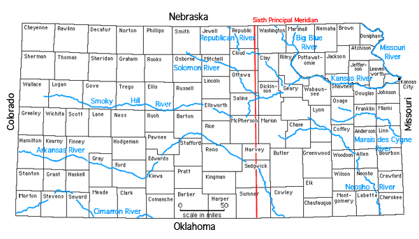
Figure 1--Index map of Kansas. A larger version of this figure is available.
"Granite wash" is a term used to describe arkosic detrital material resting on older Precambrian rocks. The "granite wash" may range in age from Precambrian to Middle Pennsylvanian. Where overlain by the Lamotte Sandstone (Upper Cambrian) it is classified as Precambrian in age. On the crests of upwarped areas the "granite wash" is deeply weathered and locally is as thick as 150 feet.
In southwestern Kansas the Precambrian surface is largely unweathered. Quartzite outliers occur along the Central Kansas uplift in northeastern Barton County (Walters, 1946) and in southeastern Kansas (Ireland, 1955). The configuration of the Precambrian surface is reflected by the structural features depicted in Figure 6. Merriam (1963) reported that all major positive features on the Precambrian surface have a southerly plunge, and in general the Precambrian surface slopes southward.
Granite is the most common type of igneous rock reported, and quartzite and schist are the most common types of metamorphic rock (Merriam, Cole, and Hambleton, 1961). Several rock types have been observed within a 5-foot interval in cores in many locations. Scott and Hambleton (1965) identified six areas (terranes) in the west ranges of Kansas in which particular rock types are prevalent: (1) plutonic and volcanic rocks of granitic composition in the southern part; (2) a complex of gneiss, plutonic granite, and metamorphic rocks of greenschist fades in central Kansas; (3) a complex of granite gneiss and metamorphic rocks of almandine-amphibolite fades in the vicinity of Phillips County; (4) plutonic granite, granodiorite, and quartz monzonite in the vicinity of Norton County; (5) basaltic rocks in the vicinity of McPherson County; and (6) unmetamorphosed feldspathic sandstone and shale in the vicinity of Rice County.
In southwestern Kansas nonfoliated biotite granite and granodiorite (Muehlberger, Denison, and Lidiak, 1967) has an average isotopic age of 1,270 million years (m.y.). Rhyolite, which occurs in the Texas Panhandle, extends into Morton County. The Rb-Sr isotopic age of the rhyolite is between 1,180 and 1,100 m.y.
Merriam and others (1961) described an area of Precambrian sediments, including schist, quartzite, arkosic quartzite, arkose, and undifferentiated metamorphic elastics, gneiss, and "granite wash," along a band trending northwestward from the boundary between Missouri and Kansas and the central part of the boundary between Nebraska and Kansas. The continuity of the band is broken along the area of the Nemaha anticline in Pottawatomie, southeastern Riley, and eastern Geary counties, northwestern Wabaunsee County, and Morris County.
Metamorphic rocks are reported along the area of the Central Kansas uplift-Cambridge arch, and a granite batholith occurs at the Kansas-Nebraska border in northwestern Kansas (Muehlberger et al., 1967). A period of thermal activity of between 1,450 and 1,350 m.y. and a period of 1,250 to 1,100 m.y. are suggested by isotopic age determinations for the northwestern and north-central Kansas areas (Scott and Hambleton, 1965; Muehlberger, Hedge, Denison, and Marvin, 1966).
Muehlberger, Denison, and Lidiak (1967) reported basalt (Keweenawan--1,000 m.y.) and associated sedimentary rock units in northeastern Kansas. Rubidium-strontium ages of granites or their contained feldspars from basement rocks along the Nemaha anticline in northeastern Kansas range from 1,950 m.y. to 1,350 m.y. This indicates the existence of pre-Keeweenawan granitic rock. Areas of high gravity anomaly in northeastern Kansas are correlated with areas of basalt containing small amounts of gabbro. These high gravity anomalies are flanked by gravity lows associated with pre-late Cambrian arkosic sedimentary rocks (Lyons, 1950; Lidiak, 1964). Along the area of the Nemaha anticline, the dominant Precambrian rock types are granite and granite gneiss.
An area in southeastern Kansas from Bourbon County on the Missouri border westward to Butler and Sumner counties marks the northern boundary of a Precambrian igneous complex of coarse-grained granite and granite gneiss. Age of the granite ranges from 1,450 m.y. to 1,350 m.y. (Muehlberger et al., 1967). Andesite and basaltic andesite occupy a 500-square-mile area along the Kansas-Oklahoma boundary in southeastern Kansas. In Bourbon County there are questionable pre-late Cambrian sediments composed of incipient to low-grade metasedimentary rocks which contain clasts of highly strained quartz rhyolite, clay or shale detritus, authogenic chlorite, and metamorphic rock fragments. Metasediments (fine-grained muscovite-biotite schist, metagraywacke, and metabasalt) occur across the Nemaha anticline in northern Butler County and in northern Greenwood County. Muehlberger, Denison, and Lidiak (1967) suggested correlation of these rocks with the Rice Formation in north-central Kansas.
RICE FORMATION
Sedimentary rocks older than Late Cambrian age in Kansas are questionably assigned to the Precambrian. A thick sequence of these rocks in north-central Kansas has been distinguished by Scott (1966) from other material called "granite wash" and named "the Rice Formation" (Pl. 1). The formation occurs in a roughly triangular area between Marshall and Osborne counties on the north and Reno and Harvey counties on the south. The Rice Formation is composed of feldspathic sandstone, arkose, and red and green sandy micaceous shale and is unconformably overlain by the Lamotte Sandstone. The Rice is believed to rest upon Precambrian crystalline rocks. In Rice County, limestone and dolomite is interbedded with feldspathic sandstone and shale, but carbonate rocks are a minor constituent. Although the base of the formation has not been penetrated, the sequence locally exceeds 1,600 feet in thickness.
Previous Page--Introduction || Next Page--Paleozoic
Kansas Geological Survey, Stratigraphic Succession in Kansas
Comments to webadmin@kgs.ku.edu
Web version August 2005. Original publication date Dec. 1968.
URL=http://www.kgs.ku.edu/Publications/Bulletins/189/03_precamb.html