![]()
Prev Page--Contents || Next Page--Rocks exposed
Introduction
Significance of the Investigation in Russell County, by Raymond C. Moore
After the richly productive oi1 and gas fields in eastern Kansas and Oklahoma had been discovered and developed, the oil-producing territory in this region was gradually and rather slowly extended westward to areas where the formations that contain oil in the region to the east are more deeply buried. This westward movement of the border of Mid-Continent production has not been simply progressive, for much country that had been partly explored without success was passed over in going from the fields of Wilson and Allen counties to the test wells in Butler county, the success of which marked the beginning of the chief "oil age" in Kansas. The discovery wells in the highly productive fields of Butler and Marion counties were located by means of good geologic evidence, and the development of these fields has been guided mainly by geologic studies. (The El Dorado oil field, by A. E. Fath: Kansas Geol. Survey Bull. 7, 1920)
The development of oil and gas in central and western Kansas west of Butler county has met many obstacles. The beds of limestone in the oil fields of Butler and Marion counties, which furnished a ready and satisfactory means of determining the geologic structure, are practically the uppermost hard rocks in the Paleozoic system in Kansas. In central Kansas the soft, variously colored shales, the easily soluble beds of salt, and the irregular, mainly rather weak "Red Beds," which here constitute the uppermost Paleozoic strata, are very poorly exposed, or in wide areas are not exposed at all. Most of central Kansas lacks beds that can be traced over territory large enough to make them valuable as key horizons in mapping the geologic structure. Consequently there is very little to guide exploration for oil and gas. Though a considerable number of wells have been drilled in this region, mostly on a "hit or miss" plan, only one or two have been productive. Some of the larger oil companies have recently been determining the geologic structure of parts of this region by drilling shallow diamond-drill test wells down to one of the beds of limestone that lies near the surface and that may be used as a datum plane.
Next to the belt that lacks surface key beds lie the basal deposits, mainly sandstone, of the Cretaceous system. These rocks, which crop out in a belt thirty: to forty miles wide, are millions of years younger than the next underlying series of rocks, and between the time of the deposition of the two series there intervened a long period in which the underlying rocks were exposed and more or less eroded. The sandstones of the Cretaceous system, therefore, rest at some places on higher and at others on lower beds in the underlying series. The erosion at the close of Paleozoic sedimentation in this region has produced a lack of parallelism of the beds, and at some places, doubtless, has made the relations between the younger and older rock series very irregular. Further, the belt of sandstone at the base of the Cretaceous is extremely irregular. It shows abundant cross-bedding, and affords, so far as known, no horizon that can be followed with confidence in structural mapping. The exposures in parts of the belt where this zone is nearest the surface are very poor. Thus there is a fairly wide belt west of the oil fields in Butler and Marion counties in which, though it may contain beds that will yield oil or gas, the surface affords no evidence that is of use to the geologist in guiding exploration.
Above the Dakota sandstone, and therefore appearing at the surface in; a belt that extends across the state next west of and parallel to the outcrops of the sandstone, there is a series of alternating beds of dark shale and thin, more or less resistent chalky limestone. In previous publications this division of the Cretaceous system has been called the Benton, but in this report it is divided into three formations--the Graneros shale below, the Greenhorn limestone in the middle, and the Carlile shale above. Each of these formations contains horizons that can be traced more or less easily and that can be used in determining the structure of the Cretaceous rocks.
The information concerning structure that is afforded by exposures of the Greenhorn limestone has led to the discovery, in the northwestern part of Russell County, of a long, well-defined fold, which offered favorable conditions for the accumulation of oil or gas and on which a test well was drilled . late in 1923. The preliminary geologic work in this area was done by Mr. V. H. McNutt, and the well was drilled by the M. M. Valerius Oil and Gas Company, whose president, Mr. Valerius, is also a geologist. The discovery of oil in commercial quantities by means of this test well is of great importance, not simply because of the additional oil that will be obtained from this new field, now more definitely! indicated by other large producers, but because of its significance as to the possibility of obtaining oil in other parts of the Great Plains country of western Kansas.
Because of the importance of the new oil production in Russell County and the widespread interest in it, the State Geological Survey undertook to make field examinations in this and other parts of western Kansas in order to gather information that may aid in extending the area of this production. The geologic mapping done by the geologists of the oil companies has been confined essentially to areas where the Greenhorn limestone is exposed. In the course of these examinations several large questions arose: To what extent can the Graneros and Carlile shales be used in determining geologic structure? Can the surface structure be reliably ascertained in the thick Niobrara chalk, which covers large areas farther west? What is the producing formation in the Russell County field, and what are the prospects of production from greater depths? What is the structure of the rocks below the surface, especially at the producing horizon? Is there any indication as to the source of oil; that is, as to the "mother beds" in which the oil originated? What is the form or character of the particular fold on which oil and gas have been found here, and what bearing has it on other drilling in western Kansas? What probably produced the fold? How do the answers to these questions affect the prospects of obtaining oil in other parts of western Kansas?
The State Survey, unable with its present resources to undertake this investigation, turned to the United States Geological Survey for aid, and made arrangements for a cooperative study of the development of oil and gas in Kansas. A survey of the area in Russell County was first planned, and to this work Messrs. W. W. Rubey and N. W. Bass were assigned. At the same time Mr. M. N. Bramlette undertook a microscopic study of all available drill cuttings from deep wells in eastern, central and western Kansas, and, supplementing the information thus obtained with well records, endeavored to trace westward to Russell County the geologic divisions found in the eastern part of the state. After they had examined Russell County, Mr. Rubey and Mr. Bramlette were transferred to work outside of Kansas, but studies of oil and gas in the state are being continued by Mr. Bass, and the state geologist.
Methods of Field Work
The work in Russell County on which this report is based was done between March and June, 1924. A brief reconnaissance of the formations exposed in eastern, central and southern Kansas was made at the beginning of the work by Raymond C. Moore, state geologist of Kansas; K. C. Heald, of the United States Geological Survey, and M. N. Bramlette, who was to make a special study of the subsurface geology and the correlation of the underground formations in Russell County. The field work in Russell County was done by W. W. Rubey and N. W. Bass.
Numerous sections of the outcropping rocks were examined and measured by Locke level or stadia, and the position of the outcropping formations throughout the county was sketched on the United States Geological Survey's topographic base maps of the region, which in all but a few very small areas were found to be sufficiently accurate for this purpose. Each drilling well was visited several times to collect records and samples of the formations drilled through.
Acknowledgments
In collecting cuttings from the wells, in granting. permission to inspect detailed structural maps, and in other ways assistance was generously given by M. M. Valerius, the Stearns-Streeter Drilling Company, Sidney Powers; E. A. Hall, of the Midwest Oil and Refining Company; H. L. Baldwin, of the Mississippi Valley Oil Company; E. R. Lloyd, H. E. Munson, J. L. Gallagher, V. H. McNutt, C. T. Lupton, and all the drillers in the field. The writers are deeply indebted to J. B. Reeside, Jr., of the United States Geological Survey, who spent several days in field conference with them, identifying fossils and determining the limits of the stratigraphic units. Thanks are also due J. L. Phinney, of Russell, who kindly guided the writers to a fossiliferous outcrop of Cenozoic deposits and donated to the State Museum an elephant tooth found there years before.
Geography and Topography
Russell County, which is about thirty miles square, lies slightly northwest of the center of Kansas, near the eastern border of the Great Plains region. More than half a dozen towns, of which Russell, the county seat and headquarters of the new oil field, is the largest, stand along the two lines of the Union Pacific railroad that run through the county. Two other towns, Fairport and Milberger, are far from the railroad. The chief occupation of the residents of Russell County is agriculture, and the principal crop raised is wheat. The wagon and automobile roads throughout the county are well kept.
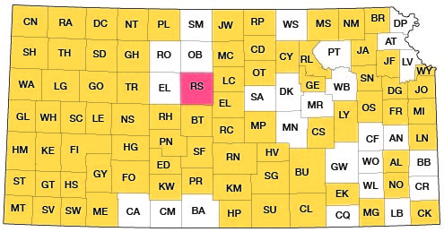
Figure 1--Index map showing location of Russell County [and areas covered by other online geologic reports, as of March 2014].
The highest point above sea level in Russell County, found on the high ridges in its northwest corner, has an elevation of about 2,050 feet, and the lowest point, where Saline river leaves the county, near the middle of its eastern boundary, has an elevation of about 1,430 feet. The uplands slope northeastward from above 2,000 feet in the northwest corner to 1,700 feet above sea level near the northeast corner of the county. Two rivers, the Saline and Smoky Hill, and Wolf creek, a large. tributary of Saline river, flow eastward across Russell County. The other tributaries, several of which have large valleys, flow northeastward and southeastward into the main streams. Saline river falls about 265 feet in a straight-line distance of 32 miles across the county--a gradient of over 8 feet to the mile. The bed of Smoky Hill river is 200 feet lower at the eastern border of the county than at the western, where it is about 1,770 feet above sea level--a fall of less than 6 1/2 feet to the mile. The relief along Saline river is 250 to 300 feet and that along Smoky Hill river is 150 feet or less, but the uplands are featureless and nearly flat.
The undissected uplands form nearly half the surface of the county, the steep to gentle slopes into the valleys make up most of the remainder, and the flat valleys comprise about a fifth.
The form of the treeless upland is controlled largely by the structure and the lithology of the surface rocks, the moderately resistant chalk beds of the Greenhorn and Carlile formations upholding it in all but the northwest corner of the county, where the higher Blue Hills scarp and plateau is made by chalk beds in the Niobrara formation.
The northern margins of the uplands between the larger streams terminate abruptly in steep slopes that lead down to the valleys, but the southern margins merge by gentle slopes into the valleys. This difference is noticeable even along the smaller tributary streams and on the valleys the trend of which inclines even less than 45° from north. The greater steepness of the northward-facing slopes is a characteristic feature of the topography of western Kansas. To one unacquainted with the region it suggests broken scarps at the north and dip slopes to the south, but the regional dip in central Kansas is northward.
The larger valleys are from less than one to several miles wide and their floors slope gently on the north sides, but commonly rise abruptly from the south sides. Of the tributaries from the south only the larger ones have noticeably flattened valley floors. The banks of the streams are commonly wooded. The capture of the headwaters of minor tributaries of Smoky Hill river by northward-flowing tributaries of Saline river is approaching, especially near the eastern border of the county.
Many of the spurs between the tributary streams are long and narrow, and those that run northward from the larger divides are steep-sided, prominently benched by beds of harder rock, and in places made irregular by small, isolated remnants of a higher, harder bed. These spurs are closely controlled by lithology, most of them being capped by one hard chalk bed of the Greenhorn limestone. The outcrops of rock in Russell County are essentially restricted to the valley walls and are generally best exposed in the northward-facing bluffs.
History of Oil and Gas Production
In Russell County, as in many areas in western Kansas, there was considerable activity in leasing oil and gas as early as 1917, but no drilling was done until July, 1923, when the M. M. Valerius Oil and Gas Company, of Tulsa, Okla., "spudded in" a well in the southwest corner of the SE of sec. 8, T. 12 S., R. 15 W., that was destined to open a new oil pool more than a hundred miles from the nearest commercial producing field. The well was drilled on the C. C. Oswald farm, on land leased from the Lucky Seven Oil Company, a local company holding leases on an area comprising nearly three-fourths of a township in the vicinity of the present Russell pool. Several encouraging shows Of gas and oil were struck late in the fall. Late in November oil was produced at the rate of about 10 barrels a day, and early in December the sand now producing was struck at a depth of 2,998 feet. Drilling was continued to the depth of 3,037 feet; but the well was not shot. A pipe line was laid to connect the well with tank cars at Paradise, on the Union Pacific railroad. The output of the well at first was about 175 barrels of oil a day; it rose to 240 barrels, and by pumping has been maintained steadily for nearly six months at about 200 barrels a day.
Soon after this well was brought in, other locations were made in Russell and bordering counties. A flow of gas, reported to be. 7,000,000 cubic feet daily, was struck in the Stearns-Streeter Company's Ed Oswald No. 1 well in the SW SW sec. 8, T. 12 S., R. 15 W., on May 15, 1924. The gas is produced from a sand 10 feet thick, at a depth of 2,461 feet. On June 8 the west offset of the discovery well, also belonging to the M. M. Valerius Oil and Gas Company, reached the oil-producing sand struck by the discovery well, and after being drilled but 10 feet into the "pay" was variously reported as being capable of producing from 500 to 1,600 barrels of oil a day. It is reported to have yielded, by swabbing, 1,260 barrels in a 19-hour test. This well is now yielding 350 barrels a day.
In the same week the Stearns-Streeter Company's Ed Oswald No. 1 was brought in as an oil well. After being drilled only 1 foot into the "pay" it was reported to) be yielding oil at the rate of 25 or 30 barrels an hour. This well now furnishes gas for drilling on near-by leases and produces 750 barrels of oil a day. A well known as the M. M. Valerius Oil and Gas Company's Muncell No. 1, drilled south of the discovery well, was reported on June 14 to be 1 foot into the "pay" and to contain 2,400 feet of oil. This well is now yielding about 100 barrels a day, but is probably capable of producing at least twice this much when the hole is cleaned out. At the time this report was written at least three other wells drilling on the Fairport-Natoma anticline are rapidly approaching the producing sand. At least 20 wells are now either located, drilling or producing oil in Russell County. One other well in Russell County has reached the horizon of the sand that produces oil on the Fairport-Natoma anticline, but has struck no oil. This is the Phillips No. 1 well of the M. M. Valerius Oil and Gas Company, in the SW SW, sec. 3, T. 13 S., R. 13 W.
[Note: As of July, 1924, press reports indicate that at the date this bulletin is being sent to press (April 15, 1925) that there are sixteen wells in Russell County producing oil, all except one in secs. 5, 8, 17 and 18, T. 12 S., R. 15 W. One well is in sec. 29, T. 11 S., R. 15 W.
All producing wells are located on the Fairport-Natoma anticline. Approximately 1,600 barrels of oil are being shipped from the field daily. More than a dozen additional operations, either drilling or building rigs, are in progress in the near vicinity of the producing wells. Two wells are drilling several miles east of the pool. Twelve wells have been drilled in the county and abandoned, each having penetrated the rocks that produce oil in the wells described above. One well in eastern Ellis County, three miles west of the producing field, failed to obtain commercial production. More than a dozen wells are drilling in Kansas west of Russell County.
Recent drilling of wells in the Russell pool below the two producing horizons of the discovery well have shown the presence of a porous limestone a short way below the lower of the two "pays" that is barren of oil, and another porous limestone approximately 75 feet below the "Oswald" pay that gives some promise of production.]
Character of the Oil
The oil produced from the discovery well has a gravity of about 41 degrees Baumé. The producing rock is limestone which is parted near the middle by a bed of shale 1/2 feet thick. According to report the oil produced above the shale had a temperature of 38 degrees Fahrenheit, and that produced below had a temperature of 70 degrees. Such a difference is unusual.
A sample of the oil from the discovery well, collected July 7, 1924, was analyzed by the Bureau of Mines, Department of the Interior, at the Bartlesville, Okla., office. The oil is of unusually light gravity for Kansas oils, and its content of gasoline and naphtha is correspondingly large. However, the amount of asphalt, as indicated approximately by the Conradson carbon residue test, and termed carbon residue of residuum in the analysis, is somewhat larger than usual. [Dean, E. W., Cooke, M. B., and Bauer, A. D.: Properties of typical crude oils from the producing fields of Kansas: Bur. of Mines Serial No. 2322, 1922.]
| Sample No. 24713. Taken from lead line when well was pumping approximately 200 barrels of oil a day. M. M. Valerius Oil and Gas Company's C. C. Oswald well No. 1, SW SE, sec. 8, T. 12 S., R. 15 W. Specific gravity, 0.820. A.P.I. gravity, 41.° (Baume gravity, 41.4°). Per cent sulphur, 0.41. Per cent water, nil. Saybolt Universal viscosity at 70° F., 45 sec. Saybolt Universal viscosity at 100° F., 20 sec. Pour point, below 5° F. First drop at 37° C. | ||||||||
| Temperature, deg. C. |
Air distillation barometer 739 mm | Vacuum distillation at 40 mm | ||||||
|---|---|---|---|---|---|---|---|---|
| Fraction percent |
Total percent |
Specific gravity |
Fraction percent |
Total percent |
Specific gravity |
Viscosity | Cloud test, deg. F |
|
| Up to 50 | 1.9 | 1.9 | ||||||
| 50 to 75 | 3.1 | 5.0 | .681 | |||||
| 75 to 100 | 5.8 | 10.8 | .701 | |||||
| 100 to 125 | 6.7 | 17.5 | .728 | |||||
| 125 to 150 | 6.0 | 23.5 | .745 | |||||
| 150 to 175 | 5.3 | 28.8 | .762 | |||||
| 175 to 200 | 4.3 | 33.1 | .778 | 3.7 | 3.7 | .842 | 41 | |
| 200 to 225 | 5.3 | 38.4 | .795 | 5.3 | 9.0 | .852 | 46 | 32 |
| 225 to 250 | 5.5 | 43.9 | .809 | 4.1 | 13.1 | .866 | 60 | 50 |
| 250 to 275 | 6.4 | 50.3 | .823 | 4.8 | 17.9 | .885 | 83 | 66 |
| 275 to 300 | 5.0 | 22.9 | .892 | 144 | 80 | |||
| Residuum. 23.8 per cent. Distillation loss, 3 per cent. Carbon residue of residuum, 11.7 per cent. Carbon residue of crude, 2.8 per cent. | ||||||||
| Approximate Summary | ||||
|---|---|---|---|---|
| Percent | Sp. gr. | °A. P. I. | Viscosity | |
| Light gasoline (end point 212° F.) | 10.8 | .692 | 73.0 | |
| Total gasoline and naphtha | 33.1 | .731 | 62.1 | |
| Kerosene distillate | 17.2 | .810 | 43.2 | |
| Gas oil | 7.8 | .847 | 35.6 | |
| Nonviscous lubricating distillate | 9.1 | .856-.886 | 33.8-28.2 | 50-100 |
| Medium lubricating distillate | 6.0 | .886-.896 | 28.2-26.4 | 100-200 |
| Viscous lubricating distillate | Above 200 | |||
| Residuum | 23.8 | .965 | 15.1 | |
| Distillation loss | 3.0 | |||
Prev Page--Contents || Next Page--Rocks exposed
Kansas Geological Survey, Geology
Placed on web March 17, 2014; originally published 1925.
Comments to webadmin@kgs.ku.edu
The URL for this page is http://www.kgs.ku.edu/Publications/Bulletins/10/02_intro.html