Kansas Geological Survey, Open File Report 96-49
The photomosaic of the quarry highwall along line D1 (Fig. 4) shows cross-bedded oolitic limestone with varying amounts of dip on the clinoforms. Apparent dips along the outcrop face are generally to the northeast and appear to correlate with the antithetic dip directions measured at several locations within the quarry (Fig. 2). However, some beds along the outcrop dip to the northeast and correlate with the primary dip directions (Fig. 2). Dip amounts as measured along the highwall vary from near horizontal to as much as 30 degrees. In the area of the GPR survey, measurable attitudes of cross-beds along the top surface of the limestone behind the highwall average N 25 degrees W, 17 degreesE.
Figure 4A--Uninterpreted photomosaic of the highwall outcrop along GPR line D1. Station locations (ft) along the GPR line are indicated above field personnel standing on the GPR line. The location of the outcrop is shown on Figure 2. Note that the outcrop is completely covered northeast of station 50. A large version is also available. The large version is 410k and will take some time to download!.
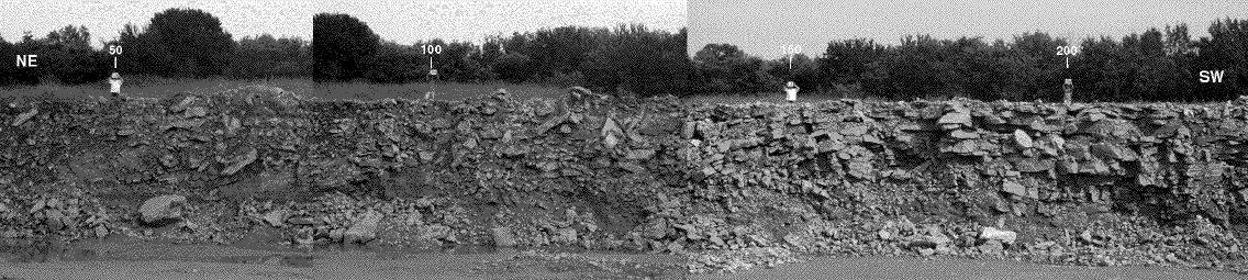
Figure 4B--Interpreted version of the photomosaic. Major horizons or bounding surfaces are indicated by thicker lines and labels (dashed where inferred), while other prominent bed boundaries are indicated by thinner lines. A large version is also available. The large version is 410k and will take some time to download!.
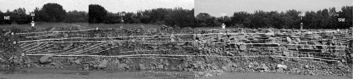
The limestone beds along the highwall are separated by several horizons or bounding surfaces (A-D), some of which may be locally erosional, that can be correlated across the outcrop. The bounding surfaces are indicated by real or apparent truncation, and flattening or thinning of cross-beds. Some of the cross-beds also exhibit a sigmoidal geometry (e.g. stations 75-100 between surfaces C and D; Fig 4b). Cross-bedding is best seen between horizons C and D from stations 50 to 100 and between horizons B and C from stations 130 to 200. Correlation of the bounding surfaces are tentative because much of the outcrop is covered with rocks pushed over the side by quarrying operations or boulders that have fallen due to lack of support. Horizon A is entirely inferred from a prominent horizon on the GPR data (Figs. 5 and 6). Although a reasonable interpretation of the highwall is presented on the photomosaic, the large amount of cover makes physical correlation on the outcrop difficult. However, GPR was able to successfully image some horizons and beds in areas of poor exposure on the outcrop, even in areas that are completely covered (e.g. the region northeast of station 45). This illustrates an important utility of GPR, that is, imaging features and extending correlations in areas of poor exposure.