


Kansas Geological Survey, Open File Report 96-49
GPR Study of The Drum Limestone, Figure 4a Large Version
Please use the "Back" command of your browser to return to the page
you were viewing.
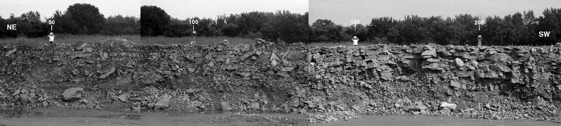
Figure 4A--Uninterpreted photomosaic of the
highwall outcrop along GPR line D1. Station locations (ft)
along the GPR line are indicated above field personnel standing
on the GPR line. The location of the outcrop is shown on
Figure 2. Note that the outcrop is
completely covered northeast of station 50.
Please use the "Back" command of your browser to return to the page
you were viewing.
Report Contents
Kansas Geological Survey, Open-File Report 96-49
Placed online Jan. 1997
Comments to webadmin@kgs.ku.edu
URL=http://www.kgs.ku.edu/PRS/publication/OFR96_49/fig4aLarge.html