![]()
Prev Page--Contents || Next Page--Geography
Introduction
Purpose and Scope of Investigation
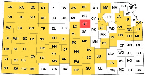
This report is the result of an investigation, by the U. S. Geological Survey and the State Geological Survey of Kansas in co-operation with the Division of Sanitation of the Kansas State Board of Health and the Division of Water Resources of the Kansas State Board of Agriculture, made to evaluate the ground-water resources of Ottawa County in relation to geology, hydrology, and water quality. Since 1937, reports on more than half the counties in Kansas have been published or are in preparation (Fig. 1).
Figure 1--Index map of Kansas showing area described in this report and areas covered by other online geologic reports, as of March 2009. For additional information, please visit the KGS Geologic Maps of Kansas Page.
The increasing importance of water makes imperative the collection, analysis, and presentation of data that may be utilized for water-supply development. Adequate data are essential for the proper use of water resources. Agriculture, municipalities, and industry all depend on vast quantities of water for their operations.
Location and Extent of Area
Ottawa County, in north-central Kansas, is bounded by Cloud County on the north, Mitchell and Lincoln counties on the west, Saline County on the south, and Dickinson and Clay counties on the east (Fig. 1). It contains 20 townships, T. 9 to 12 S., R. 1 to 5 W., which constitute approximately 723 square miles.
Previous Investigations
No publication to date specifically describes the geology or groundwater resources of Ottawa County. Plummer and Romary (1942, 1947) measured geologic sections and collected samples of clay. Two samples of clay from the Dakota Formation had been examined to determine their chemical, petrographic, and ceramic properties (Plummer and others, 1954). A statistical analysis of cross-stratified sandstone in the Dakota Formation was made by Franks and others (1959). Schoewe (1937) described "Rock City" near Minneapolis. Pleistocene volcanic ash was reported by Swineford and Frye (1946) and by Carey and others (1952). Several reports provide geological and water-resource data from adjoin- ing counties, which include Lincoln County (Berry, 1952), Mitchell County (Hodson, 1959), Cloud County (Bayne and Walters, 1959), Clay County (Walters and Bayne, 1959), and part of Saline County (Latta, 1949). Lee (1956) discussed the Salina Basin, which includes Ottawa County. The Dakota Formation in Kansas and Nebraska has been the subject of much paleontologic and lithologic study. The Dakota flora was treated by Lesquereux (1874). Logan (1897) made generalized stratigraphic distinctions; Twenhofel (1920, 1924) and Stanton (1922) made more detailed studies. Tester (1931) compared the type section of the Dakota Formation with more extensive sections in Kansas and Nebraska.
Methods of Investigation
Data were collected at intervals between June 1957 and October 1958. A total of 199 private and municipal wells were inventoried, and 111 test holes were augered or drilled. Auger and drill cuttings were examined microscopically. Water samples from 101 wells were analyzed for concentration of dissolved solids. The altitude of each well was determined by alidade, the geology was mapped, and numerous geologic sections were measured. Aerial photos were used as an aid in locating stratigraphic contacts. Three pumping tests were made to determine aquifer characteristics. Runoff records were obtained from the Surface Water Branch of the Geological Survey. Weather data were obtained from published records of the U. S. Weather Bureau. The base map was drafted from a county map prepared by the Kansas State Highway Commission.
Well-numbering System
The well and test-hole numbers used in this report give location according to General Land Office surveys in the following sequence: township, range, section, 160-acre tract within that section, 40-acre tract within that quarter section, and 10-acre tract within that quarter-quarter section. The 160-acre, 40-acre, and 10-acre tracts each are designated a, b, c, and d in a counter-clockwise direction beginning in the northeast quarter. If two or more wells or test holes are within a 10-acre tract, the wells are numbered serially beginning with the first well measured. Below are two examples illustrating the well-numbering system:
| Well number | General Land Office description |
|---|---|
| 10-2-15abc | SW NW NE sec. 15, T. 10 S., R. 2 W. |
| 11-5-3ldbb | NW NW SE sec. 31, T. 11 S., R. 5 W. |
Acknowledgments
The writer is grateful to the many residents of Ottawa County who permitted inventory of wells and who supplied much of the geologic and ground-water information. Several people in Minneapolis were especially helpful. They are George Davis (Soil Conservation Service), Louis Cooper and Norman Schlesener (Ottawa County Agents), Kermit Peterson (Park Superintendent, Kansas Forestry, Fish, and Game Commission), Rollind Olson (City Engineer), and Lionel Robins (Contractor). O. S. Fent (Hydraulic Drilling Company, Salina), J. G. Lassey (driller, Miltonvale), and George Cox (driller, Clifton) supplied logs of test holes and wells in Ottawa County.
Chemical analyses of water samples were made by Howard Stoltenberg and staff of the Sanitary Engineering Laboratory, State Board of Health. E. R. Leeson, Surface Water Branch of the U. S. Geological Survey, and R. L. Smith and W. E. Steps, Kansas Water Resources Board, supplied data on and an analysis of streamflow. Norman Plummer and Paul Franks contributed information and suggestions based on their experience in Ottawa County. Paul Franks also supplied x-ray, petrographic, and mechanical-analysis data. E. L. Reavis, Carrie Reavis, William Gellinger, and C. V. Fishel assisted in collecting a large part of the basic hydrologic data. The report was typed by Lottie Rodenhaus and Margaret Broeker, and the illustrations were drafted by Nancy Roofe Chamney.
Prev Page--Contents || Next Page--Geography
Kansas Geological Survey, Geology
Placed on web March 23, 2009; originally published January, 1962.
Comments to webadmin@kgs.ku.edu
The URL for this page is http://www.kgs.ku.edu/General/Geology/Ottawa/02_intro.html